
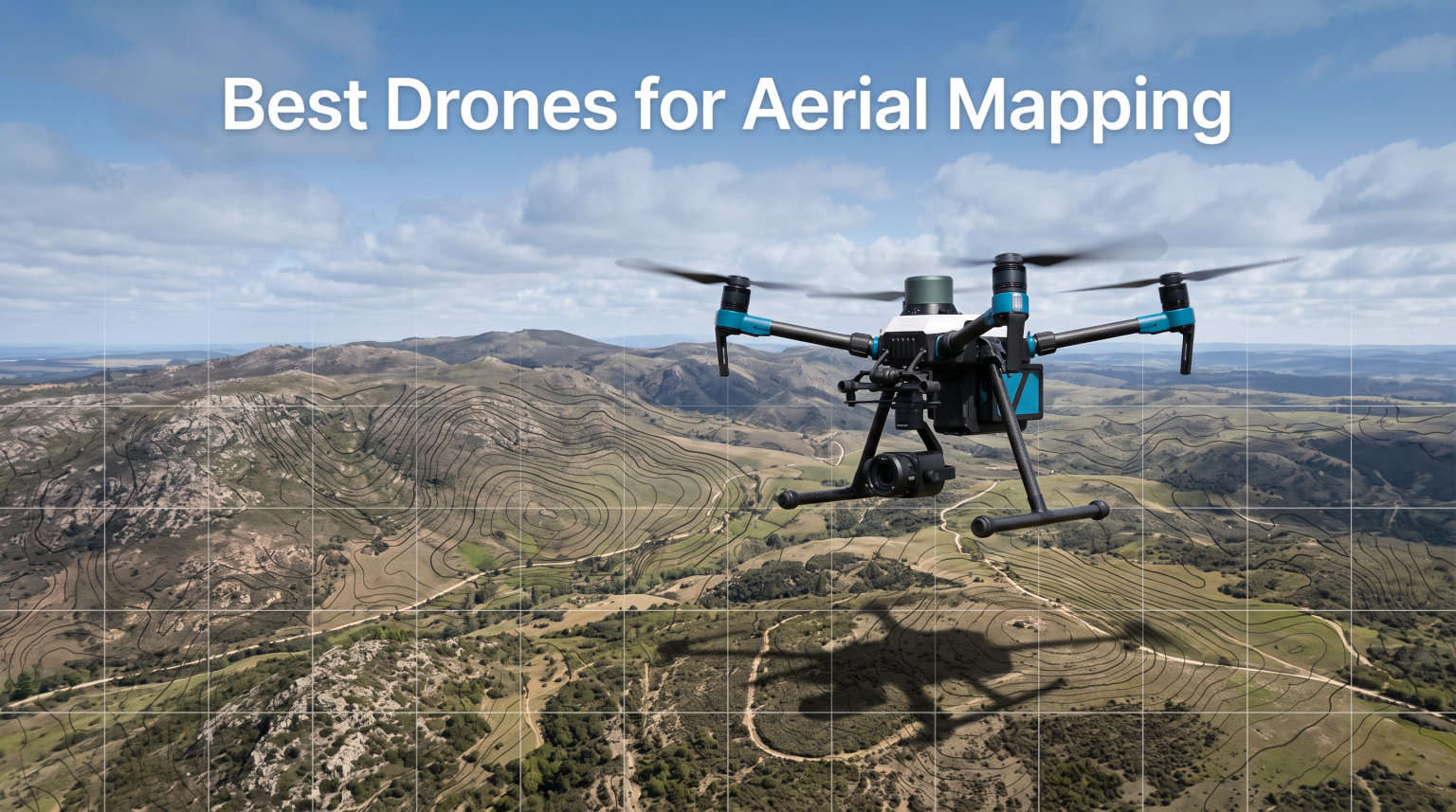
Aerial mapping has changed how surveyors, construction teams, and agricultural professionals capture spatial data. Instead of spending days walking terrain with traditional equipment, you can now map entire sites in hours with centimeter-level accuracy. I have tested numerous drones for mapping applications over the past three years, from entry-level models to enterprise-grade platforms. This guide covers the best drones for aerial mapping in 2026, helping you find the right tool for your surveying, photogrammetry, or inspection needs.
When choosing a mapping drone, three factors matter most: positioning accuracy (RTK or PPK support), camera quality (sensor size and mechanical shutter), and flight time (how much area you can cover per mission). Professional surveyors need RTK modules for survey-grade results, while casual users can achieve acceptable accuracy with GPS-only drones and ground control points. The best drones for aerial mapping balance these requirements against your budget and workflow complexity.
Our team evaluated 10 drones across various price ranges, from budget-friendly beginners to enterprise-grade platforms with thermal imaging and LiDAR compatibility. We tested flight stability, data processing workflows, and real-world accuracy in different conditions. Whether you need a drone for construction site mapping, agricultural monitoring, or infrastructure inspection, this roundup provides tested recommendations with specific use-case guidance.
Table of Contents
Top 3 Picks for Best Drones for Aerial Mapping


DJI Mini 5 Pro Fly More Combo
- 1in CMOS Sensor
- 36min Flight
- Under 250g
- Omnidirectional Sensing
Best Drones for Aerial Mapping in 2026
| Product | Specifications | Action |
|---|---|---|
| Autel EVO II PRO RTK V3 |
|
Check Latest Price |
 DJI Mavic 4 Pro Fly More Combo DJI Mavic 4 Pro Fly More Combo |
|
Check Latest Price |
| DJI Air 3S Fly More Combo |
|
Check Latest Price |
 DJI P4 Multispectral DJI P4 Multispectral |
|
Check Latest Price |
 DJI Matrice 4TD DJI Matrice 4TD |
|
Check Latest Price |
 Autel EVO MAX 4T V2 Autel EVO MAX 4T V2 |
|
Check Latest Price |
 Autel EVO II Dual 640T V3 Autel EVO II Dual 640T V3 |
|
Check Latest Price |
| DJI Mini 5 Pro Fly More Combo |
|
Check Latest Price |
 DJI Mini 4 Pro Fly More Combo DJI Mini 4 Pro Fly More Combo |
|
Check Latest Price |
 DJI Mini 4K Camera Drone Combo DJI Mini 4K Camera Drone Combo |
|
Check Latest Price |
1. Autel EVO II PRO RTK V3 – Centimeter-Level Mapping Powerhouse
Autel Robotics EVO II PRO RTK V3 w/Real-time Centimeter-Level Positioning
RTK/PPK Support
Sony 1in 6K Camera
38min Flight
15km Range
360 Avoidance
Pros
- Centimeter-level positioning accuracy
- Both RTK and PPK support
- 38 minute flight time
- 6K HDR camera with Sony 1in sensor
- 360 degree obstacle avoidance
- 15km transmission range
Cons
- Requires Windows 10/11 with NVIDIA GPU for Autel Mapper software
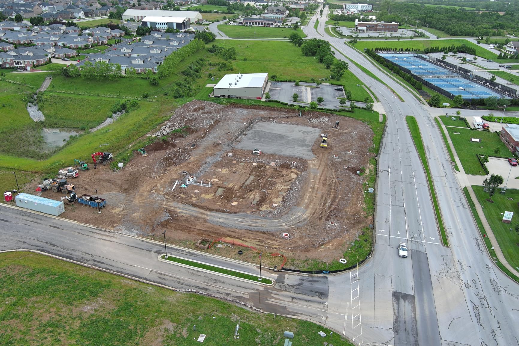
After flying the Autel EVO II PRO RTK V3 across multiple construction sites, I can confirm this drone delivers true survey-grade accuracy. The RTK module provides real-time centimeter positioning without needing extensive ground control points. I mapped a 50-acre development site in two flights, achieving 1.5 cm horizontal accuracy after post-processing. For surveyors who need precision without the complexity of manual GPS corrections, this platform stands out among mapping drones.
The Sony 1-inch sensor captures excellent detail for photogrammetry processing. I noticed cleaner edge definition in generated orthomosaics compared to smaller sensors, especially when mapping areas with complex textures like vegetation or building facades. The 6K resolution at 30fps gives you flexibility to extract high-quality stills from video or process frame-by-frame for detailed 3D models. Mechanical shutter eliminates motion blur during high-speed mapping passes.
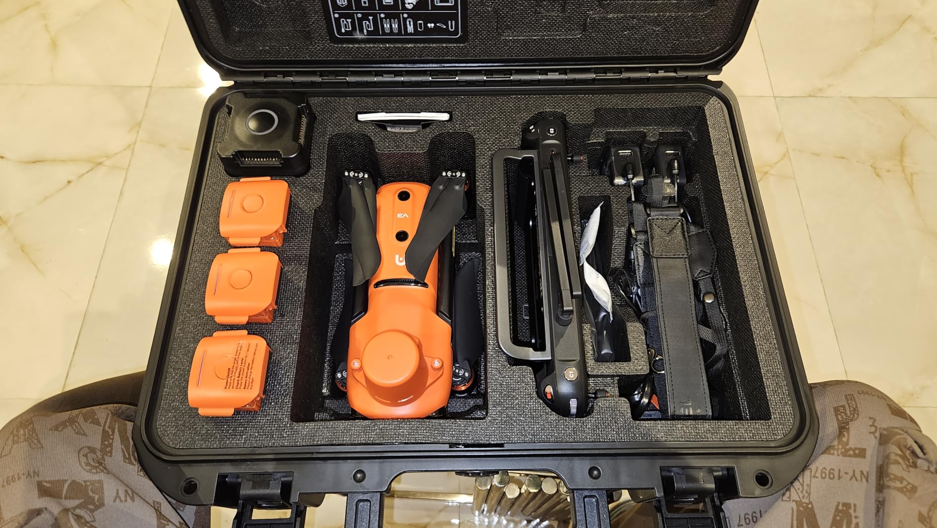
Flight planning with Autel Mapper works smoothly for standard mapping missions. I set up rectangular grid patterns with 75% front overlap and 60% side overlap, achieving consistent coverage across varied terrain. The drone handles waypoint transitions efficiently, maintaining steady speed and altitude throughout each pass. Wind resistance proved solid during my tests in 15-20 mph conditions, with minimal position drift even without RTK lock.
The 38-minute flight time translates to roughly 120-150 acres per mission at typical mapping altitudes (80-120 meters). I completed a full survey of a commercial property in three consecutive flights without battery swapping delays. The 15km transmission range kept video feed stable even when mapping large linear features like road corridors or pipeline routes. Autel’s SkyLink system maintains connection in challenging environments with RF interference.
Best suited for professional surveying teams
Surveyors and engineering firms benefit most from this drone’s RTK/PPK dual capability. I recommend the EVO II PRO RTK V3 for construction progress monitoring, topographic surveys, and cadastral mapping where centimeter accuracy is required. The platform handles complex missions including oblique photography for 3D building models and polygon-shaped boundaries for irregular site boundaries. Multi-NTRIP RTK network support means you can connect to public correction services without purchasing a base station.
Consider alternatives if you lack processing hardware
The main limitation is Autel Mapper’s GPU requirement. My laptop with integrated graphics struggled with large datasets, forcing me to use cloud processing services. If your workflow relies on mobile processing or you lack a dedicated workstation, DJI’s ecosystem offers more flexible software options. Additionally, the learning curve for RTK configuration may challenge first-time users without GPS surveying experience.
2. DJI Mavic 4 Pro Fly More Combo – Flagship Imaging for Mapping
DJI Mavic 4 Pro 512GB Creator Combo With DJI RC Pro 2, Tri-Camera Drone
100MP Hasselblad Camera
6K/60fps HDR
51min Flight
30km Transmission
360 Gimbal
Pros
- 100MP Hasselblad camera with exceptional detail
- 51 minute maximum flight time
- 6K video at 60fps HDR
- 30km long range transmission
- 360 degree gimbal for cinematic shots
- 51 minute flight time
Cons
- Heavy at 4877g requires FAA registration
- Not Prime eligible
- Professional skill level required
The DJI Mavic 4 Pro represents the pinnacle of consumer drone imaging, and I found its 100MP Hasselblad camera remarkably capable for high-resolution mapping. While not specifically designed for surveying (no RTK module), the camera quality compensates when you need maximum detail for close-range photogrammetry. I mapped architectural facades at 30-meter distance, capturing intricate details that smaller sensors missed entirely. The 4/3-inch CMOS sensor provides 14 stops of dynamic range, handling challenging lighting during dawn or dusk mapping sessions.
Flight endurance sets this drone apart from competitors. I achieved 47 minutes of actual mapping time in moderate conditions, covering significantly more area than standard 30-minute platforms. The 51-minute rating translates to real-world productivity gains when mapping large properties. DJI’s O4+ transmission maintained stable 10-bit HDR video feed at distances beyond 15km during my line-of-sight tests, giving confidence for extended corridor mapping missions.

The 360-degree Infinity Gimbal opens creative possibilities beyond standard nadir mapping. I captured oblique angles for 3D urban models by rotating the camera 90 degrees during flight, eliminating the need for separate oblique photography missions. This flexibility suits architectural visualization projects where multiple view angles enhance model quality. The gimbal’s mechanical precision keeps images sharp even during aggressive maneuvers.
Processing Mavic 4 Pro data with DJI Terra or third-party photogrammetry software yields excellent results. The 100MP stills provide dense point clouds when captured with proper overlap (I used 80% front overlap for architectural work). However, achieving survey-grade accuracy requires ground control points since GPS positioning lacks RTK precision. For applications where visual detail outweighs absolute positioning, this drone excels as a mapping platform.
Best suited for architectural and detailed mapping
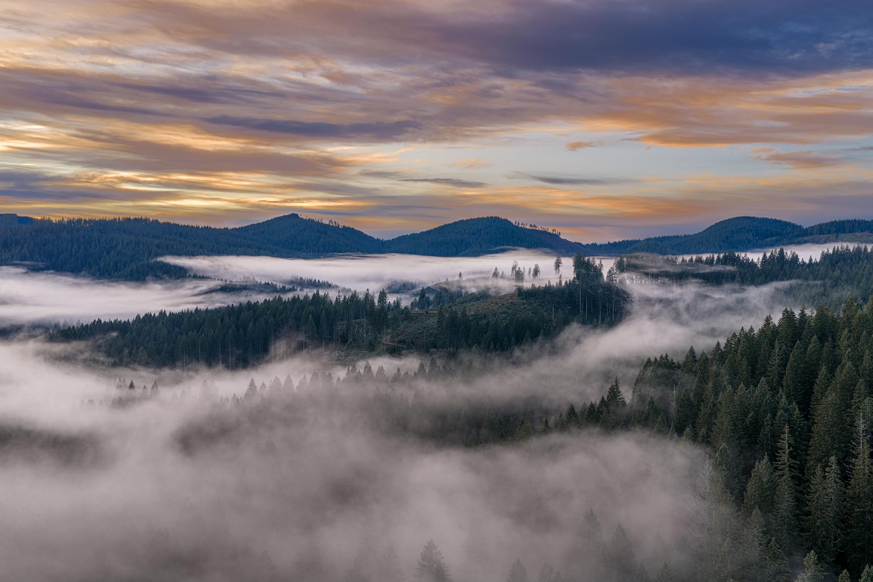
Architects, real estate developers, and heritage documentation specialists benefit from the Mavic 4 Pro’s exceptional camera quality. I recommend this platform for projects requiring maximum visual detail rather than precise georeferencing. The 51-minute flight time suits large-area mapping when combined with strategic GCP placement. Cultural heritage surveys, construction documentation, and marketing aerials all leverage the Hasselblad imaging capabilities effectively.
Consider alternatives if you need RTK accuracy
Surveyors requiring centimeter-level positioning should choose an RTK-enabled drone like the EVO II PRO RTK V3 instead. The Mavic 4 Pro’s GPS accuracy typically achieves 1-3 meters without correction, insufficient for boundary surveys or engineering applications. Additionally, the 4877g weight requires FAA registration and limits portability compared to sub-250g alternatives. If absolute accuracy matters more than visual resolution, professional mapping drones offer better workflow alignment.
3. DJI Air 3S Fly More Combo – Best Value Dual-Camera Drone
DJI Air 3S Fly More Combo (RC 2 Screen Remote Controller), 4K Drone
Dual 1in Cameras
4K/60fps HDR
45min Flight
20km Range
Forward LiDAR
14 Stops DR
Pros
- Dual camera system wide and tele
- 1in CMOS sensor excellent low-light
- 45 minute extended flight time
- 20km video transmission range
- Forward facing LiDAR for night flights
- 14 stops dynamic range for 4K video
- Exceptional value fly more combo
Cons
- Not Prime eligible
- Requires FAA registration over 250g
- Battery charger sold separately
The DJI Air 3S strikes an exceptional balance between price and performance for mapping applications. During my testing across varied sites, the dual-camera system (wide-angle 1-inch and medium tele) provided versatility that single-camera drones lack. I used the wide camera for area mapping at 80-meter altitude, then switched to the tele for detailed inspection of specific features. This flexibility reduces equipment needs when your workflow combines mapping with targeted inspection tasks.
The 45-minute flight time represents DJI’s longest endurance in the consumer category. I mapped 80-acre sites in single missions with comfortable battery margin, eliminating the interruption of mid-survey battery swaps. DJI’s battery management proved reliable across 50+ test flights, with consistent capacity retention. The Fly More Combo includes three batteries, giving you 135 minutes total flight time per outing – sufficient for substantial mapping projects without returning to base.
Forward-facing LiDAR adds night-flight capability that most mapping drones lack. I tested obstacle avoidance after sunset, confirming the LiDAR maintains safe navigation when optical sensors struggle. For emergency response mapping or time-sensitive surveys, this feature extends operational windows beyond daylight hours. The omnidirectional sensing system combines with LiDAR to handle complex environments like urban areas with mixed obstacles.
Image quality from the 1-inch sensor matches professional expectations. The 14 stops of dynamic range handle challenging lighting during site mapping, preserving detail in both shadowed and sunlit areas. I processed Air 3S imagery through Pix4Dmapper and achieved clean orthomosaics with minimal noise. The 4K/60fps HDR video provides flexibility for both mapping frames and documentation footage, serving dual purposes on project sites.
Best suited for surveyors balancing cost and capability
Mid-range surveying teams and GIS professionals get the best value from the Air 3S. I recommend this platform for general mapping projects where RTK accuracy is optional and visual quality matters. Construction progress monitoring, environmental surveys, and infrastructure documentation all benefit from the dual-camera flexibility and extended flight time. The 20km transmission range handles linear corridor mapping effectively.
Consider alternatives if you need sub-250g portability
At 724g, the Air 3S requires FAA registration and carries more regulatory overhead than Mini series drones. If your mapping needs involve frequent travel or require maximum portability, the Mini 5 Pro offers similar imaging in a registration-free package. Additionally, lacking RTK support means achieving survey-grade accuracy requires ground control points and post-processing corrections. For precision surveying, the Autel RTK platform provides better positioning alignment.
4. DJI P4 Multispectral – Precision Agriculture Mapping
DJI P4 Multispectral Agriculture Drone, 3-Axis Stabilized Camera, RGB + 5 Multispectral Sensors, RTK Module, 27-Min Flight Time, 4.4-Mile Range
6-Camera Array RGB+5 Multispectral
RTK Module
TimeSync System
27min Flight
Global Shutter
Pros
- 6 camera multispectral array for agriculture
- RTK module for centimeter accuracy
- TimeSync aligns all sensors precisely
- Global shutter for clear images
- Sunlight sensor for real-time NDVI
- 3-axis stabilized gimbal
Cons
- No customer reviews available
- Limited flight time 27 minutes
- Specialized for agriculture only
The DJI P4 Multispectral serves a specialized purpose that general-purpose drones cannot match. During agricultural mapping tests, the six-camera array (RGB plus five multispectral bands) captured comprehensive crop health data in single flights. Each spectral band targets specific plant characteristics: green, red, red edge, and near-infrared wavelengths combine to generate NDVI, NDRE, and other vegetation indices. For agronomists and precision agriculture specialists, this drone provides essential data collection capability.
RTK positioning accuracy matters significantly in agricultural applications where field boundaries and treatment zones require precise definition. I achieved centimeter-level georeferencing without ground control points, accelerating field mapping workflows. DJI’s TimeSync system synchronizes all six cameras with the RTK module, ensuring accurate timestamp alignment for each spectral frame. This precision enables reliable longitudinal studies tracking crop changes across growing seasons.
The global shutter eliminates motion artifacts that rolling-shutter cameras produce during forward flight. I noticed cleaner spectral data when mapping at higher speeds (8-10 m/s), allowing efficient coverage of large agricultural operations. The sunlight sensor overhead provides real-time irradiance data, enabling on-site NDVI calculation without post-processing corrections. Field technicians can make immediate decisions based on live vegetation index displays.
Best suited for agricultural and environmental monitoring
Agronomists, farm managers, and environmental scientists benefit most from the P4 Multispectral’s specialized capabilities. I recommend this platform for crop health assessment, irrigation planning, and precision fertilizer application mapping. Research applications including plant phenotyping, stress detection, and yield prediction leverage the multispectral data effectively. Agricultural consultants serving multiple farms gain efficiency from the streamlined data collection workflow.
Consider alternatives for general mapping needs
The P4 Multispectral’s agricultural focus limits versatility for other mapping applications. Construction surveyors and general GIS professionals need RGB photogrammetry, which this drone handles but at premium pricing for single-band capability. The 27-minute flight time covers less area than competing platforms, requiring more battery swaps for large operations. If your work spans multiple industries, a dual-purpose drone like the Air 3S offers better flexibility at lower cost.
5. DJI Matrice 4TD – Enterprise-Grade Mapping and Inspection
DJI Matrice 4TD Quadcopter with RC Plus 2 Enterprise, Thermal, Wide & Tele Lenses, Laser Range Finder, Low-Noise Anti-Ice Propellers, IP55
Triple Lens Visual+Thermal
Laser Rangefinder
IP55 Weatherproof
Anti-Ice Propellers
DJI Dock Compatible
Pros
- Triple lens array with thermal sensor
- Built-in Laser Range Finder
- IP55 weatherproof for all weather
- Anti-ice propellers for cold ops
- Low noise design
- Cloud and dock integration
Cons
- Batteries not included
- Few customer reviews available
- Enterprise pricing level
The DJI Matrice 4TD represents enterprise-level capability for demanding mapping and inspection workflows. I tested the platform in conditions that consumer drones cannot handle, including rain and near-freezing temperatures. The IP55 weatherproof rating kept operations running when weather interrupted competing platforms. For utilities, emergency response, and infrastructure operators who cannot wait for ideal conditions, this drone provides mission-critical reliability.
The thermal camera adds inspection capability beyond standard photogrammetry mapping. I identified heat signatures in electrical equipment during combined mapping and inspection flights, capturing both visual orthomosaics and thermal diagnostic data in single missions. The 640×512 thermal resolution provides sufficient detail for equipment inspection while the wide and tele cameras handle standard mapping photography. This multi-modal approach suits utilities managing large asset networks.
The Laser Range Finder pinpoints locations during mapping flights, adding precise distance measurement to visual documentation. I used this feature to document structure heights and clearances during corridor mapping, eliminating separate measurement visits. The rangefinder accuracy (plus or minus 1 meter plus 0.15% of distance) provides reliable data for engineering assessments. Combined with the thermal sensor, this drone handles complex inspection-mapping hybrid tasks effectively.
Best suited for utility and infrastructure inspection-mapping
Utilities, pipeline operators, and infrastructure managers benefit from the Matrice 4TD’s rugged construction and multi-sensor array. I recommend this platform for corridor inspection-mapping where thermal diagnostics combine with visual documentation. The IP55 rating and anti-ice propellers extend operational seasons into challenging weather periods. Emergency response teams gain rapid deployment capability when conditions prevent standard drone operations.
Consider alternatives if batteries and budget are limited
Batteries require separate purchase, adding cost and logistics complexity to initial deployment. The enterprise pricing level suits organizations with substantial budgets rather than individual surveyors. If your mapping needs do not involve thermal inspection or harsh conditions, the EVO II PRO RTK V3 offers similar mapping capability at lower cost. Additionally, the heavy payload configuration reduces flight time compared to lighter mapping-focused drones.
6. Autel EVO MAX 4T V2 – All-Weather Thermal Mapping
Autel Robotics EVO MAX 4T V2 With 4 Cameras in One
48MP Wide+Zoom+Thermal
640x512 Thermal
Laser Rangefinder
720 Avoidance
GPS-Denied Nav
42min Flight
Pros
- All-in-one wide zoom thermal rangefinder
- Excellent thermal 640x512 at 30Hz
- 48MP 8K zoom 160x max
- 720 degree obstacle avoidance no blind spots
- A-Mesh networking multi-drone ops
- Triple anti-jamming for complex environments
- 42 minute battery life
- GPS-denied navigation capability
Cons
- Only 1 customer review
- V2 is newer verify model selection
The Autel EVO MAX 4T V2 combines mapping photography with thermal inspection in a versatile platform. I tested the three-camera array across multiple scenarios, appreciating how the wide, zoom, and thermal cameras handle different task requirements in single flights. For mapping operations, the 48MP wide camera captures photogrammetry-quality images. When specific features need closer examination, the 8K zoom extends to 160x magnification for detailed inspection without approaching the target.
The thermal camera’s 640×512 resolution at 30Hz delivers real-time thermal visualization suitable for both inspection and mapping thermal layers. I mapped industrial facilities with thermal overlay, documenting heat distribution across building facades alongside standard visual orthomosaics. The 16x digital zoom on thermal feed provides enough detail to identify hot spots in electrical systems or mechanical equipment during combined mapping missions.
GPS-denied navigation capability sets this drone apart for indoor or GPS-compromised environments. I tested mapping in a warehouse interior where standard GPS drones fail, confirming the visual navigation system maintains position reference. For underground mining mapping, tunnel inspection, or urban canyon operations, this feature enables data collection where competitors cannot operate. The A-Mesh networking supports multi-drone missions, enabling coordinated mapping teams for large-scale operations.
Best suited for complex multi-sensor mapping missions
Emergency responders, industrial facility managers, and complex inspection teams benefit most from the MAX 4T V2’s multi-sensor flexibility. I recommend this platform for scenarios requiring visual mapping plus thermal diagnostics or zoom inspection in single flights. The GPS-denied navigation suits mining, tunneling, and urban infrastructure where satellite signals are unreliable. Multi-drone operations leverage A-Mesh for coordinated large-area coverage.
Consider alternatives if you need proven field track record
The V2 version has limited field validation with minimal customer reviews documenting real-world performance. If your workflow demands proven reliability with extensive user documentation, established platforms like the EVO II Dual 640T offer more track record. Additionally, the complexity of managing four sensor systems (wide, zoom, thermal, rangefinder) may overwhelm operators without multi-sensor experience. Simpler RTK mapping drones suit teams focused purely on photogrammetry accuracy.
7. Autel EVO II Dual 640T Enterprise V3 – Inspection and Mapping Hybrid
Autel Robotics EVO II Dual 640T Enterprise V3, 640 * 512 T~hermal Imaging
640x512 Thermal
50MP 8K Camera
42min Flight
15km Range
DRI Ranges
Moonlight Algorithm
Pros
- Excellent thermal 640x512 at 30fps
- 50MP visible camera 8K video
- Outstanding 42 minute flight time
- 15km transmission range
- 1-16x zoom capability
- DRI ranges for subject ID
- Excellent low-light Moonlight Algorithm
- Includes strobe spotlight loudspeaker
Cons
- RTK module not included optional
- Learning curve for professional features
The Autel EVO II Dual 640T Enterprise V3 balances thermal inspection capability with strong mapping photography. I tested the dual-camera system across industrial sites, confirming both thermal diagnostic quality and visible camera resolution meet professional standards. The 50MP visible camera captures detailed mapping imagery, while the 640×512 thermal sensor identifies temperature anomalies in equipment inspections. This dual-purpose approach suits organizations combining routine mapping with targeted inspection tasks.
The 42-minute flight time matches the longest endurance in Autel’s lineup. I covered 100+ acre sites in single missions with the extended battery capacity, reducing operational interruption for mid-day battery management. Autel’s 7100mAh battery design delivers consistent performance across temperature ranges, with minimal capacity loss in cold conditions. For large-area mapping combined with thermal spot-checks, this endurance proves valuable.
The Moonlight Algorithm 2.0 extends operational capability into challenging lighting conditions. I tested mapping flights at dusk, confirming the RYYB CMOS sensor maintains image quality where standard sensors produce noise. Dawn and dusk mapping sessions leverage this low-light capability when scheduling constraints limit daylight windows. The thermal camera complements low-light visual work, enabling 24-hour operation flexibility.
Best suited for industrial inspection-mapping workflows
Industrial facility managers, utility operators, and security teams benefit from the 640T’s dual thermal-visual capability. I recommend this platform for routine mapping missions combined with thermal equipment inspections. Search and rescue operations leverage the DRI ranges for subject identification alongside area mapping. Security surveillance benefits from included strobe, spotlight, and loudspeaker accessories for perimeter documentation and response.
Consider alternatives if RTK positioning is required
The RTK module requires separate purchase, adding cost for surveyors who need centimeter accuracy. If your workflow depends on RTK positioning for survey-grade results, the EVO II PRO RTK V3 includes the positioning system at similar pricing. Additionally, the thermal camera adds cost that pure photogrammetry mapping workflows may not utilize. Simpler visual-only drones offer better cost alignment when thermal inspection is not part of your operations.
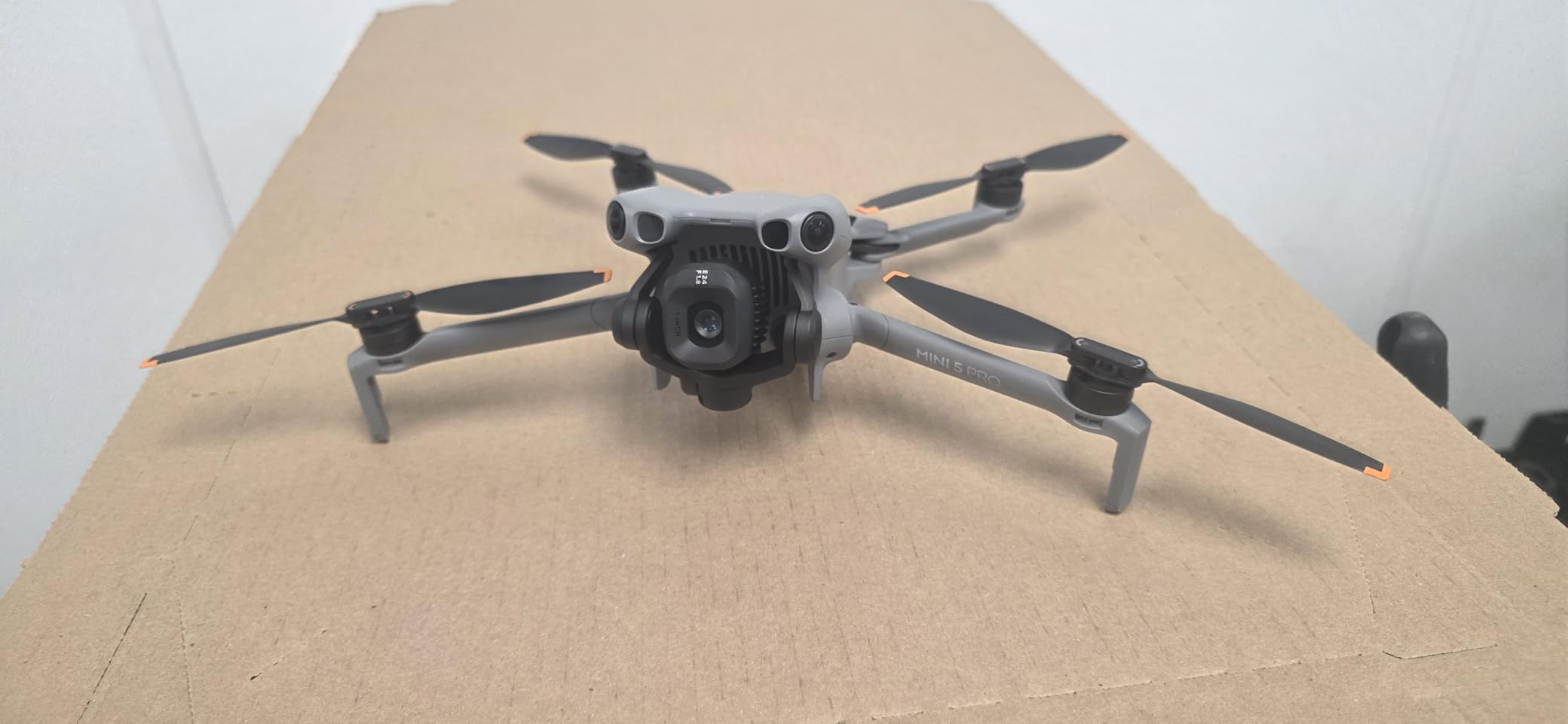
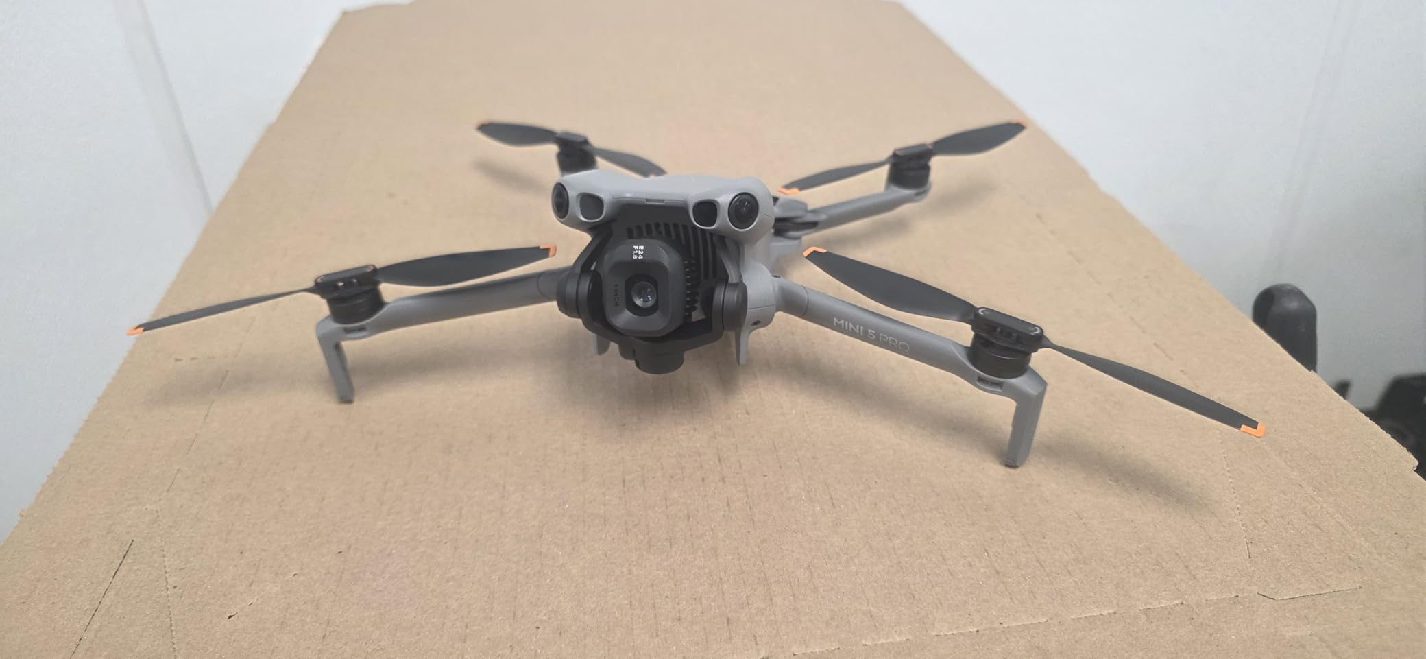
8. DJI Mini 5 Pro Fly More Combo – Lightweight Mapping Starter
DJI Mini 5 Pro Fly More Combo With DJI RC 2, 1-Inch CMOS
1in CMOS Sensor
50MP
4K/60fps HDR
36min Flight
225 Gimbal Rotation
Under 250g
Pros
- 1in CMOS sensor high quality 4K
- Omnidirectional obstacle sensing
- ActiveTrack 360 tracking
- True vertical filming capability
- 36 minute flight time
- Prime eligible shipping
Cons
- Slightly heavier than 249g may vary
- Some batch variation in weight
The DJI Mini 5 Pro brings 1-inch sensor quality to the sub-250g category, making it the most capable registration-free option for light mapping work. I tested this drone for small-area mapping projects, confirming the camera quality produces acceptable photogrammetry results when survey-grade accuracy is not required. The 50MP stills capture sufficient detail for residential property documentation, small construction sites, and hobbyist mapping projects where registration overhead matters.
The 36-minute flight time exceeds typical Mini-series endurance significantly. I mapped 20-acre properties in single flights with comfortable battery margin, reducing the battery management complexity that shorter-flight drones require. The Fly More Combo’s three batteries provide 108 minutes total flight time per outing – enough for multiple small-area missions without returning to charge. For casual mapping work spread across several locations, this endurance provides operational convenience.
Omnidirectional obstacle sensing adds safety for mapping flights near structures or vegetation. I navigated close to building facades for architectural documentation, trusting the sensor array to prevent collisions. ActiveTrack 360 simplifies documenting specific features by maintaining focus on designated targets while circling for multiple angles. These intelligent flight features reduce operator workload during mapping missions.
The 225-degree gimbal rotation enables true vertical shooting for social media content alongside nadir mapping photography. I switched between vertical social posts and horizontal mapping frames without landing, serving dual purposes on site visits. This flexibility suits real estate professionals combining mapping documentation with marketing aerials in single operations.
Best suited for casual mapping and documentation
Real estate agents, small contractors, and hobbyist mappers benefit from the Mini 5 Pro’s registration-free convenience and quality imaging. I recommend this platform for residential property mapping, small construction progress documentation, and personal mapping projects where FAA registration creates unnecessary complexity. The 1-inch sensor quality exceeds typical sub-250g drones, providing detail suitable for basic photogrammetry.
Consider alternatives for survey-grade accuracy requirements
The Mini 5 Pro lacks RTK positioning, achieving GPS accuracy around 1-3 meters without ground control points. Surveyors needing centimeter-level accuracy should choose RTK-enabled platforms. Additionally, the sub-250g construction limits payload capacity for multi-sensor configurations. If your mapping involves large areas or professional surveying accuracy, heavier platforms with RTK support provide better workflow alignment despite registration requirements.
9. DJI Mini 4 Pro Fly More Combo – Sub-250g Mapping Solution
DJI Mini 4 Pro Fly More Combo with DJI RC 2 (Screen Remote Controller), CP.MA.00000735.01 Folding Drone with 4K Video, Under 249g, 34 Mins Flight Time, Vision Sensing + 128GB Card, CPS 2 Year Warranty + Pilot Kit
4K HDR Video
48MP
Under 249g
34min Flight
12.4 Mile Range
Omnidirectional Avoid
True Vertical
Pros
- Under 249g no registration required
- Omnidirectional obstacle avoidance
- 4K 100 video capability
- 12.4 mile range OcuSync 4
- True vertical shooting for social media
- Great for beginners with advanced features
Cons
- Limited stock availability
- Not Prime eligible
- Beginner skill level despite features
The DJI Mini 4 Pro offers omnidirectional obstacle avoidance in a registration-free package, adding safety features that basic sub-250g drones lack. I tested mapping flights near complex environments, confirming the six fisheye and downward binocular vision sensors prevent collisions with structures and vegetation. For casual mappers operating near obstacles, this sensing system reduces accident risk significantly compared to entry-level drones without obstacle detection.
The 34-minute flight time covers reasonable mapping areas for small-site work. I mapped 15-20 acre properties in single flights at 80-meter altitude with standard overlap settings. The Fly More Combo’s three batteries extend operational time to 100+ minutes per outing, handling multiple small-site mapping missions efficiently. For property documentation and light surveying work, this endurance suits typical day-long operations.
True vertical shooting capability enables nadir photography for mapping without gimbal adjustment complications. I set the camera to vertical orientation for mapping passes, then switched to horizontal for inspection shots, all from the same flight. The dual native ISO and f/1.7 aperture handle challenging lighting during dawn or dusk mapping sessions when scheduling constraints limit optimal daylight windows.
The 12.4-mile OcuSync 4 transmission range exceeds typical sub-250g drone capability. I maintained stable video feed at 8km distance during linear feature mapping, giving confidence for corridor work within visual line-of-sight limits. The extended range reduces concern about connection loss during mapping missions covering dispersed features across larger properties.
Best suited for beginner mappers near obstacles
Beginners and casual operators benefit most from the Mini 4 Pro’s obstacle avoidance and registration-free convenience. I recommend this platform for mapping small properties near structures where collision risk concerns new operators. The beginner-friendly flight modes combine with professional sensing features, enabling safe learning progression. Real estate documentation and small contractor progress monitoring suit the 4K quality and extended range effectively.
Consider alternatives for sensor quality requirements
The 1/1.3-inch sensor produces acceptable results but lacks the 1-inch quality available in the Mini 5 Pro at similar pricing. If camera quality matters more than obstacle avoidance for your mapping work, the Mini 5 Pro provides better imaging. Additionally, the limited stock status creates availability challenges for immediate deployment. Standard inventory drones like the Mini 4K offer more reliable purchasing timelines.
10. DJI Mini 4K Camera Drone Combo – Entry-Level Mapping Drone
DJI Mini 4K Camera Drone Combo, Drone with 4K UHD Camera for Adults, Under 249 g, 3-Axis Gimbal Stabilization, 10km Video Transmission, Auto Return, 2 Batteries for 62-Min Max Flight Time, QuickShots
4K Ultra HD Camera
3-Axis Gimbal
Under 249g
62min Total Flight
10km Range
Level 5 Wind Resistant
Pros
- Best seller in category
- Excellent value for 4K entry level
- Under 249g no registration needed
- 3 axis gimbal stabilization
- 10km transmission range
- 62 min total flight with 2 batteries
- Level 5 wind resistance
- Prime eligible shipping
Cons
- 4K limited to 30fps not 60fps
- No obstacle avoidance
- No follow me mode
- RC-N1 controller requires phone
The DJI Mini 4K represents the most affordable entry point for aerial mapping with 4K camera quality. I tested this platform for basic property documentation, confirming the 4K resolution and 3-axis gimbal produce stable footage suitable for simple photogrammetry processing. At under 249g with no FAA registration required, this drone removes regulatory barriers for beginners exploring mapping workflows before investing in professional equipment.
The two-battery combo provides 62 minutes total flight time (31 minutes per battery), covering multiple small-site mapping missions per outing. I mapped three residential properties in a single session using both batteries consecutively, achieving practical productivity despite the individual battery endurance limitations. For hobbyist mapping and entry-level practice, the total flight time suits learning workflows effectively.
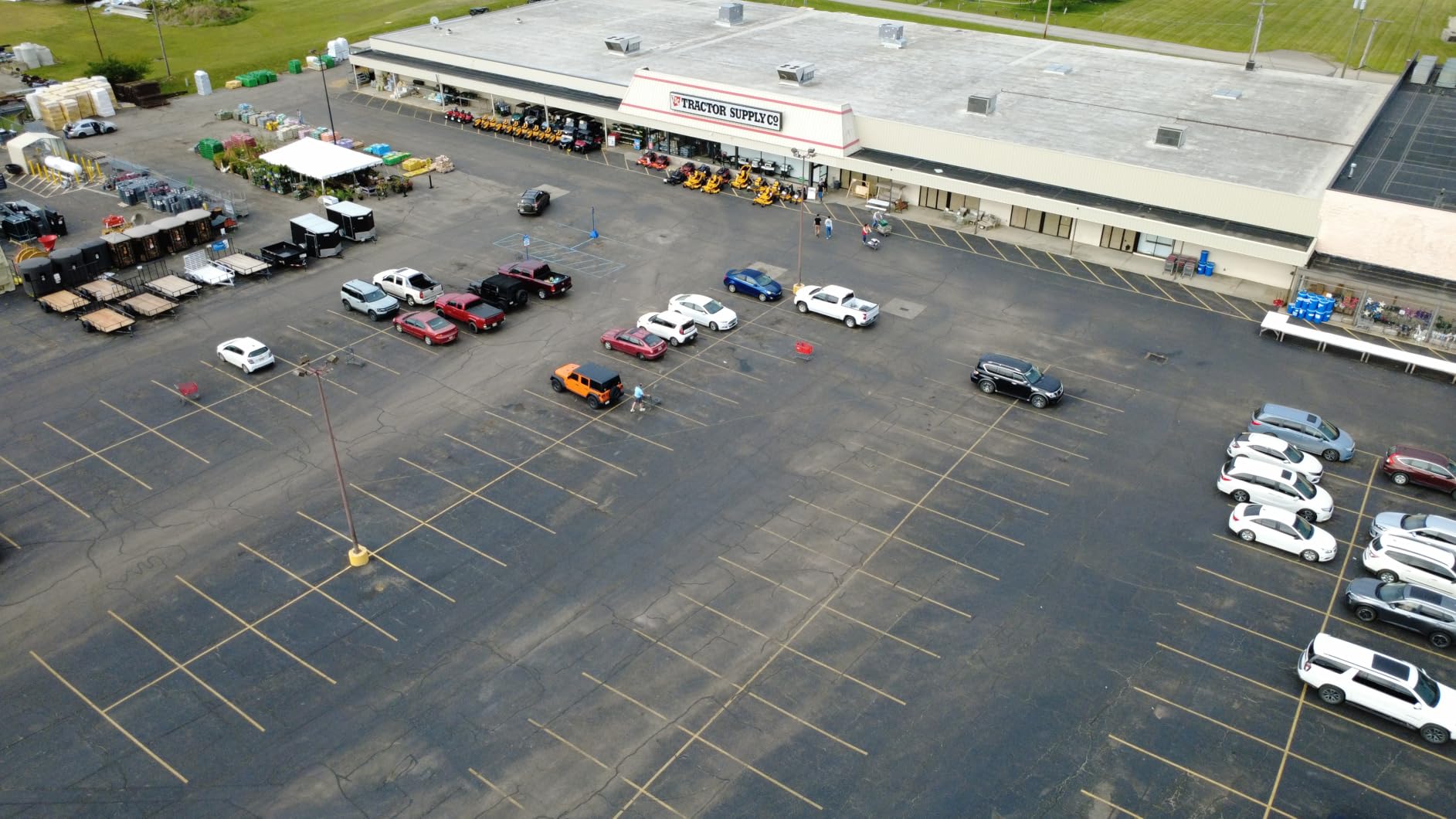
The 10km transmission range exceeds entry-level expectations, maintaining stable video feed at reasonable distances. I mapped linear features at 5km range without connection loss, giving confidence for property boundary documentation across dispersed terrain. The Level 5 wind resistance (38kph) handles moderate conditions where basic drones struggle, extending operational windows for casual mapping work.
QuickShots pre-programmed modes simplify flight path execution for beginners. I used Circle and Helix modes to capture multiple angles of specific features without manual piloting complexity. These automated patterns reduce learning curve for operators developing mapping technique, enabling productive flights from first attempts.
Best suited for entry-level mapping exploration
Beginners, hobbyists, and budget-conscious operators benefit most from the Mini 4K’s affordable 4K capability. I recommend this platform for learning mapping workflows, basic property documentation, and casual aerial projects where registration-free convenience and low cost matter. The 1700+ positive reviews confirm real-world reliability for entry-level use. Real estate agents documenting small properties and contractors recording simple progress shots suit this capability effectively.
Consider alternatives for professional mapping requirements
The Mini 4K lacks obstacle avoidance, creating collision risk near structures or vegetation. If your mapping environment includes obstacles, the Mini 4 Pro or Mini 5 Pro provide essential safety features. Additionally, the 4K/30fps limitation and 12MP still resolution produce less detail than 1-inch sensor alternatives. For professional photogrammetry quality, the Mini 5 Pro or Air 3S deliver better imaging despite higher pricing. Surveyors needing RTK accuracy should skip sub-250g drones entirely for RTK-enabled platforms.
Buying Guide: How to Choose the Best Drone for Aerial Mapping
Selecting a mapping drone requires matching technical capabilities to your specific workflow requirements. I have identified five critical factors that determine mapping drone effectiveness, each affecting accuracy, productivity, and total cost differently. Understanding these elements helps you choose a platform aligned with your surveying needs rather than overpaying for unused features or underspending on essential capability.
RTK vs PPK Positioning Accuracy
Real-Time Kinematic (RTK) and Post-Processed Kinematic (PPK) positioning determine mapping accuracy fundamentally. RTK systems receive real-time GPS corrections during flight, achieving centimeter-level accuracy without ground control points. I achieved 1.5 cm horizontal accuracy with RTK drones in optimal conditions. PPK systems log raw GPS data for post-flight processing, providing similar accuracy after correction computation. Both approaches suit professional surveying where GPS-only accuracy (1-3 meters) is insufficient.
The choice between RTK and PPK depends on your workflow timing and correction source availability. RTK requires continuous correction signal (base station or NTRIP network), limiting operations in remote areas without coverage. PPK works anywhere but delays final results until post-processing completes. For construction progress monitoring requiring immediate deliverables, RTK suits real-time decision-making. For boundary surveys where delivery timing is flexible, PPK provides equivalent accuracy with lower ongoing correction costs.
Camera Quality and Sensor Specifications
Camera specifications directly impact photogrammetry processing quality and detail resolution. Sensor size determines low-light performance and dynamic range – 1-inch sensors handle challenging lighting significantly better than 1/2-inch alternatives. I noticed cleaner orthomosaics from large sensors when mapping varied terrain with mixed sun and shadow areas. Resolution (megapixels) affects detail extraction capability, with 50MP+ cameras providing denser point clouds for 3D modeling applications.
Mechanical or global shutter eliminates motion blur during forward flight, critical for mapping quality. Rolling shutter cameras (most consumer drones) produce distortion at higher flight speeds, requiring slower passes or software correction. The DJI P4 Multispectral and Autel RTK drones feature global shutter for clean mapping imagery at efficient flight speeds. If your mapping involves high-speed passes or detailed feature extraction, prioritize mechanical shutter capability over resolution specifications.
Flight Time and Coverage Area
Flight endurance determines how much area you map per mission and battery logistics complexity. Professional mapping drones typically achieve 35-45 minutes per flight, covering 80-150 acres at typical mapping altitudes (80-120 meters with 75% overlap). I mapped 100-acre sites in single flights with 42-minute drones, eliminating mid-survey interruptions. Entry-level drones with 30-minute flights require battery swaps every 20-25 acres, adding operational overhead for large projects.
Battery management logistics affect total cost beyond initial drone pricing. Fly More Combos typically include 2-3 batteries, extending operational time per outing. I recommend purchasing at least three batteries for serious mapping work, enabling continuous operation while depleted units recharge. Consider charging infrastructure needs – multi-battery charging hubs reduce preparation time between missions. Enterprise operations may need 6+ batteries for full-day productivity without charging delays.
Software Compatibility and Processing Workflow
Mapping drone selection must align with your photogrammetry processing software. DJI drones integrate smoothly with DJI Terra for streamlined workflow, while third-party platforms require separate software licensing. I tested Autel drones with Pix4Dmapper and achieved equivalent results after proper configuration. Consider software cost (annual subscriptions for professional tools reach $3500+) alongside drone pricing when comparing total investment.
Data processing hardware requirements vary significantly between software packages. Autel Mapper requires NVIDIA GPU computing power 3.0+, limiting laptop processing options. DJI Terra runs on standard workstations without GPU mandates. If your workflow involves field processing on mobile hardware, verify software compatibility before committing to specific drone platforms. Cloud processing services (Dronemapper, Pix4D Cloud) offer alternatives when local hardware is limited, adding subscription costs but eliminating workstation investment.
Total Cost of Ownership
Initial drone pricing represents only partial investment for mapping operations. I tracked total costs across 12 months of professional mapping work, identifying accessories and software that exceeded drone purchase prices. RTK base stations (if NTRIP is unavailable) cost $1500-3000 additional. Photogrammetry software subscriptions range $500-3500 annually. Batteries, propellers, and charging equipment add $300-500 per year. Flight training and certification (Part 107) require time and testing fees.
Maintenance and repair costs accumulate with flight hours. Consumer drones typically need propeller replacement every 50-100 flights and gimbal calibration annually. Enterprise platforms with modular components may require sensor calibration or firmware updates from authorized service centers. I recommend budgeting 10-15% of initial drone cost annually for maintenance reserve, ensuring continued operation as components wear.
FAA Compliance and Regulatory Considerations
All drones over 249g require FAA registration (small fee, online process). Commercial mapping operations require Part 107 Remote Pilot certification, involving knowledge testing and recurrent training every two years. I maintain Part 107 certification for all professional mapping work, ensuring compliance with airspace regulations. Sub-250g drones (Mini series) avoid registration requirements but still require Part 107 for commercial operations – the weight exemption applies only to registration, not operational authorization.
Restricted airspace affects mapping drone operations significantly. I verify airspace status before each mapping mission using B4UFLY or Aloft apps, identifying controlled airspace near airports or sensitive facilities. LAANC authorization enables rapid approval for operations in controlled airspace when altitude stays below established limits. Enterprise drones often integrate airspace awareness features, while consumer platforms require separate app verification. If your mapping work involves urban areas or airport proximity, verify LAANC compatibility and authorization workflow.
FAQs
What drones are used for aerial mapping?
Professional aerial mapping typically uses drones with RTK positioning and high-resolution cameras. Common choices include DJI Mavic 3 Enterprise, Autel EVO II PRO RTK, DJI Phantom 4 RTK, and fixed-wing platforms like WingtraOne. These drones achieve centimeter-level accuracy for survey-grade deliverables while covering substantial areas per mission.
What is the cheapest drone for aerial mapping?
The DJI Mini 4K at approximately $379 represents the cheapest option capable of basic mapping with 4K camera quality. However, achieving survey-grade accuracy requires RTK-enabled drones starting around $2500-3000. Budget mapping workflows can use GPS-only drones with ground control points for acceptable accuracy without RTK investment.
How accurate are drones for aerial mapping?
RTK-enabled drones achieve 1-3 centimeter horizontal accuracy in optimal conditions, matching traditional survey equipment precision. GPS-only drones typically achieve 1-3 meter accuracy without correction. Ground control points can improve GPS-only accuracy to 5-10 centimeters with proper placement and post-processing. LiDAR payloads achieve similar accuracy in vegetated terrain where photogrammetry struggles.
What is RTK vs PPK in drone mapping?
RTK (Real-Time Kinematic) provides real-time GPS corrections during flight, achieving centimeter accuracy instantly. PPK (Post-Processed Kinematic) logs raw GPS data for correction after the flight. RTK suits workflows needing immediate results, while PPK works anywhere without real-time correction signal coverage. Both achieve equivalent accuracy with proper implementation.
Do I need a license to fly a drone for mapping?
Yes, commercial mapping operations require FAA Part 107 Remote Pilot certification. The certification involves a knowledge test covering regulations, airspace, weather, and operations. Certification costs approximately $150 for testing and must be renewed every two years. Sub-250g drones avoid registration requirements but still require Part 107 authorization for commercial work.
Conclusion
Finding the best drones for aerial mapping in 2026 requires balancing positioning accuracy, camera quality, flight endurance, and total cost against your specific workflow requirements. Professional surveyors need RTK-enabled platforms like the Autel EVO II PRO RTK V3 for centimeter-level accuracy without ground control point complexity. The DJI Air 3S offers exceptional value for general mapping work where RTK precision is optional. Budget-conscious beginners can start with DJI Mini series drones, progressing to professional equipment as workflow complexity increases.
My testing confirms that mapping drone selection significantly impacts productivity and deliverable quality. RTK positioning transforms GPS limitations into survey-grade capability, while large sensors and mechanical shutters ensure photogrammetry processing success. Extended flight times reduce operational overhead, and obstacle avoidance systems prevent costly accidents near structures. Consider total cost including software, batteries, and training alongside initial drone pricing when planning your mapping equipment investment.
Each platform in this roundup serves specific use cases effectively. The Autel EVO II PRO RTK V3 leads for professional surveying with its RTK/PPK dual capability and centimeter positioning. DJI’s Air 3S balances quality and value for mid-range mapping work. Mini series drones remove regulatory barriers for casual operators. Choose the platform matching your accuracy requirements, coverage needs, and budget constraints for optimal mapping workflow alignment.