
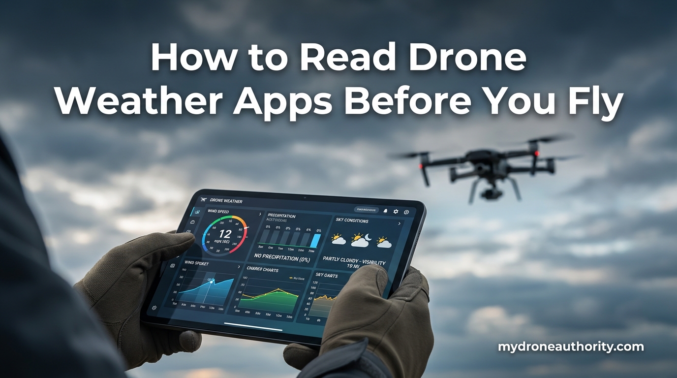
Weather causes more drone incidents than any other single factor, and most of those losses are preventable with a proper pre-flight weather check. If you have ever launched in “light wind” only to fight gusts that nearly carried your quad away, you already know why learning how to read drone weather apps before you fly is a skill, not an option. Standard weather apps are built for people deciding whether to bring an umbrella, not for pilots deciding whether a $1,200 aircraft stays in one piece.
This guide breaks down every weather variable that actually matters for drone operations, how drone-specific apps present that data, and how to translate raw numbers into a confident go or no-go decision. I will walk through wind sustained versus gusts, FAA visibility minimums, cloud ceilings, precipitation risk, battery-killing temperatures, GPS satellite health, METAR decoding, and the Kp index for solar activity.
By the end you will have a repeatable pre-flight workflow you can run in under two minutes, plus a printable checklist you can keep in your flight bag. Whether you fly recreationally or under Part 107, this is the same decision process commercial pilots use before every single mission.
Table of Contents
Why Standard Weather Apps Fall Short for Drones
Open your phone’s default weather app and you will likely see a single wind number, a temperature, and a rain percentage. That information is fine for planning a picnic, but it leaves out the variables that determine whether your drone comes home. Standard apps report wind at roughly 33 feet (10 meters) above ground, averaged over a long interval, with no separate gust reading and no altitude profile.
Drone weather apps fill those gaps by pulling aviation-grade data and translating it into flight-relevant thresholds. They show sustained wind and gusts as two distinct numbers, check visibility against the FAA three-statute-mile minimum, flag cloud ceilings that conflict with the 400-foot AGL rule, and surface the precipitation probability in a way that reflects actual hardware risk rather than just “will it rain on me.”
Forum pilots on r/drones and MavicPilots repeatedly describe the same frustration: their phone weather app showed calm conditions while their drone fought gusts at altitude. The lesson is simple. For any flight where the aircraft matters to you, use a drone-aware tool.
How to Read Drone Weather Apps Before You Fly: Step-by-Step
Reading a drone weather app should be a quick, repeatable routine, not a guessing game. The workflow below works in UAV Forecast, Aloft, OK To Fly, LightCast, Windy, or any comparable tool. Run it in this order every time so you do not miss a variable.
Step 1 – Confirm your location and flight window. Drop the pin on your exact launch site, not the nearest city. Set the start time and estimated flight duration so the hourly forecast aligns with your actual mission.
Step 2 – Read sustained wind first, then gusts. Sustained wind tells you the baseline load on your aircraft. Gusts tell you the peak load you must be able to absorb. Both numbers must be within your drone’s rated envelope or you scrub the flight.
Step 3 – Check visibility against FAA minimums. Part 107 pilots need at least three statute miles of visibility. Recreational pilots should treat the same number as a personal minimum. If the app shows less, you do not fly.
Step 4 – Verify cloud ceiling against your planned altitude. If you intend to fly at 300 feet AGL and the ceiling sits at 500 feet, you have 200 feet of clearance. If the ceiling is broken at 300 feet, you have none, and you stay on the ground.
Step 5 – Scan precipitation probability across the entire flight window. Look at every hour your drone could be in the air, not just the launch minute. Any precipitation probability above roughly 20 percent is a reason to reconsider, even on a “dry” looking day.
Step 6 – Check temperature and dew point spread. Battery chemistry suffers below about 40 degrees Fahrenheit, and a tight dew point spread signals fog or condensation risk on your lenses and sensors.
Step 7 – Confirm GPS satellite count and Kp index. A healthy fix needs roughly 10 or more satellites, and a Kp index at or above 5 warns of geomagnetic interference that can degrade GPS accuracy.
Step 8 – Make the go or no-go call. If every variable passes, fly. If any single variable fails, scrub. Do not talk yourself into a marginal flight because the other numbers look fine.
Wind Interpretation: Sustained vs Gusts
Wind is the variable that loses more drones than any other, and most of those losses come from pilots reading only one number. A standard weather app might show “8 mph wind,” which sounds calm. The same location on a drone weather app may show “8 mph sustained, gusts 16 mph” and that 16 mph figure is the one that decides whether you fly.
Sustained Wind vs Wind Gusts
Sustained wind is the average wind speed over a short window, typically one to two minutes. It represents the constant load your drone is fighting the entire time it is airborne. Wind gusts are sudden, short-duration spikes, usually lasting less than 20 seconds, that push the aircraft beyond the sustained baseline.
A drone rated for 25 mph wind can theoretically handle 25 mph sustained, but if gusts reach 35 mph, the aircraft is now flying outside its designed envelope. The gust number is almost always the more dangerous figure because it hits without warning and forces the flight controller into aggressive corrections that drain battery and can overrun the motor limits.
Wind Speed Thresholds by Drone Class
Different drones handle wind differently based on weight, motor power, and flight controller tuning. Use these thresholds as a starting point, then adjust based on your specific aircraft’s published spec and your own experience.
Small toy and sub-250g drones such as the DJI Mini series generally should not fly in sustained wind above 15 mph or gusts above 20 mph. Mid-size consumer drones like the DJI Air series handle sustained wind up to about 22 mph and gusts near 30 mph. Professional drones such as the Mavic 3 series and Inspire can manage sustained wind around 26 to 30 mph with gusts into the high 30s, but even at those limits you are working the aircraft hard.
Always subtract two to three mph from the published maximum as your personal ceiling. Manufacturer wind ratings are best-case figures in smooth air, not the turbulent boundary layer near trees, buildings, and terrain.
Reading Wind Direction
Wind direction matters as much as speed. A headwind on the outbound leg becomes a tailwind on the return, but only if you fly out and back along the same line. If you fly a long linear mission downwind, you may not have the battery to fight the headwind home. Always plan your return leg into the wind first, so the easier, downwind portion happens when the battery is lower.
Drone apps typically show wind direction with an arrow or in degrees from true north. The arrow points the direction the wind is blowing toward, not where it is coming from, though conventions vary between apps. Confirm the convention in your specific app before you trust it.
Visibility Requirements and the FAA 3-Mile Rule
Visibility is a legal requirement under Part 107, not just a comfort factor. Commercial drone pilots in the United States must maintain at least three statute miles of visibility during flight. The rule exists so you can see and avoid manned aircraft, and so manned aircraft can see you.
Recreational flyers under the community-based organization rules are not held to the exact same three-statute-mile minimum in every scenario, but treating three miles as your personal floor is the safest approach. Flying a drone you cannot see clearly is how mid-air collisions and loss-of-control events happen.
Drone weather apps report visibility in statute miles or meters. Three statute miles equals roughly 4,800 meters. If your app shows visibility below that number, the flight does not meet Part 107 minimums. Haze, fog, smoke from wildfires, and heavy precipitation all reduce visibility even when the sky otherwise looks flyable.
Pay special attention to visibility forecasts that degrade across your flight window. A day that starts at five miles and drops to two miles by noon means your morning window is fine but your afternoon mission is not legal under Part 107.
Cloud Cover, Ceiling, and the 400-Foot Rule
The FAA allows drone flights up to 400 feet above ground level (AGL) in uncontrolled airspace. Cloud ceiling is the height of the lowest broken or overcast cloud layer, measured from the ground. If that ceiling is below 500 feet, you have very little room between your maximum legal altitude and the clouds.
Part 107 requires staying at least 500 feet below clouds. That means if the ceiling is 1,000 feet, your maximum safe altitude is 500 feet AGL, which still gives you the full 400-foot envelope. If the ceiling is 700 feet, you are limited to 200 feet AGL. If the ceiling sits at 400 feet or below, you have no legal flight envelope at all.
Cloud cover is reported in “oktas,” or eighths of sky covered. Clear (CLR or SKC) means no clouds. Few (FEW) means one to two oktas, scattered (SCT) means three to four, broken (BKN) means five to seven, and overcast (OVC) means full coverage. A ceiling only exists when the layer is broken or overcast. Few and scattered layers do not technically count as a ceiling.
For drone purposes, treat any broken layer under 1,000 feet as a ceiling warning. Even if you stay legal at 400 feet, flying just below a low cloud deck puts you in poor light, possible moisture, and reduced visibility for other aircraft.
Precipitation Interpretation for Drone Safety
Precipitation probability in a standard weather app answers the question “will I personally get wet?” For a drone pilot, the better question is “is there any realistic chance moisture reaches my aircraft in flight?” Those two answers can be very different.
Most consumer drones are not waterproof. Even light drizzle can infiltrate the gimbal, short a motor winding, or fog the camera sensor permanently. A 20 percent precipitation probability sounds low, but it means there is a one-in-five chance your $1,000 aircraft gets wet during the flight. That is not a bet most pilots want to take.
Drone-specific apps tend to flag any precipitation probability above 10 to 20 percent as a caution, and anything above 30 percent as a no-fly. That conservative threshold matches the actual hardware risk better than the “chance of rain” framing on a consumer app.
Also check precipitation type. Snow, sleet, and freezing rain all add weight and moisture, and freezing temperatures compound the battery performance hit. Even dry snow can infiltrate vents and melt into the electronics after landing.
Watch the timing. A 10 percent chance that peaks two hours after your planned flight is fine. A 10 percent chance that spikes during your flight window is a reason to scrub or move the flight earlier.
Temperature Effects on Drone Battery and Performance
Li-Po batteries, the kind in nearly every consumer drone, lose significant capacity below about 40 degrees Fahrenheit. At 20 degrees Fahrenheit, you can expect as little as 50 to 60 percent of your normal flight time. The voltage sag under load is also more aggressive, which means a battery that reports 30 percent remaining can drop to critical in seconds.
Cold-weather flying is possible but requires preparation. Pre-warm the batteries indoors or in an insulated bag. Hover in place for the first 30 to 60 seconds after takeoff so the batteries self-heat under load. Set your return-to-home threshold higher than normal, around 35 to 40 percent, so you never get caught short.
High heat causes a different problem. Above about 95 degrees Fahrenheit, drone batteries and processors can overheat, especially during aggressive flying or while hovering in direct sun. Some aircraft will throttle performance or force a landing if internal temperatures exceed safe limits.
The dew point spread, also called the temperature-dew point spread, is the difference between the air temperature and the dew point. A spread of less than about 5 degrees Fahrenheit signals high humidity and a real risk of fog, condensation on your camera lens, or moisture inside the gimbal. Treat a tight spread as a warning, especially in early morning or late evening hours.
GPS Satellites and the Kp Index
Most drone pilots check wind, visibility, and precipitation, then stop. The pilots who actually understand how to read drone weather apps before you fly also check GPS satellite health and the Kp index, because both directly affect whether your drone knows where it is.
GPS satellite count is shown in some drone apps as a number, typically somewhere between 8 and 20. A solid lock for safe flight usually means at least 10 satellites, ideally more. Fewer than 8 satellites is a no-fly condition. More satellites means a tighter positional fix, which keeps your drone stable in a hover and accurate on its return-to-home.
The Kp index measures geomagnetic activity on a scale from 0 to 9. A Kp of 0 to 3 means calm conditions. A Kp of 4 to 5 signals elevated activity that can degrade GPS accuracy. A Kp of 6 or above indicates a geomagnetic storm that can cause GPS dropouts, fly-aways, and inaccurate positioning even on drones that also use GLONASS or Galileo satellites.
Check the Kp index especially if you are flying in northern latitudes, near the equinoxes, or during known solar events. Drone apps that pull space weather data will display the current Kp value and sometimes a forecast for the next few hours. If the Kp is 5 or higher and you do not absolutely need to fly, wait.
How to Read a METAR Report (Drone Pilot Basics)
METAR stands for Meteorological Aerodrome Report. It is the standard coded weather observation used in aviation worldwide, issued roughly once per hour from thousands of weather stations, usually at airports. Learning to decode a METAR gives you access to the same raw weather data that manned pilots use, often more current than what a consumer app shows.
A typical METAR looks something like this: KLAX 161753Z 25012G20KT 5SM FEW030 BKN060 22/15 A3012. It looks like alphabet soup until you break it into pieces.
KLAX is the station identifier, in this case Los Angeles International Airport. You can find the nearest station to your flight site using the FAA or any aviation weather site.
161753Z is the date and time in Zulu (UTC). The first two digits are the day of the month, the next four are the time in hours and minutes. Always convert Zulu time to your local time zone.
25012G20KT is wind. The first three digits are direction in degrees from true north, so 250 means wind from the west-southwest. The next two digits are sustained speed in knots, so 12 knots. The G20 is gusts to 20 knots. One knot equals about 1.15 mph.
5SM is visibility in statute miles. Five statute miles clears the Part 107 three-mile minimum.
FEW030 BKN060 is cloud cover. FEW030 means few clouds at 3,000 feet. BKN060 means broken clouds at 6,000 feet, which sets the ceiling.
22/15 is temperature 22 degrees Celsius and dew point 15 degrees Celsius. The spread of 7 degrees is healthy. A spread of 2 degrees or less warns of fog.
A3012 is the altimeter setting in inches of mercury, not critical for drone operations but useful context.
Once you decode a METAR a few times it becomes second nature, and you will find it more accurate and faster than scrolling through a consumer app.
Drone Weather Apps Comparison: What to Use in 2026
The right app depends on what you fly, how often, and how much detail you want. Here is how the main options stack up for 2026.
UAV Forecast remains the most popular drone-specific weather app. It shows wind, gusts, visibility, cloud cover, temperature, dew point, precipitation probability, GPS satellite count, and Kp index in a single hourly view. The app has moved some features behind a subscription, but the core forecast is still usable for free.
OK To Fly, powered by Airdata UAV, uses real flight data from over 63 million logged flights to refine its forecasts. It offers a color-coded hourly matrix (blue for fly, orange for marginal, red for no-go) and breaks wind down at different altitudes for specific aircraft types. Pilots who want data-backed predictions rather than raw model output favor this one.
Aloft, formerly Kittyhawk, is built for Part 107 operators who need airspace authorization, LAANC, and weather in the same workflow. It pairs the weather check with the legal compliance check, which is convenient for commercial missions.
Windy and MyRadar are not drone-specific, but many pilots use them as complements. Windy excels at detailed wind visualization at multiple altitudes. MyRadar gives a fast, animated view of precipitation cells so you can see if a storm is moving toward your launch site.
LightCast and similar apps translate the raw variables into a single flight score, which is convenient but removes the decision from the pilot. Use flight scores as a quick triage, not a substitute for understanding the underlying numbers.
Real-World Go/No-Go Scenarios
Real scenarios train your judgment better than any spec sheet. Here are three examples drawn from common conditions drone pilots face.
Scenario 1 – The “Looks Calm” Morning. Your phone weather app shows 6 mph wind and 10 percent chance of rain. UAV Forecast shows 6 mph sustained with gusts to 14 mph, visibility 4 miles, ceiling broken at 700 feet, precipitation probability rising to 35 percent within 90 minutes. The correct call is a short, low flight now, with a hard end time before the precipitation window opens. The gust number is acceptable for most consumer drones, and the ceiling leaves room at 200 feet AGL or below.
Scenario 2 – Sunny but Windy. Clear skies, 12 mph sustained wind, gusts to 22 mph, visibility 10 miles. For a DJI Mini pilot, this is a no-go because the gusts exceed the sub-250g threshold. For a Mavic 3 pilot, this is a cautious go, with shorter line-of-sight missions and a higher return-to-home battery threshold. Same weather, different decision based on aircraft.
Scenario 3 – Warm but Foggy. Temperature 60 degrees Fahrenheit, dew point 58 degrees, visibility 1.5 miles. Even though the wind is calm and there is no precipitation, this is a Part 107 no-go because visibility is below three statute miles. The tight dew point spread confirms fog is the cause, and it will likely persist until the sun burns it off. Wait for the spread to open.
Notice that in each scenario the deciding variable is different. That is why a checklist matters more than a gut feeling.
Pre-Flight Weather Checklist
Print this list or save it to your phone. Run through it before every flight, every time.
1. Confirm launch location and flight window in your drone weather app.
2. Check sustained wind and gusts against your drone’s rated threshold.
3. Verify visibility is at least three statute miles.
4. Confirm cloud ceiling allows your planned altitude with at least 500 feet of clearance below the clouds.
5. Scan precipitation probability across the entire flight window, not just launch.
6. Check temperature for battery performance impact (below 40 F or above 95 F).
7. Verify dew point spread is greater than 5 degrees Fahrenheit.
8. Confirm GPS satellite count is at least 10 and Kp index is below 5.
9. Review wind direction for outbound versus return flight planning.
10. Make the go or no-go decision. If any variable fails, scrub.
FAQs
What is the best weather app for drone pilots?
UAV Forecast is the most popular drone-specific weather app because it shows wind, gusts, visibility, cloud cover, precipitation probability, GPS satellite count, and Kp index in a single hourly view. OK To Fly, powered by Airdata, is favored by pilots who want data-backed predictions, while Aloft pairs the weather check with LAANC airspace authorization for Part 107 operators.
What apps to use before flying a drone?
Use a drone-specific app such as UAV Forecast, OK To Fly, or Aloft for the core weather and airspace check. Many pilots also run Windy for altitude wind data and MyRadar for live precipitation radar. The combination gives you both the drone-aware thresholds and the raw atmospheric picture.
What is the 400 foot rule for drones?
The 400 foot rule allows drone flights up to 400 feet above ground level in uncontrolled airspace in the United States. Part 107 pilots must also stay at least 500 feet below any cloud layer, so a low cloud ceiling can reduce your usable altitude well below 400 feet.
What wind speed is too high for drone flying?
Small sub-250g drones like the DJI Mini series should not fly in sustained wind above 15 mph or gusts above 20 mph. Mid-size consumer drones handle sustained wind to about 22 mph with gusts near 30 mph. Professional drones can manage sustained wind around 26 to 30 mph with gusts into the high 30s, but always fly below the published maximum for safety.
How do you interpret a METAR report?
Read a METAR left to right: station identifier, time in Zulu, wind direction and speed in knots with gusts, visibility in statute miles, cloud cover and ceiling, temperature and dew point in Celsius, and altimeter setting. Each block follows a fixed format, so once you learn the sequence you can decode any METAR in seconds.
What is the difference between METAR and TAF?
A METAR is an observation of current weather at a station, issued roughly once per hour. A TAF, or Terminal Aerodrome Forecast, is a prediction of expected weather at that station for the next 24 to 30 hours. Drone pilots use METARs to confirm actual conditions now and TAFs to plan future missions.
How far in advance can I plan a drone flight from the forecast?
Forecasts are reasonably reliable out to about 24 hours, less reliable from 24 to 72 hours, and useful only as a general trend beyond that. For mission-critical flights, check the forecast two to three days out, confirm it the night before, and verify it against a live METAR within an hour of launch.
What does precipitation probability mean for drone flying?
Precipitation probability is the chance that measurable moisture reaches your aircraft during the flight window. Because most consumer drones are not waterproof, drone pilots treat any probability above 20 percent as a caution and anything above 30 percent as a no-fly, even on days that look dry to the eye.
Conclusion
Learning how to read drone weather apps before you fly is the single highest-leverage skill you can build as a pilot, because it directly prevents the most common cause of aircraft loss. The variables themselves are simple: wind and gusts, visibility, ceiling, precipitation, temperature, dew point spread, GPS satellites, and Kp index. The discipline is in checking every one of them, every time, and respecting any single failure as a reason to scrub.
Start with UAV Forecast or OK To Fly, run the eight-step workflow before your next flight, and keep the printable checklist in your flight bag. Once the routine becomes automatic, your go or no-go decisions get faster, your flights get safer, and your aircraft comes home more often. That is the entire point.