
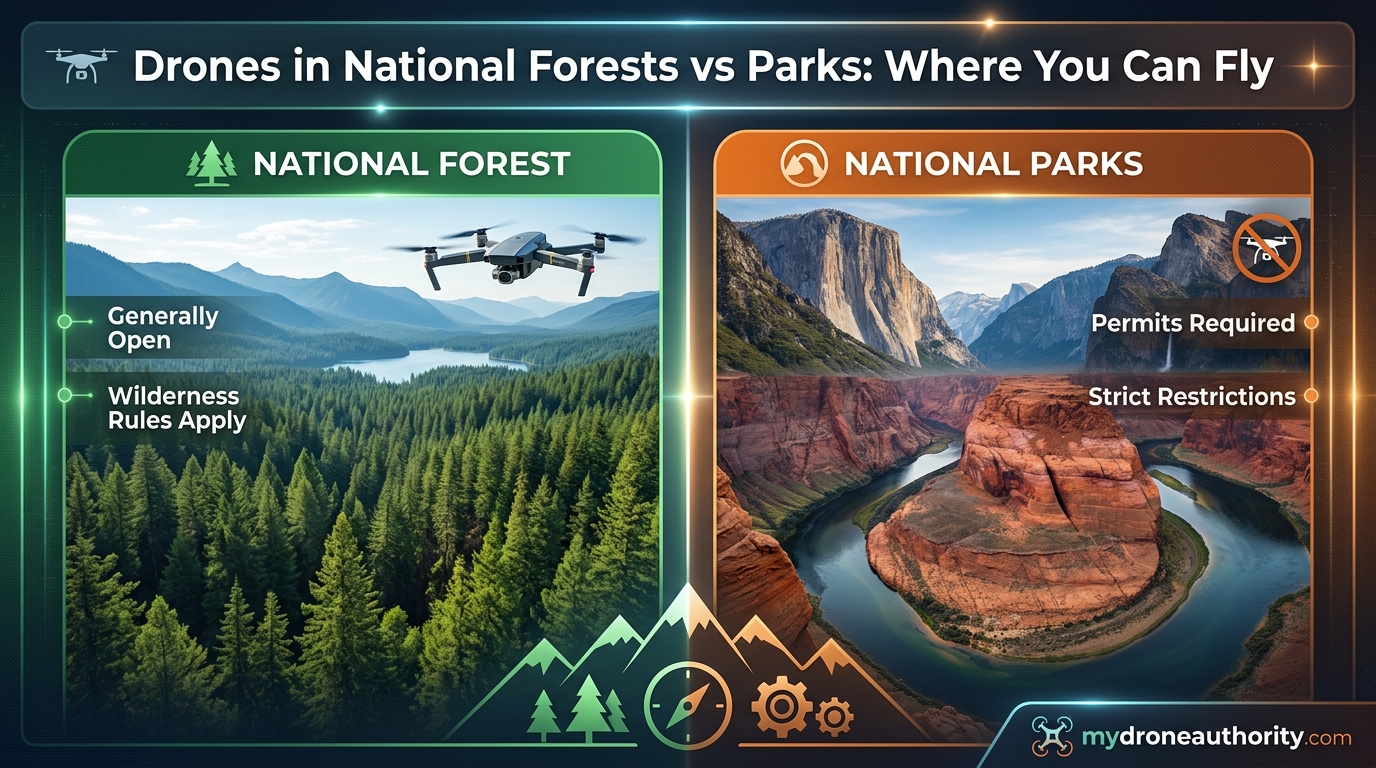
If you have ever packed your drone for a road trip through federal lands, you have probably asked the same question that confuses thousands of pilots every year. Where exactly are you allowed to fly? The rules around drones in national forests vs national parks are some of the most misunderstood regulations in the entire hobby, and getting them wrong can cost you thousands of dollars.
I have spent years flying drones across public lands in the United States, and I have seen firsthand how confusing the boundaries can be. National Parks look like the perfect place to capture aerial footage, yet they are the single most restricted federal land for drone pilots. National Forests, on the other hand, often sit right next to those same parks and welcome drone flying with open arms.
This guide breaks down everything you need to know about where you can legally fly a drone on federal lands in 2026. We will cover the complete National Park ban, the rules that govern National Forests, the wilderness area exception that trips up most pilots, and the penalties you face if you get it wrong. By the end, you will know exactly where to launch without risking a fine.
Table of Contents
The Short Answer: Where You Can and Cannot Fly
Here is the quick version that most drone pilots need before they hit the road. National Parks managed by the National Park Service (NPS) ban drones completely, with almost no exceptions. National Forests managed by the U.S. Forest Service (USFS) generally allow recreational and commercial drone flying under FAA rules, with some important exceptions.
Members of the public may fly Unmanned Aircraft Systems (UAS) for hobby or recreation in many places on National Forest System lands, according to the U.S. Forest Service. That single sentence separates National Forests from National Parks more clearly than anything else in federal drone policy.
This comparison table breaks down the key differences at a glance.
| Feature | National Parks (NPS) | National Forests (USFS) |
|---|---|---|
| Drone flying allowed? | No, complete ban | Yes, generally permitted |
| Governing policy | Policy Memorandum 14-05 | USFS recreational drone tips |
| Wilderness areas | All park land restricted | No drones in designated wilderness |
| Permit available? | Special Use Permit only | Not usually required |
| Maximum fine | Up to $5,000 plus jail | Standard FAA penalties |
| FAA rules still apply? | Yes | Yes |
If you take only one thing from this article, let it be this. Launch from a National Forest, not a National Park, and always check for wilderness boundaries and temporary flight restrictions before you fly.
National Parks: Why Drones Are Completely Banned
The National Park Service banned drones in August 2014 under Policy Memorandum 14-05. That memorandum directed every park superintendent to prohibit the launching, landing, and operation of drones within park boundaries. The ban applies to all 63 National Parks and over 400 NPS units nationwide.
Many pilots assume the ban only covers certain parks or only restricts commercial flying. That assumption is wrong. The ban is universal across every property managed by the National Park Service, and it applies equally to recreational hobbyists and Part 107 commercial operators.
The reasons behind the ban come down to four core concerns that the NPS outlines in its official policy.
Wildlife protection. Studies have documented that drones cause stress responses in wildlife, including bears, mountain goats, and nesting birds. Some animals abandon feeding or nesting sites when drones approach, which can threaten entire populations during sensitive seasons.
Visitor experience. National Parks exist partly to give visitors a chance to experience natural quiet and solitude. The buzzing sound of drone propellers shatters that experience for everyone within several hundred feet.
Safety incidents. Before the 2014 ban, drones had crashed into Yellowstone’s Grand Prismatic Spring, disturbed climbers in Yosemite, and interfered with visitors at Grand Canyon. Each incident pushed the NPS closer to a total ban.
Natural soundscape preservation. The NPS is legally required to protect natural soundscapes under its founding mandate. Drones introduce mechanical noise that the agency considers incompatible with that mission.
The FILM Act and Recent Updates
In 2025, the FILM Act (Filming In Land Management) created some confusion about whether the National Park drone ban had been lifted. It had not. The FILM Act addressed commercial filming fees and permits for traditional cinematography, not drone operations.
The drone ban under Policy Memorandum 14-05 remains in full force. If you see articles claiming the rules changed in 2025 or 2026, look closely at whether they are talking about ground-based filming crews or actual drone flights. The two are completely separate.
What Counts as a National Park
The ban covers more than just the 63 official National Parks. It extends to national monuments, national preserves, national historic sites, national battlefields, and national recreation areas managed by the NPS. That means places like Lake Mead National Recreation Area, Gettysburg National Military Park, and Statue of Liberty National Monument all fall under the same no-drone rule.
Checking who manages the land is the fastest way to know if you can fly. If the National Park Service manages it, drones are off limits. If the U.S. Forest Service, Bureau of Land Management, or state agency manages it, the rules are very different.
National Forests: Where Drone Flying Is Generally Allowed
National Forests are managed by the U.S. Forest Service under a completely different legal framework than National Parks. The USFS operates under a multiple-use mandate, which means these lands are open to logging, grazing, mining, recreation, and yes, drone flying. This is the key reason drones are welcome in National Forests but banned in National Parks.
The U.S. Forest Service publishes official recreational drone tips that confirm the general permission to fly. According to the agency, members of the public may fly UAS for hobby or recreation in many places on National Forest System lands, as long as they follow FAA regulations and any local restrictions.
This does not mean every inch of every National Forest is open. You still need to respect wilderness areas, active wildfire zones, temporary flight restrictions, and any local closures posted by the district ranger office.
FAA Rules Still Apply on Forest Service Land
Permission from the Forest Service does not replace FAA requirements. Every flight in a National Forest must still comply with federal aviation regulations.
Recreational pilots must follow the Exception for Limited Recreational Operations of Unmanned Aircraft. That means flying under 400 feet above ground level, maintaining visual line of sight, passing the free TRUST test, and registering the drone with the FAA if it weighs more than 0.55 pounds.
Commercial pilots must hold a Part 107 Remote Pilot Certificate and follow all Part 107 operating rules. This includes the 400-foot ceiling, daylight-only operations unless waiverd, and visual line of sight requirements.
Specific Forest Examples
Pilots frequently ask about specific forests because local conditions vary. Here are the most common ones that come up in forums and search queries.
Gifford Pinchot National Forest (Washington). Drone flying is generally allowed outside designated wilderness areas like the Goat Rocks Wilderness and Trapper Creek Wilderness. Check with the local ranger district for any temporary closures, especially during fire season.
White Mountain National Forest (New Hampshire and Maine). Drones are permitted in most of the forest, but the Great Gulf Wilderness, Presidential Range-Dry River Wilderness, and Sandwich Wilderness are all off limits. The Caribou-Speckled Mountain Wilderness in Maine carries the same restriction.
San Bernardino National Forest (California). Drone flying is allowed in most areas, but the forest has implemented frequent temporary flight restrictions during wildfire season. Always check current TFRs before heading out.
Pisgah and Nantahala National Forests (North Carolina). These forests border Great Smoky Mountains National Park, where drones are banned. Many pilots fly just outside the park boundary in these forests instead, but you must verify you are actually on Forest Service land and not inside the park.
The best practice for any National Forest visit is to call the local ranger district office before you go. They can tell you about current closures, fire restrictions, and any local drone rules that may apply.
Wilderness Areas: The Big Exception Inside National Forests
This is the rule that catches the most drone pilots off guard. National Forests contain designated Wilderness Areas, and drones are completely banned inside those boundaries.
The Wilderness Act of 1964 created the National Wilderness Preservation System and prohibited all motorized and mechanized equipment in designated wilderness. The Forest Service interprets this to include drones, which means launching, landing, or flying a drone over a wilderness area is illegal.
Wilderness Areas look just like the rest of the National Forest surrounding them. There are no fences or gates. You will usually find a small sign at the boundary, but if you are hiking cross-country, it is easy to cross into wilderness without realizing it.
This matters because the penalties for flying in a wilderness area can be more serious than a standard FAA violation. The Forest Service treats wilderness incursions as violations of the Wilderness Act itself, not just a local drone rule.
How to Check for Wilderness Boundaries
Before flying in any National Forest, you need to know where the wilderness boundaries are. The Forest Service website for each forest includes maps showing designated wilderness areas. You can also use apps like OnX, Gaia GPS, or the Avenza Maps app with Forest Service overlays.
A good rule of thumb is that any area with the word Wilderness in its name is off limits. If you see signs for the Maroon Bells-Snowmass Wilderness, the Eagle Cap Wilderness, or the Bob Marshall Wilderness, keep your drone packed away.
When in doubt, contact the ranger district office. They can confirm whether your specific launch site is inside or outside a wilderness boundary.
FAA Requirements That Apply Everywhere
No matter where you fly, the FAA has jurisdiction over the National Airspace System. Forest Service permission does not override FAA rules, and FAA rules do not override Forest Service closures. You must satisfy both sets of requirements.
Recreational Pilot Requirements
If you fly for fun, you fall under the recreational exception. You must pass the free TRUST (The Recreational UAS Safety Test) and keep proof of completion with you. Your drone must be registered with the FAA if it weighs more than 250 grams, and registration costs five dollars for three years.
You must fly below 400 feet above ground level, maintain visual line of sight at all times, and never fly over people who are not participating in your operation. Night flying is allowed without a waiver as long as your drone has anti-collision lighting visible for three statute miles.
Commercial Pilot Requirements
If you fly for any business purpose, including selling photos, YouTube monetization, real estate, or any work for compensation, you need a Part 107 Remote Pilot Certificate. Getting the certificate requires passing a 60-question aeronautical knowledge test at an FAA-approved testing center.
Part 107 pilots must follow the same 400-foot ceiling and visual line of sight rules, plus additional requirements around airspace authorization. Many National Forests sit within controlled airspace near airports, which means you may need LAANC (Low Altitude Authorization and Notification Capability) approval before launching.
Apps Every Pilot Should Use
Two apps dominate the airspace-checking conversation among experienced drone pilots. The FAA’s B4UFLY app is free and shows airspace classes, temporary flight restrictions, and national park boundaries. Aloft (formerly AirMap) offers similar features plus LAANC authorization in supported areas.
Checking one of these apps before every flight is non-negotiable. Temporary flight restrictions can pop up with little notice during wildfire season, stadium events, and VIP travel. A flight that was legal yesterday might be illegal today.
Penalties: What Happens If You Break the Rules
The consequences for flying a drone where you should not depend on which rule you violated. National Park violations carry the harshest penalties, while FAA violations follow a separate fine structure.
Flying a drone in a National Park is a federal misdemeanor under 36 CFR 1.5. The maximum penalty is a fine up to $5,000 and up to six months in jail. In practice, most first-time offenders receive a fine between $500 and $1,500, but park rangers have full discretion to escalate based on the circumstances.
Rangers can also confiscate your drone equipment as evidence. Getting it back can take months, and some pilots have reported never recovering their gear after a violation.
Is It a Felony to Fly in a National Park?
This question comes up constantly in forums, and the answer is generally no. A standard drone violation in a National Park is a Class B misdemeanor, not a felony. However, the situation can escalate to a felony if your drone operation causes property damage, injures someone, interferes with an emergency operation, or violates additional federal laws.
If your drone crashes into a thermal feature in Yellowstone and the park has to mount a recovery operation, the charges and fines can multiply quickly. One pilot in 2014 faced thousands in fines and restitution after crashing a drone into Grand Prismatic Spring.
FAA Penalties
The FAA handles its own enforcement separately from the National Park Service. Civil penalties for reckless drone operation can reach $27,500 per violation. Criminal penalties for especially dangerous operations can include fines up to $250,000 and up to three years in prison.
These penalties are rare for typical hobbyist violations, but they are not theoretical. The FAA has pursued enforcement action against pilots who interfered with wildfire operations, flew near airports, or operated recklessly over crowds.
Real Enforcement Stories
Forum discussions on Reddit and MavicPilots confirm that park rangers actively enforce the ban. Multiple pilots have reported receiving citations after rangers spotted drones in the air, tracked the operator, and issued tickets on the spot.
One common mistake is assuming rangers will not notice a small drone in a vast park. Rangers are trained to watch for drone activity, especially at popular viewpoints and overlooks. If your drone is in the air, someone is likely watching you launch.
Launching Outside vs Flying Over: The Boundary Question
This is one of the most misunderstood aspects of the National Park drone ban. Many pilots assume that if they launch from outside the park boundary, they can legally fly their drone over park land. That assumption is incorrect.
The NPS ban covers launching, landing, and operation of drones inside park boundaries. If your drone is flying over park land, the NPS considers it operating inside the park, regardless of where the pilot is standing. This means launching from a National Forest that borders a National Park and flying into park airspace violates the ban.
The NPS does not have jurisdiction over the airspace itself, which is controlled by the FAA. But the NPS does have jurisdiction over what happens on the ground inside park boundaries. If your drone descends, crashes, or lands inside the park, you are subject to citation.
In practice, rangers have limited ability to enforce against a drone that simply passes over park airspace at 300 feet and never lands. But if anything goes wrong, and your drone comes down inside park boundaries, you are facing the full penalty structure. Most experienced pilots advise against pushing this boundary.
The safer approach is to fly only over National Forest land, even when launching from a National Forest. Keep your drone within the forest boundary and avoid approaching the park border. A good drone map app can help you track your position relative to park boundaries in real time.
How to Get a Permit for National Parks (Yes, It Is Possible)
The National Park Service does issue permits for drone operations inside parks, but the bar is extremely high. These permits go through the Special Use Permit process, and they are almost never granted for recreational or hobbyist purposes.
Permits are typically reserved for scientific research, search and rescue operations, natural resource management, and occasionally for professional film productions with a compelling justification. Even then, the application process is rigorous and approval is far from guaranteed.
Steps to Apply for a Special Use Permit
Step 1. Contact the specific park’s permitting office. Each park handles its own permits, and there is no central application portal. You will need to explain your project in detail and justify why a drone is necessary inside the park.
Step 2. Submit a formal application with your project description, flight plan, pilot credentials, insurance documentation, and any environmental impact assessments. The park will review your application for potential impacts on wildlife, visitors, and cultural resources.
Step 3. Wait for review. The process can take weeks or months, and the park may request modifications to your plan or additional documentation before making a decision.
Step 4. If approved, pay the required fees. Special Use Permit fees vary by park and project scope, and they can be substantial for commercial filming operations.
For the vast majority of drone pilots, the permit route is not realistic. If your goal is recreational aerial photography, your best bet is to fly in a nearby National Forest instead.
Where to Fly Instead: BLM Land, State Parks, and More
If National Parks are off limits, where should you go instead? Several categories of public land offer excellent drone flying opportunities with far fewer restrictions.
Bureau of Land Management Land
BLM land covers about 245 million acres across the western United States, and it generally allows drone flying outside designated wilderness areas. Like National Forests, BLM land operates under a multiple-use mandate that accommodates recreation.
The rules are similar to National Forests. You must follow FAA regulations, avoid wilderness areas, respect temporary flight restrictions, and stay away from developed facilities if local rules prohibit flights. BLM land is often less crowded than National Parks and offers incredible landscapes for aerial photography.
State Parks
State park drone rules vary dramatically from state to state and even park to park within the same state. Some states ban drones in all state parks. Others allow them with a permit. Some leave the decision to individual park managers.
California State Parks generally prohibit drones without a film permit. Texas State Parks require advance approval from the park superintendent. North Carolina allows drones in most state parks with some restrictions. You must check the specific park rules before launching.
The safest approach is to call the state park office directly and ask about their current drone policy. Do not rely on outdated forum posts, because state park rules change frequently.
Private Land Near Parks
Private land adjacent to National Parks can be an option, but you need landowner permission and you still cannot fly over park airspace. Some private landowners near park boundaries offer paid drone flying access, especially in areas like the Tetons and areas surrounding Yellowstone.
Always verify you have explicit permission before launching from private property. Trespassing charges can compound quickly if you fly over neighboring land without authorization.
Local and County Parks
Many local and county parks allow drone flying, though some require permits or restrict flying to designated areas. These smaller parks can be excellent for practice flights and quick sessions when you cannot travel to federal land.
Check your city and county websites for local drone ordinances. Some municipalities have their own rules that go beyond FAA requirements, and those local rules are enforceable.
Practical Tips for Flying Near Parks and Forests
After years of flying on federal lands, here are the practical tips that will keep you legal and help you capture better footage.
Download B4UFLY or Aloft before every trip. Check the app the morning of your flight, not the night before. Temporary flight restrictions can appear with minimal notice.
Carry proof of TRUST completion or your Part 107 certificate. Rangers and law enforcement officers can ask to see your credentials. Having them ready makes every interaction smoother.
Pack a printed Forest Service map. Cell service is unreliable in most National Forests. A paper map showing wilderness boundaries can save you from an accidental violation.
Keep your distance from wildlife. The Forest Service recommends staying at least 100 feet from any wildlife. If an animal changes behavior because of your drone, you are too close.
Be respectful of other visitors. Even where drones are legal, some people find them annoying. Flying near popular trails and viewpoints can generate complaints, even if you are within your rights.
Have a conversation with rangers, not a confrontation. If a ranger approaches you, stay calm, answer questions honestly, and show your credentials. Most rangers are reasonable if you are cooperative.
Frequently Asked Questions
Can you fly drones over National Forests?
Yes, drones are generally allowed in National Forests managed by the U.S. Forest Service. You can fly for recreation or commercial purposes as long as you follow FAA regulations, avoid designated wilderness areas, respect temporary flight restrictions, and check for any local closures with the ranger district office.
Are you allowed to fly drones in National Parks in the USA?
No. The National Park Service banned drones in all National Parks and NPS-managed units under Policy Memorandum 14-05. This includes launching, landing, and operating drones anywhere inside park boundaries.
Why are National Parks no drone zones?
National Parks ban drones to protect wildlife from stress and disturbance, preserve the natural soundscape and visitor experience, prevent safety incidents like crashes into sensitive features, and fulfill the NPS legal mandate to protect natural resources for future generations.
Can you fly drones in Gifford Pinchot National Forest?
Yes, drones are allowed in Gifford Pinchot National Forest outside designated wilderness areas like Goat Rocks Wilderness and Trapper Creek Wilderness. Always check with the local ranger district for temporary closures, especially during wildfire season.
Is it a felony to fly a drone in a national park?
No, a standard drone violation in a National Park is a Class B misdemeanor punishable by up to a $5,000 fine and six months in jail. It can escalate to more serious charges if your operation causes property damage, injury, or interferes with emergency operations.
Can I fly my drone in Yellowstone National Park?
No. Yellowstone is a National Park managed by the National Park Service, and drones are completely banned inside the park. This ban has been strictly enforced since 2014, and several pilots have been fined for violations.
Can you fly a drone in the Smoky Mountains?
No, drones are banned in Great Smoky Mountains National Park just like every other National Park. However, the adjacent Pisgah and Nantahala National Forests in North Carolina allow drone flying outside wilderness areas.
Final Thoughts on Flying Drones on Federal Lands
The distinction between drones in national forests vs national parks comes down to one simple rule. If the National Park Service manages the land, leave your drone packed away. If the U.S. Forest Service manages it, you can almost certainly fly as long as you respect FAA rules, wilderness boundaries, and temporary restrictions.
I have watched too many pilots learn this lesson the expensive way. A five-minute flight inside a National Park can turn into a $1,500 fine, a confiscated drone, and a court date. The same flight in a neighboring National Forest would have been completely legal and produced identical footage.
Before your next trip, do three things. Download B4UFLY or Aloft and check current airspace conditions. Print or save a Forest Service map showing wilderness boundaries. Call the local ranger district office to confirm there are no closures or restrictions. These three steps take less than thirty minutes, and they can save you from a costly mistake.
Federal lands offer some of the most spectacular drone flying opportunities in the world. You just need to know where to launch.