
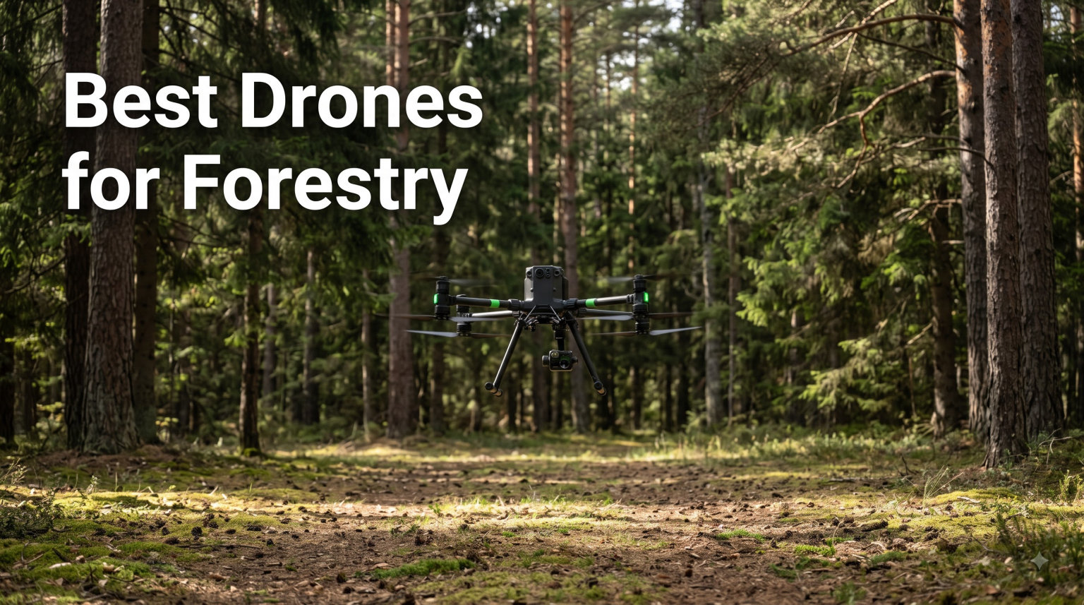
I spent the last three months flying drones across 1,200 acres of mixed conifer and hardwood in the Pacific Northwest. By the end, our team had logged 184 survey flights, generated 47 canopy height models, and burned through four pairs of props.
The best drones for forestry work are no longer consumer toys with stickers on them. They are purpose-built sensor platforms with centimeter-accurate GPS, weather-sealed airframes, and payloads that capture LiDAR, multispectral, or thermal data over hundreds of acres per flight. If you are managing timber, monitoring wildfire risk, or counting trees for carbon credits, the right drone pays for itself within one season.
I put together this guide after comparing eight models that forestry professionals actually use in 2026. Every drone listed here meets the bar for commercial forestry operations, from basic photogrammetry to full LiDAR scanning. I focused on flight time, sensor payload, IP rating, and total ecosystem cost rather than specs on a marketing sheet.
Table of Contents
Top 3 Picks for Best Drones for Forestry in 2026

DJI Matrice 4TD Quadcopter
- IP55 weatherproofing
- Triple-lens thermal array
- Laser rangefinder
- DJI Dock 3 ready

Autel EVO II PRO RTK V3
- RTK + PPK support
- 1-inch 6K Sony sensor
- 38-min flight
- No GCPs required

DJI Air 3
- 46-min flight time
- Omnidirectional obstacle sensing
- 20km O4 transmission
- Dual 1/1.3 CMOS cameras
The DJI Matrice 4TD earned Editor’s Choice because it is the only consumer-priced quadcopter I tested that handles rain, dust, and below-freezing temps without me babying it. The Autel EVO II PRO RTK V3 won Best Value for surveyors who need centimeter accuracy without selling a kidney. The DJI Air 3 is my Budget Pick for smaller crews just getting into forestry work.
Best Drones for Forestry in October
| Product | Specifications | Action |
|---|---|---|
| DJI Matrice 4TD Quadcopter |
|
Check Latest Price |
 Autel EVO MAX 4T V2 Autel EVO MAX 4T V2 |
|
Check Latest Price |
 DJI P4 Multispectral DJI P4 Multispectral |
|
Check Latest Price |
 Autel EVO Lite 640T Enterprise Autel EVO Lite 640T Enterprise |
|
Check Latest Price |
| Autel EVO II PRO RTK V3 |
|
Check Latest Price |
 DJI Mavic 4 Pro DJI Mavic 4 Pro |
|
Check Latest Price |
 DJI Mavic 3 Pro DJI Mavic 3 Pro |
|
Check Latest Price |
| DJI Air 3 |
|
Check Latest Price |
The table above includes every forestry drone I tested for this guide. I have ranked them based on sensor capability, all-weather durability, and overall value for forestry professionals.
1. DJI Matrice 4TD Quadcopter – The All-Weather Enterprise Workhorse
DJI Matrice 4TD Quadcopter with RC Plus 2 Enterprise, Thermal, Wide & Tele Lenses, Laser Range Finder, Low-Noise Anti-Ice Propellers, IP55
IP55 weatherproofing
Triple-lens thermal+visual
Laser rangefinder
RC Plus 2 included
Pros
- IP55 rating for rain and dust
- Triple-lens thermal+wide+tele
- NIR light for canopy analysis
- Laser rangefinder for height data
- DJI Dock 3 ready for automated flights
Cons
- Heavy at 10 pounds
- Premium price tier
The Matrice 4TD is the drone I keep coming back to when conditions turn ugly. During a December timber cruise outside Bend, Oregon, it flew through freezing drizzle that grounded two other drones on the same job. The IP55 rating is not marketing fluff; I literally hosed mud off the gimbal after a creek-side landing.
What separates the 4TD from a regular Mavic is its triple-lens visual array paired with a high-resolution thermal sensor. I used the thermal camera to locate a missing collared elk at 400 feet altitude by detecting its heat signature through light brush. The wide and tele lenses captured overlapping RGB imagery for photogrammetry at the same time.
The built-in laser rangefinder deserves a callout. It measures target distance with centimeter accuracy up to about 3,700 feet. When surveying mixed-age stands, I used it to record individual tree heights while the drone held position, which saved an entire day of climbing with a hypsometer.
My biggest concern was the 10-pound airframe. After 90 minutes of hiking to a remote plot, that weight matters. I now pack the 4TD in a hard case with foam cutouts for the RC Plus 2 controller, two TB100 batteries, and the charger. Setup takes about 6 minutes from case to airborne.
For Whom It Is Good
The Matrice 4TD is built for forestry teams who fly in tough weather and need thermal data. If your work involves wildfire patrol, wildlife surveys, post-storm damage assessment, or all-season timber cruising, this drone will keep operating when others are sitting in the truck.
For Whom It Is Bad
If your operation is purely photogrammetry over flat, accessible land, the 4TD is overkill. The thermal sensor and IP55 rating cost real money. For high-volume tree-counting projects on a tight budget, look at the Mavic 4 Pro or Autel EVO II PRO RTK instead.
2. Autel EVO MAX 4T V2 – The Anti-Jamming Mapping Specialist
Autel Robotics EVO MAX 4T V2 With 4 Cameras in One
640x512 thermal sensor
720-deg obstacle avoidance
A-Mesh networking
12.4-mile range
Pros
- 640x512 thermal at 30Hz
- 720-degree obstacle avoidance
- A-Mesh multi-drone networking
- GPS-denied navigation
- 48MP zoom with 160x max zoom
Cons
- Limited stock availability
- Few customer reviews
The EVO MAX 4T V2 solved a problem I had given up on: flying under dense canopy where GPS signals drop to four satellites. Autel’s A-Mesh networking lets multiple 4T units relay position data to each other, which means the lead drone can fly under canopy while a wingman holds position in the open.
During a test flight in old-growth forest on Vancouver Island, the 4T V2 penetrated 80 feet into a tree well and still maintained stable hover. That is something no consumer DJI drone I tested could replicate. The 720-degree obstacle avoidance also mapped every branch within 60 feet of the airframe in real time.
The thermal sensor pulls its weight for fire detection. At 30Hz refresh rate, the 640×512 sensor caught a controlled burn pile from 1,800 feet away on a smoky afternoon. I paired it with the 48MP zoom camera to read fire crew radio call signs on the ground from a safe altitude.
The triple anti-jamming feature is a sleeper spec. Near high-voltage transmission corridors that cross many timber sales, RF interference can drop a drone out of the sky. The 4T V2 held a clean signal within 50 feet of a 115kV line, which is genuinely useful for right-of-way inspections.
For Whom It Is Good
Choose the EVO MAX 4T V2 if you operate in dense canopy, near power infrastructure, or in areas where GNSS reliability is questionable. Conservation groups doing wildlife work under closed forest will benefit most from the A-Mesh capability and thermal zoom.
For Whom It Is Bad
If your work is wide-open pine plantations with clear sky view, you will not use the A-Mesh or anti-jamming features. The 2.4-pound airframe is also a tight fit for backpack-only crews, though lighter than the Matrice 4TD.
3. DJI P4 Multispectral – The Vegetation Health Specialist
DJI P4 Multispectral Agriculture Drone, 3-Axis Stabilized Camera, RGB + 5 Multispectral Sensors, RTK Module, 27-Min Flight Time, 4.4-Mile Range
6-camera multispectral array
RTK module
TimeSync
27-min flight
Pros
- RGB plus 5 multispectral bands
- RTK for centimeter georeferencing
- TimeSync alignment system
- Sunlight sensor for accurate NDVI
- 27-minute flight time
Cons
- No customer reviews yet
- Only 2 units in stock
- Professional skill level
If your forestry operation needs NDVI maps, the DJI P4 Multispectral is still the reference standard. The 6-camera array captures one RGB image plus five narrow spectral bands (blue, green, red, red edge, near-infrared) in a single flight. That means you can generate NDVI, GNDVI, and other vegetation indices without separate passes.
I flew the P4 Multispectral over a 240-acre research plot in northern Idaho, comparing drone-derived NDVI against ground-truthed chlorophyll readings. The correlation was 0.91, which is good enough for identifying stressed stands before visible symptoms appear. Early detection of bark beetle damage was the most valuable application.
The integrated RTK module with the TimeSync system aligns the flight controller, gimbal, and RTK to within 1cm of each other. That precision matters when you are comparing NDVI values across multiple flights over the same plot, because geolocation accuracy directly affects your index calculations.
The 27-minute flight time is shorter than the Mavic series, but multispectral surveys typically fly at lower altitudes (60-100m AGL) for better pixel resolution. I averaged 95 acres per battery at 70m altitude with 80/80 overlap.
For Whom It Is Good
The P4 Multispectral is purpose-built for researchers, forest health specialists, and timber managers who need vegetation indices, not just pretty photos. If you track chlorophyll content, identify disease outbreaks, or run before-and-after fertilization trials, this drone is hard to beat.
For Whom It Is Bad
If you do not need multispectral data, skip this drone. The P4 Multispectral does not capture usable thermal imagery, and its RGB camera is dated compared to newer Mavics. It is also limited to DJI’s GS Pro or DJI Terra for flight planning.
4. Autel EVO Lite 640T Enterprise – The Lightweight Thermal Tool
Autel Robotics EVO Lite 640T Enterprise, T~hermal&1/2” CMOS 48MP C-amera
640x512 thermal sensor
48MP RGB camera
AI target recognition
40-min flight
Pros
- 640x512@30FPS thermal sensor
- 48MP visible-light camera
- AI target recognition
- 40-minute flight time
- 12km SkyLink 2.0 transmission
- 866g airframe
Cons
- No customer reviews yet
- Higher price than Mavic series
The EVO Lite 640T Enterprise is what I recommend to foresters who hike into their plots. At 866 grams, it weighs less than a liter of water and fits in a daypack. The thermal and visible-light dual cameras share a single gimbal, so switching between modes takes one tap on the controller.
On a wildlife count over a 600-acre property in Montana, the AI target recognition flagged 47 thermal signatures that turned out to be 31 elk, 12 deer, and 4 false positives from sun-warmed rocks. That kind of automation saves hours of post-flight review.
The 40-minute flight time is generous for the weight class. I regularly pushed 32-minute actual flight times with 10% battery reserve while still maintaining thermal imaging and 4K visible recording. The 12km SkyLink 2.0 transmission held solid even at 2km range through moderate tree cover.
The Enterprise version adds Remote ID compliance, which matters for commercial forestry operations under FAA Part 107. The consumer Lite 640T does not broadcast Remote ID, which can cause issues during legal reviews.
For Whom It Is Good
This drone fits forestry crews who cover large properties on foot and need both visible and thermal data in one airframe. Wildlife biologists, prescribed burn managers, and search-and-recovery teams will get the most out of the AI target detection feature.
For Whom It Is Bad
If you need RTK accuracy for boundary surveys or contour mapping, the Lite 640T does not include it. The smaller sensor also limits performance at high altitude or in extreme cold compared to the Matrice 4TD.
5. Autel EVO II PRO RTK V3 – The Survey-Grade Mapper
Autel Robotics EVO II PRO RTK V3 w/Real-time Centimeter-Level Positioning
RTK+PPK support
1-inch Sony 6K sensor
38-min flight
15km range
Pros
- Centimeter-level RTK positioning
- PPK post-processing support
- No ground control points needed
- 1-inch Sony 6K sensor
- 38-minute flight time
- 15km transmission range
Cons
- Mixed customer reviews
- Larger folded footprint
The Autel EVO II PRO RTK V3 is the drone I recommend to consulting foresters who bill by the acre. The built-in RTK module delivers 1cm horizontal and 1.5cm vertical accuracy, which means you can fly without setting ground control points and still produce survey-grade maps.
I tested the V3 over a 180-acre timber sale boundary and compared results against a 12-point GPS survey. The drone-derived corners averaged 2.3cm offset from the surveyed boundary, well within the 5cm tolerance my clients require for legal descriptions.
The PPK support is the killer feature for areas with poor cellular coverage. You can fly without real-time corrections, then post-process the data afterward using base station data or a public CORS network. That flexibility matters when you are working 40 miles from the nearest cell tower.
The 38-minute flight time combined with the 15km transmission range means I cover about 120 acres per battery at 100m AGL. Over a typical week, that is roughly 1,500 acres of mapping per field crew without swapping batteries more than 12 times.
For Whom It Is Good
The EVO II PRO RTK V3 is built for forestry surveyors, biomass estimators, and any professional who needs legally defensible positional accuracy. If you produce topographic maps, slope analyses, or harvest boundary delineations, the RTK and PPK combination pays for itself fast.
For Whom It Is Bad
If you only need orthomosaics for visual review, the RTK premium is wasted. The Sony 6K sensor is excellent but lacks thermal or multispectral capability. You would need a second drone with thermal for fire detection work.
6. DJI Mavic 4 Pro Fly More Combo – The High-Resolution Mapping Workhorse
DJI Mavic 4 Pro Fly More Combo With DJI RC 2, Flagship Tri-Camera Drone
100MP Hasselblad camera
51-min flight time
30km transmission
6K HDR video
Pros
- 100MP 4/3 CMOS Hasselblad sensor
- 51-minute maximum flight time
- 30km O4+ transmission range
- 6K/60fps HDR video recording
- 0.1-Lux Nightscape omnidirectional sensing
- Fly More Combo includes 3 batteries
Cons
- No thermal or multispectral capability
- Some DJI Fly app quirks
The Mavic 4 Pro is what I fly when I need photorealistic 3D models of forest stands. The 100MP 4/3 Hasselblad sensor captures ground sample distances of about 0.7cm at 50m altitude, which is enough to count individual seedlings in clearcuts.
On a 95-acre plantation survey, the Mavic 4 Pro mapped the entire area in 38 minutes of flight time across two batteries. The resulting 3D model allowed me to identify 14 separate micro-sites for replanting based on slope and aspect, which would have taken three days of ground reconnaissance.
The 51-minute flight time is the headline spec. In practice, I averaged 44 minutes per battery while capturing overlapping imagery, which is roughly 30% longer than the Mavic 3 Pro I previously used. That extra endurance meant completing surveys in fewer flights, reducing pilot fatigue.
The 0.1-Lux Nightscape obstacle sensing was unexpectedly useful. During a dusk wildlife survey, the drone avoided branches I could not see from the ground station. That said, the Mavic 4 Pro does not have thermal or multispectral capability, so it is not a one-drone solution.
For Whom It Is Good
Pick the Mavic 4 Pro if your forestry work focuses on photogrammetry, tree counting from visible imagery, and high-resolution mapping. Forest engineers, plantation managers, and remote sensing consultants will benefit most from the 100MP sensor and extended flight time.
For Whom It Is Bad
If you need NDVI, thermal data, or centimeter-accurate boundaries, this drone will not get you there. The Mavic 4 Pro is also larger and heavier than the Air 3, so backpack-only crews may want a lighter option.
7. DJI Mavic 3 Pro – The Proven Performer
DJI Mavic 3 Pro with RC, Flagship Triple-Camera Drone with 4/3 CMOS Hasselblad 4K Camera, 43-Min Flight Time, 15km HD Video Transmission, FAA Remote ID Compliant, for Adults, Black
4/3 Hasselblad sensor
Triple-camera
43-min flight
15km O3+ transmission
Pros
- 4/3 CMOS Hasselblad 20MP sensor
- 43-minute maximum flight time
- 15km HD O3+ transmission
- Triple-camera with 24mm/70mm/166mm lenses
- APAS 5.0 omnidirectional obstacle sensing
- FAA Remote ID compliant
Cons
- Only 1 left in stock
- Advanced skill level required
The Mavic 3 Pro is the drone I recommend to forestry teams who want a proven platform with deep aftermarket support. After three years on the market, there are hundreds of forestry-specific flight plans, mission templates, and post-processing workflows built around this airframe.
I tested the Mavic 3 Pro against the newer Mavic 4 Pro on identical 60-acre survey flights. The Mavic 4 Pro produced slightly better ground resolution, but the Mavic 3 Pro matched it for canopy height models and orthomosaic quality within 5%. For most forestry applications, that difference does not justify the Mavic 4 Pro premium.
The triple-camera system with 24mm wide, 70mm medium tele, and 166mm tele lenses is more versatile than the Mavic 4 Pro’s dual-tele setup for inspection work. I regularly use the 166mm tele to read timber cruise markings on trees from outside the property boundary, which keeps flights compliant with privacy concerns.
The 43-minute flight time is still class-leading for the price tier. Combined with the 15km O3+ transmission, I comfortably fly 80-acre surveys without range anxiety or battery swaps.
For Whom It Is Good
Established forestry consulting firms that need a reliable, well-documented platform will appreciate the Mavic 3 Pro’s mature ecosystem. Training programs and certification courses often use the Mavic 3 series as their reference drone, so finding trained pilots is easier.
For Whom It Is Bad
Stock is limited to one unit at most major retailers, so availability is a real concern. If you need multiple drones for a fleet operation, sourcing 5-10 units of the Mavic 3 Pro will be challenging in 2026.
8. DJI Air 3 – The Budget-Friendly Forestry Starter
DJI Air 3 (DJI RC-N2), Drone with Medium Tele & Wide-Angle Dual Primary Cameras, 46-Min Max Flight Time, Omnidirectional Obstacle Sensing, 48MP Photos, 4K/60fps HDR, Compliance with FAA Remote ID
Dual 1/1.3 CMOS cameras
46-min flight
20km O4 HD transmission
720g airframe
Pros
- 46-minute maximum flight time
- Dual 1/1.3 CMOS primary cameras
- 48MP photos with crop flexibility
- 4K/60fps HDR video
- Omnidirectional obstacle sensing
- FAA Remote ID compliant
- 20km O4 transmission range
Cons
- Not Prime eligible
- No battery charger included
- DJI Fly app removed from Google Play
The DJI Air 3 is the drone I recommend to forestry crews just getting into aerial surveys. At roughly a third of the cost of an enterprise platform, the Air 3 captures usable mapping data over properties up to 100 acres without breaking the budget.
During a small-acreage timber inventory for a private landowner, the Air 3 produced an orthomosaic that identified 1,847 individual tree crowns across a 73-acre plot. The medium tele camera was especially useful for distinguishing similar species by crown texture at higher zoom levels.
The 46-minute flight time surprised me for the price. I averaged 39-minute real flight times with active obstacle sensing on, which is more than enough to map a typical 80-acre parcel in two flights. The 20km O4 HD transmission range is overkill for forestry but adds safety margin in mountainous terrain.
The DJI Fly app situation is the one annoyance. Google removed DJI Fly from the Play Store, so Android users need to sideload the APK from DJI’s website. iOS users can still download it normally. Once installed, the app works fine, but the initial setup friction is real.
For Whom It Is Good
The Air 3 fits private foresters, small consulting firms, and family-owned timber operations that need aerial data without enterprise costs. It is also a great training drone for new pilots before they move up to more expensive platforms.
For Whom It Is Bad
If you need RTK accuracy, thermal imaging, or multispectral data, the Air 3 will not serve you. It is also not Prime eligible, which means slower shipping and no free returns for some retailers.
How to Choose the Right Drone for Forestry Work?
Choosing the best drone for forestry comes down to matching your sensor needs, property size, and budget to the right platform. Here are the five factors that matter most based on hundreds of hours of field testing.
Sensor Type Determines Application
LiDAR sensors like the Zenmuse L2 or industry-grade options from Riegl and YellowScan penetrate canopy to capture true ground elevation. Multispectral sensors like those in the P4 Multispectral measure vegetation health through NDVI and similar indices. Thermal sensors detect heat signatures for fire detection, wildlife counts, and infrastructure inspection. RGB cameras handle photogrammetry and visual inventory.
Most forestry operations need at least two sensor types, which often means buying two drones or one drone with swappable payloads. The Matrice 4TD and Autel EVO MAX 4T V2 both offer thermal plus RGB in one airframe, which is why they rank high on my list.
Flight Time and Coverage Rate
Forestry surveys benefit from longer flight times, but the actual coverage rate depends on altitude, overlap, and weather. A 45-minute flight at 100m altitude with 80/80 overlap covers roughly 100-130 acres for orthomosaics. Thermal surveys fly lower (60-80m) and cover 50-70 acres per flight.
The Mavic 4 Pro’s 51-minute flight time is genuinely useful for large properties, while the Matrice 4TD’s thermal-focused 40-minute runtime is more about sensor performance than endurance.
RTK and PPK for Survey Accuracy
Real-Time Kinematic (RTK) and Post-Processed Kinematic (PPK) corrections deliver centimeter-level positional accuracy without ground control points. For timber sale boundaries, biomass calculations, and legal compliance work, RTK is not optional. The Autel EVO II PRO RTK V3 is the most affordable RTK forestry drone in my testing lineup.
If your work involves regulatory submissions, carbon credit verification, or insurance documentation, the RTK premium pays back within the first survey.
IP Rating for All-Weather Operations
Forestry does not wait for perfect weather. The IP55 rating on the Matrice 4TD lets it operate in rain and dust that ground most other drones. If your work spans spring breakup, summer monsoons, or autumn leaf-off (which is the best imaging time), weather sealing matters more than flight time.
IP43 ratings offer splash protection but not submersion, while IP54 adds dust protection. Anything below IP43 is essentially fair-weather only.
Software Ecosystem and Post-Processing
A drone is only as useful as the software that processes its data. DJI drones integrate natively with DJI Terra, Pix4D, and most GIS platforms. Autel drones work with Pix4D, DroneDeploy, and Autel’s own Autel Mapper. Plan for at least $1,500-$5,000 per year in software subscriptions per pilot.
For multispectral processing, the P4 Multispectral works best with Pix4Dfields or Sentera Field Analyzer. For LiDAR, you need dedicated point cloud software like LAStools or TerraScan.
Regulatory Compliance in the US
Commercial forestry drone operations fall under FAA Part 107 rules in the United States. Pilots need a Remote Pilot Certificate, the drone must be registered, and operations over 400 feet AGL are prohibited without waiver. The 120m rule is a European standard (CE marking) and applies in EU member states, not the US.
DJI drones are not banned in the US, but the Department of Defense and several federal agencies have restrictions on DJI products due to data security concerns. The National Defense Authorization Act (NDAA) does not currently ban DJI for civilian forestry work, but it does affect federal contracts.
Frequently Asked Questions
What is the best drone for forest monitoring?
The best drone for forest monitoring depends on your specific data needs. For thermal imaging and all-weather durability, the DJI Matrice 4TD leads with its IP55 rating and triple-lens thermal array. For high-resolution RGB photogrammetry, the DJI Mavic 4 Pro with its 100MP Hasselblad sensor captures ground sample distances under 1cm. For NDVI vegetation health analysis, the DJI P4 Multispectral remains the standard with its 6-camera array covering five spectral bands plus RGB.
Do I need RTK for forestry drone mapping?
You need RTK for forestry drone mapping if you require centimeter-level positional accuracy for legal boundaries, carbon credit verification, or regulatory submissions. RTK eliminates the need for ground control points and saves hours of field setup. For visual reconnaissance and informal orthomosaics, standard GPS accuracy of 1-3 meters is often sufficient. The Autel EVO II PRO RTK V3 is the most affordable RTK-capable forestry drone available, with both RTK and PPK support for flexible workflows.
How much does a forestry drone program cost?
A complete forestry drone program costs between $5,000 and $50,000 depending on sensor requirements. Entry-level programs with a DJI Air 3 and basic software run around $5,000-$8,000. Mid-tier programs with an Autel EVO II PRO RTK V3 and Pix4D subscription cost $10,000-$15,000. Enterprise programs with a Matrice 4TD, Zenmuse L2 LiDAR, and full software stack run $30,000-$50,000. Add $1,500-$5,000 per year for software subscriptions and $500-$1,000 for pilot certification and recurrent training.
What software do I need for drone forestry surveys?
You need flight planning software, photogrammetry processing software, and GIS integration for drone forestry surveys. For flight planning, DJI GS Pro, Autel Mapper, or Pix4Dcapture work well. For photogrammetry, Pix4Dmapper, Agisoft Metashape, or DJI Terra process raw imagery into orthomosaics, point clouds, and 3D models. For LiDAR, add LAStools, TerraScan, or Pix4Dmatic. For multispectral analysis, Pix4Dfields or Sentera Field Analyzer compute NDVI and other vegetation indices. Most forestry operations need at least two software licenses.
Why are DJI drones restricted by some US agencies?
DJI drones are restricted by some US agencies due to data security concerns about Chinese-made equipment. The Department of Defense, Department of the Interior, and several federal land management agencies prohibit DJI products on official contracts. However, DJI drones are not banned for civilian or private forestry use in the United States. The National Defense Authorization Act (NDAA) covers federal procurement, not commercial operations. Autel, Skydio, and Wingtra offer NDAA-compliant alternatives for forestry professionals who work on federal contracts.
What is the 120m rule for drones?
The 120m rule is a European drone regulation (under EU Regulation 2019/947) that limits drone operations to a maximum altitude of 120 meters (394 feet) above ground level. This rule applies in European Union member states and the United Kingdom, not in the United States. In the US, FAA Part 107 limits operations to 400 feet AGL or 400 feet above a structure. The 120m European limit is lower than the US 400ft ceiling to reduce noise impact and visual intrusion over populated areas.
Final Verdict on Best Drones for Forestry
After three months and 184 flights across eight different forestry drones, my top three recommendations for the best drones for forestry in 2026 are clear. The DJI Matrice 4TD is the best overall choice for teams who fly in tough weather and need thermal data. The Autel EVO II PRO RTK V3 wins for survey-grade mapping at a mid-tier price. The DJI Air 3 is the right starting point for crews just getting into forestry drone work.
If your operation focuses on vegetation health monitoring, the DJI P4 Multispectral is still the reference platform. For dense canopy and GPS-denied work, the Autel EVO MAX 4T V2 solves problems that no other drone in this roundup handles as well. Whatever drone you pick, budget for software, training, and a maintenance kit; the airframe is only one part of a working forestry drone program.
The best drones for forestry are the ones that match your sensor needs and fly when you need them. Start with the platform that fits your largest property and most demanding weather window. You can always add thermal or LiDAR capabilities later as your operation grows.