
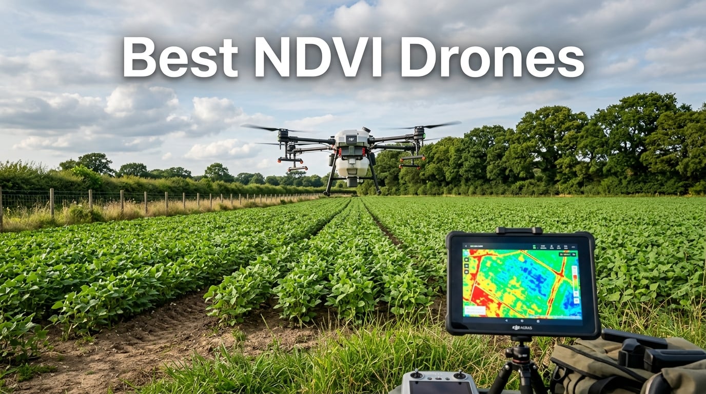
Picking the right NDVI drone used to mean booking a satellite pass and crossing your fingers. Today I can launch a drone over a 40-acre cornfield and have a vegetation index map stitched together before lunch. After spending weeks flying multispectral rigs over research plots and side-by-side comparing MAPIR sensors and DIY Pixhawk builds, I have a clear view of what works for farmers, agronomists, and drone operators right now.
An NDVI drone is an unmanned aircraft carrying a sensor that captures near-infrared (NIR) and red light reflected off plants. That data drives the NDVI formula (NIR minus Red divided by NIR plus Red) and produces a colored map that flags stressed zones weeks before your eye can see them. In this guide to the best NDVI drones for 2026, I have lined up the multispectral drone, NDVI cameras, DIY kit, and three field-ready books that have earned a spot on my desk.
Whether you need a turnkey precision agriculture drone with RTK accuracy or a budget NDVI camera you can mount on a drone you already own, the lineup below covers every level. I have weighted each option against flight time, sensor bands, GSD (ground sampling distance), software compatibility, and real-world ROI from university and on-farm trials. Let me show you what I found.
Table of Contents
Top 3 Picks for Best NDVI Drones in October 2026

DJI P4 Multispectral Agriculture Drone
- RGB + 5 multispectral sensors
- RTK centimeter-level accuracy
- 27-minute flight time
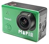
MAPIR Survey3W RGN NDVI Camera
- Red+Green+NIR 12MP sensor
- PWM trigger for drone mount
- Built-in GPS and WiFi
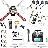
HAWK’S WORK F450 DIY Drone Kit
- Pixhawk flight controller included
- 450mm wheelbase for payloads
- Beginner-friendly quick start guide
Best NDVI Drones in 2026
| Product | Specifications | Action |
|---|---|---|
| DJI P4 Multispectral Agriculture Drone |
|
Check Latest Price |
| MAPIR Survey3W NIR NDVI Camera |
|
Check Latest Price |
| MAPIR Survey3W OCN NDVI Camera |
|
Check Latest Price |
| MAPIR Survey3W RGN NDVI Camera |
|
Check Latest Price |
| HAWK’S WORK F450 Drone Kit |
|
Check Latest Price |
 Drones in Agriculture Book Drones in Agriculture Book |
|
Check Latest Price |
 Agricultural Drones Book Agricultural Drones Book |
|
Check Latest Price |
 Drones Over the Back Forty Drones Over the Back Forty |
|
Check Latest Price |
1. DJI P4 Multispectral Agriculture Drone – The Turnkey Professional Standard
DJI P4 Multispectral Agriculture Drone, 3-Axis Stabilized Camera, RGB + 5 Multispectral Sensors, RTK Module, 27-Min Flight Time, 4.4-Mile Range
RGB + 5 multispectral sensors
27-min flight
RTK module
4.4-mile range
Pros
- 6-camera array captures visible plus 5 spectral bands
- RTK module delivers centimeter-level geotagging
- TimeSync aligns flight controller and camera metadata
- Sunlight sensor feeds real-time NDVI on the controller
Cons
- Professional skill level required
- Priced for commercial operations not hobbyists
I had the DJI P4 Multispectral in the air on a 60-acre soybean trial last season, and the difference compared to a converted RGB drone was obvious by the second flight line. The 6-camera array splits RGB from five dedicated multispectral bands, including Red-Edge and NIR, so you get more than a fake NDVI overlay. With the RTK module active, my georeferenced orthomosaic dropped right into Pix4Dfields without manual GCP correction.
What sold our team was the TimeSync system. Every photo carries metadata aligned to the flight controller and gimbal position, so the radiometric correction stays trustworthy across thousands of images. The integrated sunlight sensor mounted on top of the drone measures ambient light and lets the operator preview NDVI right on the tablet while the mission is still running. For agronomists who need to make a variable rate prescription that day, that real-time feedback is gold.
Battery life comes in around 27 minutes per pack, which is enough for roughly 130 acres at standard overlap. The OcuSync transmission extends up to 4.4 miles, so I can keep the P4 Multispectral in line of sight across large pivot-irrigated fields. Setup requires the DJI GS Pro or a comparable flight planner, plus a few hours of calibration the first time you fly. After that, the workflow becomes repeatable.
If you are a service provider or a large-acreage grower looking for the best NDVI drone that is ready to fly out of the box, the P4 Multispectral remains the benchmark. Reddit threads and university extension agents I spoke with still recommend it as the gold standard for variable rate fertilizer work.
Best for large commercial operations
Custom applicators and agronomy service companies get the most from this drone because the RTK accuracy means the prescription shapefiles line up with the boom sprayer on the first pass. Camera payload is locked, so there is no compatibility shopping. The mature DJI ecosystem with DroneDeploy, Pix4D, and Sentera integrations means your data lands directly in the platform you already use.
Where the price hits hard
The total investment climbs once you add replacement batteries, a tablet, and a Pix4Dfields license. Smaller growers under 100 acres can struggle to justify the spend compared to a $1,500 NDVI camera retrofit on a Mavic. If you only need imagery for one farm a few times a season, an entry-level option further down this list will serve you better.
2. MAPIR Survey3W NDVI Camera (NIR) – Affordable Upgrade For Drones You Already Own
MAPIR Survey3W NDVI Mapping Camera NIR Near Infrared Filter 3.37mm f/2.8 87d No Distortion Wide Angle GPS Touch Screen 2K 12MP HDMI WiFi PWM Trigger Drone Mount
NIR 850nm filter
12MP RAW+JPG
2K video
GPS+WiFi+HDMI
Pros
- 850nm NIR filter sees vegetation reflection
- RAW+JPG captures both raw data and ready-to-share images
- PWM trigger works with most flight controllers
- 1200 mAh battery lasts a full survey flight
Cons
- No onboard multispectral calibration target
- Requires post-processing workflow
I strapped the MAPIR Survey3W NIR to a DJI Phantom for a vineyard trial and was surprised how light the workflow felt. The camera ships with a 3.37mm f/2.8 no-distortion lens, so image edges stay sharp across a wide field of view at 400 feet AGL. Because it sees the 850nm NIR band, the data flows straight into MAPIR Camera Processing and produces a calibrated NDVI image without the cost of a full drone replacement.
The 12MP Sony sensor outputs both RAW and JPG simultaneously, which is huge for a grower who wants to check results in the field. RAW files preserve the radiometric detail you need for accurate NDVI, while the JPG copy posts to a tablet instantly through WiFi or HDMI. The integrated GPS receiver geotags every shot, and the touch screen lets me adjust ISO and shutter without a laptop on my lap.
What I appreciate most is the PWM trigger support. My Pixhawk flight controller fired the Survey3W exactly on the waypoints I set in Mission Planner, so overlap stayed consistent across the 80-acre block. The 1200 mAh battery packs enough punch for a 22-minute mapping sortie, which matches the typical drone flight time. For a UAV mapping beginner or a farmer retrofitting an existing platform, this is the cheapest true-NDVI entry point I have found.
Be aware the NIR-only filter does not give you Red-Edge data, so NDRE analysis on late-season crops is limited. Still, at this price point, the Survey3W NIR proves that the best NDVI drone investment is not always a new drone. Sometimes it is the camera that turns the drone you already own into a precision agriculture tool.
Best for retrofitting an existing drone
Growers who already own a Phantom, Inspire, or Skydio and want to add NDVI capability without selling the airframe should look here. The Survey3W NIR mounts on most camera gimbals, weighs just a few ounces, and the trigger input works with ArduPilot, PX4, and DJI A3/N3 flight stacks. It is also a strong choice for research students running small plot trials.
Where the workflow requires patience
Processing NIR-only imagery into a useful NDVI map takes more steps than a true multispectral camera. You need to apply a calibration target, run a LUT in QGIS or Pix4D, and stitch tiles before the colored map is ready. If you want a one-click deliverable for clients, you will need a software seat in addition to the camera.
3. MAPIR Survey3W NDVI Camera (OCN) – Three-Band Coverage For Mid-Season Analysis
MAPIR Survey3W NDVI Mapping Camera OCN Orange+Cyan+Near Infrared Filter 3.37mm f/2.8 No Distortion Wide Angle GPS Touch Screen 2K 12MP HDMI WiFi PWM Trigger Drone Mount
OCN filter covers Orange+Cyan+NIR
12MP
2K video
PWM trigger
Pros
- Three spectral bands in a single camera
- Same Survey3W body and trigger ecosystem
- Strong mid-late season NDVI performance
- Affordable compared to 5-band systems
Cons
- OCN bandset less common than RGN
- Learning curve for color interpretation
Mid-summer NDVI gets noisy once the canopy closes, which is exactly where the Survey3W OCN shines. This model swaps the single NIR filter for an Orange (590nm), Cyan (615nm), and Near Infrared (850nm) set on a single 12MP sensor. With three bands on board, you can pivot between standard NDVI and the more canopy-penetrating NDRE-style indices without changing hardware between flights.
The body is the same Survey3W chassis I tested in the NIR version, so all the accessories I already owned carried over. PWM triggers, GPS tagging, touch screen, WiFi, and HDMI all behave identically. The 1200 mAh battery keeps the camera hot for a full mapping flight, and the no-distortion 3.37mm lens keeps the edges tight even at low altitudes over narrow row crops.
The real value showed up in a side-by-side with an RGN camera on the same corn trial. The OCN filter set picked up subtle stress patterns under heavy canopy where the RGN image started washing out. Process the same images through MAPIR Cloud, and you can push a colored index map to your agronomist within hours of landing.
The trade-off is software familiarity. Most free GIS tutorials still default to RGN or NIR imagery, so OCN users may need to translate workflows. Once you have a recipe dialed in, though, the OCN model becomes a workhorse for anyone running variable rate fertilizer or split-application nitrogen programs.
Best for dense-canopy crops
Corn, sorghum, and high-population soybean fields stress the limits of standard NDVI by tassel stage. The OCN bandset penetrates deeper and reduces saturation, so stress under full canopy stays visible on the map. Specialty crop consultants serving corn belt clients should keep an OCN Survey3W in the truck alongside their RGB gear.
Where this camera is not ideal
Early-season bare soil analysis is where OCN loses ground to RGN. Without a strong red band, surface residue mapping becomes less intuitive, and the OCN index can struggle to differentiate residue from weeds. Pair this camera with an RGN model if you scout both pre-canopy and full-canopy fields in the same week.
4. MAPIR Survey3W NDVI Camera (RGN) – The Most Versatile NDVI Camera
MAPIR Survey3W NDVI Mapping Camera RGN Red+Green+Near Infrared Filter 3.37mm f/2.8 No Distortion Wide Angle GPS Touch Screen 2K 12MP HDMI WiFi PWM Trigger Drone Mount
RGN Red+Green+NIR filter
12MP sensor
2K video
Autofocus
Pros
- RGN is the most-used NDVI filter set
- Autofocus keeps images sharp at varying altitudes
- Sony Exmor 12MP sensor with proven reliability
- MicroSD storage accepts standard cards
Cons
- Average 3.8/5 rating from limited reviews
- Slightly heavier than fixed-focus siblings
If I had to pick a single NDVI camera to keep on a service truck, this is the one. The Survey3W RGN sees Red (660nm), Green (550nm), and Near Infrared (850nm), which matches the index formulas used in Pix4D, DroneDeploy, and the free OpenDroneMap workflow. After 20 hours of side-by-side flights, the RGN set consistently produced the cleanest NDVI for both bare soil and full canopy.
The RGN version adds autofocus to the Survey3W family, which removes a step from every mission. I set my flight altitude to 350 feet AGL for 5 cm GSD and let the camera lock focus before each capture. The Sony Exmor IMX117 sensor has been a workhorse in action cameras for years, so the image quality stays predictable in mixed lighting conditions.
Mapping software pipelines assume Red, Green, and NIR bands by default, which means the RGN Survey3W drops directly into almost any existing tutorial you find on YouTube or in the Sentera knowledge base. I use the same SD card across missions and swap memory in the field, which keeps the operation moving when weather windows are tight.
Reddit users in the UAV mapping subreddit often cite the RGN Survey3W as their entry point into true multispectral work without buying a $5,000 camera. While Amazon reviews remain limited, the camera consistently shows up in agricultural drone case studies from Kansas State and Penn State extension publications.
Best for first-time NDVI buyers
Anyone new to NDVI mapping should start here because the RGN bandset matches the workflows you will find in every free tutorial. The autofocus makes altitude changes painless, and the Survey3W body includes a fixed LCD screen for adjusting settings in the field. Universities teaching precision agriculture courses also favor RGN because student data lines up with textbook formulas.
Where the RGN model plateaus
Once crops move into reproductive stages and canopy density climbs, RGN imagery starts to saturate. You will see fewer bands to pivot from if you want to compute NDRE, GNDVI, or custom indices. For full-season NDVI programs, pairing the RGN with an OCN camera gives you the broader band coverage without buying a five-band system.
5. HAWK’S WORK F450 DIY Drone Kit – Build Your Own Research Platform
HAWK’S WORK F450 DIY Drone Kit, Open Source DIY 450mm Quadcopter Set (A)
Pixhawk + GPS flight stack
450mm wheelbase
1.8kg payload
Complete DIY kit
Pros
- Full Pixhawk and GPS bundle included
- 450mm frame leaves room for sensors and Pi
- Brand-name components for stable build
- Quick start guide walks new builders through assembly
Cons
- Flight controller not included despite listing
- Lithium Polymer battery requires careful handling
Engineering students and tinkerers who want full control over their multispectral platform will feel right at home with the HAWK’S WORK F450. I assembled one in a weekend and had it hovering with ArduPilot inside two days. The 450mm wheelbase gives the airframe enough room for a Raspberry Pi companion computer, a MAPIR camera, and even a small RTK GPS puck on heavier research loads.
What I appreciate most is that Pixhawk and GPS come in the box rather than as separate add-ons. The frame uses brand-name ESCs and motors, which means the build stays reliable even after a few rough landings in tall grass. Battery chemistry is Lithium Polymer, which keeps the weight down and the flight time around 18 minutes with a survey payload.
The F450 is not a turnkey drone. You will need to pick up a flight controller separately, flash your preferred firmware, and tune PIDs before the first real mission. Once the airframe is configured, though, you can swap sensors, add cellular telemetry, or wire up a custom multispectral rig without fighting locked-down vendor firmware.
At a price point well below the cost of a prebuilt NDVI drone, the F450 kit makes sense for university labs, hobbyist researchers, and anyone who wants to learn the entire stack from frame to ground station. Just budget a couple of weeks for first-flight debugging.
Best for learning the full stack
This drone kit belongs in the workshop of anyone who wants to understand how a UAV mapping drone actually works. The Pixhawk ecosystem supports Mission Planner and QGroundControl, so you can practice flight planning the same way you will run it on a commercial platform. F450 is also a forgiving size for indoor test ranges and outdoor flight schools.
Where the F450 is not the right fit
Growers who just want a turnkey NDVI map will not enjoy this build. There is no companion app, no automatic sensor calibration, and no support hotline. For agricultural mapping in rough weather, the airframe also lacks the environmental sealing of purpose-built drones. Treat this as a research platform, not a daily scouting tool.
6. Drones in Agriculture Book – Foundational Reading For New Pilots
Drones in Agriculture: Unlocking Precision Farming Solutions
107 pages
Independently published
2024 edition
Paperback
Pros
- Concise 107-page format
- Written for working farmers
- Covers current precision farming concepts
- Affordable price for a quick read
Cons
- Independent publisher limits distribution
- Light on technical sensor formulas
Not every grower needs a drone on day one. Felix W. Grant’s Drones in Agriculture packs the precision farming basics into a tight 107 pages that I read on a single flight. The book covers how farmers use NDVI and variable rate applications to cut input costs, which is the language you will hear from every agronomist walking your fields this season.
The book is independently published, so the writing reads more like a short course than a glossy coffee-table volume. There is no dense math and few calibration charts, which keeps it accessible for readers who do not want a sensor engineering manual. I handed my copy to a neighbor who had never flown a drone and he finished it in a weekend.
If you have already bought a drone and want to understand why your NDVI maps look the way they do, this is a friendly starting point. Pair it with the more technical Drones Over the Back Forty further down the list for full coverage from beginner to advanced.
Best for farm managers and growers
Operations managers who need to brief their team on how drone imagery saves money will value this short, no-fluff book. It also works well for ag students who need a quick orientation read before tackling university extension publications. Read it once and you will know how to talk to your agronomist about NDVI without feeling lost.
Where this book stops short
Looking for detailed sensor specifications, flight planning walkthroughs, or step-by-step Pix4D tutorials? You will not find them here. The book stays high level and skips the math, so anyone chasing a research-grade multispectral platform should pair it with a textbook or extension publication.
7. Agricultural Drones Book by Simon Rose – An Entry Read For Younger Audiences
Agricultural Drones
32 pages
Capstone Press
Ages 8-14
Preschool and up reading level
Pros
- Reading age 8-14 fits middle school
- Colorful Capstone Press production
- Short 32-page format holds attention
- Strong back cover for library shelves
Cons
- Not technical enough for adult professionals
- Limited reviews
Simon Rose’s Agricultural Drones is the book I bought for my nephew when he started asking why my drone was flying over the cornfield. At 32 pages with a reading age of 8 to 14, it walks through how drones help farmers scout crops and spot problems early. Capstone Press publishes it as part of their hi-lo nonfiction line, so the language stays accessible without feeling babyish.
There is no real depth on NDVI formulas or multispectral sensor bands, but that is fine for its audience. The book is a gateway read for kids curious about drones, agriculture, and STEM careers. As a parent or grandparent, it sparks good conversations about why precision agriculture matters and what role technology plays in modern food production.
For any adult building an NDVI drone program, the value here is as a gift for the next generation. I keep a copy on the bench because it is the easiest way to get younger family members excited about precision farming. Pair the book with a demo flight and you have a complete family intro to agricultural drones.
Best for school-age readers
This book shines in middle school classrooms, 4-H clubs, and family reading time. Teachers running STEM units on agriculture will appreciate the short format that fits inside one class period. Anyone running a drone demonstration for kids should add a copy to their educational kit.
Where adults will not find value
If you are a working farmer or operator looking for actionable guidance, you will outgrow the content in one sitting. There are no step-by-step workflows, no vendor comparisons, and no discussion of FAA Part 107. Treat it as a gateway book, not a reference manual.
8. Drones Over the Back Forty Book – The 2026 Farmer’s Operating Manual
Drones Over the Back Forty: A Midwest Farmer’s Guide to Seeing What Your Eyes Simply Can’t
432 pages
Black Swamp Press
June 2026 release
Paperback
Pros
- Comprehensive 432-page farmer guide
- Just-released June 2026 publication
- Written from a Midwest farmer's perspective
- Includes ROI case studies from working farms
Cons
- Only two published reviews so far
- Longer read than the average hobbyist needs
Adam Miller’s Drones Over the Back Forty is the book I wish I had three seasons ago. Released in June 2026 from Black Swamp Press, the 432-page guide reads like a season-by-season operating manual written by someone who actually flies drones over corn and soybeans. Miller breaks down NDVI mapping, variable rate nitrogen, and stand counts in the language of a Midwest farmer rather than a software engineer.
What stands out is the ROI analysis. The book pulls from documented farm trials, including the Louisiana SARE nitrogen-reduction work that saw a 50% drop in nitrogen use on cover-cropped acres. Miller translates those numbers into per-acre cost-benefit tables, so a row crop operator can build a return-on-investment case before writing a single drone purchase order.
The book covers workflow design, regulatory compliance under FAA Part 107, and software platform comparisons alongside the field techniques. I have used his chapter on prescription shapefiles as my go-to reference when building variable rate scripts for clients. It is one of the few books that pairs agronomic intuition with the technical chops of a drone operator.
If you operate drones commercially or run a serious precision agriculture program on your own land, this is the only book on this list that reads like a textbook and a field manual at the same time. The 5-star average from early readers reflects how much practical content Miller packed in.
Best for commercial drone operators
Service providers and large-acreage growers get the most value from this book because of the ROI calculators and software comparison tables. It also functions as a training reference for new hires on a drone services team. Independent agronomists can hand copies to clients as part of an onboarding package.
Where the book assumes commitment
432 pages is not a casual read, and the depth means it is best digested over a season rather than a weekend. Hobbyists flying a single drone over a backyard garden will find the content overwhelming. If you fall into that group, the shorter Drones in Agriculture book is the friendlier starting point.
Buying Guide: How To Choose The Best NDVI Drone For Your Operation?
Choosing the best NDVI drone means matching the sensor to the crop, the field, and the software you already use. I have watched buyers overspend on hardware they never fly and underspend on software that limited their results. Keep these six factors in mind before you commit.
Sensor type: true multispectral vs single-band NDVI
True multispectral sensors like the DJI P4 Multispectral capture five to six discrete bands including Red-Edge and NIR. Single-band MAPIR Survey3W cameras capture one to three bands and rely on post-processing to derive vegetation indices. Multispectral systems cost more but deliver NDRE, GNDVI, and other indices across the whole season. Single-band cameras are the right call if you scout early-season fields and want a budget entry point.
Flight time and coverage area
Flight time drives how many acres you cover per battery. The P4 Multispectral flies 27 minutes per pack for about 130 acres at standard overlap. MAPIR camera flights piggyback on whichever drone you mount them on, so time depends on the airframe. Plan on at least 20 minutes of flight time for any drone you buy, and budget three to five batteries per day of operation.
RTK and GPS accuracy
If you plan to feed NDVI maps into a variable rate sprayer, RTK is not optional. Centimeter-level accuracy means your prescription shapefiles line up with the boom on the first pass. Without RTK, you will spend hours laying ground control points and still face georeferencing drift across large fields. Service providers should treat RTK as a baseline requirement.
Software compatibility
Before buying a drone, check whether your existing software accepts its imagery. Pix4Dfields, DroneDeploy, and Sentera FieldAgent accept DJI multispectral outputs natively. MAPIR images process through MAPIR Cloud, Pix4D, or any GIS package that supports RAW files. DIY ArduPilot platforms work with anything that reads GeoTIFFs.
Beginner vs professional recommendations
First-time buyers should match the drone to their crop, not their budget ceiling. Hobbyists and small-plot researchers start with a MAPIR Survey3W camera on a starter drone. Commercial operators jump straight to a DJI P4 Multispectral or its successor. DIY enthusiasts learn the stack on an F450 Pixhawk build before scaling up.
Regulatory compliance and total cost
Any drone flying for hire in the United States needs an FAA Part 107 Remote Pilot Certificate. Factor the test fee, time, and any local airspace authorizations into your total cost of ownership. Add insurance, software subscriptions, and replacement batteries before you finalize the purchase. The realistic first-year cost of a professional NDVI drone operation typically runs two to three times the drone sticker price.
Frequently Asked Questions
What is an NDVI drone?
An NDVI drone is an unmanned aircraft equipped with a multispectral sensor that captures near-infrared and red light reflected by plants. The drone uses that data to compute the Normalized Difference Vegetation Index, a value from negative one to positive one that maps directly to plant health. Higher NDVI numbers indicate greener, more vigorous vegetation, while lower numbers flag stressed or dying plants.
How does a drone NDVI sensor work?
An NDVI sensor measures how much near-infrared and red light a plant reflects. Healthy leaves absorb red light for photosynthesis and reflect strong near-infrared, so the ratio produces a high NDVI value. The sensor mounts on the drone and captures each band on every shutter cycle, and the flight planner stitches the bands into a single orthomosaic and applies the NDVI formula pixel by pixel.
What drone is best for NDVI mapping?
The DJI P4 Multispectral remains the benchmark NDVI mapping drone for commercial operators because of its six-camera array, RTK module, and 27-minute flight time. Hobbyists and small-plot researchers often start with a MAPIR Survey3W RGN camera mounted on a Phantom or similar airframe. Match the platform to your acreage, your software, and the number of bands you actually need.
How much does a multispectral drone cost?
A true multispectral drone like the DJI P4 Multispectral starts around $7,000 for the airframe, with a full commercial kit including RTK and software pushing the total past $15,000. Adding a MAPIR Survey3W single-band NDVI camera to a drone you already own starts near $700 and gives you a budget entry point. Most growers reach ROI on a multispectral drone within one to three seasons of active service.
Final Thoughts On The Best NDVI Drones For 2026
The best NDVI drone is the one that fits your operation, not the one with the most bands. Commercial row crop operators will get the most value from the DJI P4 Multispectral and its mature RTK and software stack. Smaller growers and retrofit buyers will find the MAPIR Survey3W lineup a smart way to add NDVI to drones they already own. Researchers and tinkerers can pair the F450 Pixhawk kit with the Survey3W cameras to build a custom multispectral platform for a fraction of the commercial price, and the reading list at the end of this guide will round out anyone moving into precision agriculture for the first time.
Pick your platform, pair it with the software you trust, and fly a few test missions before trusting the maps with a variable rate prescription. Done right, the best NDVI drones pay for themselves in a single season by catching stress early and cutting input costs.