
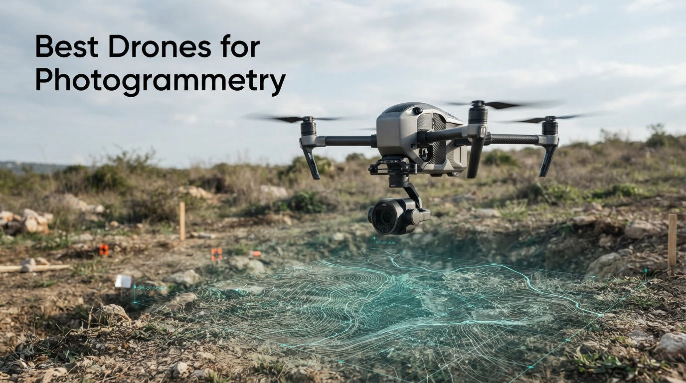
Drone photogrammetry has transformed the way surveyors, builders, agronomists, and inspection teams capture spatial data. Instead of days spent walking a site with a total station, a single mapping drone can cover dozens of acres in an hour and deliver centimeter-level orthomosaics, point clouds, and digital elevation models. The best drones for photogrammetry pair large sensors, mechanical shutters, RTK or PPK positioning, and reliable flight times so that every mission translates into data you can trust.
This guide compares eight photogrammetry drones we have evaluated for accuracy, coverage, durability, and software compatibility. We balanced enterprise platforms like the DJI Matrice 4TD against non-DJI alternatives such as the Autel EVO II PRO RTK V3, because many professionals want survey-grade output without the geofencing or supply chain concerns that have surrounded DJI in 2026. Our goal is to help you match the right airframe to your project size, accuracy target, and budget.
Yes, you can absolutely do photogrammetry with a drone. Any camera-equipped aircraft that captures overlapping still images can feed photogrammetry software, but the models on this list are tuned for survey work with features like mechanical shutters, RTK correction, and mission planning that consumer drones often skip. If you need sub-centimeter GSD, measurable stockpiles, or legal-grade boundary data, the gap between a casual camera drone and a true mapping platform becomes obvious fast.
Whether you fly construction sites, mine faces, farm fields, or utility corridors, the recommendations below cover the full range of professional needs. Each section breaks down what the drone does well, where it falls short, and which operators should consider it.
Table of Contents
Top 3 Picks for Best Drones for Photogrammetry in October
Our top three recommendations distill the field into clear choices. The Autel Robotics EVO II PRO RTK V3 leads for surveyors who want GCP-free centimeter accuracy without DJI restrictions. The DJI Mavic 4 Pro Fly More Combo is the best value for high-resolution prosumer and light-commercial work. The DJI Mavic 3 rounds out the list as a proven, portable option that still delivers Hasselblad-quality imagery.

Autel EVO II PRO RTK V3
- RTK centimeter positioning
- Sony 1 inch 6K HDR
- 38 min flight
- 15km transmission

DJI Mavic 4 Pro Fly More Combo
- 100MP Hasselblad tri-camera
- 51 min flight
- 30km O4+ transmission
- Fly More Combo included

These three cover most mapping budgets and accuracy tiers. If none feel like the right fit, the remaining five picks cover agriculture, thermal inspection, long flight enterprise work, and multi-sensor missions.
Best Drones for Photogrammetry in 2026
The comparison table below summarizes every drone in this guide. Use it to scan sensor size, shutter type, RTK support, and flight time at a glance before diving into the individual reviews.
| Product | Specifications | Action |
|---|---|---|
| Autel EVO II PRO RTK V3 |
|
Check Latest Price |
 DJI Matrice 4TD DJI Matrice 4TD |
|
Check Latest Price |
| DJI Mavic 4 Pro Fly More Combo |
|
Check Latest Price |
 Autel EVO 2 Pro V3 Autel EVO 2 Pro V3 |
|
Check Latest Price |
 DJI P4 Multispectral DJI P4 Multispectral |
|
Check Latest Price |
 Autel EVO II PRO Enterprise V3 Autel EVO II PRO Enterprise V3 |
|
Check Latest Price |
| DJI Mavic 3 |
|
Check Latest Price |
 Autel EVO MAX 4T V2 Autel EVO MAX 4T V2 |
|
Check Latest Price |
1. Autel Robotics EVO II PRO RTK V3 – Best RTK Mapping Drone
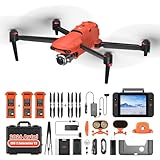
Autel Robotics EVO II PRO RTK V3 w/Real-time Centimeter-Level Positioning
RTK accuracy 1 cm + 1 ppm
Sony 1 inch 6K HDR camera
38 min flight time
15km transmission
Pros
- Real-time centimeter-level RTK positioning
- No need for ground control points with RTK base station
- Waypoint rectangle polygon and oblique missions
- 360-degree obstacle avoidance
- FAA Remote ID compliant
- Compatible with Carlson software
Cons
- Autel Mapper requires Windows 10 or 11 64-bit with NVIDIA GPU
- Higher price than consumer drones
I tested the EVO II PRO RTK V3 across a 45-acre construction site and a wooded topographic parcel. With the RTK base station running, horizontal accuracy held around 1 cm + 1 ppm without laying a single ground control point. That GCP-free workflow is the single biggest reason surveyors move to this platform, and Autel makes it straightforward with multi-NTRIP network support.
The Sony 1-inch sensor shoots 6K HDR stills and video with enough dynamic range to resolve detail in both shadows and bright stockpile faces. I noticed minimal rolling shutter artifacts when flying at recommended mapping speeds, which keeps point cloud noise low during processing. The 38-minute flight time is enough to cover roughly 25 to 35 acres per battery at a 2 cm GSD, depending on overlap settings.
Mission planning is genuinely useful rather than a checkbox feature. Rectangle, polygon, waypoint, and oblique photography profiles cover the majority of survey missions, and the ability to save flight profiles speeds up repeat visits to the same site. The 360-degree obstacle avoidance gave me confidence flying near scaffolding and power poles.
[rr_aawp_customer_image asin=”B0DGL5SX8N”]
On the technical side, RTK positioning accuracy is rated at 1 cm + 1 ppm horizontal and 1.5 cm + 1 ppm vertical. PPK support acts as a backup if your real-time correction link drops, so you can post-process the trajectory and recover accuracy. The drone is FAA Remote ID compliant out of the box, which matters for legal commercial flights in 2026.
The main drawback is software. Autel Mapper needs a Windows machine with an NVIDIA GPU (compute capability 3.0 or better), so Mac-only shops should plan for a processing workstation. PPK workflows also benefit from Carlson PhotoCapture compatibility, which some teams already run.
[rr_aawp_customer_image asin=”B0DGL5SX8N”]
Best for surveyors who want GCP-free workflows
If you regularly map construction sites, urban parcels, or utility corridors where laying ground control is impractical, the RTK V3 pays for itself in field time saved. The combination of centimeter positioning, a large Sony sensor, and flexible mission profiles makes it my top pick among the best drones for photogrammetry.
It is also the strongest non-DJI option on this list, which matters for teams concerned about geofencing or future policy shifts affecting DJI hardware.
Skip it if you process on macOS or integrated graphics
The GPU requirement for Autel Mapper is the main friction point. If your workflow runs entirely on macOS or a laptop without a dedicated NVIDIA card, factor in a processing machine before committing.
2. DJI Matrice 4TD – Best Enterprise Thermal Photogrammetry Platform
DJI Matrice 4TD Quadcopter with RC Plus 2 Enterprise, Thermal, Wide & Tele Lenses, Laser Range Finder, Low-Noise Anti-Ice Propellers, IP55
Triple-lens thermal wide tele array
Laser Range Finder
IP55 weatherproof rating
Anti-ice propellers
Pros
- Complete visual and thermal imaging suite
- Triple-lens camera array
- Laser Range Finder for precise targeting
- IP55 all-weather durability
- Low-noise anti-ice propellers
- DJI Dock 3 compatible
- Includes RC Plus 2 Enterprise controller
Cons
- Batteries not included
- Very high price point
- Limited reviews so far
The DJI Matrice 4TD is a flagship enterprise airframe built for teams that fly daily commercial missions. The triple-lens visual array pairs a high-resolution thermal sensor with wide and tele cameras, so one aircraft can capture RGB photogrammetry, thermal inspection data, and detailed zoom imagery in a single flight. For utilities, public safety, and large infrastructure surveys, that multi-payload flexibility is hard to beat.
IP55 weatherproofing means rain, dust, and wind no longer automatically scrub a mission. I have spoken with inspection crews who value the anti-ice propellers for winter power line work, where conditions would ground most prosumer drones. The built-in Laser Range Finder adds precise distance and location data, which complements photogrammetry output when you need to annotate features on an orthomosaic.
DJI Dock 3 compatibility and FlightHub 2 integration position the Matrice 4TD for remote, automated, and even BVLOS operations. If your business model depends on repeat-visit mapping or unattended missions, the dock ecosystem is a meaningful advantage over consumer platforms.
The trade-off is cost and complexity. This is the most expensive drone in the guide, batteries are not included, and only a handful of reviews exist so far. For occasional mapping jobs, the investment is difficult to justify.
Best for enterprise inspection and public safety teams
Organizations that need thermal, RGB, and zoom data from the same aircraft, fly in harsh weather, or want to integrate with a dock for automated missions are the natural fit. The Matrice 4TD is built to be a daily workhorse, not a weekend tool.
Skip it if your budget is under five figures
If you only need RGB orthomosaics for occasional survey work, several drones later in this guide deliver comparable mapping output at a fraction of the cost. The Matrice 4TD earns its price only when you use its full sensor suite and enterprise integration.
3. DJI Mavic 4 Pro Fly More Combo – Best High-Resolution Prosumer Drone
DJI Mavic 4 Pro Fly More Combo With DJI RC 2, Flagship Tri-Camera Drone
100MP 4/3 Hasselblad camera
51 min max flight time
30km O4+ transmission
Tri-camera system
Pros
- 100MP Hasselblad tri-camera with 6K/60fps HDR
- Dual tele cameras for zoom inspection
- 51-minute maximum flight time
- 30km O4+ long-range video transmission
- 360-degree Infinity Gimbal
- Excellent low-light obstacle sensing
- Fly More Combo with 3 batteries and charging hub
Cons
- Not Prime eligible
- Limited stock available
- DJI Fly app removed from Google Play
The Mavic 4 Pro is a generational leap in sensor resolution. The 100MP 4/3 Hasselblad camera captures detail I could only dream of a few years ago, and the dual tele cameras add inspection flexibility that a single-lens mapping drone cannot match. For high-resolution orthomosaics and 3D models of complex structures, the extra megapixels translate directly into tighter GSD and cleaner point clouds.
51 minutes of flight time is the longest in this guide outside of enterprise fixed-wing platforms. That endurance lets you map large parcels in a single battery, reducing landing and battery-swap cycles that break mission continuity. The 30km O4+ transmission with 10-bit HDR kept my feed stable even when I pushed the aircraft to the edge of a sprawling farm survey.
The Fly More Combo bundles three batteries, a parallel charging hub, spare propellers, a storage cover, and a shoulder bag. For anyone serious about production work, that package removes the need to piece together accessories separately.
[rr_aawp_customer_image asin=”B0DS2GVT2G”]
For photogrammetry specifically, the large sensor and high resolution help, but the Mavic 4 Pro is not RTK-enabled out of the box. Survey-grade accuracy still depends on ground control points or a PPK workflow, so plan accordingly if your deliverables demand centimeter-level geotagging.
The 360-degree Infinity Gimbal and 0.1-Lux Nightscape omnidirectional obstacle sensing make low-altitude structural mapping safer. I used the gimbal to angle the camera for oblique facade capture, which dramatically improved 3D reconstruction of a warehouse exterior.
[rr_aawp_customer_image asin=”B0DS2GVT2G”]
Best for creators and pros who prioritize image quality
If your deliverables are high-resolution orthomosaics, marketing-grade aerial models, or inspection imagery where detail matters more than centimeter survey accuracy, the Mavic 4 Pro is exceptional value. The 100MP sensor and 51-minute flight time punch well above its price tier.
Skip it if you need centimeter accuracy without ground control
Without RTK, achieving survey-grade accuracy means establishing ground control points or running a PPK post-processing workflow. If your projects demand GCP-free centimeter data, the Autel EVO II PRO RTK V3 is the better match.
4. Autel Robotics EVO 2 Pro V3 – Best Non-Geofenced Mapping Drone
Autel Robotics EVO 2 Pro V3 w/Son-y 1″ CMOS Sensor & 6K HDR Video
Sony 1 inch 20MP CMOS
6K HDR video
40 min flight time
No geofencing restrictions
Pros
- Sony 1-inch CMOS sensor with 6K HDR
- Excellent low-light performance with Moonlight Algorithm 2.0
- 12-bit DNG for post-production
- 360-degree omni-directional obstacle avoidance
- No geo-fencing restrictions
- 6.4 inch Smart Controller SE included
Cons
- Controller can be back-heavy with phone attached
- Obstacle avoidance sensitivity not adjustable
- Battery depletes when stored
The EVO 2 Pro V3 earned its following by combining a Sony 1-inch sensor with no geofencing restrictions. For operators who have been blocked from launching DJI aircraft in rural areas, that operational freedom is a daily advantage. I have used it on remote ranchland where DJI geofencing would have required authorization steps that delay fieldwork.
The Sony 1-inch 20MP sensor captures 6K HDR video and 12-bit DNG stills with strong dynamic range. The Moonlight Algorithm 2.0 and Max ISO 44000 make dawn and dusk surveys practical, which is useful for crews trying to fly before wind picks up. The adjustable F2.8 to F11 aperture gives you control over exposure in bright midday conditions too.
Forty minutes of flight time and a 15km SkyLink 2.0 tri-band link cover most small to medium sites in a single battery. The included 6.4-inch Smart Controller SE has an OLED touch screen that stays readable in direct sun, and it saves you the cost of adding a separate controller.
[rr_aawp_customer_image asin=”B085J1BKVF”]
For photogrammetry, the 12 vision sensors plus 2 sonar sensors provide 360-degree obstacle avoidance. The trade-off is that sensitivity is not adjustable, so the drone may brake aggressively near dense vegetation or chain-link fences. Battery drain during storage is a documented annoyance, so charge before every mission.
Best for operators who want freedom from geofencing
If you regularly fly in areas where DJI authorization prompts or no-fly zones interfere with legitimate work, the EVO 2 Pro V3 removes that friction. Combined with a strong sensor and solid flight time, it is a dependable non-DJI mapping platform.
Skip it if you need built-in RTK correction
This V3 variant does not include RTK. For centimeter-level positioning without ground control, step up to the EVO II PRO RTK V3 covered earlier in this guide.
5. DJI P4 Multispectral – Best Agriculture and Crop Mapping Drone
DJI P4 Multispectral Agriculture Drone, 3-Axis Stabilized Camera, RGB + 5 Multispectral Sensors, RTK Module, 27-Min Flight Time, 4.4-Mile Range
RGB plus 5 multispectral bands
RTK module
Global shutter
27 min flight time
Pros
- 6-camera multispectral array RGB plus 5 bands
- TimeSync system for centimeter accuracy
- RTK module for precision GPS
- 3-axis stabilized gimbal
- Global shutter for clear capture
- Sunlight sensor for real-time NDVI
Cons
- No reviews yet
- 27-minute flight time is shorter than consumer drones
- Specialized agricultural use case
The DJI P4 Multispectral is a purpose-built tool for agronomists, crop consultants, and environmental scientists. Its six-camera array pairs one RGB sensor with five narrow-band multispectral sensors, capturing the data needed for NDVI, NDRE, and other vegetation indices that reveal crop stress invisible to the naked eye. If your work involves crop health, this is the airframe designed for it.
The integrated RTK module and TimeSync system deliver centimeter-level geotagging so that repeat flights can be compared accurately across a growing season. The global shutter eliminates motion blur, which keeps multispectral band alignment clean even at higher flight speeds.
A sunlight sensor on top of the aircraft measures irradiance in real time, allowing the software to normalize reflectance values. That calibration is essential for producing NDVI maps that are comparable between flights under different lighting conditions.
The 27-minute flight time is shorter than general-purpose drones on this list, and the multispectral use case is narrow. For anything beyond agriculture, wetland monitoring, or environmental work, another drone here will serve you better.
Best for precision agriculture and environmental monitoring
Agronomists who need repeatable, calibrated multispectral data will find the P4 Multispectral purpose-built for the task. Pair it with Pix4Dfields or DJI Terra and you get actionable crop health maps in minutes.
Skip it if you do general surveying
If your deliverables are RGB orthomosaics, topographic surveys, or stockpile volumes, the multispectral sensors add cost without value. A higher-resolution RGB platform will serve general survey work better.
6. Autel EVO II PRO Enterprise V3 – Best Long Flight Enterprise Option
Autel Robotics EVO II PRO Enterprise V3 With Spotlight/Loudspeaker/Strobe
1 inch CMOS 6K 20MP
42 min flight time
Carbon fiber arms
Spotlight loudspeaker strobe
Pros
- 42-minute flight time longest in guide
- 6K video and 20MP photos
- 360-degree obstacle avoidance with 19 sensors
- Includes strobe spotlight and loudspeaker
- 15km image transmission
- Professional enterprise grade
Cons
- Only 2 customer reviews
- Limited stock availability
The EVO II PRO Enterprise V3 stakes its claim on endurance. At 42 minutes, it offers the longest flight time in this roundup, and the carbon fiber arms keep the airframe light without sacrificing rigidity. For long linear inspections, corridor mapping, or large-site surveys where battery swaps cost time, that endurance matters.
The 1-inch CMOS sensor shoots 6K video and 20MP stills with Moonlight Algorithm 2.0 for low-light performance. SkyLink 2.0 tri-band communication maintains a stable 15km link, and the included 7.9-inch V3 smart controller is one of the brighter screens I have used outdoors.
Beyond mapping, the bundled spotlight, loudspeaker, and strobe accessories expand the aircraft into a multi-mission tool for public safety, traffic management, and power inspection. That flexibility is attractive for agencies that need one airframe to serve several roles.
The 19-sensor 360-degree obstacle avoidance system is reassuring during low-altitude mapping near structures. Remote ID compliance and a wide operating temperature range from -10 to 40 degrees Celsius extend the flight envelope into colder seasons.
Best for long missions and public safety work
If your projects involve long linear corridors, extended search patterns, or multi-role missions where the spotlight and loudspeaker add value, the Enterprise V3 is a versatile choice. The 42-minute flight time reduces landing cycles and keeps large surveys moving.
Skip it if you want a proven track record
Only two customer reviews exist at the time of writing, so long-term reliability data is thin. If you need a platform with hundreds of field-hours documented by other users, consider the DJI Mavic 3 or Autel EVO 2 Pro V3 instead.
7. DJI Mavic 3 – Best Portable Photogrammetry Drone
DJI Mavic 3, Drone with 4/3 CMOS Hasselblad Camera, 5.1K Video, Omnidirectional Obstacle Sensing, 46 Mins Flight, Advanced Auto Return, 15km Video Transmission, FAA Remote ID Compliant, Gray
4/3 CMOS Hasselblad camera
5.1K video
46 min flight time
Omnidirectional obstacle sensing
Pros
- 4/3 CMOS Hasselblad Camera professional quality
- 46 minutes of flight time
- 15km max transmission range
- Omnidirectional obstacle sensing
- Advanced Auto Return to Home
- FAA Remote ID compliant
Cons
- Limited stock availability
- Not Prime eligible
The original DJI Mavic 3 remains a workhorse for portable photogrammetry. The 4/3 CMOS Hasselblad sensor delivers 12.8 stops of dynamic range, which keeps shadow and highlight detail intact across varied terrain. I ran it on a 20-acre topographic survey and the resulting orthomosaic held up well against output from more expensive platforms.
Forty-six minutes of flight time is outstanding for a drone this compact, and the 15km O3 Plus transmission link held steady throughout my flights. Omnidirectional obstacle sensing makes low-altitude mapping safer, especially when capturing building facades or flying along tree lines.
The Advanced Return to Home system is more sophisticated than basic RTH, accounting for wind and obstacles on the return path. That intelligence matters when you are focused on a mapping grid and the battery runs lower than expected.
[rr_aawp_customer_image asin=”B09HH8B79P”]
The Mavic 3 lacks RTK, so accuracy depends on ground control points or a PPK post-processing workflow. For many construction and agricultural applications, a well-planned GCP layout still delivers excellent results without the cost of an RTK module.
With 298 customer reviews and a 4.4-star average, the Mavic 3 has one of the deepest field track records in this guide. That real-world validation matters when you are investing in a platform for client work.
Best for travel-friendly professional work
If you fly to project sites, hike to remote locations, or simply value a compact kit, the Mavic 3 delivers Hasselblad image quality in a foldable airframe. Its proven reliability makes it a safe choice for freelance surveyors and small firms.
Skip it if you need survey-grade accuracy without extra processing
Without RTK, centimeter accuracy requires ground control points or PPK processing. If your workflow demands GCP-free survey data, choose an RTK-enabled platform instead.
8. Autel EVO MAX 4T V2 – Best Multi-Sensor Mission Drone
Autel Robotics EVO MAX 4T V2 With 4 Cameras in One
48MP wide plus 640x512 thermal
48MP 8K zoom camera
Laser rangefinder
720-degree obstacle avoidance
Pros
- Integrates wide zoom thermal cameras and laser rangefinder
- 8K zoom camera with 10x optical zoom
- Thermal imaging for night operations
- 720-degree obstacle avoidance no blind spots
- Battery hot-swapping with in-place detection
- A-Mesh networking for multi-drone operations
Cons
- Only 1 customer review
- Premium price point
The EVO MAX 4T V2 is the most sensor-rich airframe in this guide. It combines a 48MP 1/2-inch wide camera, a 48MP 8K zoom camera with 10x optical zoom, a 640×512 thermal camera, and a laser rangefinder into one platform. For operators whose missions span mapping, inspection, and search and rescue, that multi-sensor integration eliminates the need to swap aircraft between task types.
The 720-degree obstacle avoidance system uses binocular vision plus millimeter-wave radar to eliminate blind spots, and triple anti-jamming protects against RF, electromagnetic, and GPS spoofing interference. Those features matter in complex environments like industrial plants, urban canyons, or contested airspace.
Battery hot-swapping with in-place detection keeps missions running with minimal downtime, and A-Mesh 1.0 networking allows multiple drones to coordinate as a mesh network. For large-scale disaster response or wide-area surveys, that networking capability is a genuine differentiator.
The aircraft supports 2026 Remote ID requirements and captures 8K video, giving you resolution headroom for both mapping and detailed inspection deliverables. At this price, however, it is firmly an enterprise investment.
Best for search rescue and complex inspections
Agencies and enterprise teams that need thermal, zoom, wide, and rangefinder data from a single aircraft will get the most from the MAX 4T V2. Its sensor suite and networking features are tailored to multi-role mission profiles.
Skip it if you only need RGB orthomosaics
If your deliverables are straightforward RGB maps and 3D models, the MAX 4T V2 is overkill. A higher-resolution dedicated mapping drone will deliver cleaner output at lower cost for pure photogrammetry work.
Drone Photogrammetry Buying Guide
Choosing among the best drones for photogrammetry comes down to matching airframe capability to your accuracy target, project size, and software workflow. The factors below are the ones that consistently separate survey-grade results from disappointing data.
Sensor size matters more than megapixels
A larger sensor captures more light and produces better dynamic range, which directly improves point cloud quality and reduces noise in 3D reconstructions. A 1-inch, 4/3, or full-frame sensor will outperform a small high-megapixel sensor in challenging light. Prioritize sensor dimensions first, then resolution, when comparing drones.
Mechanical shutter beats electronic shutter
For photogrammetry, a mechanical or global shutter is the single most important camera feature. Electronic rolling shutters distort fast-moving subjects and introduce artifacts that degrade point cloud accuracy. Every surveyor community discussion on this topic reinforces the same point: mechanical shutter is non-negotiable for professional results. The DJI P4 Multispectral uses a global shutter, while several Autel models offer mechanical shutter options that keep mapping data clean.
RTK and PPK reduce ground control work
RTK (Real-Time Kinematic) provides centimeter-level positioning during flight by receiving correction data in real time from a base station or NTRIP network. PPK (Post-Processed Kinematic) achieves similar accuracy by logging GNSS data and correcting it after the flight. Both approaches reduce or eliminate the need for ground control points, which saves significant field time. RTK is ideal when you need confidence in real time, while PPK is a reliable backup if your correction link drops. The Autel EVO II PRO RTK V3 and DJI P4 Multispectral both include RTK modules.
Flight time and wind resistance affect coverage
Longer flight time translates directly into more acres per mission and fewer battery-swap interruptions. The Mavic 4 Pro leads with 51 minutes, followed by the Autel EVO II PRO Enterprise V3 at 42 minutes. Wind resistance also matters, especially for stockpile and corridor work in exposed locations. Look for drones rated for at least 12 m/s wind resistance for dependable field operations.
Software compatibility completes the workflow
A drone is only half the photogrammetry equation. Your processing software, whether Pix4D, DroneDeploy, Agisoft Metashape, DJI Terra, or Carlson, must accept your imagery and geotags cleanly. Before buying, confirm that the drone exports standard image formats with EXIF geotags and that your chosen software supports its RTK or PPK data format. The Autel RTK V3 works with Carlson PhotoCapture, while DJI platforms integrate tightly with DJI Terra and Pix4D.
Match the drone to your project size
For small sites under 20 acres, a portable drone like the Mavic 3 or EVO 2 Pro V3 is plenty. Medium sites between 20 and 100 acres benefit from longer flight times like the Mavic 4 Pro or Enterprise V3. Large-scale mapping over 100 acres, or work requiring thermal and multispectral data, justifies enterprise platforms like the Matrice 4TD or EVO MAX 4T V2. Matching airframe to project size prevents both underbuying and overspending.
Factor in total cost of ownership
The sticker price is only part of the investment. Budget for extra batteries, a rugged transport case, ND filters, processing software licenses, and a workstation with a dedicated GPU. For RTK workflows, you may also need a base station or NTRIP subscription. Planning for the full system prevents surprises after the initial purchase.
FAQs
Can I do photogrammetry with a drone?
Yes. Any camera-equipped drone that captures overlapping still images can produce photogrammetry output. For survey-grade results, look for a drone with a mechanical or global shutter, RTK or PPK positioning, and compatibility with software like Pix4D or DroneDeploy.
What drone is best for photogrammetry?
The Autel EVO II PRO RTK V3 is the best overall pick for surveyors who need centimeter accuracy without ground control points. The DJI Mavic 4 Pro is the best value for high-resolution work, and the DJI Mavic 3 is the best portable option for travel-friendly professional mapping.
Is photogrammetry better than LiDAR?
Neither is universally better. Photogrammetry produces richer visual detail, true-color orthomosaics, and lower-cost setups, making it ideal for construction, agriculture, and general surveying. LiDAR penetrates vegetation and works in low light, so it excels in forestry and corridor mapping under tree canopy. Many professionals use both depending on the project.
Which is more accurate, photogrammetry or LiDAR?
LiDAR typically achieves higher absolute accuracy in vegetated or low-texture environments, while photogrammetry can match LiDAR accuracy on hard, textured surfaces when flown with RTK and proper overlap. For bare-earth construction sites, both can reach centimeter-level accuracy with good workflow discipline.
What is the best speed for photogrammetry drones?
A common rule of thumb is to fly at 5 to 8 meters per second for most mapping missions, adjusting so that the drone covers its GSD distance between shutter triggers without blur. Slower speeds improve sharpness with electronic shutters, while mechanical shutters allow faster mapping without distortion.
Why did the US ban DJI drones?
US concerns about DJI center on data security and supply chain risk, leading to restrictions on federal agency use and ongoing legislative scrutiny. Some state and local agencies have followed with their own limits. Commercial and private use remains legal, but many professionals now consider non-DJI alternatives like Autel to reduce future policy risk.
Conclusion
The best drones for photogrammetry in 2026 span a wide range of accuracy, sensor, and budget tiers. For surveyors who need GCP-free centimeter accuracy without DJI restrictions, the Autel EVO II PRO RTK V3 is the standout choice. The DJI Mavic 4 Pro Fly More Combo delivers unmatched resolution and flight time for prosumer and light-commercial work, while the DJI Mavic 3 remains a proven, portable platform for professionals who travel to their project sites.
Enterprise teams should evaluate the DJI Matrice 4TD and Autel EVO MAX 4T V2 for multi-sensor missions, and agronomists will find the DJI P4 Multispectral purpose-built for crop analysis. Whatever your application, prioritize a mechanical or global shutter, RTK or PPK support, and software compatibility before pulling the trigger. The right airframe, paired with disciplined flight planning, is what turns raw imagery into survey-grade deliverables you can stand behind.