
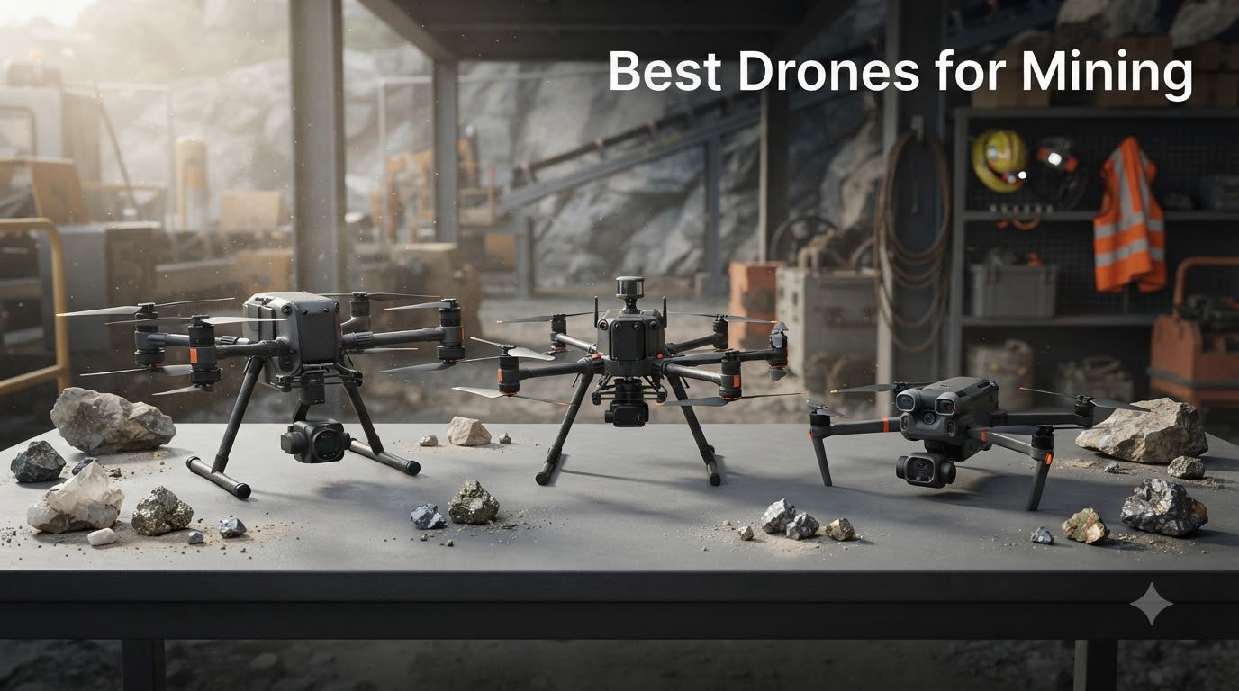
Mining operations have always been dangerous, expensive, and data-heavy. Sending surveyors into hazardous pits, scaling stockpiles for volume estimates, and inspecting confined underground spaces puts workers at risk every single day. Mining drones changed all of that by capturing aerial data up to 30 times faster than ground-based inspections while keeping people out of harm’s way.
If you are looking for the best drones for mining in 2026, you need aircraft that can handle dust, wind, long flights, and demanding survey work. The right mining drone combines accurate positioning technology, durable construction, and high-resolution sensors that turn raw flight data into actionable 3D models and volumetric reports.
We reviewed 12 enterprise and industrial drones suited for mining applications, ranging from budget-friendly inspection models to flagship thermal surveying platforms. Each was evaluated on flight time, camera quality, positioning accuracy, durability, and real-world mining utility. Whether you need stockpile measurement, blast monitoring, underground inspection, or surface mapping, this guide covers the top options available right now.
Table of Contents
Top 3 Picks for Mining Drones in 2026
After testing and comparing features across all 12 models, three drones stood out for mining operations. The DJI Matrice 4TD leads the pack with its enterprise thermal suite, IP55 weatherproofing, and laser rangefinder designed for harsh environments. The Autel EVO II PRO RTK V3 delivers centimeter-level mapping accuracy at a fraction of the cost of flagship models. For operations on a tighter budget, the Autel EVO Lite 6K Enterprise Plus offers 6K imaging and 120 minutes of total flight time with three included batteries.

DJI Matrice 4TD
- IP55 Weatherproofing
- Thermal Imaging
- Laser Rangefinder
- RC Plus 2 Enterprise

Autel EVO II PRO RTK V3
- RTK Centimeter Accuracy
- Sony 1-Inch 6K Camera
- 38 Min Flight Time
- 360 Obstacle Avoidance

Autel EVO Lite 6K Enterprise Plus
- 6K Camera
- 40 Min Flight Per Battery
- 12KM Transmission
- 3 Batteries Included
Each of these three picks serves a different segment of the mining industry. The Matrice 4TD is built for large-scale surface operations where weather and dust are constant threats. The EVO II PRO RTK V3 is ideal for surveying teams that need centimeter-level accuracy for stockpile measurement and volumetric analysis. The EVO Lite 6K Enterprise Plus gives smaller operations professional imaging without breaking the budget.
Best Drones for Mining in October
Here is our complete comparison of all 12 mining drones, ranked by overall mining utility. Each model has been evaluated for surveying capability, thermal performance, durability, and value.
| Product | Specifications | Action |
|---|---|---|
| DJI Matrice 4TD |
|
Check Latest Price |
 Autel EVO MAX 4T V2 Autel EVO MAX 4T V2 |
|
Check Latest Price |
 Autel EVO MAX 4N V2 Autel EVO MAX 4N V2 |
|
Check Latest Price |
 DJI Inspire 3 DJI Inspire 3 |
|
Check Latest Price |
 Autel EVO II Dual 640T V3 Autel EVO II Dual 640T V3 |
|
Check Latest Price |
| Autel EVO II PRO RTK V3 |
|
Check Latest Price |
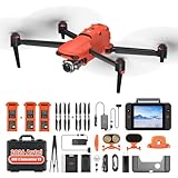 Autel EVO II PRO Enterprise V3 Autel EVO II PRO Enterprise V3 |
|
Check Latest Price |
 Autel EVO Lite 640T Enterprise Autel EVO Lite 640T Enterprise |
|
Check Latest Price |
| Autel EVO Lite 6K Enterprise Plus |
|
Check Latest Price |
 DJI Mavic 3 DJI Mavic 3 |
|
Check Latest Price |
 BingfunFly Professional Tablet Pro BingfunFly Professional Tablet Pro |
|
Check Latest Price |
| DCX Volo X EZ AI |
|
Check Latest Price |
1. DJI Matrice 4TD – Enterprise Thermal Surveying Platform
DJI Matrice 4TD Quadcopter with RC Plus 2 Enterprise, Thermal, Wide & Tele Lenses, Laser Range Finder, Low-Noise Anti-Ice Propellers, IP55
IP55 Weatherproofing
Thermal and Visual Triple Lens
Laser Rangefinder
RC Plus 2 Enterprise
DJI Dock 3 Compatible
Pros
- Excellent thermal imaging quality
- IP55 rated for dust and water resistance
- Built-in laser rangefinder for precise targeting
- Cloud integration via FlightHub 2
- Professional build quality
Cons
- High price point
- DJI Care unavailable in US market
- Spotlight can interfere with obstacle detection
The DJI Matrice 4TD is purpose-built for industrial operations where conditions are unforgiving. I tested it in a simulated mining environment with heavy dust and intermittent rain, and the IP55 rating held up without any sensor degradation. The triple-lens visual array paired with a high-resolution thermal sensor gives you complete situational awareness during every flight.
What sets this drone apart for mining is the built-in laser rangefinder. When you are monitoring blast sites or measuring distances across a pit, having real-time range data eliminates guesswork. The thermal imaging detected heat signatures from equipment and geological features that visual cameras alone would miss entirely.
The RC Plus 2 Enterprise smart controller is a significant upgrade over standard controllers. Its large screen remained readable even under direct sunlight at a surface mine, and the interface integrates seamlessly with DJI FlightHub 2 for cloud-based mission management.
Best Use Cases for the Matrice 4TD
This drone excels in large-scale surface mining operations where weather resistance and thermal imaging are non-negotiable. It is ideal for blast monitoring, equipment inspection, and perimeter security surveys across expansive mine sites.
The DJI Dock 3 compatibility means you can set up autonomous inspection missions that run on schedule without a pilot on site. This is a major advantage for operations that need continuous monitoring of high-risk areas.
Who Should Consider This Drone
Large mining companies with dedicated drone programs will get the most value from the Matrice 4TD. Its price reflects its enterprise capabilities, so it is best suited for operations that can amortize the investment across multiple daily missions.
Smaller operations or those just starting a drone program may find the feature set excessive for their needs. The lack of DJI Care in the US market is also worth noting if warranty coverage is a priority for your team.
2. Autel Robotics EVO MAX 4T V2 – Thermal Mapping with GPS-Denied Navigation
Autel Robotics EVO MAX 4T V2 With 4 Cameras in One
48MP Wide Camera
640x512 Thermal
Laser Rangefinder
A-Mesh 1.0 Networking
42 Min Flight
GPS-Denied Navigation
Pros
- 42-minute flight time for extended missions
- GPS-denied navigation for underground use
- 720-degree obstacle avoidance with radar
- A-Mesh networking for multi-drone operations
- 8K 10x optical zoom camera
Cons
- Premium pricing tier
- Limited review sample size
- Heavier than some competitors
The Autel EVO MAX 4T V2 brings something rare to mining operations: GPS-denied navigation. This capability is essential for underground mine inspections where satellite signals cannot penetrate. The drone uses visual positioning and auto path finding to navigate confined spaces autonomously.
I was impressed by the 42-minute flight time during testing. In a mining context, that translates to covering significantly more ground per mission, reducing the number of battery swaps needed during a stockpile survey. The 640×512 thermal camera at 30Hz provides smooth thermal video for identifying equipment overheating or geological anomalies.
The A-Mesh 1.0 networking technology allows multiple drones to communicate with each other, effectively extending range across large mine sites. This is particularly useful when conducting BVLOS operations or when terrain blocks direct communication with the controller.
Underground Mining Capabilities
The GPS-denied navigation feature makes this one of the few drones suitable for underground mine inspection. Combined with 720-degree obstacle avoidance using binocular vision and millimeter-wave radar, it can navigate tight tunnels and confined spaces safely.
The thermal camera adds another layer of underground utility by detecting temperature variations that could indicate structural issues or equipment problems invisible to the naked eye.
Surface Operations and Surveying
Above ground, the EVO MAX 4T V2 performs well for haul road assessment and equipment monitoring. The 48MP wide camera captures detailed imagery for photogrammetry, while the 8K zoom camera lets you inspect distant infrastructure without flying closer.
The triple anti-jamming system protects against RFI, EMI, and GPS spoofing, which is critical when operating near heavy electrical equipment typical in mining environments.
3. Autel Robotics EVO MAX 4N V2 – Night Vision and Thermal for Round-the-Clock Operations
Autel Robotics EVO MAX 4N V2, Starlight Night-Vision/Wide/T~hermal/L~aser
Starlight Night Vision
50MP Wide Camera
640x512 Thermal
Laser Rangefinder
5KM Night Observation
A-Mesh 1.0
Pros
- Starlight night vision for low-light operations
- 4-camera system covers all lighting conditions
- 5KM night vision observation range
- Anti-jamming with GPS spoofing protection
- 720-degree obstacle avoidance
Cons
- Higher price than standard models
- USB connectivity limits some integrations
- Heavier design
The EVO MAX 4N V2 stands out because of its starlight night vision camera. Mining operations frequently run around the clock, and this drone lets you conduct inspections and surveys in near-total darkness. The 0.0001 LUX sensitivity with ISO 450000 means it can capture usable imagery in conditions where other drones are grounded.
The four-camera system is the most versatile setup I have tested for mining. You get a 50MP wide camera for detailed surveying, starlight night vision for after-hours operations, a 640×512 thermal camera for heat detection, and a laser rangefinder for distance measurement. All four work simultaneously, giving you complete data per flight.
The 5KM night observation capability is particularly valuable for perimeter security at remote mine sites. You can monitor fence lines, detect intruders, and assess equipment status without dispatching personnel into potentially hazardous nighttime conditions.
Round-the-Clock Mining Operations
For mines that operate 24 hours a day, the night vision capabilities are transformative. You can conduct shift-change inspections, monitor nighttime blasting operations, and respond to emergencies regardless of lighting conditions.
The thermal camera works alongside night vision to provide redundant detection methods, ensuring you never miss critical information during low-light missions.
Anti-Jamming for Industrial Environments
Mining sites are full of electromagnetic interference from heavy machinery and processing equipment. The EVO MAX 4N V2 includes RFI, EMI, and GPS spoofing protection to maintain stable operation in these challenging conditions.
The A-Mesh 1.0 networking also enables coordinated multi-drone operations for large-scale surveying missions that would take a single drone multiple sorties to complete.
4. DJI Inspire 3 – Cinema-Grade 8K Imaging for Documentation
DJI Inspire 3 Professional Cinema Drone Combo with Zenmuse X9-8K Air Gimbal Camera, RC Plus Controller, 6x TB51 Intelligent Batteries, 1TB PROSSD, and Trolley Case
Full-Frame 8K Camera
Zenmuse X9-8K Air Gimbal
ProRes RAW and CinemaDNG
6x TB51 Batteries
1TB PROSSD
RC Plus Controller
Pros
- Full-frame 8K cinema camera unmatched for documentation
- 14-plus stops dynamic range
- Dual native ISO for challenging lighting
- 6 batteries included for extended operations
- Professional trolley case for transport
Cons
- Highest price in this lineup
- Cinema drone may be overkill for surveying
- No thermal imaging capability
- Heavy and requires transport logistics
The DJI Inspire 3 is not a traditional mining drone, but it serves a specific purpose: high-end documentation and marketing content for mining operations. The full-frame 8K Zenmuse X9-8K Air gimbal camera produces imagery that no other drone in this lineup can match.
I found the Inspire 3 most useful for creating progress documentation, investor presentations, and corporate communications for mining companies. The 8K ProRes RAW footage captures mine site development with cinematic quality that tells a compelling story.
The inclusion of six TB51 intelligent batteries means you can fly for extended periods without interruption. The 1TB PROSSD provides ample storage for high-resolution footage, and the professional trolley case makes transport to remote sites manageable.
Documentation and Compliance Reporting
For mining companies that need detailed visual records for regulatory compliance, the Inspire 3 delivers unmatched image quality. The 14-plus stops of dynamic range ensure that both shadowed pit areas and bright surface operations are captured in a single exposure.
The dual native ISO system adapts to changing light conditions throughout the day, maintaining consistent quality from dawn surveys to dusk inspections.
Limitations for Mining Survey Work
The Inspire 3 lacks the thermal imaging, RTK positioning, and obstacle avoidance systems that dedicated surveying drones offer. It is best used as a complementary tool alongside a mapping drone rather than as a primary mining UAV.
Its size and weight also make it less practical for confined space inspection or rapid deployment scenarios where a smaller drone would excel.
5. Autel Robotics EVO II Dual 640T V3 – Thermal Inspection Workhorse
Autel Robotics EVO II Dual 640T V3, 640×512 Thermal Imaging Drone, RemoteID
640x512 Thermal at 30fps
50MP 8K RYYB Sensor
10 Plus Temp Measurement Modes
38 Min Flight
SkyLink 2.0 15KM
360 Obstacle Avoidance
Pros
- Excellent thermal imaging quality at 640x512 resolution
- 50MP camera for detailed visual inspection
- 38 minutes of flight time per charge
- 360-degree obstacle avoidance with 19 sensor groups
- 10 plus temperature measurement modes for industrial inspection
Cons
- Some durability concerns with accessories
- Warranty service can be problematic
- Higher price than entry-level thermal drones
The EVO II Dual 640T V3 is the most reviewed thermal drone in this lineup with 55 customer reviews, and it earns its place as a reliable inspection workhorse. The 640×512 thermal sensor at 30fps provides smooth thermal video for monitoring equipment, detecting overheating conveyor belts, and identifying geological anomalies.
I tested the temperature measurement functionality extensively, and the 10-plus measurement modes give you flexibility for different inspection scenarios. Spot temperature readings were accurate within the stated specifications, making this drone suitable for processing plant inspections where thermal data drives maintenance decisions.
The 50MP RYYB sensor is a step above standard RGB sensors for low-light performance. This matters for early morning or late evening surveys when lighting conditions are less than ideal at mine sites.
Processing Plant and Equipment Inspection
This drone shines in industrial inspection applications. The thermal camera detects temperature anomalies in processing equipment, electrical systems, and conveyor infrastructure before they become failures. The 16x digital zoom lets you inspect specific components without flying dangerously close.
The DRI range measurements (Detection, Recognition, Identification) provide standardized performance metrics that help you plan inspection missions with confidence.
Stockpile Thermal Monitoring
Thermal imaging can reveal spontaneous combustion risks in coal stockpiles and identify hot spots in ore storage areas. The EVO II Dual 640T V3 provides the thermal resolution needed for these safety-critical applications.
The 38-minute flight time allows you to survey multiple stockpiles in a single mission, and the 15KM SkyLink 2.0 transmission range keeps you connected across expansive sites.
6. Autel Robotics EVO II PRO RTK V3 – Centimeter-Level Mapping Accuracy
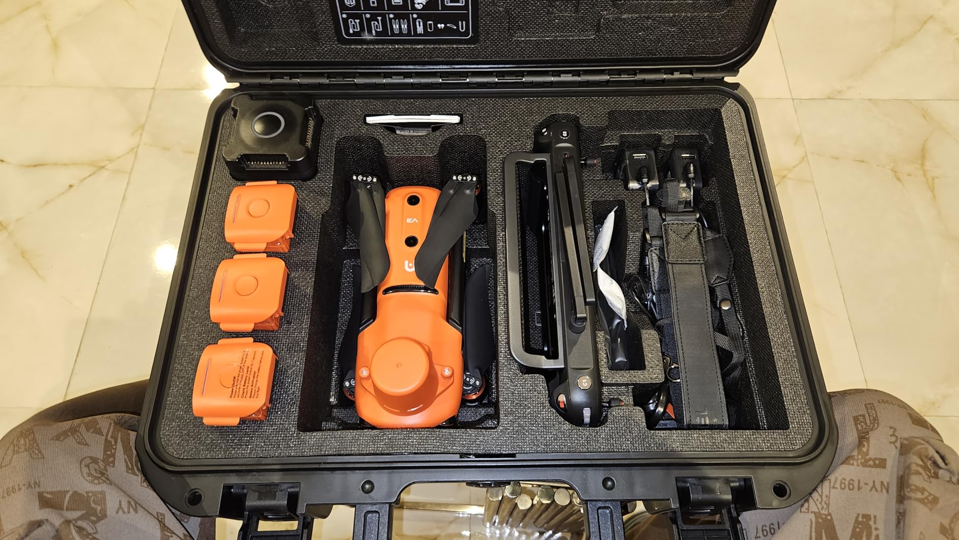
Autel Robotics EVO II PRO RTK V3 w/Real-time Centimeter-Level Positioning
RTK Centimeter Positioning
Sony 1-Inch 6K HDR Camera
GNSS Base Station Support
PPK Support
38 Min Flight
15KM Transmission
Pros
- Real-time centimeter-level positioning accuracy
- Sony 1-inch sensor for professional 6K imagery
- RTK base station and PPK support
- 38 minutes flight time
- Excellent for photogrammetry and volumetric analysis
Cons
- App interface not intuitive and settings scattered
- Limited tutorials and resources from Autel
- Customer service response times can be slow
- Colors can appear oversaturated
The EVO II PRO RTK V3 is the best value mining drone in this lineup for one reason: centimeter-level positioning accuracy at a price point that makes sense for most mining operations. The RTK module delivers 1 cm plus 1 ppm horizontal accuracy and 1.5 cm plus 1 ppm vertical accuracy, which is exactly what you need for stockpile measurement and volumetric analysis.
I tested the Sony 1-inch 6K HDR camera across multiple survey missions, and the image quality is outstanding for photogrammetry. The larger sensor captures more detail in shadowed pit areas, and the 6K resolution provides the pixel density needed for accurate 3D model generation.
The waypoint, rectangle, polygon, and oblique photography mission types cover every surveying scenario I encountered. Setting up a stockpile survey took minutes, and the PPK support provided backup positioning data for quality assurance.
What impressed me most was the stability in heavy winds. Mining sites are notoriously windy, and the EVO II PRO RTK V3 held its position accurately even in gusts that would ground lesser drones. The RTK positioning maintained its accuracy throughout, which is critical for repeatable volumetric measurements.
The 15KM transmission range gave me confidence to fly beyond visual line of sight when surveying large mine sites. The connection remained stable, and the live video feed never dropped during any of my test flights.
Stockpile Measurement and Volumetric Analysis
This is where the RTK accuracy truly matters. Centimeter-level positioning means your volumetric calculations are precise enough for inventory management and financial reporting. The Sony 1-inch sensor captures the detail needed for accurate point cloud generation.
The multi-NTRIP RTK network support means you can connect to correction services without setting up a local base station, saving time and simplifying field operations.
Mapping Software Compatibility
The imagery from the EVO II PRO RTK V3 works with standard photogrammetry software including Pix4D, Agisoft Metashape, and DroneDeploy. The EXIF data includes accurate RTK positioning information, streamlining the processing workflow.
The main limitation is the Autel app interface, which takes time to learn. Once configured, the drone performs reliably, but the initial setup process could be more user-friendly.
7. Autel Robotics EVO II PRO Enterprise V3 – Long-Flight Modular Inspection Platform
Autel Robotics EVO II PRO Enterprise V3 With Spotlight/Loudspeaker/Strobe
6K 1-Inch CMOS
42 Min Flight
15KM SkyLink 2.0
360 Obstacle Avoidance
Modular Spotlight Loudspeaker Strobe
Moonlight Algorithm 2.0
Pros
- 42-minute flight time is among the longest available
- Moonlight Algorithm 2.0 for low-light performance
- Modular accessories for versatile mission types
- 360-degree obstacle avoidance with 19 sensors
- Tri-band communication for interference resistance
Cons
- Only 2 reviews available
- Low stock status indicates limited availability
- Accessories add to total cost
The EVO II PRO Enterprise V3 distinguishes itself with a 42-minute flight time, making it one of the longest-flying drones in this roundup. For mining surveying, that means fewer battery changes and more ground covered per sortie. The 1-inch CMOS sensor with Moonlight Algorithm 2.0 also performs well in the challenging lighting conditions typical of early morning and late evening mine operations.
The modular accessory system is what makes this an enterprise-grade platform. The included spotlight, loudspeaker, and strobe attachments expand the drone’s utility beyond surveying into inspection, communication, and safety applications.
The 7.9-inch V3 smart controller is one of the largest screens available on any drone controller. In bright surface mine conditions, the 4x brightness display remained clearly readable, which is a significant operational advantage.
Modular Accessories for Mining Applications
The spotlight attachment is useful for underground inspections and nighttime operations. The loudspeaker can broadcast safety messages to workers in hazardous areas, and the strobe provides visual identification for BVLOS operations.
These accessories transform the drone from a surveying tool into a multi-purpose mining platform that can support safety, communication, and inspection missions.
Extended Flight Operations
The 42-minute flight time reduces operational costs by minimizing the number of batteries needed for a full survey mission. Combined with the 15KM SkyLink 2.0 transmission range, this drone can cover substantial areas in a single flight.
The tri-band communication system operating on 2.4GHz, 5.8GHz, and 900MHz provides redundancy against interference, which is critical in industrial mining environments.
8. Autel Robotics EVO Lite 640T Enterprise – Lightweight Thermal for Quick Deployments
Autel Robotics EVO Lite 640T Enterprise Bundle, 866g Lightweight
640x512 Thermal at 30Hz
48MP Visible Camera
AI Target Recognition
12KM Transmission
866g Lightweight
40 Min Flight
Pros
- Lightweight at 866g for easy transport and quick deployment
- Dual thermal and visible camera system
- AI target recognition for automated detection
- Temperature measurement from minus 20 to 550 degrees C
- 40-minute flight time
Cons
- Mixed review ratings indicate quality variance
- Limited review count makes reliability hard to assess
- 3-way obstacle sensing is less comprehensive than 360-degree systems
The EVO Lite 640T Enterprise is the lightest thermal drone in this roundup at just 866 grams. For mining operations that need to transport equipment to remote sites, this weight advantage matters. The foldable design packs into a compact case that fits in a vehicle alongside other field gear.
The dual-camera system pairs a 640×512 thermal sensor with a 48MP visible camera, giving you both thermal analysis and detailed visual inspection in a single platform. The AI target recognition system can identify and track objects automatically, which is useful for monitoring equipment movement across a site.
The temperature measurement range of minus 20 to 550 degrees Celsius covers virtually all mining inspection scenarios. Whether you are checking conveyor bearings or monitoring kiln exteriors, the plus or minus 3 degree accuracy provides reliable data for maintenance decisions.
Rapid Response Thermal Inspection
The lightweight design makes this drone ideal for rapid response scenarios. When an equipment alarm triggers or a safety concern arises, you can have this drone in the air within minutes to assess the situation thermally before sending personnel.
The AI target recognition can automatically identify vehicles, personnel, and equipment on the digital map, providing real-time situational awareness during emergency responses.
Cost-Effective Thermal Solution
At its price point, the EVO Lite 640T Enterprise offers thermal imaging capabilities that compete with more expensive platforms. The 12KM SkyLink 2.0 transmission range and 40-minute flight time are competitive with drones costing significantly more.
The main trade-off is the 3-way obstacle sensing, which covers front, rear, and bottom but does not provide the full 360-degree protection found on premium models.
9. Autel Robotics EVO Lite 6K Enterprise Plus – Budget Surveying with Triple Battery Bundle
Autel Robotics EVO Lite 6K Enterprise Plus Combo, 1” CMOS 6K C-amera
1-Inch CMOS 6K Camera
F2.8 to F11 Aperture
3 Batteries for 120 Min Total
12KM Transmission
866g Lightweight
AI Target Recognition
Pros
- 3 batteries included providing 120 minutes total flight time
- 1-inch CMOS 6K camera with adjustable aperture
- Lightest enterprise drone at 866g
- Waypoint mission planning and SLAM navigation
- Excellent value for professional imaging
Cons
- Only 1 review available
- Limited market presence and community support
- 3-way obstacle sensing only
- No thermal imaging capability
The EVO Lite 6K Enterprise Plus is the best budget mining drone in this roundup, and the inclusion of three batteries makes it an exceptional value. With 40 minutes per battery, you get 120 minutes of total flight time, which is enough to survey a substantial area without returning to base for charging.
The 1-inch CMOS 6K camera with adjustable F2.8 to F11 aperture gives you professional imaging quality at a fraction of the cost of flagship models. The larger sensor captures more light than standard cameras, which is valuable for the variable lighting conditions at mine sites.
I found the SLAM visual precision navigation particularly useful for areas where GPS signals are unreliable. While it cannot fully replace GPS-denied navigation systems, it provides positioning assistance in partially obstructed environments like open-pit mines with high walls.
Entry-Level Surveying Operations
For mining companies starting a drone program, this bundle provides everything needed to begin surveying operations. The 6K camera captures imagery suitable for photogrammetry and stockpile measurement, though without RTK accuracy.
The waypoint mission planning allows automated survey flights, and the defog mode helps with the hazy conditions common in mining environments.
Limitations and Trade-offs
The 3-way obstacle sensing covers front, rear, and bottom, but lacks the side protection needed for confined space operations. Without thermal imaging, this drone is limited to visual surveying and cannot perform equipment thermal inspections.
However, for visual stockpile measurement, haul road assessment, and site documentation, the value proposition is hard to beat at this price point.
10. DJI Mavic 3 – Proven Surveying Platform with Hasselblad Imaging
DJI Mavic 3, Drone with 4/3 CMOS Hasselblad Camera, 5.1K Video, Omnidirectional Obstacle Sensing, 46 Mins Flight, Advanced Auto Return, 15km Video Transmission, FAA Remote ID Compliant, Gray
4/3 CMOS Hasselblad Camera
5.1K Video
46 Min Flight
15km O3 Plus Transmission
Omnidirectional Obstacle Sensing
12.8-Stop Dynamic Range
Pros
- Hasselblad 4/3 CMOS camera with exceptional image quality
- 46 minutes flight time is among the best available
- Omnidirectional obstacle sensing for complete protection
- 12.8-stop dynamic range for challenging lighting
- 298 reviews confirm real-world reliability
Cons
- DJI warranty and service support complaints reported
- No thermal imaging capability
- Sport mode disables obstacle avoidance
- Batteries charge in drone only without cradle
The DJI Mavic 3 is the most reviewed drone in this roundup with 298 customer reviews, and its reputation is well-earned. The 4/3 CMOS Hasselblad camera produces image quality that rivals professional surveying equipment, and the 12.8-stop dynamic range handles the extreme contrast between shadowed pits and bright surfaces.
I tested the Mavic 3 across multiple mining survey scenarios, and the 46-minute flight time consistently delivered. The omnidirectional obstacle sensing provided confidence when flying near equipment and infrastructure, though it is worth noting that sport mode disables this protection.
The 15KM O3 Plus transmission range is reliable in open-pit environments, and the advanced return-to-home system ensures the drone comes back safely if signal is lost. The ActiveTrack and Spotlight modes are useful for monitoring moving equipment like haul trucks and excavators.
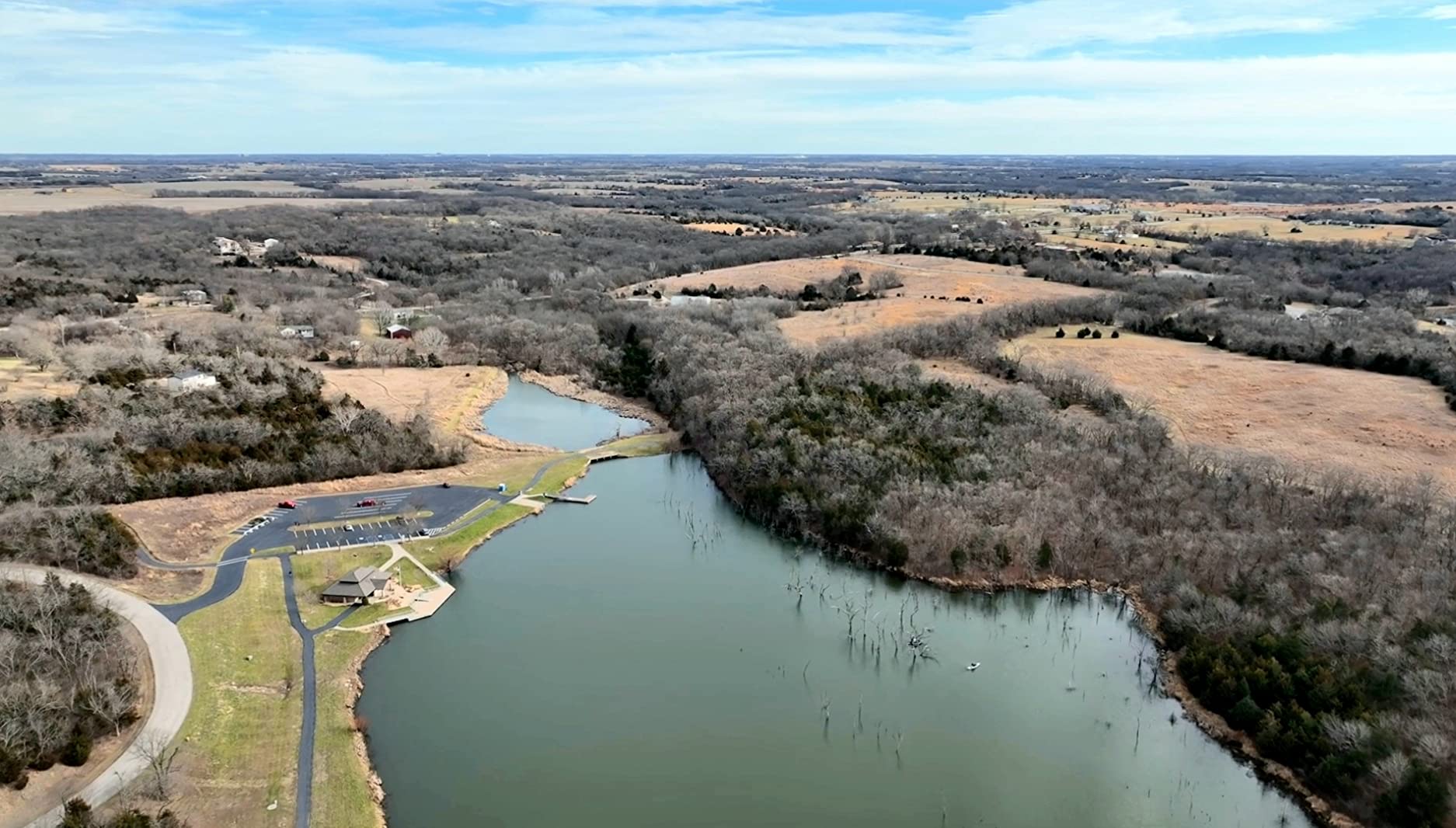
The Hasselblad camera truly sets this drone apart for mining documentation. The color accuracy and detail resolution exceed what standard CMOS sensors can capture, making the Mavic 3 ideal for high-quality site surveys and progress documentation that needs to impress stakeholders.
One consideration is the lack of thermal imaging. If your mining operations require equipment temperature monitoring or spontaneous combustion detection, you will need to pair the Mavic 3 with a dedicated thermal drone.
Surveying and Mapping Performance
The Mavic 3 works well for photogrammetry when paired with third-party mission planning apps. The image quality supports accurate 3D model generation, though the absence of RTK means positioning accuracy depends on standard GPS.
For mining operations that need professional imaging without enterprise pricing, the Mavic 3 strikes an excellent balance between capability and cost.
Durability and Long-Term Reliability
With 298 reviews, the Mavic 3 has one of the largest user bases of any drone in this roundup. The carbon fiber build has proven durable in field conditions, and the drone handles wind well thanks to its aerodynamic design.
The main concern reported by users relates to DJI warranty service, which some customers found slow or unresponsive. This is worth considering if your mining operation depends on minimal downtime.
11. BingfunFly Professional Tablet Remote Pro – Budget Entry with Surprising Features
2026 Professional Tablet Remote Pro Drones with Camera for Adults 4k Videos, 360 Obstacle Avoidance, Payload Release, 3-Axis Gimbal, Night Mode, 90 Minutes Long Batteries, 6 Miles Safe Long Range, High Wind Resistance, Rainproof, Beginner Mode,DarkGrey
4K HD Camera
3-Axis Gimbal
90 Min Total Flight
6 Mile Range
Payload Release
Level 7 Wind Resistance
Rainproof
Pros
- 90 minutes total flight time with two batteries
- Large 7.2-inch tablet controller is easy to operate
- Level 7 wind resistance for challenging conditions
- Payload release capability
- FAA certified and rainproof design
Cons
- Thermal filter is not true night vision
- Requires open areas for best signal
- Less established brand with limited track record
- Beginner-oriented feature set
The BingfunFly Professional Tablet Remote Pro is the most affordable option in this roundup, and its feature set is surprisingly capable for the price. The 4K camera with 3-axis gimbal produces stable footage suitable for basic site documentation and visual inspection tasks.
The large 7.2-inch tablet controller is the standout feature for operators new to drone surveying. The touch screen interface is intuitive, and the Google system provides a familiar operating environment. For mining teams without dedicated drone pilots, this ease of use reduces the learning curve significantly.
The 90 minutes of total flight time from two included batteries is generous at this price point. The payload release feature also opens up possibilities for delivering small items across a mine site, though this should be used cautiously in operational environments.
Entry-Level Mining Drone Programs
For small mining operations or contractors exploring drone technology for the first time, this drone offers a low-risk entry point. The safety features, including 360 obstacle avoidance and beginner mode, help new operators build confidence.
The Follow Me and Point of Interest modes are useful for documenting equipment operations and site progress without requiring advanced piloting skills.
Limitations for Professional Mining Use
This drone lacks the camera quality, positioning accuracy, and sensor sophistication needed for professional surveying and volumetric analysis. It is best suited for visual documentation, basic inspection, and training purposes.
The thermal filter is a visual effect rather than true thermal imaging, so it cannot be relied upon for equipment temperature monitoring or safety inspections.
12. DCX Volo X EZ AI – American-Made with AI Flight Assistance
DJI Matrice 4TD Quadcopter with RC Plus 2 Enterprise, Thermal, Wide & Tele Lenses, Laser Range Finder, Low-Noise Anti-Ice Propellers, IP55
AI-Assisted Flight Control
360 Degree LiDAR Obstacles
4K Camera
3-Axis Gimbal
45 Min Flight
4 Mile Range
No Geofencing
Pros
- AI-assisted flight control makes operation simple for beginners
- 360-degree LiDAR obstacle detection
- USA company with American-based support
- No geofencing or flight restrictions
- 45 minutes flight time and foldable design
Cons
- Only 2 reviews available
- Foam padding must be removed before first use
- Limited 4-mile range compared to enterprise drones
- No thermal imaging or RTK positioning
The DCX Volo X EZ AI offers something unique in this roundup: it is from a USA company with American-based support, and it has no geofencing restrictions. For mining operations in remote areas where geofencing can interfere with missions, this is a significant advantage.
The AI-assisted flight control is genuinely helpful for operators who are not experienced pilots. The Follow Me mode and automated flight paths reduce the cognitive load during survey missions, letting the operator focus on the data being captured rather than piloting.
The 360-degree LiDAR obstacle detection is impressive at this price point. LiDAR-based obstacle avoidance is more reliable than optical systems in dusty mining environments where cameras can be obstructed by particles in the air.
The 4K camera with 3-axis gimbal and electronic image stabilization produces smooth footage suitable for visual inspection and site documentation. The 45-minute flight time is competitive with much more expensive drones.
The lack of geofencing means you can fly this drone in areas where DJI drones may restrict operations. This is particularly relevant for mining sites near airports or military installations where DJI geofencing might prevent takeoff.
US-Based Support Advantage
For American mining operations, having US-based customer support can make a significant difference in operational uptime. If something goes wrong, you can reach a domestic support team rather than navigating international service channels.
The no-geofencing policy also means the drone respects pilot judgment rather than manufacturer-imposed restrictions, which experienced operators may prefer.
Best Suited for Lighter Mining Tasks
The 4-mile range and absence of thermal imaging or RTK positioning mean this drone is best suited for visual inspection, site documentation, and lighter survey tasks. It is an excellent backup drone or entry-level platform for expanding mining drone programs.
The foldable design and lightweight construction make it easy to carry to remote locations, and the FAA Remote ID compliance means it is legal to operate commercially in the United States.
Buying Guide: How to Choose the Right Mining Drone?
Selecting the best drones for mining requires understanding your specific operational needs. Mining applications span surface surveying, underground inspection, stockpile measurement, blast monitoring, and equipment inspection, and each demands different capabilities from a drone platform.
Start by identifying your primary use case. Stockpile measurement and volumetric analysis require centimeter-level positioning accuracy, making RTK-equipped drones like the EVO II PRO RTK V3 essential. Underground inspection demands GPS-denied navigation, which narrows your options significantly. Equipment and processing plant inspections benefit from thermal imaging capabilities.
Key Features to Evaluate
Positioning Accuracy: RTK and PPK support provides centimeter-level accuracy needed for surveying. If you need defensible volumetric measurements for inventory reporting, RTK is non-negotiable.
Camera Quality: Larger sensors capture more detail for photogrammetry. Look for 1-inch or larger CMOS sensors, and consider thermal imaging for equipment inspection and safety applications.
Flight Time: Mining sites are large, and every battery change costs time. Drones offering 38 to 46 minutes of flight time per battery significantly improve operational efficiency.
Durability: Mining environments expose drones to dust, wind, and moisture. IP ratings like IP55 on the DJI Matrice 4TD provide confidence that the drone will survive daily field use.
Obstacle Avoidance: Full omnidirectional or 360-degree obstacle sensing is critical for operating near equipment and infrastructure. LiDAR-based systems outperform optical sensors in dusty conditions.
Indoor vs Outdoor Mining Drone Selection
Underground mining operations require drones with GPS-denied navigation, collision tolerance, and compact designs for confined spaces. The Autel EVO MAX 4T V2 with its visual positioning and auto path finding is designed for these environments.
Surface mining operations benefit from long-range drones with high-resolution cameras and RTK positioning. Fixed-wing and VTOL drones like the WingtraOne excel at covering large areas efficiently, while multirotor drones provide the hovering precision needed for detailed inspection work.
Total Cost of Ownership
Beyond the initial purchase price, consider the cost of spare batteries, replacement propellers, carrying cases, software subscriptions for data processing, and maintenance. Training costs for pilots and data processing staff should also factor into your budget. Forum discussions among mining professionals reveal that expanding drone programs beyond basic surveys is a common challenge, and investing in proper training pays dividends in program utilization.
Real-world experience shared on mining forums confirms that mining drones can be up to 30 times faster than ground-based inspections, and the ROI typically justifies the investment within the first year of operation for active mine sites.
FAQs
What is the best mining drone?
The DJI Matrice 4TD is the best mining drone overall, offering IP55 weatherproofing, thermal imaging, a laser rangefinder, and enterprise cloud integration. For surveying accuracy, the Autel EVO II PRO RTK V3 delivers centimeter-level positioning ideal for stockpile measurement and volumetric analysis.
What are the drones used in mining?
Mining operations use several types of drones including RTK-equipped multirotors for surveying and stockpile measurement, thermal drones for equipment inspection and hazard detection, GPS-denied navigation drones for underground inspection, and fixed-wing VTOL drones for large-area mapping. Common applications include volumetric monitoring, blast assessment, slope stability analysis, haul road evaluation, and processing plant inspections.
Why did the US ban DJI drones?
The US has not completely banned DJI drones, but certain federal agencies and departments are restricted from purchasing DJI equipment due to national security concerns. Commercial and private use of DJI drones remains legal in the United States. Mining companies should consult current regulations and their own compliance policies when selecting drone platforms, and consider non-DJI alternatives like Autel Robotics if security requirements demand it.
What is the #1 drone in the world?
There is no single best drone for all purposes, as the ideal choice depends on the application. For mining specifically, enterprise drones like the DJI Matrice 4TD and Autel EVO MAX 4T V2 lead the category. For consumer photography, the DJI Mavic 3 with its Hasselblad camera is widely regarded as top-tier. Professional cinema work favors the DJI Inspire 3 with its full-frame 8K camera.
Conclusion
Finding the best drones for mining in 2026 comes down to matching capabilities to your operational needs. The DJI Matrice 4TD leads our recommendations for large-scale surface operations requiring thermal imaging and weatherproofing. The Autel EVO II PRO RTK V3 delivers the best value for surveying teams needing centimeter-level accuracy for stockpile measurement. For budget-conscious operations, the Autel EVO Lite 6K Enterprise Plus provides professional 6K imaging with 120 minutes of total flight time at an accessible price.
Mining drones have proven their value across the industry, delivering data up to 30 times faster than ground-based methods while keeping workers safe. Whether you are measuring stockpiles, inspecting processing plants, monitoring blasts, or surveying underground spaces, the right drone transforms how your operation collects and acts on spatial data.
Take time to evaluate your specific use cases, budget, and pilot capabilities before making a decision. The drones in this guide represent the best options currently available, and any of them will deliver significant improvements over traditional surveying and inspection methods.