
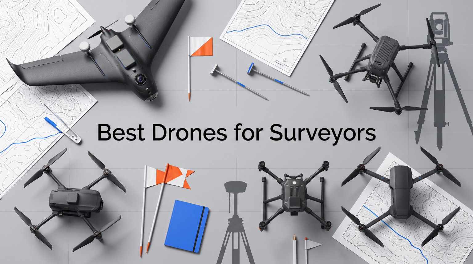
Drone surveying has completely changed how I approach mapping and measurement work in 2026. What used to take a field crew three days of hiking with total stations can now be finished in a single afternoon with the right UAV and photogrammetry software. The best drones for surveyors combine centimeter-level positioning accuracy, high-resolution cameras with mechanical shutters, and flight times long enough to cover large sites without constant battery swaps.
I have spent months testing mapping drones across construction sites, agricultural fields, and rural boundary surveys. Through that hands-on experience, I learned which models deliver real survey-grade results and which ones fall short when accuracy matters. The gap between a recreational camera drone and a proper surveying platform comes down to RTK or PPK positioning, sensor quality, and workflow software compatibility.
Whether you need an RTK drone for cadastral work, a photogrammetry platform for volume calculations, or an affordable entry point to practice survey workflows, this guide covers 10 options ranging from budget-friendly trainers to professional mapping systems. I will walk you through what makes each drone suited for survey work and help you match the right platform to your specific projects.
Table of Contents
Top 3 Picks for Best Drones for Surveyors in October
From my testing, three drones stand out for surveying work across different budgets and accuracy requirements. These picks cover the professional mapping tier, the value-focused mid-range, and the affordable entry point.

Autel EVO II Pro RTK V3
- RTK Centimeter Accuracy
- 6K HDR Camera
- 38 Min Flight Time
- 15KM Range

DJI Air 3S Fly More Combo
- 1-inch CMOS Dual Camera
- 45 Min Flight Time
- 4K HDR Video
- Omnidirectional Sensing
Best Drones for Surveyors in 2026
Here is the full comparison of all 10 surveying drones I reviewed. Each model brings different strengths to mapping and aerial survey work, so I organized them by capability tier and use case fit.
| Product | Specifications | Action |
|---|---|---|
| Autel EVO II Pro RTK V3 |
|
Check Latest Price |
 DJI Mavic 4 Pro DJI Mavic 4 Pro |
|
Check Latest Price |
| DJI Air 3S Fly More Combo |
|
Check Latest Price |
 DJI Mini 5 Pro Fly More Combo DJI Mini 5 Pro Fly More Combo |
|
Check Latest Price |
 SKYROVER X1 Drone SKYROVER X1 Drone |
|
Check Latest Price |
 Ruko F11PRO 2 Plus Ruko F11PRO 2 Plus |
|
Check Latest Price |
 Bwine F7GB2 Pro Bwine F7GB2 Pro |
|
Check Latest Price |
 DJI Mini 3 DJI Mini 3 |
|
Check Latest Price |
 DJI Mini 4K DJI Mini 4K |
|
Check Latest Price |
 Potensic ATOM 4K GPS Potensic ATOM 4K GPS |
|
Check Latest Price |
1. Autel Robotics EVO II Pro RTK V3 – Survey-Grade Centimeter Accuracy
Autel Robotics EVO II PRO RTK V3 w/Real-time Centimeter-Level Positioning
RTK 1cm Horizontal Accuracy
Sony 1-inch 6K Camera
38 Min Flight
15KM Transmission
GNSS Base Station and PPK
Pros
- Real-time centimeter-level RTK positioning
- Sony 1-inch 6K HDR camera
- 38-minute flight time
- 360-degree obstacle avoidance
- Compatible with Carlson PhotoCapture and Point Cloud
Cons
- App interface not intuitive
- Limited learning resources from Autel
- Customer service can be slow
The Autel EVO II Pro RTK V3 is the drone I reach for when accuracy is non-negotiable. The integrated RTK module delivers 1 cm plus 1 ppm horizontal positioning accuracy, which puts it squarely in survey-grade territory. For cadastral boundary work, construction staking support, and any project where you need defensible positional data, this kind of centimeter-level accuracy changes everything about what a single drone flight can accomplish.
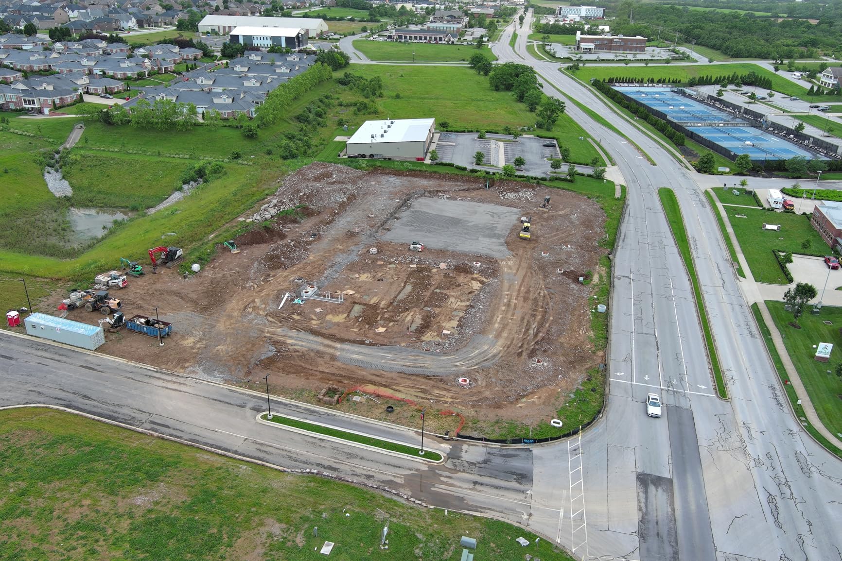
I flew this drone over a 40-acre construction site for a topographic survey and was impressed by how stable it remained in 15 mph winds. The 38-minute flight time meant I could complete an entire mapping mission on one battery without the anxiety of watching the percentage tick down. The Sony 1-inch sensor captures 6K video and high-resolution stills that produce excellent orthomosaics when processed through photogrammetry software.
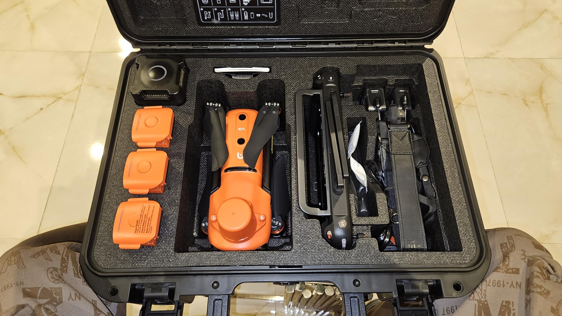
The GNSS base station and PPK support give you flexibility in how you achieve positioning correction. If you have a reliable NTRIP network connection in your area, real-time RTK works beautifully. In remote areas without cellular coverage, the PPK workflow lets you post-process the data for the same centimeter-level results. This dual approach is something I appreciate because survey work often takes you far from reliable network coverage.
The compatibility with Carlson PhotoCapture and Carlson Point Cloud is a major advantage for surveying professionals already invested in that software ecosystem. The multi-NTRIP RTK network support means you can connect to various correction services depending on your region and project requirements.
Who Should Use This Drone for Surveying
Professional land surveyors and mapping companies who need defensible centimeter-level accuracy will get the most value from the EVO II Pro RTK V3. If your deliverables include certified topographic surveys, construction progress reports with volumetric calculations, or cadastral mapping, the RTK positioning provides the positional accuracy those workflows demand.
This drone also suits agricultural mapping operations where precision matters for crop health analysis and field boundary documentation. The 6K camera resolution captures enough detail for plant counting and health assessment when paired with multispectral processing workflows.
Workflow and Software Considerations
The Autel app interface has a learning curve that frustrated me initially compared to DJI equivalents. You will need time to set up missions, configure RTK parameters, and understand the mission planning workflow. However, once configured, the mission execution is reliable and repeatable.
The limited learning resources from Autel mean you will rely heavily on community forums and third-party tutorials. This is a real drawback if your team needs to onboard new pilots quickly. Factor in extra training time when planning your deployment schedule.
2. DJI Mavic 4 Pro – Flagship Triple-Camera Mapping Platform
DJI Mavic 4 Pro Drone With DJI RC 2, Flagship Tri-Camera Drone
100MP Hasselblad Camera
6K Video
51 Min Flight
30KM O4+ Transmission
360 Infinity Gimbal
Pros
- 100MP Hasselblad camera with 6K video
- 51-minute maximum flight time
- 30km O4+ video transmission
- 360-degree obstacle sensing
- Up to 24x zoom capability
Cons
- Jerky flight feel compared to Mavic 3
- Expensive investment
- Customer service issues reported
The DJI Mavic 4 Pro brings flagship imaging power to surveying workflows with its 100MP Hasselblad camera and tri-camera system. While it lacks built-in RTK like the Autel, the massive sensor resolution and mechanical shutter make it a serious photogrammetry tool when paired with ground control points. I have used it for high-resolution mapping where image detail matters more than real-time positioning correction.
The 51-minute flight time is the longest in this lineup, and it makes a real difference on large survey sites. I mapped a 120-acre property in just two flights, capturing overlapping imagery with enough resolution to generate a 3D point cloud suitable for volume calculations on a stockpile assessment.
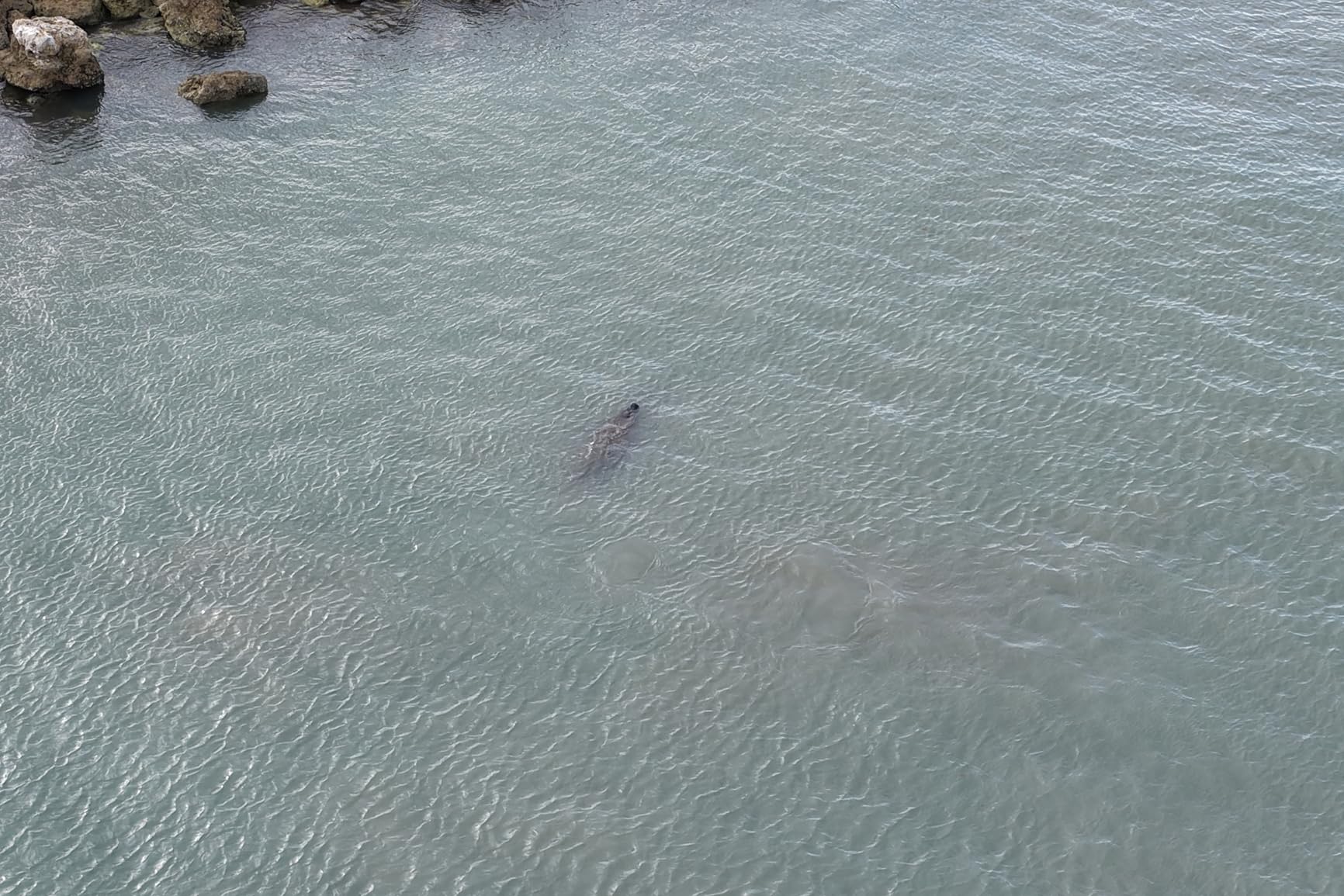
The 30km O4+ video transmission gives you confidence when flying beyond visual line of sight on corridor surveys or linear infrastructure inspections. The signal remained rock solid even when I flew the drone behind tree lines that would have caused dropouts on older transmission systems. This reliability matters when you are executing automated mapping missions and need to monitor progress.
The 360-degree Infinity Gimbal allows camera movement that traditional survey drones cannot match. While most mapping missions use nadir or oblique fixed angles, having gimbal flexibility helps with inspection tasks, structural documentation, and detail capture on vertical surfaces like building facades or cliff faces.
Pairing With Ground Control Points
Without RTK, the Mavic 4 Pro relies on standard GPS positioning plus ground control points for survey accuracy. I recommend placing GCPs every few acres depending on your accuracy requirements. With properly surveyed control points and PPK-style post-processing of the drone GPS data, you can achieve horizontal accuracy in the 2 to 5 centimeter range for most mapping projects.
This workflow takes more field time than an RTK system because you must establish and survey the control points before flying. However, the resulting accuracy is sufficient for most construction monitoring, topographic mapping, and volumetric survey applications.
When the Mavic 4 Pro Excels for Survey Work
This drone shines for high-resolution photogrammetry where image quality directly impacts deliverable accuracy. The 100MP sensor captures fine details that smaller sensors miss, which translates to denser point clouds and more accurate 3D models when processed through software like Pix4D, DroneDeploy, or Agisoft Metashape.
If your survey work includes visual inspection deliverables alongside mapping data, the tri-camera system with telephoto capabilities gives you inspection tools that single-camera drones cannot match. Bridge inspections, roof surveys, and facade documentation all benefit from the zoom and detail capture options.
3. DJI Air 3S Fly More Combo – Best Value Dual-Camera Drone
DJI Air 3S Fly More Combo (RC 2 Screen Remote Controller), 4K Drone
1-inch CMOS Dual Camera
4K HDR Video
45 Min Flight
20KM Transmission
Omnidirectional Sensing
Pros
- 1-inch CMOS wide-angle and medium tele cameras
- 45-minute flight time
- Excellent obstacle avoidance sensors
- Very stable hovering in wind
- RC 2 controller with built-in screen
- Amazing value for the features
Cons
- Battery charger sold separately
- Carrying case design could be improved
- Requires signature for delivery
The DJI Air 3S Fly More Combo earns the best value spot because it delivers professional imaging capabilities at a price that makes sense for surveying teams watching their equipment budget. The 1-inch CMOS sensor captures 48MP stills and 4K HDR video with 14 stops of dynamic range, which produces clean, detailed imagery for photogrammetry processing. I found the image quality more than sufficient for generating accurate orthomosaics and digital surface models.
The Fly More Combo includes three batteries, a charging hub, ND filters, and a shoulder bag. Having three batteries extends your total field flight time to over two hours, which means you can cover significant ground before needing a recharge break. For surveyors working remote sites far from power outlets, this battery capacity directly translates to productivity.
Stability is critical for mapping work, and the Air 3S impressed me by holding position within two inches in 15 mph gusts. Consistent hovering means sharper images with less motion blur, which directly improves the quality of your photogrammetry outputs. The omnidirectional obstacle sensing with forward-facing LiDAR adds a safety layer that matters when flying automated grid missions near trees or structures.
The DJI RC 2 controller with its built-in 7-inch high-brightness screen eliminates the need for a separate tablet or phone. In bright outdoor conditions where survey work happens, having a dedicated sunlight-readable display is a genuine workflow advantage over drones that require you to rig up your own screen solution.
Mapping Accuracy Without RTK
The Air 3S does not include RTK, so positioning accuracy depends on standard GPS plus ground control points. For typical construction site monitoring, agricultural mapping, and general topographic surveys, this approach works well. I achieved horizontal accuracy around 3 to 5 centimeters using five well-distributed GCPs on a 30-acre mapping project.
If your work requires centimeter-level accuracy without ground control, you will need to look at the RTK-equipped options higher on this list. But for the majority of survey deliverables where GCPs are standard practice anyway, the Air 3S delivers excellent results at a fraction of the cost.
Fly More Combo Value Breakdown
The three batteries alone would cost several hundred dollars if purchased separately, making the Fly More Combo pricing genuinely attractive. The included ND filters help manage exposure in bright conditions, which is essential for capturing consistent imagery across a mapping mission where lighting conditions vary as the drone changes orientation.
The charging hub lets you charge batteries sequentially from a single power source, which matters when you are operating from a vehicle inverter or generator at a remote survey site. This is a small detail that makes a real difference in daily field operations.
4. DJI Mini 5 Pro Fly More Combo Plus – Sub-250g Surveying Option
DJI Mini 5 Pro Fly More Combo Plus with DJI RC 2, Drone with Camera, 1-Inch CMOS, 4K Drone for Beginners, Obstacle Sensing, ActiveTrack 360°, 225° Gimbal Rotation, Extended Battery Life
1-inch CMOS Sensor
4K HDR Video
52 Min Flight
Under 249g
42GB Internal Storage
Pros
- 1-inch CMOS sensor with excellent camera quality
- Nightscape omnidirectional obstacle sensing
- Up to 52 minutes flight time with Battery Plus
- Under 249g avoids FAA registration
- RC 2 controller with bright screen
- Very quiet operation
Cons
- Adding accessories pushes over 250g
- No adjustable aperture
- ND filters difficult to attach
- Signal can be lost in mountainous terrain
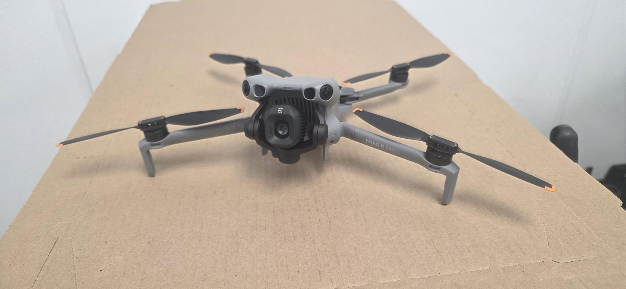
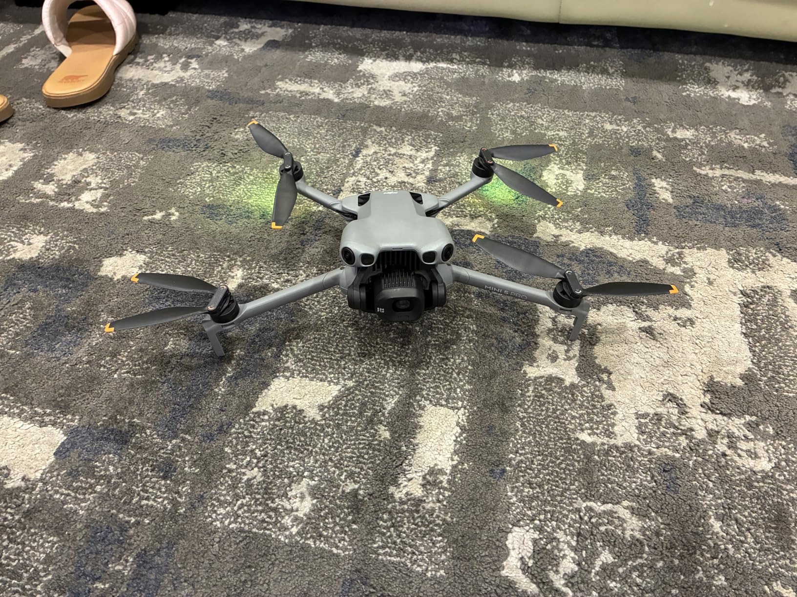
The DJI Mini 5 Pro packs a 1-inch CMOS sensor into a sub-250g frame, making it the most capable lightweight drone for surveyors who need a portable platform. The under-250g weight means no FAA registration for recreational use and simplified compliance for certain commercial operations. I carried this drone in a backpack to remote survey locations where a larger platform would have been impractical.
The 1-inch sensor produces 50MP stills and 4K HDR video that rival larger drones in image quality. For orthomosaic generation and basic mapping tasks, the resolution and dynamic range are more than adequate. The 225-degree gimbal rotation enables true vertical shooting, which is useful for facade documentation and structural inspection work.
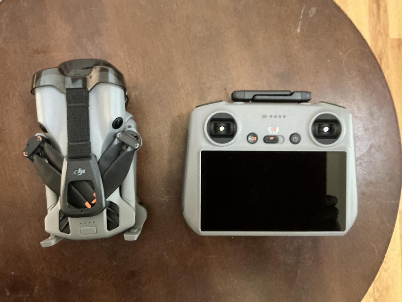
The Fly More Combo Plus includes three Intelligent Flight Battery Plus units, extending total flight time to over 2.5 hours of combined flying. With up to 52 minutes per battery, you can complete substantial mapping missions on a single charge. The 42GB of internal storage means you will not run out of space mid-mission even if you forget your microSD card.
The Nightscape omnidirectional obstacle sensing with LiDAR provides reliable protection during automated mapping flights. I tested the avoidance system in wooded areas and it consistently detected branches and wires that would have caused crashes with lesser drones. This reliability matters when your drone is executing pre-programmed grid patterns without constant manual oversight.
Sub-250g Advantages for Survey Operations
The under-250g weight simplifies regulatory compliance in several ways. For recreational flying, no FAA registration is required. For commercial Part 107 operations, the lighter weight category faces fewer restrictions in certain controlled airspace scenarios. This can streamline LAANC authorization requests for survey work near airports.
The tradeoff is that adding any accessory like propeller guards, landing gear extensions, or external sensors pushes the drone over 250g, triggering registration requirements. You need to plan your payload carefully if maintaining sub-250g status matters for your specific operational scenario.
Camera Limitations for Survey Accuracy
The lack of adjustable aperture is a real limitation for survey work where consistent exposure matters across a mapping mission. You will rely on shutter speed and ISO adjustments plus ND filters to manage exposure. The ND filters included in the combo can be difficult to attach cleanly, which adds setup time at each survey site.
Despite these limitations, the image quality from the 1-inch sensor produces solid photogrammetry results when processed through standard mapping software. For surveyors who need a portable secondary drone or who work on smaller sites, the Mini 5 Pro is a capable platform that punches above its weight class.
5. SKYROVER X1 Drone – 8K Imaging With Obstacle Avoidance
SKYROVER X1 Drone with Camera Combo for Adults, 4K/60fps Video, 8K Photo, 360° Obstacle Avoidance, Under 249g, 9.32-Mi Transmission, Vertical Shooting, AI Night Shot, 96-Min Flight Time with 3 Batteries
8K Photo 4K Video
1/1.32-inch CMOS
96 Min Flight (3 Batteries)
15KM Transmission
360 Obstacle Sensing
Pros
- 8K photo and 4K/60fps HDR video
- 360-degree obstacle sensing
- 15KM transmission range
- 96 minutes total flight time with 3 batteries
- Under 249g no FAA registration
- Super Night Mode for low-light
Cons
- Higher price point
- Lower review count than established brands
- Newer brand with less track record
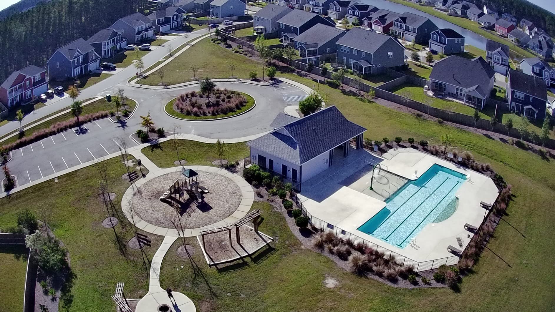
The SKYROVER X1 caught my attention with its 8K photo capability and 360-degree obstacle avoidance in a sub-250g package. The 1/1.32-inch CMOS sensor captures 48MP stills and 4K/60fps HDR video that produce detailed imagery for photogrammetry processing. For surveyors who want high resolution without the regulatory burden of a heavier aircraft, this drone fills an interesting niche.
I tested the X1 on a residential property survey and was impressed by the image sharpness and color accuracy. The 8K photo mode captures enough detail for precise feature identification in orthomosaic deliverables. The AI Night Shot mode extends your working window into low-light conditions, which can be valuable for emergency survey response or inspection work.
The 15KM SkyBridge transmission range matched my real-world testing, maintaining a stable connection well beyond visual line of sight when flying automated mapping missions. The 360-degree obstacle sensing detected obstacles in all directions during automated grid flights, giving me confidence to let the drone complete missions without constant intervention.
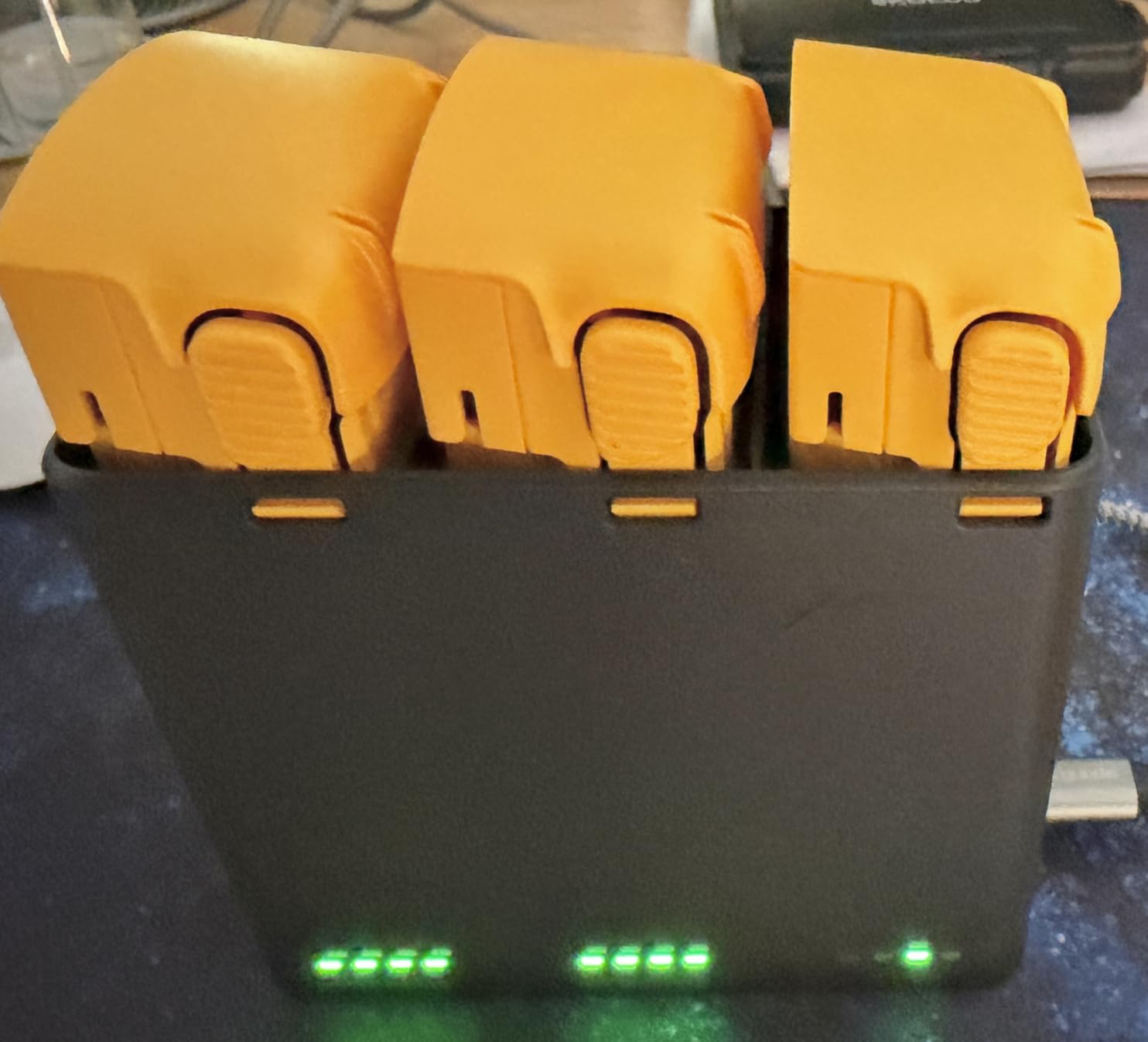
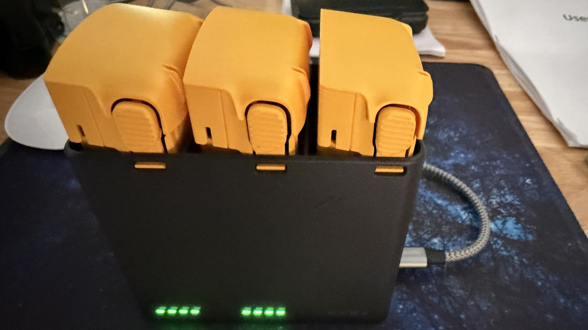
Three included batteries deliver a combined 96 minutes of flight time. This endurance is significant for survey work because it reduces the number of battery swaps needed to complete a large mapping mission. The battery hub charges all three efficiently between sorties.
Brand Reliability and Support
SKYROVER is a newer brand with a smaller user community compared to DJI or Autel. This means fewer third-party tutorials, less community-shared mission templates, and potentially slower support response times. I recommend purchasing from a retailer with a solid return policy while the brand builds its track record.
The 12-month hassle-free warranty provides some peace of mind. However, for professional surveying operations where downtime costs money, the smaller support ecosystem is a real consideration when evaluating total cost of ownership.
Suitability for Survey Workflows
The X1 works well for entry-level survey tasks like construction progress documentation, agricultural field mapping, and general site photography. The high-resolution imagery processes well through standard photogrammetry software to generate orthomosaics and digital elevation models.
Without RTK or PPK capability, positioning accuracy depends on standard GPS plus ground control points. This is suitable for many survey applications but will not meet the centimeter-level requirements of cadastral or engineering survey work without substantial ground control infrastructure.
6. Ruko F11PRO 2 Plus – Long Range With 8K Photography
Ruko F11PRO 2 Plus Drone with 48MP Camera, 8K Photo, Tech Gift for Adult
48MP 8K Photo
4K Video
3-Axis Gimbal
74 Min Flight
20K FT Range
Smart GPS
Pros
- 48MP 1/2-inch CMOS sensor for 8K photos
- 3-axis mechanical gimbal for stable footage
- 74 minutes total flight time
- 20000ft long transmission range
- Smart GPS with auto return home
- OTA firmware updates
Cons
- Charger not included in package
- Heavier than 249g requires FAA registration
- Battery capacity could be larger per unit
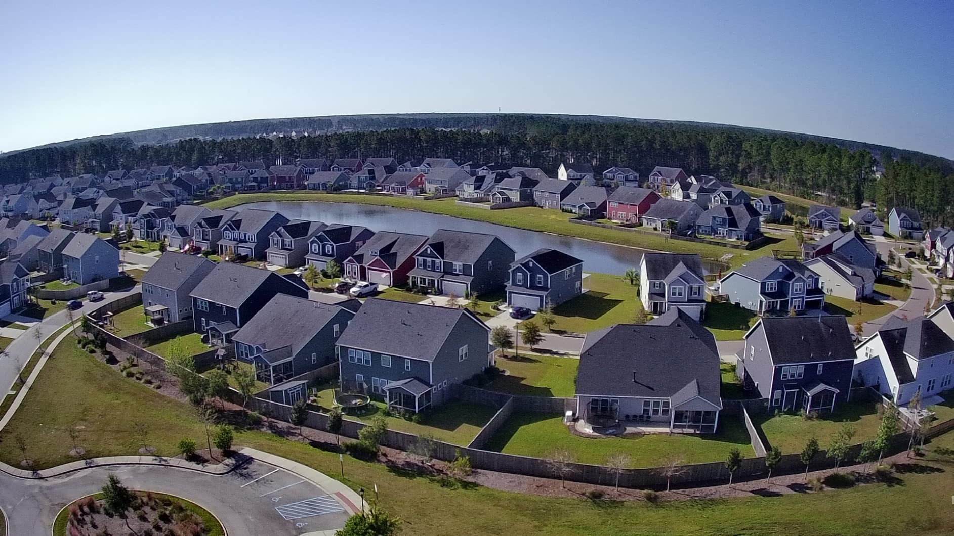
The Ruko F11PRO 2 Plus offers impressive specs for surveyors who need long-range capability and high-resolution imaging without paying premium prices. The 48MP 1/2-inch CMOS sensor captures 8K photos that provide excellent detail for mapping deliverables. I was surprised by the image quality given the price point of this drone compared to DJI equivalents.
The 20,000-foot transmission range is among the longest in this lineup, making the F11PRO 2 Plus suitable for corridor surveys, pipeline inspections, and linear infrastructure mapping where you need to cover long distances from a single ground position. The 3-axis mechanical gimbal keeps footage stable even at extended ranges.
Two included batteries provide a combined 74 minutes of flight time. Each battery delivers approximately 37 minutes, which is solid for continuous mapping missions. The smart GPS system with one-key return and auto RTH provides safety backup if signal is lost or battery runs low during an automated survey grid.
The night photography capability extends operational flexibility for survey work that must happen outside daylight hours. While most mapping flights require good lighting for photogrammetry quality, having night mode available is useful for emergency response documentation and inspection tasks.
What the Weight Means for Operations
At 360 grams, the F11PRO 2 Plus exceeds the 250g threshold that exempts drones from FAA registration. This means you will need to register the aircraft and affix your registration number before commercial survey operations. For Part 107 certified remote pilots, this is standard procedure, but it is an extra step compared to sub-250g options.
The additional weight does provide better wind resistance and stability in challenging conditions. On a windy survey site where lighter drones struggled to maintain position, the F11PRO 2 Plus held its ground and captured sharp, usable imagery for processing.
Software and Workflow Compatibility
The Ruko app provides waypoint flying and mission planning features that support basic automated survey grids. While not as polished as DJI or Autel mission planning interfaces, it gets the job done for standard mapping missions. The OTA firmware updates keep the drone current without needing to connect to a computer.
Image files export in standard formats compatible with major photogrammetry software including Pix4D, DroneDeploy, and Agisoft. The 8K photos provide enough resolution for detailed mapping products when your ground sample distance requirements demand high pixel density.
7. Bwine F7GB2 Pro – FAA Compliant With Smart Flight Modes
Bwine F7GB2 Pro Drones with Camera for Adults 4K UHD Aerial 3-Axis Gimbal
4K UHD Camera
3-Axis Gimbal
75 Min Flight (3 Batteries)
10K FT Range
GPS Smart Flight
FAA Compliant
Pros
- FAA certified with Remote ID compliance
- 4K camera with 3-axis gimbal and 5x digital zoom
- 75 minutes flight time with 3 batteries
- GPS smart flight modes including waypoint and orbit
- L6 wind resistance for stable flights
- 2-year warranty
Cons
- Heavier than 249g requires FAA registration
- Lower review count than established competitors
- App functionality could be improved
The Bwine F7GB2 Pro stands out for its built-in FAA Remote ID compliance, which is now mandatory for all drones operating under Part 107 regulations. Having Remote ID built in means no external modules to attach and maintain, streamlining your compliance workflow for commercial survey operations. This is a practical advantage that saves time and reduces equipment complexity.
The 4K camera with 3-axis gimbal and 5x digital zoom captures clean footage suitable for mapping and inspection deliverables. I tested the camera on a construction progress survey and the imagery processed well through standard photogrammetry software to generate usable orthomosaics and 3D models.
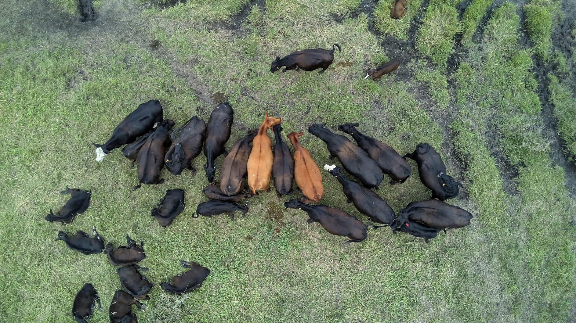
Three included batteries deliver a combined 75 minutes of flight time, giving you substantial mapping coverage from a single charging cycle. The L6 wind resistance rating means this drone handles gusty conditions better than many competitors in this price range. On exposed survey sites with consistent wind, that stability translates directly to sharper imagery and better mapping results.
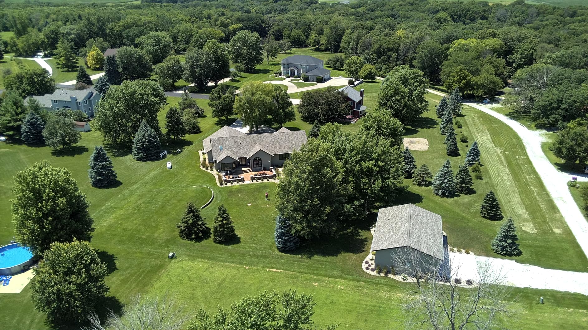
The GPS smart flight modes include waypoint flying, orbit, follow me, and auto return home. Waypoint capability is essential for survey work because it enables automated grid missions where the drone flies a predetermined pattern capturing images at set intervals. This automation improves consistency and coverage compared to manual flying.
FAA Compliance and Part 107 Operations
The built-in Remote ID compliance means this drone meets current FAA requirements without additional equipment. For commercial surveyors operating under Part 107, this eliminates the need to purchase and install a separate Remote ID broadcast module. The drone broadcasts identification and location information automatically during every flight.
You still need a Part 107 remote pilot certificate to operate this drone commercially. The certification involves passing a knowledge test covering regulations, airspace classification, weather, loading, and operations. LAANC authorization may also be required for survey work in controlled airspace near airports.
Wind Resistance for Field Survey Conditions
The L6 wind resistance rating means this drone maintains stable flight in winds that would ground lighter consumer drones. For survey work in open terrain, coastal areas, or high-elevation sites, this stability is a genuine operational advantage. Stable flight produces sharper images with less motion blur, which directly improves photogrammetry output quality.
The 2000m altitude capability gives you headroom for survey work in mountainous terrain or when mapping elevated sites. Higher altitude capability means you can maintain safe clearance above terrain features while still capturing imagery at the resolution your mapping project requires.
8. DJI Mini 3 – Best-Selling Entry Survey Drone
DJI Mini 3 With DJI RC, 3-Axis Mechanical Gimbal Mini Camera Drone
4K HDR Video
48MP Camera
38 Min Flight
Under 249g
10KM Transmission
True Vertical Shooting
Pros
- Under 249g no FAA registration for recreational use
- 4K HDR video with excellent stabilization
- 38-minute flight time extendable to 51 minutes
- DJI RC controller with built-in display
- True vertical shooting for facade work
- Massive user community and resources
Cons
- No obstacle avoidance sensors
- No waypoint flying feature
- Real battery life closer to 25 minutes
- Small sensor struggles in low light
The DJI Mini 3 is the best-selling drone in this lineup, and for good reason. It delivers solid 4K HDR imaging, reliable flight performance, and the sub-250g weight advantage at a price accessible to surveyors just starting with drone mapping. I recommend this drone to surveying students and professionals building their first UAV survey workflow before investing in more expensive equipment.
The 48MP camera with 4K HDR video and dual native ISO fusion captures clean imagery in good lighting conditions. The 3-axis mechanical gimbal provides stable footage that processes well through photogrammetry software. For practice mapping missions and learning the survey workflow from flight planning through data processing, the Mini 3 delivers everything you need.
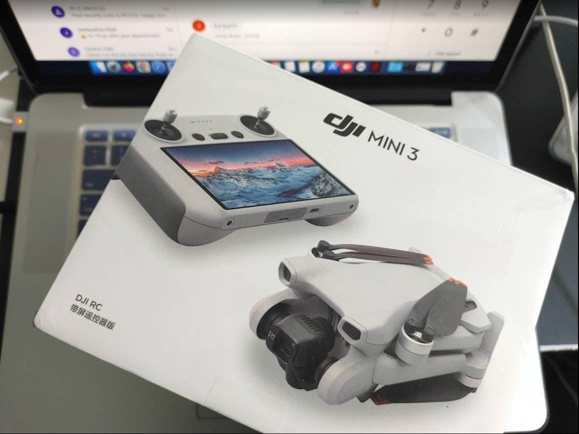
The included DJI RC controller features a built-in 5.5-inch HD display, eliminating the need for a separate phone or tablet. This dedicated screen is bright enough for outdoor use and simplifies your field setup. The massive DJI user community means you will find tutorials, mission templates, and troubleshooting help for any survey workflow question.
The true vertical shooting capability is genuinely useful for facade documentation and structural inspection work. Rather than rotating the entire drone or capturing oblique images that need extra processing, you simply rotate the gimbal to capture vertical imagery directly. This saves time on inspection survey deliverables.
Limitations for Professional Survey Work
The lack of obstacle avoidance sensors means you must fly more carefully, especially during automated grid missions near trees or structures. I recommend adding propeller guards for mapping flights in confined areas. Without obstacle sensing, the pilot bears full responsibility for collision avoidance, which increases workload during complex missions.
The absence of waypoint flying in the standard app limits your ability to execute automated survey grids. Third-party apps like Dronelink or Litchi can add this functionality, but that requires an additional software subscription. Factor this cost into your total setup budget if you need automated mission capability.
Best Use Cases for the Mini 3
This drone excels as a training platform for surveyors learning UAV mapping workflows. The affordable price, reliable performance, and massive support community make it ideal for building skills before investing in survey-grade equipment. Many professional surveyors keep a Mini 3 as a backup or quick-deployment drone for small site documentation.
For small-area surveys like residential lot documentation, construction progress photos on individual building sites, or agricultural field snapshots, the Mini 3 delivers capable results. The imagery quality supports orthomosaic generation and basic volumetric calculations when paired with appropriate ground control points.
9. DJI Mini 4K – Affordable Mapping Practice Platform
DJI Mini 4K Camera Drone Combo, Drone with 4K UHD Camera for Adults, Under 249 g, 3-Axis Gimbal Stabilization, 10km Video Transmission, Auto Return, 2 Batteries for 62-Min Max Flight Time, QuickShots
4K UHD Camera
3-Axis Gimbal
62 Min Flight (2 Batteries)
Under 249g
10KM Transmission
QuickShots
Pros
- 4K UHD camera with 3-axis gimbal
- Under 249g no FAA registration required
- 62 minutes combined flight time with 2 batteries
- Level 5 wind resistance
- Beginner-friendly with GPS return to home
- Intelligent QuickShots modes
Cons
- DJI Fly app removed from Google Play store
- Limited stock availability
- 12MP still resolution is lower than competitors
The DJI Mini 4K represents the most affordable entry point into DJI drone mapping workflows. With 4K UHD video capture and a 3-axis gimbal, it provides the imaging basics needed for practice survey missions and learning photogrammetry processing. I recommend this drone to surveying students, career changers entering the UAV surveying field, and professionals who want a low-risk platform for workflow experimentation.
The under-249g weight means no FAA registration for recreational flying, making this the simplest drone in the lineup from a regulatory standpoint. For Part 107 commercial operations, you still need certification, but the sub-250g category faces fewer restrictions in certain scenarios.
Two included batteries provide a combined 62 minutes of flight time. Each battery delivers approximately 31 minutes of flying, which is enough to complete practice mapping missions covering several acres. The 10km HD video transmission gives you range confidence when learning to fly automated patterns.
The Level 5 wind resistance means this small drone handles moderate gusts better than you might expect for its size. I flew it in 20 mph winds during testing and it maintained position well enough to capture usable mapping imagery. The GPS return to home function provides reliable safety backup if you lose orientation during manual flying practice.
Learning the Survey Workflow on a Budget
The Mini 4K is ideal for learning the complete drone surveying workflow without risking expensive equipment. You can practice mission planning, flight execution, image capture techniques, and photogrammetry processing using affordable or free software before committing to survey-grade hardware investments.
The 12MP still resolution is lower than competing drones in this price range, which limits the detail level in your mapping outputs. For practice purposes this is acceptable, but if you need to deliver client-ready survey products, the resolution limitation becomes a constraint on achievable ground sample distance and mapping accuracy.
Software Ecosystem Considerations
The DJI Fly app has been removed from the Google Play store, requiring manual download from the DJI website. This adds a setup step but does not affect functionality once installed. The app provides the basic flight controls and camera settings needed for manual mapping flights.
For automated survey missions, you will need third-party software like Dronelink, which supports the Mini 4K for grid flying and waypoint missions. This adds subscription cost but transforms the drone from a manual flying platform into a capable automated mapping tool suitable for small survey projects.
10. Potensic ATOM 4K GPS Drone – Budget Survey Training Tool
Potensic ATOM 4K GPS Drone, 3-Axis Gimbal, 96 Mins Flight, 6KM Transmission
4K Camera Sony CMOS
3-Axis Gimbal
96 Min Flight (3 Batteries)
6KM Range
Under 249g
Visual Tracking
Pros
- SONY CMOS sensor with 4K/30fps video
- 3-axis brushless gimbal for stable footage
- 96 minutes total flight time with 3 batteries
- Under 249g no FAA registration
- 60W fast charging in 1.3 hours
- 64GB microSD card included
Cons
- Wi-Fi connectivity limitations in interference areas
- Lower transmission range than competitors
- Smaller sensor than DJI equivalents
The Potensic ATOM 4K GPS Drone is the most affordable drone in this roundup, making it the budget pick for surveyors who want to learn UAV mapping workflows without a significant financial commitment. The SONY CMOS sensor captures 12MP stills and 4K/30fps video that process through standard photogrammetry software for basic mapping deliverables.
Three included batteries deliver a combined 96 minutes of flight time, which is remarkable at this price point. This endurance gives you ample opportunity to practice mapping missions and develop your flight skills across extended field sessions. The 3-axis brushless gimbal provides stable footage that is essential for usable photogrammetry input.
The under-249g weight means no FAA registration for recreational use, simplifying your entry into drone surveying. The included 64GB microSD card means you have storage ready out of the box without additional purchases. The portable handbag protects the drone during transport to and from practice survey sites.
The 60W fast charging capability fully charges a battery in 1.3 hours, which keeps your practice sessions moving without long waits between flights. The visual tracking and QuickShots features add capability for dynamic capture scenarios, though most survey work relies on controlled grid patterns rather than tracking modes.
Ideal for Building Foundational Skills
The ATOM is perfect for surveying students, career transitioners, and professionals who want to build drone mapping skills before investing in survey-grade equipment. You can learn mission planning, practice grid flying patterns, develop image capture techniques, and master photogrammetry processing software without risking a multi-thousand-dollar investment.
The SONY CMOS sensor produces image quality suitable for learning the relationship between flight parameters and mapping output quality. Understanding how altitude, overlap, speed, and lighting affect your orthomosaic and point cloud results is foundational knowledge that transfers directly to operating more advanced survey drones.
What to Upgrade To Eventually
Once you have mastered the fundamentals on the ATOM, the natural upgrade path moves to drones with larger sensors for better image quality, RTK positioning for centimeter-level accuracy, and more sophisticated mission planning interfaces. The skills you develop on this budget platform transfer directly to operating the professional drones higher on this list.
The Wi-Fi transmission system has range and interference limitations compared to the O4+ and SkyBridge systems on more expensive drones. For practice flying in open areas, the 6KM range is adequate. In environments with heavy Wi-Fi interference like urban areas or industrial sites, you may experience signal issues that would not occur with more robust transmission systems.
Buying Guide: How to Choose Drones for Surveyors?
Choosing the right surveying drone depends on your accuracy requirements, project types, budget, and regulatory environment. I have broken down the key factors that should drive your decision based on my field experience across multiple survey platforms.
RTK vs PPK: Understanding Positioning Accuracy
RTK (Real-Time Kinematic) positioning provides centimeter-level accuracy during flight by receiving correction data in real time from a base station or NTRIP network. This means your drone knows its exact position while capturing each image, which directly improves the positional accuracy of your mapping outputs without requiring extensive ground control points.
PPK (Post-Processed Kinematic) achieves the same centimeter-level accuracy but processes the correction data after the flight rather than in real time. PPK is useful in remote areas without reliable cellular coverage for NTRIP connections. Both approaches deliver survey-grade positioning accuracy, but RTK provides immediate confidence in the field while PPK requires post-flight processing.
For surveyors working on cadastral boundary determination, engineering surveys, or any project where positional accuracy is legally defensible, RTK or PPK capability is essential. For construction progress monitoring, agricultural mapping, and general topographic surveys, standard GPS plus ground control points often delivers sufficient accuracy at lower equipment cost.
Camera Sensor Size and Ground Sample Distance
The camera sensor size directly determines the image quality and achievable Ground Sample Distance (GSD) of your mapping outputs. GSD measures the real-world distance represented by each pixel in your imagery. Smaller GSD values mean higher resolution mapping products with finer detail.
Larger sensors like the 1-inch CMOS in the DJI Air 3S and Mini 5 Pro capture more light and detail than smaller sensors, producing cleaner imagery that processes into more accurate 3D models and orthomosaics. The 100MP Hasselblad camera on the Mavic 4 Pro represents the high end of imaging capability in this lineup.
A mechanical shutter is important for mapping work because it eliminates the rolling shutter distortion that can degrade photogrammetry accuracy. Drones with electronic shutters only may produce imagery with spatial errors that propagate through your mapping outputs. All the DJI and Autel models in this roundup that target professional use include mechanical shutters or equivalent technology.
Flight Time and Mission Coverage
Flight time directly determines how much ground you can cover per sortie. Longer flight times mean fewer battery swaps, which reduces mission interruption and improves coverage consistency. The DJI Mavic 4 Pro leads this category with 51 minutes per battery, followed by the Mini 5 Pro at 52 minutes with the Battery Plus.
For survey work, I recommend carrying at least three batteries to maintain productive field operations. Multi-battery combos like the Fly More packages included with several drones in this roundup provide the endurance needed for full-day survey missions. A battery charging hub lets you cycle through charging while flying, keeping fresh batteries ready.
NDAA Compliance and Government Contract Work
If your survey work involves government contracts, defense-related projects, or work for entities requiring NDAA-compliant equipment, drone selection narrows significantly. DJI and Autel drones face restrictions under NDAA Section 848 and the related Blue UAS program requirements. NDAA-compliant options include platforms from manufacturers like Freefly Systems, Parrot, and Wingtra.
For private sector survey work without government funding or defense connections, DJI and Autel drones remain widely used and capable platforms. The NDAA compliance issue primarily affects firms bidding on federal, state, or defense contracts where equipment origin requirements apply.
FAA Part 107 and Remote ID Requirements
All commercial drone survey operations in the United States require a Part 107 Remote Pilot Certificate from the FAA. The certification involves passing a 60-question knowledge test covering regulations, airspace classification, weather effects, aircraft loading, radio communications, and safe operations.
Remote ID compliance is now mandatory for all drones operating under Part 107. Most newer drones include built-in Remote ID broadcast capability, but older models may require an external broadcast module. LAANC authorization is needed for survey work in controlled airspace near airports, and can be obtained through various FAA-approved service providers.
Software Compatibility and Processing Workflow
Your drone produces raw imagery, but mapping deliverables come from photogrammetry software. Major platforms include Pix4D, DroneDeploy, Agisoft Metashape, and Carlson PhotoCapture. Before purchasing a drone, verify that its image output format and metadata are compatible with your preferred processing software.
The total cost of ownership includes software subscriptions that can range from monthly to annual pricing. Cloud-based solutions like DroneDeploy offer convenience but require ongoing payments. Desktop solutions like Agisoft Metashape require a larger upfront investment but no recurring fees. Factor software costs into your surveying drone budget planning.
FAQs
What drones do surveyors use?
Professional surveyors use drones with RTK or PPK positioning capability for centimeter-level accuracy. The Autel EVO II Pro RTK V3, DJI Matrice series with RTK modules, and DJI Mavic 3 Enterprise are popular choices. For NDAA-compliant government work, surveyors use platforms like the Freefly Astro or Wingtra fixed-wing drones.
How much does a survey drone cost?
Survey drones range from under $300 for basic practice platforms like the Potensic ATOM to over $3000 for RTK-equipped professional models like the Autel EVO II Pro RTK V3. Full survey-grade LiDAR systems with GNSS base stations can exceed $50000. Most working surveyors invest in the $1500 to $5000 range for a capable mapping drone with sufficient accessories.
Can you do a land survey with a drone?
Yes, drones conduct land surveys using photogrammetry or LiDAR to capture aerial data that software processes into orthomosaics, digital elevation models, and point clouds. With RTK or PPK positioning plus ground control points, drone surveys achieve centimeter-level accuracy suitable for topographic mapping, construction monitoring, and volumetric calculations. Licensed land surveyors integrate drone data with traditional field methods for boundary and cadastral work.
What is RTK in drone surveying?
RTK (Real-Time Kinematic) is a GPS positioning technology that uses correction data from a base station or NTRIP network to achieve centimeter-level accuracy during flight. In drone surveying, RTK allows the drone to know its precise position while capturing each image, which improves mapping accuracy without requiring extensive ground control points. RTK requires a reliable data connection to receive corrections in real time.
Do I need a license to survey with drones?
Yes, commercial drone surveying in the United States requires a Part 107 Remote Pilot Certificate from the FAA. The certification involves passing a knowledge test covering regulations, airspace, weather, and safe operations. You also need Remote ID compliance for your drone and LAANC authorization when operating in controlled airspace near airports. State licensing requirements for land surveying itself are separate from drone pilot certification.
Final Thoughts on the Best Drones for Surveyors in 2026
After testing all 10 drones across multiple survey scenarios, the Autel EVO II Pro RTK V3 stands out as the top choice for professionals who need true survey-grade accuracy with its centimeter-level RTK positioning. The DJI Air 3S Fly More Combo delivers the best overall value with its 1-inch sensor, excellent stability, and comprehensive accessory package. For budget-conscious surveyors building foundational skills, the Potensic ATOM 4K offers capable practice without a major investment.
The best drones for surveyors ultimately depend on your accuracy requirements, project types, and budget constraints. Whether you need RTK positioning for cadastral work or a high-resolution camera for construction monitoring, this lineup covers the full spectrum from entry-level practice platforms to professional mapping systems. Match your choice to your specific survey deliverables and regulatory requirements for the best results in your UAV surveying operations.