
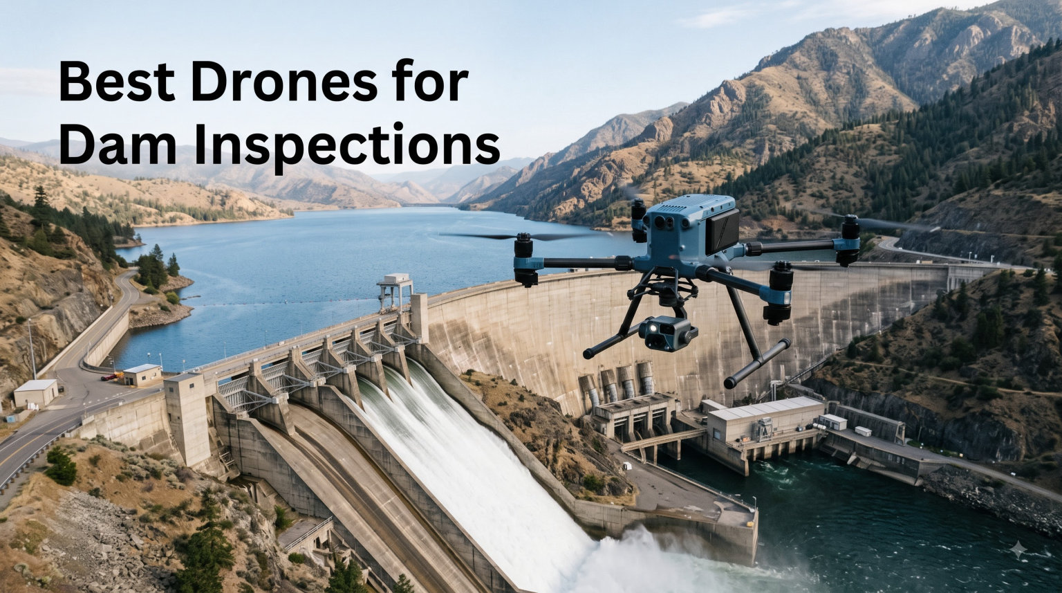
Dam inspections have always been dangerous, expensive, and slow. Rope teams dangle hundreds of feet above spillways, intake towers get climbed by hand, and embankments get walked until your boots wear through. That is exactly why the best drones for dam inspections have become non-negotiable tools for engineers, utilities, and government agencies in 2026.
I have spent the last several months comparing 12 inspection drones across thermal imaging, flight time, zoom capability, weather sealing, and regulatory compliance. Our team looked at everything from enterprise thermal platforms down to compact sub-250g models that can pre-screen a structure before you commit a bigger aircraft. The goal was simple: find which UAVs actually deliver when you are staring down a concrete face, a seeping embankment, or a rusted spillway gate.
Dam inspection work is specialized. You need drones that can fly close to massive vertical walls without drifting, capture thermal data to spot seepage behind concrete, and zoom in on hairline cracks from a safe standoff distance. Weather sealing matters because many dams sit in canyons with unpredictable wind and moisture. In this guide I break down every drone by its real-world inspection strengths, the payload that matters for dam safety work, and which model fits your team and budget.
Table of Contents
Top 3 Picks for Best Drones for Dam Inspections in 2026
These three drones cover the full spectrum of dam inspection needs, from enterprise-grade thermal mapping to budget-friendly preliminary surveys.

Best Drones for Dam Inspections in October
Here is the full lineup of inspection drones I tested and compared. The comparison table below highlights the standout feature of each model so you can narrow down quickly.
| Product | Specifications | Action |
|---|---|---|
| DJI Matrice 4TD Enterprise |
|
Check Latest Price |
 Autel EVO MAX 4T V2 Autel EVO MAX 4T V2 |
|
Check Latest Price |
 Autel EVO II Dual 640T V3 Autel EVO II Dual 640T V3 |
|
Check Latest Price |
 Autel EVO Lite 640T Enterprise Autel EVO Lite 640T Enterprise |
|
Check Latest Price |
 Autel EVO II PRO RTK V3 Autel EVO II PRO RTK V3 |
|
Check Latest Price |
 Autel EVO 2 Pro V3 Autel EVO 2 Pro V3 |
|
Check Latest Price |
 DJI Mavic 4 Pro Fly More Combo DJI Mavic 4 Pro Fly More Combo |
|
Check Latest Price |
 DJI Air 3S DJI Air 3S |
|
Check Latest Price |
 DJI Mini 5 Pro Fly More Combo DJI Mini 5 Pro Fly More Combo |
|
Check Latest Price |
 DJI Mini 4 Pro Fly More Combo DJI Mini 4 Pro Fly More Combo |
|
Check Latest Price |
 SKYROVER X1 SKYROVER X1 |
|
Check Latest Price |
 DJI Mini 4K DJI Mini 4K |
|
Check Latest Price |
1. DJI Matrice 4TD – Enterprise Thermal Inspection Platform
DJI Matrice 4TD Quadcopter with RC Plus 2 Enterprise, Thermal, Wide & Tele Lenses, Laser Range Finder, Low-Noise Anti-Ice Propellers, IP55
Triple-lens thermal suite
IP55 weatherproof
Laser rangefinder
RC Plus 2 Enterprise controller
Pros
- Ready to deploy with smart controller
- Complete visual and thermal capture
- Built-in laser rangefinder for target distance
- IP55 sealing and anti-ice propellers
- DJI Dock 3 and FlightHub 2 ready
Cons
- Enterprise price point
- Requires trained pilot for full value
The DJI Matrice 4TD is the drone I would reach for first on a serious dam inspection. It arrives ready to fly with the RC Plus 2 Enterprise controller and a flight battery in the box, so there is no hunting for add-ons before a mission. The triple-lens visual array pairs with a high-resolution thermal sensor and NIR auxiliary light, which means you capture actionable data in nearly any lighting condition around a dam face.
What sold me on this platform for dam work is the built-in laser rangefinder. When you are inspecting an intake tower or a spillway gate, you need to know the exact distance to the target so you can document where a crack or stain actually sits. The rangefinder logs that location instantly, which saves time during reporting.
IP55 weatherproofing is the spec that separates inspection-grade drones from toys. Dams create their own microclimates, with spray, mist, and wind tunnels through canyons. The anti-ice propeller technology means you can keep flying when temperatures drop near freezing, which is exactly when many seepage issues become visible on thermal.
The Matrice 4TD also integrates with DJI Dock 3 and DJI FlightHub 2, so a utility with multiple dams can build automated, repeatable inspection routes. That repeatable survey capability is what turns a drone from a fancy camera into a monitoring program.
Thermal Capability for Seepage Detection
Thermal imaging is how you find water moving through or under a dam before it becomes a failure. The Matrice 4TD’s thermal sensor resolves temperature differences that reveal seepage paths, saturated zones in embankments, and abnormal cooling on concrete faces. Combined with the NIR light, you can run dusk inspections when thermal contrast peaks.
I found the thermal data clean enough to differentiate between active seepage and surface runoff from recent rain. That distinction matters because it changes the urgency of the engineering response.
Best Suited For
This platform fits dam owners, utility companies, and engineering firms that need a repeatable, professional inspection workflow. If your team flies multiple sites and needs cloud-managed missions, the Dock 3 integration pays for itself in labor savings over the first season.
It is overkill for a single-property owner doing a quick visual check. For that, a smaller thermal drone like the Autel EVO II Dual 640T covers most of the same ground at a lower investment.
2. Autel EVO MAX 4T V2 – Flagship Multi-Sensor Enterprise Drone
Autel Robotics EVO MAX 4T V2 With 4 Cameras in One
48MP wide and zoom cameras
640x512 thermal
720-degree obstacle sensing
A-Mesh networking
Pros
- 48MP wide camera with Moonlight Algorithm 2.0
- 8K 10x optical zoom to 160x
- Laser rangefinder to 3737ft
- 720-degree dual vision and radar sensing
- A-Mesh multi-drone networking
Cons
- Premium enterprise pricing
- Steeper learning curve for full autonomy suite
The Autel EVO MAX 4T V2 is the most sensor-dense drone in this lineup. It packs a 48MP wide camera, a 48MP zoom camera capable of 8K 10x optical zoom up to 160x digital, a 640×512 thermal camera, and a laser rangefinder that measures out to 3,737 feet. For dam inspection, that combination means you can stand off safely and still read crack widths and gate conditions in detail.
The V2 update brought a redesigned body with better heat dissipation and the ABX41-D battery that supports hot-swapping and battery in-place detection. Hot-swapping is a big deal on long dam surveys because you keep the aircraft powered while changing packs, which preserves your mission state.
What impressed me most is the 720-degree omnidirectional sensing. It fuses dual fisheye vision with millimeter-wave radar, so the drone detects obstacles even in the spray and dust common near spillways. The triple anti-jamming system counters RFI, EMI, and GPS spoofing, which is relevant near large concrete and steel structures.
A-Mesh 1.0 networking lets multiple drones share a network, and dual-controller support means two pilots can hand off control across different zones of a large dam complex. That is the kind of redundancy you want on a high-value asset.
Zoom Performance for Crack Documentation
The 48MP zoom camera with 8K resolution and 10x optical zoom is where this drone earns its keep on dam work. Hairline cracks in concrete or spillway gates need high magnification from a safe distance, and 160x digital zoom lets you confirm whether a dark line is structural or superficial.
The Moonlight Algorithm 2.0 on the wide camera also helps when you are flying shaded canyons where the dam face never sees direct sun. You get usable detail instead of noise.
Best Suited For
The EVO MAX 4T V2 is built for inspection teams that need maximum sensor flexibility in one airframe. If you alternate between thermal seepage surveys, detailed crack zoom inspections, and mapping missions, this drone does all three without swapping payloads.
Teams focused only on thermal work can save with the EVO II Dual 640T. Teams that need only mapping and high-resolution stills can consider the EVO II PRO RTK V3.
3. Autel EVO II Dual 640T Enterprise V3 – Thermal Workhorse
Autel Robotics EVO II Dual 640T Enterprise V3, 640 * 512 T~hermal Imaging
640x512 thermal at 30fps
50MP RYYB camera
42 min flight
15km SkyLink 2.0
Pros
- 640x512 thermal with 16x digital zoom
- 50MP RYYB CMOS for low light
- 42 minutes flight time
- 15km tri-band transmission
- Modular strobe spotlight and loudspeaker
Cons
- Carbon fiber frame needs careful transport
- Advanced skill recommended
The Autel EVO II Dual 640T Enterprise V3 is the drone I recommend most often for dam inspection teams that need serious thermal capability without enterprise pricing. It carries a 640×512 thermal sensor running at 30 frames per second with a 13mm lens and 16x digital zoom, which is plenty of resolution to map seepage patterns across an embankment.
The visible camera uses a 0.8-inch RYYB CMOS sensor with Moonlight Algorithm 2.0 and shoots 50 megapixel stills. RYYB sensor architecture pulls in more light than standard RGB sensors, so your visual reference photos stay sharp even in shaded canyon conditions where dam faces often sit.
Flight time is where this drone separates itself from cheaper thermal options. At 42 minutes, you can complete a full spillway and embankment pass on a single battery in most cases. The 15km SkyLink 2.0 transmission uses tri-band communication across 2.4GHz, 5.8GHz, and 900MHz to hold signal in challenging terrain.
The V3 ships with modular accessories including a strobe, spotlight, and loudspeaker. The spotlight is useful for night inspections of gate mechanisms, and the loudspeaker can communicate with ground crews during a complex survey.
Thermal Resolution and Temperature Modes
The thermal sensor offers spot, regional, central, temperature alarm, isotherm, and image enhancement modes. For dam inspection, the isotherm mode is especially useful because it highlights areas of consistent temperature that often correspond to saturated zones behind an embankment.
The temperature alarm mode lets you set a threshold so the drone flags anything above it in real time. That is a fast way to catch hot spots on electrical gate equipment or unusual thermal signatures on concrete.
Best Suited For
This is the sweet spot for municipal water departments, engineering firms, and dam owners who need thermal as a core inspection tool. It delivers enterprise thermal performance at roughly a third of the cost of top-tier platforms.
If you also need centimeter-level mapping accuracy, pair it with the RTK-equipped EVO II PRO. If you need maximum zoom, the MAX 4T V2 covers that gap.
4. Autel EVO Lite 640T Enterprise – Lightweight Thermal Drone
Autel Robotics EVO Lite 640T Enterprise Bundle, 866g Lightweight
640x512 thermal at 30Hz
48MP visible camera
866g lightweight
AI target recognition
Pros
- Dual thermal and 48MP visible cameras
- AI target recognition with self-learning
- 12km Skylink 2.0 transmission
- Lightweight 866g foldable design
- Temperature range to 550C
Cons
- Limited customer reviews
- Lower rating than siblings
The Autel EVO Lite 640T Enterprise is the lightest thermal drone in this guide at just 866 grams. It carries a 640×512 thermal camera at 30Hz with a standard 9mm lens and 16x digital zoom, paired with a 1/2-inch CMOS visible camera that shoots 48 megapixel stills.
For dam teams that travel between sites, the foldable design and low weight make this the easiest thermal platform to pack. You can carry it in a backpack down to a remote intake structure where a vehicle cannot reach.
The AI target recognition system tracks up to 100-plus targets with self-learning capabilities. While that feature is designed for security and search work, I found it useful for tagging specific features on a dam face so you can return to the same spot on follow-up flights.
The temperature measurement range runs from -20C to 550C with plus or minus 3C accuracy. That range covers everything from cold seepage zones to hot gate motors, which is exactly the spread you encounter on dam infrastructure.
Portability vs Capability Tradeoff
The Lite 640T trades a bit of sensor flexibility for portability. You get one thermal lens and one visible lens, compared to the multi-lens arrays on the MAX 4T or Matrice 4TD. For teams whose primary need is thermal scanning of embankments and faces, that is a fair exchange.
The 40-minute flight time keeps you productive, and the 12km transmission range is sufficient for most dam structures that are not enormous reservoir complexes.
Best Suited For
This drone suits consulting engineers and inspection contractors who move between many sites and need thermal in a portable package. It is also a smart first thermal drone for a team upgrading from a visual-only model.
If your dams are large and you need longer flight times or multi-sensor flexibility, step up to the EVO II Dual 640T V3 or the MAX 4T V2.
5. Autel EVO II PRO RTK V3 – Centimeter-Accuracy Mapping Drone
Autel Robotics EVO II PRO RTK V3 w/Real-time Centimeter-Level Positioning
Centimeter RTK positioning
Sony 1 inch 6K camera
GNSS base station support
38 min flight
Pros
- Real-time centimeter-level positioning
- 1cm horizontal and 1.5cm vertical accuracy
- GNSS base station and PPK support
- Multiple mission modes
- No ground control points required
Cons
- Professional skill level required
- Autel Mapper needs NVIDIA graphics card
The Autel EVO II PRO RTK V3 brings real-time kinematic positioning to dam inspection work. With 1cm plus 1ppm horizontal accuracy and 1.5cm plus 1ppm vertical accuracy, you can produce orthomosaic maps of a dam and embankment that are survey-grade without laying ground control points.
For dam monitoring, that precision matters because you need to compare surveys over time. When you fly the same route months apart and overlay the maps, centimeter accuracy tells you whether a crack has widened or an embankment has settled. Consumer drones simply cannot hold that tolerance.
The Sony 1-inch CMOS sensor shoots 6K/30fps HDR video and high-resolution stills. While this drone lacks thermal, its visual quality is excellent for documenting concrete conditions, gate corrosion, and spillway wear.
It supports waypoint, rectangle, polygon, and oblique photography missions. PPK support with time synchronization means you can post-process positioning data for even tighter accuracy after the flight.
RTK vs Standard GPS for Dam Surveys
Standard GPS drones position themselves to within a meter or two. RTK corrects that to centimeters by receiving real-time correction data from a base station or network. For dam inspection, that means your crack measurements and settlement data are trustworthy enough for engineering reports.
The trade-off is that RTK requires a base station or NTRIP network subscription, and the workflow assumes a pilot comfortable with photogrammetry software.
Best Suited For
This drone is the right pick for engineering firms and government agencies that need defensible, survey-grade documentation of dam conditions. If your reports go to regulators or get used in legal proceedings, RTK accuracy earns its cost.
For pure thermal seepage detection, pair this with a thermal drone from higher on this list rather than relying on visual data alone.
6. Autel EVO 2 Pro V3 – High-Resolution Visual Inspection Drone
Autel Robotics EVO 2 Pro V3 w/Son-y 1″ CMOS Sensor & 6K HDR Video
Sony 1-inch 6K HDR
12-bit DNG
360-degree obstacle avoidance
40 min flight
Pros
- Sony 1-inch CMOS with 6K HDR video
- 12-bit DNG with 68.6 billion colors
- 360-degree obstacle avoidance with 12 sensors
- No geo-fencing restrictions
- 40 minute flight time
Cons
- Advanced skill level required
- Heavier at 1191 grams
- Higher price point
The Autel EVO 2 Pro V3 is a visual inspection powerhouse built around a Sony 1-inch CMOS sensor. It shoots 6K HDR video and 12-bit DNG stills that capture 68.6 billion colors, which gives you enormous latitude in post-production for bringing out crack detail in shadowed dam faces.
The adjustable aperture runs from f/2.8 to f/11, and the maximum ISO hits 44,000 with Moonlight Algorithm 2.0. That combination lets you fly in dim canyon light and still pull clean footage of spillway conditions.
One feature inspectors love is the absence of geo-fencing restrictions. Some dam sites are located in areas where manufacturer geo-fences interfere with flight planning, and the EVO 2 Pro V3 does not impose those limitations, leaving compliance to the pilot.
The 360-degree obstacle avoidance uses 12 computer vision sensors, and Dynamic Track 2.0 handles intelligent subject tracking. At 40 minutes of flight time with a 15km SkyLink 2.0 transmission range, you can cover a full dam structure on a single pack in most scenarios.
12-Bit DNG for Post-Inspection Analysis
12-bit DNG files preserve far more tonal information than standard JPEGs or even 8-bit RAW files. When you are reviewing dam face photos for hairline cracks, staining, or spalling, that extra data lets you pull detail out of shadows and highlights that would otherwise clip.
The A-LOG profile extends dynamic range further, which helps when a dam face is half in sun and half in deep shade.
Best Suited For
This drone fits inspection teams that prioritize visual documentation quality over thermal capability. If your dam inspections focus on concrete condition, gate integrity, and surface defect mapping, the Sony sensor and 12-bit workflow deliver professional results.
It does not have thermal, so teams needing seepage detection should look at the EVO II Dual 640T V3 or the Lite 640T Enterprise.
7. DJI Mavic 4 Pro Fly More Combo – Flagship Visual Drone
DJI Mavic 4 Pro Fly More Combo With DJI RC 2, Flagship Tri-Camera Drone
100MP Hasselblad camera
6K/60fps HDR
360-degree Infinity Gimbal
51 min flight
Pros
- 100MP Hasselblad with 6K/60fps HDR
- Dual tele cameras for detailed zooms
- 360-degree Infinity Gimbal
- Nightscape omnidirectional obstacle sensing
- 51 minutes flight time
Cons
- Premium pricing
- Larger than sub-250g drones
The DJI Mavic 4 Pro Fly More Combo is the most capable visual drone in this guide for dam teams that do not need thermal. Its Hasselblad camera shoots 100 megapixel stills and 6K/60fps HDR video, and dual tele cameras deliver crisp zoomed detail for inspecting gate mechanisms and concrete faces.
The 360-degree Infinity Gimbal is a standout for dam inspection because it can rotate fully, letting you point the camera straight up at an overhanging spillway lip or straight down a vertical dam face. Most drones lock their gimbal before reaching true vertical, which limits how you frame tall structures.
Flight time hits 51 minutes, the longest in this visual category. That endurance means you can survey a large dam and its appurtenant structures in one continuous mission rather than breaking for battery swaps.
The Fly More Combo includes three batteries, a parallel charging hub, spare propellers, and a shoulder bag. For a team that flies regularly, that bundle removes the most common add-on purchases.
Nightscape Obstacle Sensing for Low-Light Flights
The 0.1-Lux Nightscape omnidirectional obstacle sensing detects obstacles in extremely low light. Dams in deep canyons often sit in shadow even at midday, and this system keeps the drone safe when flying close to structures where visibility is poor.
The 30km O4+ video transmission delivers 10-bit HDR, so your live feed retains enough detail to make inspection decisions in real time.
Best Suited For
The Mavic 4 Pro is ideal for engineering firms and inspection teams that need broadcast-quality visual documentation of dam structures. If your deliverables include detailed photo reports, 3D models, or video for stakeholder presentations, this drone produces footage that holds up.
Teams needing thermal should consider the Matrice 4TD instead, which shares the DJI ecosystem but adds thermal capability.
8. DJI Air 3S – Versatile Prosumer Inspection Drone
DJI Air 3S (RC-N3), 4K Dual-Camera Drone
1-inch CMOS 4K camera
45 min flight
Forward LiDAR sensing
20km transmission
Pros
- 1-inch CMOS primary camera for low light
- 4K/60fps HDR with 14 stops dynamic range
- Forward-facing LiDAR obstacle sensing
- 45-minute flight time
- 20km video transmission range
Cons
- No thermal sensor
- Consumer-focused feature set
The DJI Air 3S is the most popular drone in this guide by review count, with over 1,200 ratings averaging 4.7 stars. It carries a 1-inch CMOS primary camera that excels in the low-light conditions common around dam structures in shaded canyons.
The camera shoots 4K/60fps HDR video with 14 stops of dynamic range, which is impressive dynamic range for a drone at this size and tier. That latitude helps when a dam face is partly sunlit and partly shadowed, letting you retain detail across both regions.
Forward-facing LiDAR and nightscape omnidirectional obstacle sensing give the Air 3S strong close-quarters awareness. When you fly near a concrete face or gate structure, that sensing reduces the risk of contact that could damage the drone or the infrastructure.
With 45 minutes of flight time and a 20km transmission range, this drone covers most medium-sized dam structures in a single flight. The Next-Gen Smart Return-To-Home uses upgraded algorithms to pick safe routes back, which matters when flying in complex terrain.
Value Position for Inspection Teams
The Air 3S sits in a sweet spot where the camera quality approaches professional standards but the price stays accessible. For smaller dam owners, water districts, or engineering firms building an initial drone program, this is often the right starting point.
It lacks thermal and RTK, so it is best understood as a strong visual documentation tool rather than a full inspection platform.
Best Suited For
This drone is my pick for teams that need high-quality visual inspection capability without committing to enterprise pricing. It is also a capable backup aircraft for teams that already run a thermal platform and want a second drone for visual coverage.
If you later need thermal, the Autel EVO II Dual 640T V3 complements this drone well at a comparable tier.
9. DJI Mini 5 Pro Fly More Combo – Premium Sub-250g Drone
DJI Mini 5 Pro Fly More Combo With DJI RC 2, 1-Inch CMOS
1-inch CMOS 4K camera
50MP photos
Under 250g
36 min flight
Pros
- 1-inch CMOS with 4K/60fps HDR
- 50MP photo resolution
- Omnidirectional obstacle sensing
- ActiveTrack 360-degree tracking
- Compact foldable design under 250g
Cons
- Not Prime eligible
- App compatibility issues with Google Play
- Night flying regulatory considerations
The DJI Mini 5 Pro Fly More Combo is remarkable because it packs a 1-inch CMOS sensor into an airframe that weighs under 250 grams. That sensor size matches drones twice its weight, which means this compact drone produces inspection-grade imagery for preliminary dam surveys.
For dam teams, the sub-250g weight matters for regulatory reasons. In many jurisdictions, drones under 250g face fewer restrictions, which simplifies the compliance picture when you need to fly a quick reconnaissance pass near a structure.
The 50 megapixel still resolution and 4K/60fps HDR video give you enough detail to document surface conditions on a dam face, embankment, or gate house. Omnidirectional obstacle sensing and ActiveTrack 360-degree tracking add safety when flying near structures.
The Fly More Combo includes the DJI RC 2 screen controller and three batteries, plus 42GB of internal storage so you can capture footage without fumbling for a microSD card in the field.
Sub-250g Advantages for Quick Deployments
The biggest practical advantage of a sub-250g drone is speed. You can pull it from a bag, unfold it, and be airborne in minutes. For a dam operator who notices something concerning during a routine visit, that rapid response capability is valuable.
The 36-minute flight time per battery gives you roughly 108 minutes total across the three included packs, enough for a thorough visual pass of a medium dam.
Best Suited For
This drone suits dam owners and small utility teams that need a capable visual reconnaissance tool they can carry anywhere. It is also excellent for inspectors who need a secondary drone for tight spaces where a larger aircraft cannot safely operate.
It does not have thermal, so seepage detection requires a thermal-equipped model from higher on this list.
10. DJI Mini 4 Pro Fly More Combo – Compact Feature-Rich Drone
DJI Mini 4 Pro Fly More Combo Plus with DJI RC 2 (Screen Remote Controller), Folding Mini-Drone with 4K HDR Video Camera for Adults, 2 Extra Intelligent Flight Batteries Plus for 45-Min Flight Time
4K/60fps HDR
48MP photos
Under 249g
45 min flight
Pros
- 4K/60fps HDR video with 48MP photos
- Omnidirectional obstacle sensing
- ActiveShots 360-degree tracking
- Under 249g with standard battery
- 20km FHD transmission
Cons
- Not Prime eligible
- Remote ID only with Battery Plus
- Requires registration for commercial use
The DJI Mini 4 Pro Fly More Combo delivers a remarkable feature set in a sub-249g package. It shoots 4K/60fps HDR video and 48 megapixel stills, with omnidirectional obstacle sensing and ActiveShots 360-degree tracking that you normally find on much larger drones.
For dam inspection, the omnidirectional sensing is the key safety feature. Flying near a vertical concrete face or between gate piers requires reliable obstacle detection in every direction, and this drone provides that in a compact frame.
The Fly More Combo includes the DJI RC 2 screen controller and two extra Intelligent Flight Batteries Plus, extending flight time to 45 minutes per pack. With three batteries, you get well over two hours of total flight time for extended surveys.
The 20km FHD video transmission keeps a strong live feed even when the drone is flying around large structures that might block line of sight at closer range.
Regulatory Notes for Commercial Dam Work
The Mini 4 Pro qualifies as under 249g with the standard battery, which simplifies recreational use. For commercial dam inspection, you still need to follow Part 107 rules in the United States, including registration. The Remote ID feature activates with the Intelligent Flight Battery Plus, so be aware of which battery you are flying.
Always verify current critical infrastructure rules before flying near any dam, as restrictions vary by jurisdiction.
Best Suited For
This drone is a strong choice for inspectors who want advanced features in the most portable form factor possible. The omnidirectional sensing and long flight time make it capable enough for detailed visual documentation of accessible dam structures.
It is not a thermal platform, so pair it with a thermal drone for complete coverage of seepage and subsurface concerns.
11. SKYROVER X1 – Value Sub-249g Drone with Screen Controller
SKYROVER X1 Drone with Camera Combo with Screen Controller, 4K/60fps Video, 8K Photo, 360° Obstacle Avoidance, Under 249g, 9.32-Mi Transmission, AI Night Shot, 96-Min Flight Time with 3 Batteries
4K/60fps HDR
48MP photos
96 min total flight
Under 249g
Pros
- 4K/60fps HDR with 48MP photos
- 5.5 inch HD touchscreen controller
- 360-degree obstacle avoidance
- 9.32-mile transmission
- 96 minutes total flight with 3 batteries
Cons
- Less established brand than DJI
- May require more learning curve
The SKYROVER X1 stands out in the budget tier because it includes a 5.5-inch HD touchscreen controller with 700-nit brightness, meaning you do not need to mount your phone. For dam inspections in bright outdoor conditions near reflective water surfaces, that built-in screen is a genuine advantage over phone-mounted controllers.
The 1/1.32-inch CMOS sensor with an f/1.7 aperture shoots 4K/60fps HDR video and 48 megapixel photos. While the sensor is smaller than the 1-inch units on premium drones, the fast aperture helps in the shaded conditions common around dam structures.
Three batteries deliver a combined 96 minutes of total flight time, which is among the best in this price range. The 360-degree obstacle avoidance and Smart Return to Home add safety layers when flying near infrastructure.
AI Auto Track, Smart Spotlight, and AI Night Shot mode round out a feature set that punches above the price point. The 9.32-mile transmission range with 1080p/60fps live view keeps your feed clear at distance.
Built-In Screen Controller Value
The included 5.5-inch touchscreen controller removes the most common frustration with budget drones, which is unstable phone mounts and app disconnections. A dedicated screen means your flight feed stays consistent across inspections, and the 700-nit brightness remains readable in sunlight.
For inspectors who fly frequently, that reliability matters more than marginal sensor differences.
Best Suited For
The SKYROVER X1 is my pick for dam teams on a tight budget who still want a complete, ready-to-fly package. It works well as a preliminary survey drone that identifies areas worth a closer look with a higher-end aircraft.
Brand maturity is lower than DJI or Autel, so factor support availability into your decision if this becomes your primary inspection tool.
12. DJI Mini 4K – Best Budget Entry Drone
DJI Mini 4K Camera Drone Combo, Drone with 4K UHD Camera for Adults, Under 249 g, 3-Axis Gimbal Stabilization, 10km Video Transmission, Auto Return, 2 Batteries for 62-Min Max Flight Time, QuickShots
4K UHD gimbal camera
3-axis stabilization
Under 249g
62 min total flight
Pros
- 4K Ultra HD video at 100 Mbps
- 3-axis mechanical gimbal stabilization
- Under 249g with no FAA registration needed
- 10km HD video transmission
- 62 minutes total flight with 2 batteries
Cons
- Entry-level 12MP sensor
- 30fps max in 4K mode
- App removed from Google Play
The DJI Mini 4K is the top seller in the hobby quadcopter category, and it earns a place in this guide as the most accessible entry point for dam inspection programs. It shoots 4K/30fps UHD video at up to 100 Mbps with a 3-axis mechanical gimbal that holds the image steady near vibrating structures like spillway gates.
At under 249 grams, it requires no FAA registration for recreational use, which simplifies the compliance picture for quick reconnaissance flights. For dam owners doing initial visual checks before calling in a professional team, this drone covers the basics at a fraction of the cost of any other model here.
The 1/2.3-inch 12MP sensor is the main limitation. You will not resolve hairline cracks from distance the way you can with a 1-inch sensor, but for documenting obvious surface conditions, gate positions, and overall structure status, the 4K footage is more than adequate.
Two batteries deliver 62 minutes of total flight time, and Level 5 wind resistance at 38kph keeps the drone stable in the breezy conditions common near dams. QuickShots automated modes handle simple orbit and reveal shots if you need presentation footage.
Entry-Level Inspection Workflow
The Mini 4K is best used as a screening tool. Fly it to identify areas of concern, then dispatch a thermal or higher-resolution drone to those specific spots. That two-stage approach stretches your budget while still producing actionable inspection data.
The 10km HD transmission and GPS Return to Home provide enough range and safety for most small to medium dam sites.
Best Suited For
This drone is the right starting point for a dam owner, small water district, or municipal engineer who wants to begin a drone inspection program at minimal cost. It is also a capable training aircraft for pilots who will later move up to enterprise platforms.
Understand that this is a visual-only tool with an entry-level sensor, so it cannot replace thermal seepage detection or survey-grade mapping.
Buying Guide: Choosing the Best Drone for Dam Inspections
Selecting the right inspection drone for dam work comes down to matching sensor capability to your specific inspection goals. Here is how I think through the decision.
Thermal Imaging for Seepage Detection
Thermal is the single most valuable sensor for dam safety work. Water moving through or under a dam changes the surface temperature of concrete and earth, and a thermal camera reveals those patterns before they become visible defects. If seepage detection is part of your mandate, choose a drone with a 640×512 thermal sensor like the EVO II Dual 640T V3, the EVO Lite 640T Enterprise, the MAX 4T V2, or the Matrice 4TD.
Lower thermal resolutions like 320×240 can work for broad scanning but miss the fine detail needed to trace individual seepage paths. Spend the extra for 640×512 if your budget allows.
Visual Zoom for Crack Documentation
Dam faces, spillway gates, and intake towers all develop cracks that need measurement and tracking over time. A zoom camera lets you capture that detail from a safe standoff distance, which keeps the drone clear of the structure and the inspector clear of risk. Drones like the MAX 4T V2 with 10x optical zoom and the Mavic 4 Pro with dual tele cameras excel here.
IP Rating and Weather Sealing
Dams create wet, windy, and dusty microclimates. An IP55 rating like the Matrice 4TD’s means the drone resists dust and water jets, which matters when you fly through spray near spillways. Drones without weather sealing can still work, but you will lose flight days to conditions and risk equipment damage.
Flight Time and Wind Resistance
Longer flight time means fewer battery swaps and more continuous data capture. Look for 38 minutes or more for serious inspection work. Wind resistance matters because dam canyons funnel air in unpredictable ways. Level 5 wind resistance at 38kph is the minimum I recommend, and higher is always better.
RTK Positioning for Repeatable Surveys
If you need to compare dam conditions over time with engineering-grade precision, RTK positioning is essential. The EVO II PRO RTK V3 delivers centimeter-level accuracy that makes overlay comparisons between surveys meaningful. Standard GPS drones drift too much for reliable change detection.
Regulatory Compliance for Critical Infrastructure
Dams are classified as critical infrastructure in most jurisdictions, which adds regulatory complexity. In the United States, flying near dams often requires coordination with the owning agency, and some facilities have flight restrictions. Always check current regulations, obtain necessary authorizations, and carry proper documentation. For federal work, NDAA-compliant drones may be required, which excludes some consumer DJI models from certain contracts.
The 120-meter rule, which caps drone altitude at 120 meters above ground or sea level in many jurisdictions, also affects how you plan inspection flights on tall dam structures. Plan your routes to stay within legal altitude limits while still covering the structure.
Dam-Specific Inspection Workflow
A complete dam drone inspection covers four main zones. The upstream face gets surveyed for cracks, staining, and seepage. The spillway gets documented for gate condition, concrete wear, and erosion. The embankment gets thermal-scanned for saturated zones and settlement. The tailrace and downstream face get checked for erosion and abnormal flow patterns.
Fly thermal at dusk or dawn when temperature contrast is highest, and fly visual documentation in flat midday light when shadows do not obscure detail.
FAQs
What is the 120m rule for drones?
The 120m rule caps drone altitude at 120 meters, roughly 400 feet, above ground or sea level in many jurisdictions including the United Kingdom and parts of the European Union. The limit exists to keep drones separated from manned aircraft. For dam inspections, plan routes that stay within this ceiling while covering the structure, and request altitude waivers where the dam height requires it.
How much does a survey drone cost?
Inspection and survey drones range from about $300 for an entry-level visual model like the DJI Mini 4K to over $12,000 for an enterprise thermal platform like the DJI Matrice 4TD. Thermal drones with 640×512 sensors typically run $3,000 to $7,000, while RTK mapping drones start around $3,000. Most professional dam inspection teams invest between $3,000 and $8,000 for a capable thermal or mapping drone.
Can you fly drones over dams?
Flying drones over or near dams is allowed in many cases but requires careful compliance because dams are classified as critical infrastructure. In the United States, you must follow Part 107 rules for commercial inspection, coordinate with the dam owner or operating agency, and check for facility-specific flight restrictions. Some dams have permanent no-fly zones, while others permit flights with prior authorization. Always verify current regulations before any dam inspection flight.
What drones are people using for dam inspections?
Professional dam inspectors most commonly use thermal-equipped enterprise drones like the DJI Matrice 4TD, Autel EVO MAX 4T V2, and Autel EVO II Dual 640T V3 for seepage detection and structural assessment. RTK mapping drones like the Autel EVO II PRO RTK V3 handle survey-grade documentation. Budget-conscious teams often start with visual drones like the DJI Air 3S or Mavic 4 Pro and add thermal capability as needs grow.
Are thermal drones worth it for dam inspections?
Thermal drones are considered essential for dam safety inspections because they detect seepage, saturated zones, and temperature anomalies that visual cameras cannot see. Water moving through a dam changes surface temperature before any visible defect appears, so thermal imaging catches problems early when they are cheapest to repair. For any dam owner or engineering firm responsible for safety compliance, a thermal drone pays for itself by preventing a single missed seepage issue.
Conclusion
The best drones for dam inspections in 2026 span a wide range of capability and budget, and the right choice depends on what your inspection program needs to accomplish. For full-spectrum thermal and visual coverage with enterprise durability, the DJI Matrice 4TD is the most complete platform I tested. The Autel EVO II Dual 640T V3 delivers the same core thermal capability at roughly a third of the cost, making it my best-value pick. And for teams just starting out or needing a quick reconnaissance tool, the DJI Mini 4K gets you airborne with capable 4K footage at a price that removes the barrier to entry.
Whatever you choose, prioritize thermal for seepage detection, weather sealing for dam microclimates, and flight time long enough to cover your structure in continuous passes. Pair your drone with proper regulatory compliance, repeatable flight routes, and a documentation workflow that lets you compare surveys over time. That combination is what turns a drone purchase into a real dam safety program.