
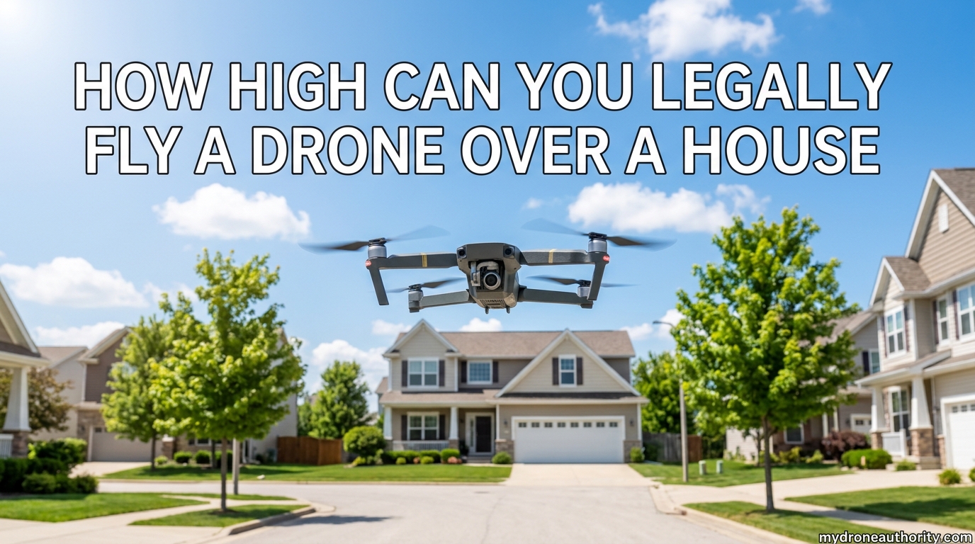
Under FAA rules, you can legally fly a drone up to 400 feet above ground level (AGL) in uncontrolled airspace. Part 107 licensed pilots get one extra benefit: when flying within 400 feet of a tall structure, you can add another 400 feet on top of that building’s height. So the short answer to how high you can fly over a house depends on whether a structure is nearby and what type of pilot you are.
Our team has flown drones over countless residential and commercial properties, and the same confusion comes up every week. Pilots wonder if 50 feet is too low. Homeowners ask if a drone at 200 feet is breaking the law. Both sides deserve a clear answer, and we wrote this guide to give you one.
Here is what we will cover: the exact FAA altitude rule, how the structure exception works, where state privacy laws come in, and what to do if a drone keeps showing up over your house.
Whether you are a new Part 107 pilot, a recreational hobbyist, or a homeowner trying to understand your rights, this guide is built for you. The FAA rules have not changed dramatically in 2026, but enforcement has tightened, and several states have passed new privacy statutes worth knowing.
Table of Contents
The FAA 400 Foot AGL Rule Explained
The baseline federal rule is simple: stay at or below 400 feet above ground level. This is the cap that applies to nearly every drone flight in the United States, and it has been the FAA’s core altitude limit since small drones became mainstream.
The rule is spelled out in 14 CFR 107.51 for commercial pilots and in Section 44809 for recreational flyers. Both sets of rules converge on the same 400 foot ceiling, which keeps the framework easy to remember.
What ‘Above Ground Level’ Actually Means
AGL means your altitude is measured from the ground directly beneath your drone, not from sea level. If you take off from a hilltop at 2,000 feet elevation, you still only get 400 feet above that hill before you break the rule.
This trips up a lot of new pilots because drone apps usually display both AGL and MSL (mean sea level) readings. Always check which one your controller is showing when you set your max altitude. DJI, Autel, and Skydio controllers all default to AGL in the United States, but the units can be toggled.
Why the FAA Chose 400 Feet
The 400 foot limit exists to keep drones away from manned aircraft. Crewed airplanes are required to fly at least 500 feet above the ground in non-congested areas under FAR 91.119, so the 400 foot ceiling creates a 100 foot buffer between drones and airplanes.
That buffer matters because propeller strikes between drones and crewed aircraft can be catastrophic. FAA near-miss reports climbed sharply between 2022 and 2025, with the agency logging thousands of pilot reports per year. This is one reason the agency continues to enforce the limit strictly and has increased its drone enforcement staff.
Helicopters can fly lower than airplanes in certain situations, which is another reason the FAA has started mapping helicopter routes and posting them in B4UFLY. Drone pilots are expected to yield to all manned aircraft, no matter the altitude.
Who Must Follow the 400 Foot Rule
Both recreational flyers under Section 44809 and commercial pilots under Part 107 must obey the 400 foot ceiling. There is no exception for hobbyists, and there is no exception based on drone size or weight (within the small UAS category, which is drones under 55 pounds).
Public safety operators, military pilots, and some government agencies can apply for Certificates of Waiver or Authorization (COAs) that allow them to exceed 400 feet. The rules for emergency response drones have also been expanded, but those exceptions do not apply to private pilots.
If you are flying under Part 107 for work, you also need to keep the drone within visual line of sight, which we cover in our guide to Part 107 operating rules.
Part 107 vs Section 44809: Two Sets of Rules, One Altitude Limit
The FAA recognizes two main categories of drone pilots, and the rules differ in important ways. Both groups share the 400 foot AGL baseline, but commercial pilots have access to the structure exception that recreational flyers do not.
Choosing the right category is important. If you fly commercially without a Part 107 certificate, you are technically violating FAA rules even if the actual flight follows every safety guideline. The FAA has issued thousands of enforcement actions against unlicensed commercial operators over the past three years.
Part 107 Commercial Pilots
Part 107 covers anyone flying drones for hire, including real estate photographers, roof inspectors, and surveyors. To fly under Part 107 you must pass the Aeronautical Knowledge Test and hold a Remote Pilot Certificate, which costs $175 to obtain and is valid for two years.
Part 107 pilots get the structure exception, which lets them fly up to 400 feet above a structure when they are within 400 feet of it. We will dig into this in the next section, but the short version is that Part 107 gives commercial operators more flexibility in urban and industrial settings.
Part 107 also requires a preflight inspection, a current sectional chart review, and a weather briefing before each flight. These requirements slow down operations slightly but significantly reduce incident rates.
Section 44809 Recreational Flyers
Section 44809 is the law that lets you fly a drone as a hobby without a Part 107 certificate. To qualify, the flight must be for personal enjoyment, you must follow the safety guidelines of a community-based organization (like the Academy of Model Aeronautics), and you must keep the drone within visual line of sight.
Recreational flyers do NOT get the structure exception. Even if you are standing right next to a 500 foot building, you are still capped at 400 feet AGL under Section 44809. This is a major limitation for hobbyists who want to photograph tall landmarks or inspect tall structures on their own property.
Recreational flyers must also pass The Recreational UAS Safety Test (TRUST) before flying. The test is free, takes about 30 minutes, and is offered by several FAA-approved providers.
Key Differences That Affect Your Flight
If you are a Part 107 pilot working a job near a tall structure, the structure exception can save your shoot. If you are a hobbyist, your ceiling does not change based on nearby buildings.
Both groups must still register their drones if they weigh over 0.55 pounds, and both must follow airspace rules. A drone near an airport requires LAANC authorization regardless of which category you fly under.
One often overlooked difference: Part 107 pilots can apply for waivers from many rules, including the 400 foot limit. Recreational flyers cannot. If you regularly need to fly above 400 feet, getting a Part 107 certificate is worth the effort even for occasional commercial work.
The 400 Foot Structure Exception: Flying Higher Near Buildings
The structure exception is the most misunderstood part of FAA drone law. It only applies to Part 107 pilots, and it only works under very specific conditions. Getting the math wrong can mean a fine of up to $27,500 per violation.
The structure exception exists because many legitimate commercial operations require flying near or above tall objects. Tower inspections, roof surveys, and high-rise construction monitoring are impossible without going higher than 400 feet AGL in some cases.
How the Structure Exception Works
Under 14 CFR 107.51, a Part 107 remote pilot may operate a drone up to 400 feet above the top of a structure, provided the drone is within 400 feet horizontally of that structure. Think of it as a 400 foot radius cylinder extending upward from the building’s highest point.
If the structure is 200 feet tall and you are 300 feet from it, your legal ceiling becomes 600 feet AGL (200 feet of structure plus 400 feet of vertical buffer). This is the rule that lets roof inspectors and tower surveyors do their jobs.
The exception also works with antennas, cranes, and other man-made objects. The FAA defines a “structure” broadly, so it includes communication towers, wind turbines, and even tall trees in some interpretations.
Examples in Real Life
Here is the scenario from the PAA questions: you are 800 feet above the ground on top of a building, can you fly your drone? Yes, under Part 107 you can fly up to 1,200 feet AGL (800 feet structure plus 400 feet exception) as long as you stay within 400 feet of the building.
If you are flying over a typical suburban house at 25 feet tall, the structure exception does almost nothing for you. The 400 foot AGL rule is still your real ceiling, because adding 400 feet to a 25 foot home only changes the math at a building taller than the typical house.
A more realistic example: a cell tower inspection where the tower is 250 feet tall. The Part 107 pilot can fly up to 650 feet AGL within 400 feet of the tower, which is more than enough to inspect antennas at the top. The same pilot could not legally fly at 650 feet over the parking lot next to the tower, because that parking lot is more than 400 feet from the structure.
Limits and Conditions
The structure exception does not waive airspace rules. If the structure sits in controlled airspace, you still need LAANC authorization. The exception also does not extend laterally; once you fly more than 400 feet from the building, you drop back to the 400 foot AGL cap.
You also need to keep visual line of sight. The structure exception only adjusts altitude, not the other Part 107 requirements. You cannot fly behind a 500 foot building and use the structure exception to justify losing sight of the drone.
Finally, the structure exception does not apply in designated prohibited or restricted areas. Military bases, certain national parks, and FAA-restricted zones override the exception entirely.
AGL vs MSL: Why Measurement Matters
Most drone controllers show altitude as AGL, but the FAA actually cares about both numbers depending on the situation. Knowing the difference can save you from a violation.
Most consumer drones rely on GPS for altitude, which can introduce its own set of errors. Understanding the tools you are using is the first step to flying safely and legally.
Defining AGL and MSL
AGL (above ground level) is measured from the terrain directly below you. MSL (mean sea level) is measured from a fixed global reference point. Denver and Death Valley have very different MSL readings even if your drone is sitting on the ground.
For routine Part 107 flights, the FAA cares about AGL. For airspace classification, the FAA cares about MSL or floor/ceiling data published on sectional charts. The FAA’s B4UFLY app uses MSL thresholds to determine whether you are in controlled airspace.
This dual standard catches many new pilots off guard. A drone in a mountain valley might be in Class G uncontrolled airspace at the surface but Class E controlled airspace at 1,200 feet AGL, simply because the surrounding terrain pushes the airspace floor higher.
Terrain Challenges
AGL gets tricky in mountainous terrain or over cliffs. If you launch from a ridge at 6,000 feet MSL and fly over a canyon 1,000 feet below, your drone might show 400 feet AGL even though it is technically 5,600 feet MSL.
This is rarely a problem because manned aircraft fly well above terrain, but it does matter near mountainous airports with high minimum altitudes. Always check the sectional chart for the area before flying in elevation changes greater than a few hundred feet.
Canyon and cliff operations also create GPS multipath issues, which can cause your altitude reading to bounce. We recommend visual line of sight backup in these cases and a slightly lower ceiling than the legal maximum.
Barometric Altimeter Limitations
Consumer drones use barometric altimeters, which measure air pressure. They can drift by 10 to 30 feet depending on weather, and they are not as accurate as GPS altitude readings.
Cold weather, low pressure systems, and rapid ascents can all cause barometric drift. A drone launched in the morning at sea level pressure can read 50 feet low by afternoon if a weather front moves in.
We recommend setting your max altitude 20 to 30 feet below the legal limit to give yourself a buffer. This protects you from sensor error and from unintended climbs in turbulent air.
State Privacy Laws: Where Federal Authority Stops
The FAA controls the airspace, but states control privacy and trespass. Once you obey the 400 foot rule, you still have to follow state laws about what you can photograph and where you can fly.
Drone privacy law is one of the fastest-changing areas of state legislation. Bills have been introduced in nearly every state legislature over the past three years, and several new statutes took effect in 2026.
Why State Laws Matter
FAA preemption means states cannot regulate the actual flight of your drone, but they CAN regulate what you do with the camera. Recording someone in a place where they have a reasonable expectation of privacy can violate state wiretapping or surveillance laws.
If you hover over a backyard at 200 feet AGL and stream video of someone sunbathing, you may have broken state law even though you followed every FAA rule. The legal theory is similar to using a telephoto lens from a public sidewalk, except that drones are far more intrusive.
Some states have also passed laws that define drone-based trespass as a separate offense, distinct from surveillance. This means you can be liable even if you never turn the camera on.
States With Drone Privacy Laws
More than half of U.S. states have passed some form of drone privacy legislation. Here is a quick overview of how the most active states handle it:
- California – Limits drone use for surveillance, trespass, and harassment. Strong penalties for capturing images of people in private spaces. Landowner consent is required for drone flights below 350 feet over private property in some counties.
- Florida – Defines drone trespass as operating over private property at less than 400 feet with intent to record. First-time violations are misdemeanors, repeat violations are felonies.
- Texas – Captures images used for surveillance can violate the state privacy act. Strong protections for private property, with civil damages available to homeowners.
- New York – Restricts drone use near critical infrastructure and creates a private right of action for invasion of privacy. Police need a warrant for most drone surveillance.
- Illinois – Has one of the strictest drone laws, requiring warrants for most law enforcement drone use. Strong civil remedies for private citizens.
- Massachusetts – Defines drone harassment and gives police authority to order drones to land in certain situations.
This is not legal advice. Check your specific state statutes before flying over private property, especially in residential areas. Many state laws also include carve-outs for newsgathering, real estate marketing, and other legitimate commercial uses.
Hovering Duration Concerns
Forum discussions on r/drones and r/legaladvice show that homeowners care less about a single flyover and more about drones that linger. Hovering over the same property for minutes at a time is far more likely to trigger a complaint than a quick transit flight.
Even if no state law has been broken, prolonged hovering can support a harassment claim. Keep your passes brief when flying near homes. Our team aims for no more than 30 seconds over any single property unless we have explicit permission.
Some states have started writing specific hovering time limits into law, generally capping legal loitering at 60 seconds. Even where no statute exists, courts have used long hover times as evidence of intent to surveil.
Property Owner Rights: What to Do If a Drone Is Over Your House
If a drone keeps showing up over your property, you have more options than you might think. You also have fewer options than some people assume.
Homeowner frustration is one of the most common topics on drone forums, and the law in this area is still developing. Recent cases in Alaska and Michigan have started to clarify where the line is between a flyover and aerial trespass.
Your Legal Options
You can document the flights with timestamps, photos, and video. You can file a complaint with the FAA if the drone is breaking the 400 foot rule or flying in restricted airspace. You can also pursue a civil claim under your state’s privacy or trespass laws.
What you cannot do is take matters into your own hands. Damaging or shooting down a drone is a federal crime under 18 U.S.C. 32, and it can also lead to state charges for destruction of property.
In some states, you can ask law enforcement to intervene if you have evidence of repeated surveillance. A pattern of flights, especially with video or photographic evidence, can support a harassment claim even if the drone itself is flying legally.
Why You Cannot Shoot It Down
The FAA classifies drones as aircraft. Shooting one down is treated like shooting at a manned plane, with penalties up to $25,000 and possible prison time. There is no exception for drones flying low over your property.
Even if you feel your privacy has been invaded, the legal remedy is a civil lawsuit or a complaint to law enforcement, not physical action. The FAA has brought cases against homeowners who shot down drones, even when the drone operator was clearly violating state privacy laws.
The federal classification also means that local “stand your ground” laws generally do not apply to drones. A drone is not a person, and damaging it is not legally a defensive act.
How to Report Drone Activity
If you believe a drone is breaking the law, document the date, time, altitude (if you can estimate it), and any camera or registration markings. File a complaint with your local police non-emergency line and the FAA DroneZone portal.
If the drone is interfering with manned aircraft or operating in restricted airspace, contact local law enforcement immediately rather than handling it yourself. Air traffic controllers can sometimes vector manned aircraft away from drone activity, but only if they know about it.
Starting in 2026, the FAA also requires most drones over 0.55 pounds to broadcast Remote ID, which can help identify the operator. If you can pick up the Remote ID signal (using apps like AirSentinel), you can sometimes identify the pilot directly.
Legal Pathways to Fly Above 400 Feet
Most pilots never need to fly above 400 feet, but some jobs require it. The FAA offers two main pathways for higher operations.
Each pathway has tradeoffs in cost, time, and flexibility. Understanding which one fits your operation is the first step in choosing the right authorization.
Part 107 Altitude Waivers
Part 107.200 lets you apply for a waiver from the 400 foot rule. The FAA evaluates each request based on the proposed operation, the drone’s safety features, and the pilot’s qualifications. Approved waivers often come with extra conditions like altitude restrictions and time-of-day limits.
Waivers take 60 to 90 days to process on average, so they are not a same-day solution. They also typically cost nothing to file, but you may need to provide supporting documentation like risk assessments and standard operating procedures.
Common uses for altitude waivers include power line inspections, large agricultural operations, and high-altitude mapping projects. The FAA has issued hundreds of altitude waivers since 2018, and approval rates have improved as the application process has matured.
LAANC Authorization
LAANC (Low Altitude Authorization and Notification Capability) gives near-real-time airspace authorization, but it does not waive the 400 foot rule for most pilots. It authorizes flights in controlled airspace at the standard ceiling, not above it.
LAANC is essential if you are flying near an airport, and it is free through apps like AirMap and B4UFLY. Most controlled airspace authorizations come back in under a minute, which has dramatically reduced the planning burden for commercial pilots.
The altitude ceiling LAANC will authorize depends on the airspace class and the surrounding terrain. In some Class B areas, you may be capped at 100 feet AGL, while in Class D you can often get the full 400 feet.
When a Waiver Makes Sense
Waivers are worth the effort for tower inspections, large-scale mapping, and operations over tall structures where the structure exception does not apply. For routine real estate or roof work, the structure exception or a shorter drone usually solves the problem without paperwork.
If you regularly need to fly above 400 feet in the same area, applying for a standing waiver can save weeks of waiting. The FAA has started offering “blanket” waivers for common operations, which are pre-approved for any pilot who meets the basic criteria.
Best Practices for Flying Over or Near Houses
Even when the law is on your side, flying over a house the wrong way can start a confrontation. Here is what we recommend.
Our team has been flying residential missions for over five years, and we have learned that small operational choices make a big difference in how neighbors react.
Minimum Altitude Recommendations
Most legal guides suggest staying above 83 feet AGL over private property to avoid harassment complaints. The 83 foot figure comes from general aviation rules for congested areas, but it has become a soft benchmark for drone pilots.
In practice, we fly between 100 and 200 feet AGL for residential real estate work. That height keeps us clear of trees and gives homeowners less reason to feel intruded upon. We also avoid flying directly over a home when we can frame the shot at an angle instead.
If you need to inspect a specific feature like a roof, communicate with the homeowner first. A quick phone call or text goes a long way, and it can head off misunderstandings before the props start spinning.
Hovering Duration Guidelines
Keep your hover time under 30 seconds when possible. Long hovers draw attention, look invasive, and create stronger legal exposure if someone complains.
If you need a stable platform for photos, plan your shots so the drone is moving slowly rather than stationary. A slow forward pass can be just as cinematic as a hover, and it is much less likely to provoke a complaint.
For real estate listings, multiple short passes usually look better in the final edit than a single long hover. This also matches what professional helicopter cinematographers have done for decades.
Communication With Neighbors
Knocking on doors before a flight takes five minutes and prevents ninety percent of conflicts. Tell them what you are doing, how high you will fly, and how long you will be there.
Our team started doing this in 2024 and has not had a single complaint since. A polite conversation beats a legal dispute every time, and it often turns a nervous neighbor into an enthusiastic one.
If a neighbor still objects after talking, find a different angle. The shot is rarely worth a confrontation, and there are usually alternative compositions that avoid the disputed property entirely.
Frequently Asked Questions
How do I stop drones from flying over my property?
You can document each flight with timestamps and footage, file a complaint with the FAA DroneZone if the drone breaks the 400 ft AGL rule or airspace restrictions, and pursue a civil claim under your state’s privacy or trespass laws. You cannot shoot it down or otherwise damage it, since drones are classified as aircraft under federal law.
Can I shoot down a drone spying on my property?
No. Shooting down a drone is a federal crime under 18 U.S.C. 32 and can carry penalties of up to $25,000 and prison time. Even if you believe your privacy has been invaded, the legal remedy is a civil lawsuit or a complaint to law enforcement, not physical action.
Can you sue someone for flying a drone over your house?
Yes, in many states you can pursue a civil claim for invasion of privacy, trespass, or harassment if a drone operator violates state privacy laws. The strength of your case depends on your state’s drone statutes, whether the drone was recording, and how long it hovered. FAA rules do not block state privacy claims.
Can I fly my drone if I’m 800 ft above ground on a building?
Yes, if you are a Part 107 remote pilot. Under 14 CFR 107.51, you can fly up to 400 feet above the top of a structure when you are within 400 feet of it horizontally. From the roof of an 800 ft building, that gives you a legal ceiling of 1,200 ft AGL. Recreational flyers under Section 44809 do not get this exception and remain capped at 400 ft AGL.
The Bottom Line
How high you can legally fly a drone over a house depends on where you are, what airspace you are in, and whether you are flying under Part 107 or Section 44809. For most residential flights, the answer is 400 feet AGL or lower.
If you are a Part 107 pilot working near a tall structure, the structure exception under 14 CFR 107.51 lets you fly higher, but you still need to stay within 400 feet of the building horizontally. State privacy laws add another layer on top of federal rules, and they are the ones most likely to affect you when flying over homes.
Our final recommendation: stay above 100 feet AGL over residential areas, keep your passes short, talk to neighbors when you can, and check your state’s privacy laws before you fly. If a drone keeps showing up over your property, document everything and contact the FAA or local police rather than handling it yourself.
The drone industry is growing fast, and so is the body of case law around it. The rules we covered in 2026 are likely to evolve, especially around privacy, Remote ID enforcement, and BVLOS (Beyond Visual Line of Sight) operations. Bookmark this page and check back as we update it with new court decisions, FAA guidance, and state law changes throughout the year.
For more on FAA rules, Part 107 waivers, and how to fly legally in your state, browse the rest of our drone guides updated for 2026.