
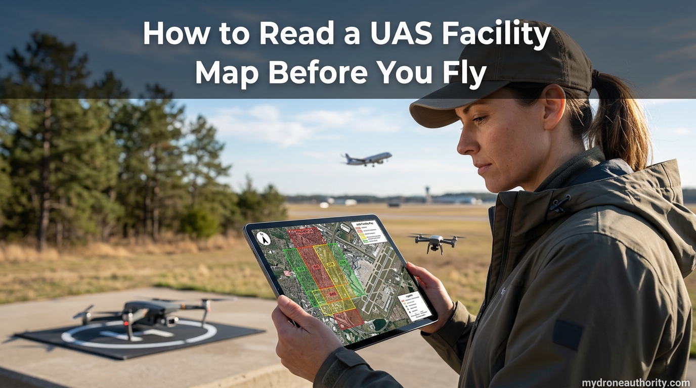
You arrive at a job site at 7:45 a.m. The client wants a roof inspection, the property sits 1.4 nautical miles from a towered airport, and you have about 90 minutes of calm wind before the gusts pick up. The temptation is to launch, fly, and finish before anyone notices.
That single decision is how most Part 107 pilots end up with a warning letter from the FAA. Controlled airspace around towered airports is not a suggestion, and the document that tells you exactly what you can and cannot do there is the UAS Facility Map.
If you have ever stared at a B4UFLY screen covered in colored squares and wondered what any of it meant, this guide is for you. I will walk through how to read a UAS Facility Map before you fly, one grid square at a time, using a real-world example you can replicate on your next job. By the end, you will be able to look at any controlled airspace in the United States and know within seconds whether LAANC will cover you, at what altitude, and when you need to ask for more.
Table of Contents
What Is a UAS Facility Map?
A UAS Facility Map (UASFM) is an FAA-published grid overlay on controlled airspace around airports. Each 1-nautical-mile square shows the maximum altitude (0 to 400 ft AGL) at which the FAA will auto-approve a drone flight through LAANC. Every LAANC provider checks this dataset before issuing an airspace authorization, so when you tap “Request Authorization” in Aloft, AutoPylot, or Airmap, the answer comes from the UASFM.
The FAA began publishing UASFMs in 2017 as part of the rollout of Low Altitude Authorization and Notification Capability (LAANC). Before LAANC, getting permission to fly inside the 5-mile radius of a towered airport meant a manual waiver process that could take 60 to 90 days. The UASFM compressed that timeline to seconds for the majority of routine commercial flights.
Each grid square carries a single number: an altitude ceiling in feet above ground level (AGL). That number represents the maximum altitude at which the FAA has predetermined that drone flights do not require additional safety analysis. Anything at or below that ceiling is eligible for near-instant LAANC approval. Anything above it requires what the FAA calls Further Coordination, which is manual review by Air Traffic Control.
It is worth noting what a UAS Facility Map is not. It is not a sectional chart, it is not a list of TFRs, and it does not show Temporary Flight Restrictions, stadium TFRs, national security flight restrictions, or wilderness area bans. It is one tool that answers exactly one question: at what altitude will LAANC auto-approve my flight in this controlled airspace?
For anything else — including Remote ID compliance, visual line of sight rules, and right-of-way — you still need to consult Part 107, the B4UFLY app, and the FAA’s TFR list before every flight.
How to Read a UAS Facility Map Before You Fly: The Grid System
The grid system is the heart of every UAS Facility Map. Once you understand the grid, the rest of the map becomes almost self-explanatory.
Grid Square Size and Shape
Each UASFM grid square measures 1 nautical mile by 1 nautical mile, which is equivalent to approximately 30 seconds of latitude by 30 seconds of longitude in the lower 48 states. In Alaska, where sectional charts historically used a different convention, the FAA uses 4 nautical mile by 4 nautical mile grid squares to match the existing aviation grid. If you are flying in Alaska, treat each large grid as the unit of analysis.
Every grid square is identified by a unique alphanumeric code tied to the underlying airspace and airport. You will see this code when you tap a grid in a LAANC app, and it is what appears in your authorization record.
Altitude Ceiling Values
Inside each grid square is a number representing the maximum auto-approval altitude in feet AGL. The FAA uses a fixed set of values: 0, 50, 100, 150, 200, 300, and 400 ft. You will rarely see intermediate values like 250 ft because the FAA rounds to these standard increments.
A grid marked 400 ft means LAANC can auto-approve you all the way up to the Part 107 maximum. A grid marked 200 ft means anything from the surface up to 200 ft AGL auto-approves, but if your roof inspection requires 280 ft, you need Further Coordination. A grid marked 0 ft means no auto-approval is possible at all in that square.
These values reflect what air traffic control at that specific facility has determined is safe without case-by-case review. The numbers often step up in rings radiating out from a runway — closer to the approach path means a lower ceiling, further out means a higher one. This is why two adjacent squares can show 0 ft and 400 ft.
Color Coding in B4UFLY
The FAA’s Visualize It map shows grids as flat overlays with the altitude number printed in each square. Most pilots, however, encounter the UASFM through the B4UFLY app or a LAANC provider app, where the data is color-coded for fast scanning.
In B4UFLY, red typically corresponds to 0 ft grids, yellow to intermediate ceilings (50, 100, 150, 200, or 300 ft), and green to 400 ft grids where you can fly at the full Part 107 maximum. The exact color palette changes between app versions, so always read the printed altitude number rather than relying on color alone.
One common forum complaint is that B4UFLY shows a colored area with no altitude number at all. That usually means the location is inside controlled airspace that the FAA has not yet gridded — it defaults to 0 ft and requires Further Coordination if you want to fly there.
Grid Squares Versus Sectional Chart Airspace Shelves
This is one of the most confusing distinctions for new pilots. A sectional chart shows the controlled airspace itself — the rings and shelves that define where Class B, C, D, and surface Class E begin and end, and at what altitudes. A UAS Facility Map sits on top of that airspace and tells you the LAANC ceiling within it.
A grid square never extends beyond controlled airspace. If a 1-nautical-mile square straddles the line between Class D and Class G, only the controlled portion is gridded. The other portion has no grid because LAANC does not apply in Class G.
Reddit threads are full of pilots confused about why their location appears inside a blue airport circle but shows no grid. The answer is almost always that they are looking at the airport’s airspace boundary on a sectional chart, not at the UASFM grid. The two layers serve different purposes.
Three Ways to Access UAS Facility Maps
You do not need a paid tool to read a UAS Facility Map. Three free options cover every pilot’s workflow.
1. FAA Visualize It (Browser Map)
The FAA’s official UAS data viewer is the Visualize It map, hosted at udds-faa.opendata.arcgis.com. It shows every published UASFM grid in the country overlaid on satellite imagery, with the altitude ceiling printed inside each square. Use it on a desktop when you are planning a job days in advance and want the source-of-truth view with no third-party filtering.
Visualize It also layers UAS Flight Restrictions, National Security UAS Flight Restrictions, and recreational fixed flying sites, so you can verify those alongside the LAANC grid in one screen.
2. B4UFLY App (Mobile)
B4UFLY is the FAA-endorsed mobile app for iOS and Android. It is the most popular pre-flight check tool because it combines the UASFM grid with airports, heliports, stadiums, TFRs, and national parks in a single map. The app will mark your current location as “Good to Fly,” “Authorization Required,” or “Restricted” based on the underlying UASFM data.
One important caveat: B4UFLY’s “Authorization Required” status tells you LAANC applies, but it does not tell you the ceiling. Tap into the airspace layer or open your LAANC provider’s app to read the actual grid number before requesting authorization.
3. LAANC Provider Apps
If you are flying commercially, your everyday tool will be a LAANC provider app — Aloft (formerly Kittyhawk), AutoPylot, Airmap, Avision, or Skyward. These apps embed the UASFM grid and let you submit your authorization request in the same screen where you read the ceiling. For working Part 107 pilots, this is the fastest path from “I see the grid” to “I am legally authorized to launch.”
All three of these sources pull from the same FAA UASFM dataset, so they should always agree. If you ever see a discrepancy between B4UFLY and a LAANC app, trust the LAANC app for authorization purposes and report the discrepancy through the FAA’s UAS help desk.
Step-by-Step: How to Read a UAS Facility Map Before You Fly
Here is the exact process I use before every commercial flight inside controlled airspace. The example assumes a roof inspection at a commercial property 1.5 nautical miles from a Class D airport.
Step 1: Drop Your Exact Flight Location Into the Map
Open B4UFLY or your LAANC provider’s app and enter the street address or GPS coordinates of the job site. Do not estimate — a 200-yard error can move you from a 400 ft grid into a 0 ft grid. Zoom in until you can clearly see the grid lines on the property.
Note which grid square the takeoff point falls into, and note whether the flight footprint extends into any adjacent squares. If the inspection will carry you across a grid boundary, you must respect the lowest ceiling of any square you enter.
Step 2: Identify the Grid Square and Read the Altitude Ceiling
Find the altitude number printed inside the grid square. In our Class D example, the property sits in a grid marked 200 ft. That means LAANC will auto-approve any altitude from the surface up to 200 ft AGL for the duration I request.
If the grid had read 0 ft, I would stop here and decide whether to request Further Coordination (see the next section) or move the flight to a different location.
Step 3: Confirm Your Required Altitude Fits Under the Ceiling
Calculate the altitude your drone needs to complete the job. For a roof inspection, that is the structure’s height plus the clearance you want above it, plus any buffer for terrain. If the building is 65 ft tall and I want to fly 50 ft above the roofline, I need about 115 ft AGL, which fits comfortably under the 200 ft ceiling.
If my required altitude exceeds the ceiling, I have two choices. I can request only up to the grid ceiling and adjust my flight plan, or I can request Further Coordination for the higher altitude and wait for ATC review.
Step 4: Verify You Are in Controlled Airspace
Before submitting, confirm that the colored overlay actually represents controlled airspace (Class B, C, D, or surface Class E) and not another layer like an airport marker or advisory area. B4UFLY labels this clearly, but Visualize It is the most reliable source if there is any doubt.
This step matters because in Class G (uncontrolled) airspace, LAANC does not apply at all — you do not need authorization regardless of what a grid says, but you must still follow Part 107 rules including the 400 ft AGL ceiling.
Step 5: Submit the LAANC Request
Inside your LAANC provider app, tap the grid, enter your requested altitude (at or below the ceiling), set the start and end time, and submit. Auto-approval typically returns in under 30 seconds. Save the authorization record — you are legally required to have it available during the flight.
Step 6: Re-Verify on the Day of Flight
The UASFM updates approximately every 56 days on the FAA’s standard aeronautical chart cycle. A grid that read 200 ft last month may now read 100 ft or 0 ft. Open the app the morning of your flight and re-confirm the ceiling before you drive to the site.
You also must check for new TFRs on the day of flight. A TFR issued after your LAANC authorization overrides the authorization — you cannot legally fly inside the TFR area even if you have an active LAANC approval on screen. This is the single most missed step in pre-flight planning.
What a 0 ft Grid Square Means
Seeing a 0 ft on a UAS Facility Map is the most common reason a planned job falls apart. It does not mean “do not fly here forever.” It means LAANC cannot auto-approve any altitude in that grid square, and any flight there requires Further Coordination.
Zero-foot grids almost always exist for a reason tied to runway operations. They cover approach corridors, departure paths, traffic pattern areas, and the airspace immediately over the runway itself. The FAA and ATC have determined that no routine drone operation in those squares can be approved without a human review of the specific flight plan.
How Further Coordination Works
Further Coordination is the manual authorization pathway. You submit a request through your LAANC provider with details about your flight — location, altitude, duration, aircraft, and operation type. The request goes to the ATC facility responsible for that airspace, where a controller or manager reviews it.
Turnaround times vary widely. Some facilities respond within hours, others take days, and the FAA’s stated maximum response time is technically up to 90 days. Submit Further Coordination requests as far in advance as possible, especially for jobs in busy Class B or C airspace.
Alternatives When Further Coordination Is Not Viable
If ATC denies the request or the timeline does not work, your options are limited but real. You can move the flight outside the 0 ft grid, even a few hundred yards can make a difference. You can reduce the requested altitude and try again under auto-approval. You can also wait for the next 56-day UASFM cycle, because grid ceilings do change as ATC re-evaluates its airspace.
What you cannot do is fly anyway. Flying in a 0 ft grid without authorization is a federal violation regardless of how short or low the flight is.
When LAANC Does Not Apply
LAANC is a powerful tool, but it has hard limits. Understanding those limits is what separates pilots who stay out of trouble from pilots who get a phone call from the FAA.
TFRs Override LAANC Authorization
A Temporary Flight Restriction is an active airspace closure issued for reasons ranging from VIP travel to wildfire response to stadium events. TFRs are layered on top of the UASFM and supersede any LAANC authorization you already hold. If a TFR is issued for your flight area at 10 a.m. and your LAANC authorization runs 9 a.m. to noon, you must land and stay grounded for the remainder of the TFR.
Pilots consistently underestimate this risk. Check for active TFRs on the FAA’s TFR list or in B4UFLY immediately before takeoff, not just when you submit the LAANC request days earlier.
Remote ID Compliance Is Separate
The UASFM tells you nothing about Remote ID. Since the FAA’s Remote ID rule took effect, almost all drones operated in the National Airspace System must broadcast identification and location information, either through a built-in transmitter or an external module. Operating without compliant Remote ID in controlled airspace is a separate violation layered on top of any airspace issue.
Before every flight, verify your drone is Remote ID compliant. This check is independent of the UASFM grid reading and applies equally in Class G airspace.
Class G Airspace Does Not Require LAANC
Class G (uncontrolled) airspace has no LAANC requirement at all. If your flight location shows no grid overlay on B4UFLY, you are in Class G and do not need authorization. You are still bound by Part 107 rules — 400 ft AGL ceiling, daylight-only operations (without a waiver), visual line of sight, and airspace-class awareness — but the LAANC system simply does not apply.
One nuance: the boundary between surface Class E and Class G is not always intuitive, especially around uncharted airports and remote areas. When in doubt, check the sectional chart or use the FAA’s Visualize It viewer to confirm the airspace class before assuming Class G.
Recreational Flyers Versus Part 107
Recreational flyers under the Exception for Limited Recreational Operations of Unmanned Aircraft can use LAANC in the same controlled airspace as Part 107 pilots. The grid ceilings and auto-approval logic are identical. The differences show up in the operating rules outside of airspace authorization — recreational flyers are limited to 400 ft AGL in all conditions (no structure allowance), must pass TRUST, and cannot fly for compensation.
Penalties for Flying Without Authorization
Flying in controlled airspace without LAANC or Further Coordination authorization is a violation of 14 CFR 107.51 and the airspace rules in Part 71. Civil penalties can reach tens of thousands of dollars per violation under the FAA Reauthorization Act of 2018 and subsequent enforcement guidance, and the FAA has been visibly increasing enforcement against unauthorized commercial drone flights. Beyond fines, violations can put your Part 107 certificate at risk.
Quick Pre-Flight Checklist
Use this three-step check before every flight inside controlled airspace:
- UASFM Grid — Open your LAANC app, find your exact takeoff point, read the altitude ceiling, and confirm your required altitude fits under it.
- TFRs — Check the FAA’s active TFR list or B4UFLY for any restrictions issued since your last check, including stadium and VIP TFRs.
- Remote ID — Confirm your drone is broadcasting compliant Remote ID before motors are armed.
This sequence takes under two minutes and catches the three failure modes that cause most enforcement actions: wrong altitude authorization, TFR override, and missing Remote ID.
What is a UAS facility map?
A UAS Facility Map (UASFM) is an FAA-published grid overlay on controlled airspace around airports. Each 1-nautical-mile square shows the maximum altitude (0 to 400 ft AGL) at which the FAA will auto-approve a drone flight through LAANC. Every LAANC provider checks this dataset before issuing an airspace authorization.
What is the 400 foot rule for drones?
Under Part 107, the maximum legal altitude for drone operations is 400 feet above ground level (AGL). You may fly above 400 ft only when within 400 feet horizontally of a structure, up to that structure’s height plus 400 ft. A UASFM ceiling of 400 ft means LAANC can auto-approve up to that Part 107 maximum.
What app can I use to see where I can fly my drone?
Three free options: B4UFLY (the FAA-endorsed mobile app for iOS and Android), the FAA Visualize It map at udds-faa.opendata.arcgis.com, or any FAA-approved LAANC provider app such as Aloft, AutoPylot, Airmap, Avision, or Skyward.
Can LAANC be denied?
Yes. LAANC will deny auto-approval if your requested altitude exceeds the grid ceiling, or if your flight location falls in a 0 ft grid square. In those cases you must submit a Further Coordination request, which triggers manual ATC review and can take days to weeks with no guarantee of approval.
How often does the UAS Facility Map update?
The FAA updates UAS Facility Maps approximately every 56 days, aligned with the standard aeronautical chart cycle. Always re-check the grid on the day of your flight, because an altitude ceiling that read 200 ft last month may now read 0 ft.
Do I need LAANC in Class G airspace?
No. Class G (uncontrolled) airspace has no LAANC requirement. If your flight location shows no grid overlay on B4UFLY, you are likely in Class G. You must still follow Part 107 rules including the 400 ft AGL ceiling, daylight operation limits, and visual line of sight.
Conclusion
Learning how to read a UAS Facility Map before you fly takes about one job’s worth of practice, and from that point on it becomes second nature. The grid system, the altitude ceilings, and the LAANC workflow are all designed to be scannable from a phone in the field. The hard part is making the check a non-negotiable habit before every flight, not just the ones that feel complicated.
Pull up the map, read the grid, confirm the altitude, check for TFRs, verify Remote ID, then launch. Two minutes of pre-flight work is the entire difference between a clean commercial operation and a violation that follows your certificate for years.