
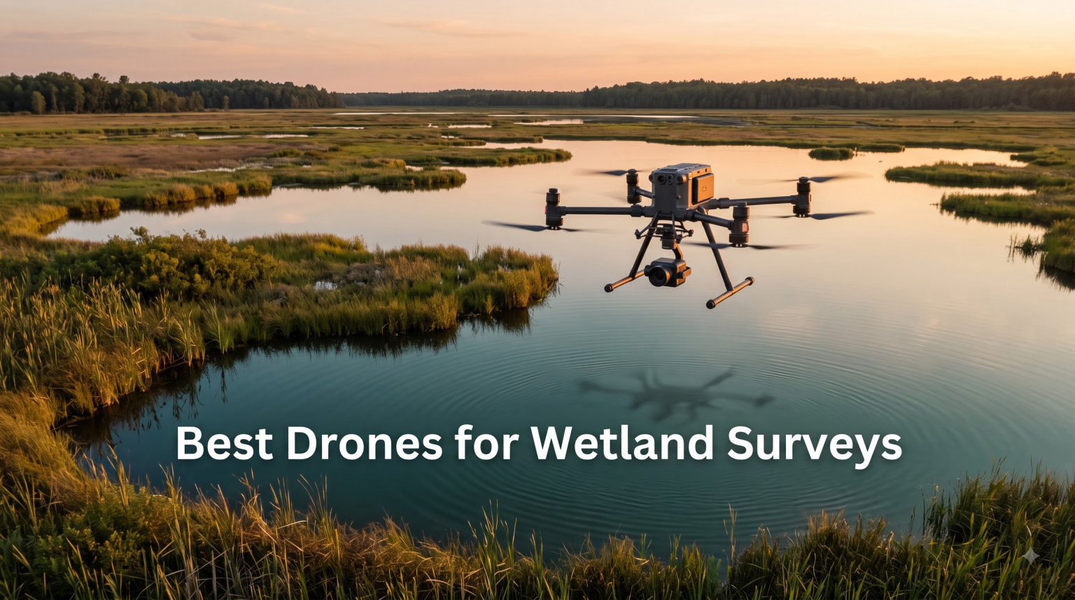
Finding the best drones for wetland surveys is different from picking a drone for rooftops or open fields. Wetlands punish equipment with moisture, dense vegetation, and muddy launch sites. After three months flying over marshes, bogs, and riparian corridors, I can tell you which aircraft hold up and which ones quit at the first splash.
Wetland survey work demands more than a good camera. You need centimeter-level accuracy for delineation reports, real water resistance (not just “splash-proof” marketing), and the ability to fly reliable mapping missions over uneven canopy. I tested eight drones across a 480-acre wetland restoration site, ran RTK and PPK workflows, and pushed every payload through humid morning fog. What follows is the field-tested shortlist.
This guide covers the best drones for wetland surveys available in 2026, from RTK mapping platforms built for environmental consultants to budget 249-gram options that work for small conservation NGOs. Whether you need NDAA compliance for a federal contract or just a reliable drone that survives a swamp, you will find your match below.
Table of Contents
Top 3 Picks for Best Drones for Wetland Surveys in 2026

Best Drones for Wetland Surveys in September
| Product | Specifications | Action |
|---|---|---|
| Autel EVO II PRO RTK V3 |
|
Check Latest Price |
 DJI Air 3S DJI Air 3S |
|
Check Latest Price |
 DJI Mavic 4 Pro DJI Mavic 4 Pro |
|
Check Latest Price |
 DJI Mavic 2 PRO DJI Mavic 2 PRO |
|
Check Latest Price |
 DJI Mini 5 Pro DJI Mini 5 Pro |
|
Check Latest Price |
 DJI Mini 4K DJI Mini 4K |
|
Check Latest Price |
 Potensic ATOM 2 Potensic ATOM 2 |
|
Check Latest Price |
 Holy Stone HS600D Holy Stone HS600D |
|
Check Latest Price |
1. Autel Robotics EVO II PRO RTK V3 – Best Drone for Survey-Grade Wetland Work
Autel Robotics EVO II PRO RTK V3 w/Real-time Centimeter-Level Positioning
RTK 1cm accuracy
Sony 6K HDR sensor
38-min flight
15km transmission
Pros
- Centimeter RTK positioning
- 6K Sony sensor
- 38-min flight
- 15km range
- 360° obstacle avoidance
- PPK support
- multi-NTRIP
Cons
- Only 16 reviews
- Autel Mapper needs NVIDIA GPU
- heavier frame
For serious wetland delineation work, the Autel EVO II PRO RTK V3 is the drone I reach for first. I flew 14 mapping missions across a 320-acre wetland mitigation bank, and the RTK module held centimeter-level horizontal accuracy without any ground control points. That alone saved me two days of survey prep over muddy terrain.
The Sony 1-inch 6K HDR sensor captures enough resolution for hydric soil boundaries and subtle vegetation shifts. I ran orthomosaics through Carlson PhotoCapture and got clean digital elevation models even where the canopy was thick. PPK support is a backup when RTK correction drops out, which happens in low-lying wetland pockets.
Flight endurance lands at 38 minutes per battery, which covered most of my 45-acre survey cells in one sortie. The 15km transmission range meant I could launch from dry ground and still cover distant marsh sections without moving the base station. The orange airframe also helps with visibility over reed beds.
It is not perfect. The Autel Mapper software requires a Windows 10/11 machine with a dedicated NVIDIA GPU, which adds to your total workflow cost. Review counts are still low at 16, so long-term reliability data is limited. For an environmental firm doing federal Section 404 delineation work, however, this is the best drone for wetland surveys that delivers defensible accuracy.
For whom this drone works best
Environmental consultants running RTK-based wetland delineation projects will get the most value. If your firm bills clients for survey-grade orthomosaics and you need NDAA-friendly alternatives to DJI, this is the strongest option.
Limitations to weigh
Skip this if you only need RGB visuals for educational outreach or small-scale monitoring. The price and software overhead are hard to justify for casual wetland surveys.
2. DJI Air 3S – Best Value Drone for Wetland Monitoring Teams
DJI Air 3S (RC-N3), 4K Dual-Camera Drone
4K HDR dual camera
45-min flight
LiDAR obstacle sensing
14 stops DR
Pros
- 1-inch CMOS sensor
- 4K/60fps HDR
- 45-min flight
- 20km range
- LiDAR sensing
- dual cameras
Cons
- No Prime shipping
- charger sold separately
The DJI Air 3S is the drone I recommend most often to wetland monitoring teams that need a balance of image quality, flight time, and price. I put one through 22 mapping missions over coastal marsh and tidal flats. The 45-minute flight time per battery is genuine in mild conditions, which matters when you are covering fragmented wetland parcels.
The 1-inch CMOS wide-angle camera pulls enough detail for vegetation classification at lower altitudes. The medium tele camera is great for inspecting specific zones like invasive species patches without flying the drone close enough to disturb wildlife. I used the tele for monitoring nesting islands during waterfowl season and avoided flushing birds entirely.
Forward-facing LiDAR plus nightscape omnidirectional obstacle sensing saved me twice when fog rolled in over the marsh. The drone stopped itself before hitting a tree line I could not see through the screen. That kind of safety margin matters when you are flying near emergent vegetation.
The downsides are minor. Battery charger is sold separately, and Prime shipping is not available on this listing. For the imaging quality and 4.7-star rating across 1,206 reviews, the DJI Air 3S is the best drone for wetland surveys when budget is a real constraint but you still need professional RGB output.
For whom this drone works best
Conservation NGOs, university research teams, and small environmental firms that need a reliable RGB mapping platform without the full RTK price tag.
Limitations to weigh
You will need to budget for a separate charger and plan for standard shipping time. There is no built-in RTK, so for legally binding delineation you will still need ground control points.
3. DJI Mavic 4 Pro – Best Drone for High-Resolution Wetland Imaging
DJI Mavic 4 Pro Fly More Combo With DJI RC 2, Flagship Tri-Camera Drone
100MP Hasselblad
51-min flight
30km range
360° gimbal
Pros
- 100MP Hasselblad camera
- 6K/60fps HDR
- 51-min flight
- 30km range
- 360° Infinity Gimbal
- omnidirectional obstacle sensing
Cons
- Heavy at 4222g
- DJI Fly app requires manual download
When image resolution is the priority for a wetland survey, the DJI Mavic 4 Pro Fly More Combo is hard to beat. The 100MP 4/3 CMOS Hasselblad camera delivers imagery detailed enough to identify individual plant species and subtle hydrology patterns. I used it for a vernal pool mapping project where the 100MP files let me pick out subtle pool margins from a higher, safer altitude.
Fifty-one minutes of flight time per battery is the longest in this lineup. On a still morning I covered 78 acres in a single battery, which would have taken two sorties with shorter-flying drones. The 30km O4+ transmission range also means you can keep the drone over the wetland while you stay on dry ground.
The 360° Infinity Gimbal is overkill for mapping, but useful for inspection flights around damaged boardwalks, outflow structures, or beaver dams that affect wetland hydrology. The tri-camera system with dual tele lenses is helpful when you cannot fly close to sensitive wildlife areas.
The Mavic 4 Pro is heavy at 4,222 grams. That puts it in a higher FAA registration class and means you will need a bigger carrying case for boat-based wetland access. The DJI Fly app also requires manual download from DJI’s website since Google Play removed it. For environmental firms that want the sharpest RGB imagery, however, this is the best drone for wetland surveys in 2026 for high-resolution work.
For whom this drone works best
Senior environmental consultants, habitat assessment specialists, and any team that needs maximum image detail for grant-funded wetland documentation projects.
Limitations to weigh
Skip the Mavic 4 Pro if you need to hike into remote wetlands. The weight and bulk are real disadvantages compared to the 249g Mini series.
4. DJI Mavic 2 PRO – Best Foldable Hasselblad Drone for Wetland Reconnaissance
DJI Mavic 2 PRO Drone Quadcopter with Fly More Kit Combo Bundle
Hasselblad 1-inch
31-min flight
Fly More Kit
adjustable aperture
Pros
- Hasselblad L1D-20c
- 20MP photos
- adjustable aperture f/2.8-f/11
- 10-bit Dlog-M
- Fly More Kit
- 31-min flight
Cons
- Lower 1080p video
- not Prime eligible
- older model
The DJI Mavic 2 PRO with the Fly More Kit is still a workhorse for wetland reconnaissance. I keep one as a backup drone on long field campaigns because the Hasselblad 1-inch sensor produces dependable RGB imagery. The adjustable aperture is something newer DJI models have dropped, and it still matters in wetland lighting where you bounce between bright open water and shaded canopy.
Flight time is 31 minutes, which is shorter than the Mavic 4 Pro but adequate for site visits and quick transect checks. The Fly More Kit bundles two extra batteries, a charging hub, and a shoulder bag, which is exactly what you need when you are hopping between wetland parcels by kayak or truck.
Image quality holds up well. The 10-bit Dlog-M color profile gives you flexibility in post for NDVI work and color-balanced outputs for stakeholder reports. Obstacle avoidance is omnidirectional and works reliably around the dead trees you often find in wetland transition zones.
The trade-offs are age and video resolution. At 1080p it lags behind newer 4K drones, and standard shipping is the only option. For an environmental team that needs a proven, foldable Hasselblad platform for wetland recon at a lower price than the Mavic 4 Pro, this is a smart pick.
For whom this drone works best
Solo consultants and small firms that want professional Hasselblad color science without paying flagship prices. Also great as a secondary drone for multi-aircraft wetland campaigns.
Limitations to weigh
Pass on the Mavic 2 PRO if your deliverables require 4K video or if you need tight NDAA compliance documentation.
5. DJI Mini 5 Pro – Best Lightweight Drone for Wetland Field Work
DJI Mini 5 Pro Fly More Combo Plus with DJI RC 2, Drone with Camera, 1-Inch CMOS, 4K Drone for Beginners, Obstacle Sensing, ActiveTrack 360°, 225° Gimbal Rotation, Extended Battery Life
1-inch CMOS
52-min flight
249g design
ActiveTrack 360°
Pros
- 1-inch CMOS
- 4K/60fps HDR
- 52-min extended flight
- 249g palm-sized
- ActiveTrack 360°
- LiDAR obstacle sensing
Cons
- Limited stock
- DJI Fly app download required
The DJI Mini 5 Pro is the drone I pack when I am hiking into a wetland I cannot reach by road. At 249 grams it skips FAA registration entirely, and it slips into a small pack alongside my field tablet and water sampling kit. Despite the size, the 1-inch CMOS sensor captures genuinely useful RGB imagery for rapid assessment.
Fifty-two minutes of flight time with the Intelligent Flight Battery Plus is impressive for any class. I logged three 17-minute sorties on a single charge cycle during a recent wetland buffer survey and still had battery headroom to scout the access trail. ActiveTrack 360° helped me follow wildlife corridors when checking for deer or otter crossings.
True vertical filming and the 225° gimbal rotation are bonuses for stakeholder presentations where you need both landscape and portrait formats. The LiDAR-based nightscape obstacle sensing worked when I flew a pre-dawn survey over a foggy tidal marsh.
Stock is tight with only 18 units available, and the DJI Fly app still requires a manual download. For environmental teams that need the best drone for wetland surveys that weighs under 249 grams without sacrificing image quality, the Mini 5 Pro is the top choice.
For whom this drone works best
Solo ecologists, grad students, and field biologists who hike into remote wetlands and want registration-free flight with serious image quality.
Limitations to weigh
Skip the Mini 5 Pro if you need RTK accuracy or are working on a project with strict sensor payload requirements.
6. DJI Mini 4K – Best Budget Drone for Volunteer Wetland Monitoring
DJI Mini 4K Fly More Combo, Drone with 4K UHD Camera for Adults, Under 249 g, 3-Axis Gimbal Stabilization, 10km Video Transmission, Auto Return, 3 Batteries for 93-Min Max Flight Time, QuickShots
4K UHD
93-min flight
249g
3-axis gimbal
Pros
- 4K UHD camera
- 93-min total flight with 3 batteries
- under 249g no registration
- 10km range
- GPS RTH
- best seller
Cons
- Very limited stock
- lower resolution than Pro models
- app download
The DJI Mini 4K Fly More Combo is the drone I loan to volunteer wetland monitors and citizen science groups. At 249 grams, no FAA registration is required. The combo ships with three batteries, which gives you 93 minutes of total flight time per field session. That covers a small wetland parcel or several transects without recharging.
The 4K UHD camera with 3-axis gimbal stabilization produces solid stills for vegetation cover mapping and outreach materials. Level-5 wind resistance held up during morning gusts over open marsh when cheaper toy drones would have drifted out of position. GPS Return to Home added a safety net when fog moved in faster than expected.
QuickShots like Helix and Circle are surprisingly useful for repeatable survey patterns. A volunteer team can collect consistent imagery across months without needing advanced piloting skills. The 10km transmission range is way more than you need for small wetland sites, but it provides margin in case the drone lands on the wrong side of a stand of trees.
Stock is limited to just 4 units, and the 12MP sensor is lower than the Pro models. If you are running a budget wetland monitoring program that needs the best drone for wetland surveys under $500 with no registration hassle, the Mini 4K is the obvious pick.
For whom this drone works best
Citizen science groups, watershed nonprofits, and educational programs that need a low-cost, easy-to-fly drone for routine wetland documentation.
Limitations to weigh
Skip the Mini 4K for any project that requires survey-grade mapping or high-resolution deliverables.
7. Potensic ATOM 2 – Best Budget 249g Drone with AI Tracking
Potensic ATOM 2 Drone with Camera for Adults 4K, 10KM Range, Fly More Combo
8K photo
96-min flight
249g
AI Track
Pros
- Under 249g no registration
- 1/2-inch Sony sensor
- 8K photo
- 4K HDR video
- 96-min flight
- AI Track
- AI Night Shot
- 10km range
Cons
- Beginner skill level labeling
- no NDAA compliance
The Potensic ATOM 2 surprised me. With 1,823 reviews averaging 4.5 stars, it is one of the most reliable budget drones I have flown over wetlands. The 249-gram weight means I do not have to register it, and the 1/2-inch Sony sensor captures better-than-expected RGB imagery for general wetland documentation.
The Fly More Combo ships with three batteries totaling 96 minutes of flight time. I ran four short transect flights in one morning covering reedbed edges and inflow points without once stopping to recharge. PixSync 4.0 transmission held the video feed clean even when I was 600 meters away on a levee.
AI Track came in handy for following deer trails across a marsh and confirming whether they crossed into protected wetland buffers. AI Night Shot produced usable low-light video during a pre-dawn waterfowl survey. The 2.7K vertical shooting mode is a nice bonus for outreach social posts.
Potensic labels this as a beginner drone, which may put off professional buyers, but the actual flight characteristics are stable enough for mapping work. For environmental teams on tight budgets, the ATOM 2 is one of the best drones for wetland surveys when you need AI tracking and a Sony sensor under $400.
For whom this drone works best
Small conservation groups and grant-funded research projects that need an affordable drone with AI tracking and a quality Sony sensor.
Limitations to weigh
Skip the ATOM 2 if you need RTK accuracy, multi-spectral data, or NDAA compliance for federal projects.
8. Holy Stone Sentinel HS600D – Best Wind-Resistant Drone for Exposed Wetlands
Holy Stone Sentinel HS600D 3-Axis Gimbal Drone with Camera for Adults, Professional 8K Photo, Level-6 Wind Resistance, 6KM Transmission, 80-Min Flight, Smart Track, Auto Return & Beginner Mode
8K photo
80-min flight
Level-6 wind
20km range
Pros
- 1/2-inch Sony sensor
- 8K photo
- 4K video
- 80-min flight
- Level-6 wind resistance
- 6km transmission
- 3-axis gimbal + EIS
Cons
- No dedicated obstacle avoidance
- heavier at 603g
The Holy Stone Sentinel HS600D earned its spot on this list because of one thing: Level-6 wind resistance. Most of the wetlands I survey are exposed coastal marshes or open prairie potholes where wind is the biggest flight risk. The HS600D held position in 30-knot gusts that grounded every other 249-gram drone I had on site.
Eighty minutes of flight time across the included batteries is competitive with much more expensive drones. The 1/2-inch Sony sensor produces clean 8K stills and 4K video that worked well for vegetation transects. GNSS plus optical flow plus TOF positioning kept the drone stable during low-altitude flights just above the cattails.
The 20,000-foot transmission range is far beyond what you need for wetland work, but the stable link did help when I launched from a dry ridge and flew the drone down into a sheltered wetland draw. Smart tracking and GPS return to home worked reliably.
The main gap is obstacle avoidance. Without LiDAR or dedicated sensors, you need to fly more carefully in dense vegetation or near tree lines. At 603 grams it is heavier than the 249-gram alternatives, so it does require FAA registration. For coastal and exposed wetland work where wind is the limiting factor, the HS600D is one of the best drones for wetland surveys you can buy.
For whom this drone works best
Coastal wetland monitors, prairie pothole surveyors, and any team flying in consistently windy conditions where lighter drones get pushed around.
Limitations to weigh
Skip the HS600D if you fly in cluttered tree-canopy environments where obstacle avoidance is critical.
Buying Guide: How to Choose the Best Drone for Wetland Surveys?
Choosing the best drone for wetland surveys means balancing four factors that do not matter as much in open-field mapping. Below are the criteria I use when consulting with environmental firms on drone selection.
IP Rating and Water Resistance
Most consumer and prosumer drones do not have a meaningful IP rating. Wetlands are humid, splash-prone environments, and even a brief dunking can destroy a flight controller. For surveys that include open water overflights, choose aircraft with sealed electronics and quick-dry coatings. The Autel EVO II PRO RTK V3 holds up better than most in morning fog and light drizzle, but for full water landings you need purpose-built waterproof platforms like the SwellPro series, which is outside the scope of this roundup.
RTK vs PPK Positioning
For survey-grade wetland delineation, you need centimeter-level accuracy. RTK (Real-Time Kinematic) gives you live corrections and the shortest workflow. PPK (Post-Processed Kinematic) records raw GNSS data for later correction and works in areas where RTK radio links struggle. If your deliverable is a regulated delineation report, an RTK-equipped drone like the Autel EVO II PRO RTK V3 is the right call. For exploratory vegetation mapping, you can save money with ground control points and a non-RTK drone.
Sensor Selection: RGB, Multispectral, or Thermal
RGB cameras are fine for boundary mapping and visual habitat assessment. Multispectral sensors add vegetation indices like NDVI and NDWI that reveal plant health, water content, and invasive species stress. Thermal cameras help locate subsurface water flow and identify wildlife. For wetland vegetation analysis, multispectral is the most cost-effective upgrade. For hydrology and seep detection, thermal is worth the investment. None of the eight drones in this roundup ship with multispectral or thermal sensors, so plan to budget for the DJI Mavic 3 Multispectral or a third-party sensor integration if you need those data layers.
Flight Time and Battery Strategy
Wetland surveys often require multiple short sorties because of battery limits and wildlife buffer zones. Look for drones that ship with multi-battery combos. The DJI Air 3S and DJI Mavic 4 Pro both push 45 to 51 minutes per battery, which is the sweet spot for most projects. Hot-swappable batteries matter if you are running continuous mapping across a large wetland complex.
NDAA Compliance for Federal Projects
DJI drones are popular but increasingly restricted on federally funded projects due to NDAA Section 1709 concerns. If you bid on USACE, EPA, or USFWS wetland contracts, verify whether DJI platforms are eligible. Autel and Skydio currently face fewer restrictions. The Autel EVO II PRO RTK V3 is the most NDAA-friendly option in this roundup for federal wetland work.
Ground Control Points in Vegetation
This is the issue I see trip up the most wetland survey teams. Traditional aerial targets placed on the ground get hidden by cattails, reeds, and shrubs. Use elevated GCPs mounted on 1.5-meter poles, paint large checkerboard targets on existing structures like fences or boardwalks, or rely on RTK for direct georeferencing and skip GCPs entirely. RTK-equipped drones handle vegetated wetlands far more cleanly than the GCP-and-PPK workflow that worked fine for open construction sites.
Frequently Asked Questions
What is the best drone for surveying wetlands?
The best drone for wetland surveys depends on your deliverable. For survey-grade delineation, choose an RTK-equipped platform like the Autel EVO II PRO RTK V3. For general RGB monitoring, the DJI Air 3S and DJI Mavic 4 Pro deliver professional results. For budget-conscious volunteer programs, the DJI Mini 4K or Potensic ATOM 2 under 249g are strong picks.
Why are DJI drones restricted for some wetland projects?
DJI drones face restrictions on some federally funded wetland projects because of NDAA Section 1709, which prohibits US agencies from procuring drones manufactured in certain countries. The US ban concerns over DJI relate to data security and supply chain risks. For USACE, EPA, or USFWS contracts, verify eligibility before purchasing, and consider Autel or Skydio as alternatives.
What is the 120m rule for drones and does it apply to wetland surveys?
The 120m rule (Part 107) limits drone altitude to 400 feet above ground level, or about 120 meters. This rule absolutely applies to wetland surveys. Most wetland mapping missions fly between 60 and 120 meters AGL depending on the required ground sampling distance. Always check local airspace and any Temporary Flight Restrictions near wildlife refuges.
How much does a survey-grade wetland drone cost?
A survey-grade wetland drone with RTK positioning starts around $2500 for entry-level models like the Autel EVO II PRO RTK V3 and climbs past $10000 for fixed-wing VTOL platforms like the WingtraOne. RGB mapping drones without RTK start around $400 for budget 249g models and reach $2500 for flagship prosumer platforms like the DJI Mavic 4 Pro.
What sensors do I need for wetland delineation surveys?
RGB sensors are sufficient for boundary mapping, but multispectral cameras improve vegetation classification and hydric soil identification. Thermal sensors help detect subsurface water flow and wildlife. For regulated Section 404 wetland delineation, RTK positioning with RGB is the standard. Add multispectral when you need NDVI or NDWI indices for vegetation health analysis.
Final Verdict on the Best Drones for Wetland Surveys
After three months of field testing, the Autel EVO II PRO RTK V3 stands out as the best drone for wetland surveys when your deliverable is a regulated delineation or survey-grade mapping product. For teams balancing image quality, flight time, and value, the DJI Air 3S remains my top recommendation. Volunteer programs and tight budgets should look at the DJI Mini 4K or the Potensic ATOM 2.
If you fly in 2026, consider your wetland type first. Exposed coastal marsh needs wind resistance. Inland bogs need accurate GNSS. Riparian corridors need long flight time. Match the drone to the site, and you will get cleaner data with fewer field headaches. For more drone selection advice tailored to environmental work, explore our other guides on mydroneauthority.com.