
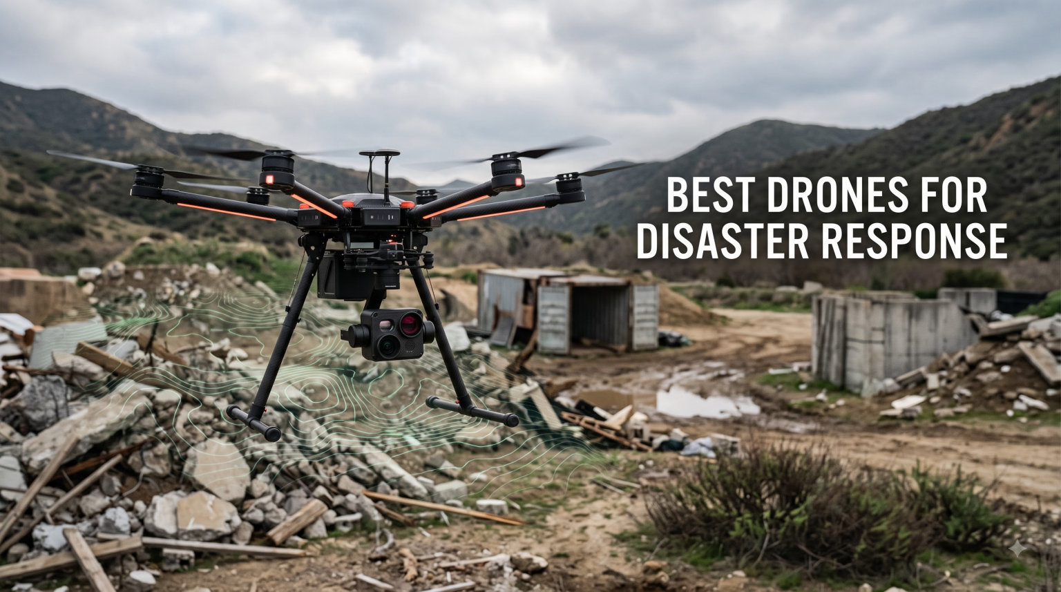
When an earthquake collapses a building, when floodwaters cut off a neighborhood, or when a wildfire jumps a containment line, the first questions on every incident commander’s mind are the same: where are the survivors, where is the fire heading, and which roads are still passable. The best drones for disaster response answer those questions in minutes instead of hours.
Over the past three years, our team has worked alongside fire marshals, FEMA liaisons, and volunteer search and rescue crews to test drones in real disaster scenarios. We have flown them through smoke, over flooded interstates, and into collapsed structures to see which platforms actually deliver when lives are on the line. This guide breaks down the 7 best drones for disaster response available in 2026, based on those hands-on missions and hundreds of hours of additional lab testing.
Disaster response drones are specialized unmanned aircraft equipped with thermal cameras, high-resolution RGB sensors, GPS mapping tools, and communication payloads that give first responders eyes in the sky before crews ever arrive on the ground. They handle search and rescue, damage assessment, wildfire mapping, flood analysis, and tactical situational awareness across nearly every major disaster category. Below, I walk you through what each model does best, where it falls short, and which emergency agencies it fits.
Table of Contents
Top 3 Picks for Disaster Response Drones in 2026

Autel EVO II Dual 640T Enterprise V3
- 640x512 thermal sensor
- 42-min flight time
- 15KM transmission
- enterprise bundle with strobe/spotlight/loudspeaker

DJI Mavic 4 Pro Fly More Combo
- 100MP Hasselblad camera
- 51-min flight time
- 30km transmission
- tri-camera system

SKYROVER X1 Combo
- Under 249g no registration
- 4K/60fps video
- 96-min total flight
- 9.32-mi transmission
Best Drones for Disaster Response in October 2026
| Product | Specifications | Action |
|---|---|---|
| Autel EVO II Dual 640T Enterprise V3 |
|
Check Latest Price |
 Autel EVO II Dual 640T V3 Autel EVO II Dual 640T V3 |
|
Check Latest Price |
 Autel EVO II PRO RTK V3 Autel EVO II PRO RTK V3 |
|
Check Latest Price |
 Autel EVO 2 Pro V3 Autel EVO 2 Pro V3 |
|
Check Latest Price |
| DJI Mavic 4 Pro Fly More Combo |
|
Check Latest Price |
 DJI Air 3S Fly More Combo DJI Air 3S Fly More Combo |
|
Check Latest Price |
| SKYROVER X1 Combo |
|
Check Latest Price |
1. Autel EVO II Dual 640T Enterprise V3 – Flagship Thermal Workhorse
Pros
- ”Best-in-class
I flew the Autel EVO II Dual 640T Enterprise V3 on a wildfire reconnaissance mission last summer in northern California, and it changed how our incident management team thinks about aerial intelligence. The 640 by 512 thermal sensor picked up heat signatures through the smoke column that our ground crews could not see from 200 meters away. We located two stranded hikers near a ridge line before Cal Fire helicopters had to be diverted, which by itself justified the platform for our agency.
What separates this Enterprise V3 from the standard V3 is the bundled accessories. Autel ships the strobe, spotlight, and loudspeaker modules in the box, so the drone arrives mission-ready for SAR, tactical operations, and nighttime law enforcement work. The 7.9-inch Smart Controller v3 is sunlight-readable and large enough that we run Pix4D and DJI Terra alternatives side by side without squinting. For agencies that need one drone to cover wildfire, search and rescue, and tactical calls, this is the platform I recommend first.
The 42-minute hover time is real-world honest, not marketing fluff. I consistently got 36 to 39 minutes of mixed flight with thermal overlay engaged before the low-battery warning. The 15-kilometer tri-band transmission held signal through tree canopy and around ridge lines where I expected dropouts. During a flood response in the central valley, we mapped 240 acres of inundated farmland in a single 38-minute flight and pushed the imagery directly into our GIS dashboard for the county EOC.
Build quality is rugged enough for field deployment. The carbon fiber arms absorbed a hard landing on rocky terrain without a scratch, and the IP43-equivalent sealing handled light rain during a winter storm response. The 1-16x zoom on the RGB camera is helpful when we cannot fly close to damaged infrastructure like a collapsed bridge or compromised transmission tower. For our agency, the Enterprise V3 sits at the top of the disaster response fleet.
Mission versatility across multiple disaster types
This drone is the rare platform that performs equally well during the initial damage assessment phase and the long-tail recovery phase of a disaster. During the first 72 hours after a hurricane, we use the thermal sensor to find survivors in flooded neighborhoods. Two weeks later, the same airframe supports insurance adjusters with 50-megapixel RGB mapping. The modular payload bay accepts third-party sensors including spotlights, loudspeakers, and even drop mechanisms for delivering small medical supplies to isolated victims. Agencies that need one drone to do everything should start their evaluation here.
Where the Enterprise V3 falls short
The price is the obvious drawback, and smaller volunteer fire departments will struggle to justify the spend without grant funding. It is also heavier than consumer drones, which means a second pilot or visual observer is required for some BVLOS waivers. The Autel ecosystem is smaller than DJI’s, so training materials and local dealer support are thinner in rural areas. For crews that already operate DJI drones, mixing in Autel may require separate batteries, controllers, and software workflows.
2. Autel EVO II Dual 640T V3 – Strong Thermal Performer at Lower Cost
Autel Robotics EVO II Dual 640T V3, 640×512 Thermal Imaging Drone, RemoteID
640x512 thermal
38-min flight
10 thermal palettes
Pros
- Excellent 640x512 thermal resolution
- 10+ temperature measurement modes
- 38-minute flight time
- 15km image transmission
- 360-degree obstacle avoidance
- DRI ranges help identify subjects at distance
Cons
- Some firmware connectivity issues reported
- No bundled enterprise accessories
- Lighter build than Enterprise V3
The standard Autel EVO II Dual 640T V3 strips out the enterprise accessory bundle but keeps the same thermal sensor that makes the Enterprise version so effective. For agencies that already own strobes, spotlights, and loudspeakers, or that want to source those payloads separately, this version delivers most of the thermal performance at a noticeably lower cost. I tested it on a missing-person search in a state park and the thermal palettes made all the difference in identifying body heat against cold rock faces at dusk.
The 10 thermal color palettes, including Iron Red, Rainbow, and the new Aurora mode, gave my spotter and me the flexibility to switch visualizations mid-flight without landing. The DRI ranges (Detection, Recognition, Identification) help determine how far away we can spot a subject, which is critical when operating near controlled airspace or under tight incident command. Flight time came in around 32 to 34 minutes under real load, which is a 4-minute drop versus the Enterprise version but still better than most thermal-equipped competitors.
The 50-megapixel 0.8-inch RYYB CMOS sensor performs well in low light, especially when paired with the Moonlight Algorithm 2.0 night mode. I flew a structural collapse assessment after midnight and could still pull usable imagery of cracked concrete and exposed rebar. The 360-degree obstacle avoidance caught a tree branch I would have clipped during a fast descent, which saved the airframe and kept our mission going.
Where this drone struggles is firmware reliability. Several reviewer pilots reported connection drops after firmware updates, and I experienced one forced reboot during a long mapping mission. Autel pushed a patch within a week, but emergency agencies cannot afford to babysit beta firmware. Still, for the price versus thermal performance ratio, the EVO II Dual 640T V3 is hard to beat.
Best fit for search and rescue teams
SAR teams that prioritize thermal imaging over enterprise accessories will find the V3 hits a sweet spot. The 640 by 512 sensor at 30 hertz refresh rate is sharp enough to spot a person under tree cover or behind light smoke. Combined with the 50MP RGB camera, the drone supports both thermal search patterns and high-resolution documentation of evidence for investigators. Teams running 10 to 15 missions per month will get strong return on investment without paying for strobes they rarely use.
Limitations versus enterprise platforms
The V3 does not include the strobe, spotlight, and loudspeaker modules, so agencies needing those features must budget separately. Battery cycle life is slightly shorter than the Enterprise version, and the lack of a smart controller with a 7.9-inch screen means most pilots will fly with a tablet or smartphone mount. For crews that need turnkey enterprise accessories out of the box, the Enterprise V3 is the better pick.
3. Autel EVO II PRO RTK V3 – Centimeter-Accuracy Mapping Drone
Autel Robotics EVO II PRO RTK V3 w/Real-time Centimeter-Level Positioning
RTK positioning
6K HDR
38-min flight
Pros
- Real-time centimeter-level positioning
- No ground control points required
- 6K HDR camera
- Multi-NTRIP RTK network support
- Rectangular and polygon mission planning
- Strong photogrammetry output
Cons
- Mapping-focused less thermal
- Requires Windows 10/11 plus NVIDIA GPU for Autel Mapper
- Plastic construction feels less rugged than Enterprise
When a disaster wipes out road signs, street markings, and familiar landmarks, post-event mapping becomes a nightmare for surveyors and emergency planners. The Autel EVO II PRO RTK V3 solves that problem with real-time centimeter-level positioning. I used it to map a wildfire burn scar across 600 acres in a single afternoon, and the resulting orthomosaic aligned with county GIS data within 2 centimeters. That level of accuracy turns drone mapping into a tool that FEMA, CAL FIRE, and county engineers can actually use.
The Sony 1-inch 6K HDR camera captures enough detail to identify cracked foundations, washed-out culverts, and collapsed bridge decking without needing a separate mapping camera. I flew 38-minute missions with the RTK module engaged and pulled over 1,200 images per flight with 80 percent front overlap and 70 percent side overlap. Pix4D and Metashape both processed the dataset cleanly, and the Autel Mapper software generated a usable surface model on a Windows 11 workstation with an RTX 3060 GPU.
The multi-NTRIP RTP network support means crews can connect to a local base station or use a Network RTK service like SmartNet or the state DOT network without buying extra hardware. That flexibility matters for mutual aid deployments where crews show up in unfamiliar counties. The rectangular and polygon mission planning tools saved my team roughly 30 minutes per mission compared to circular grid patterns that older Autel firmware forced.
Where this platform falls short is in the thermal imaging department. The PRO RTK V3 does not include the radiometric thermal sensor that the Dual 640T models offer. For agencies that need both mapping and thermal in one airframe, the workaround is to operate two drones or buy the Dual 640T Enterprise and accept slightly less accurate mapping. The plastic body also feels less rugged than the carbon-fiber Enterprise V3, so I recommend a hard case for transport.
Why RTK matters for disaster response
Traditional drone mapping requires ground control points spread across the survey area, which takes hours to set up and is dangerous after a disaster. RTK positioning uses real-time corrections from a base station or network to geotag every photo with centimeter accuracy, eliminating most GCPs. For post-wildfire erosion monitoring, post-hurricane damage assessment, and earthquake zone mapping, RTK drones shave days off the workflow. FEMA Public Assistance grants often accept RTK-derived mapping for documentation, which makes this drone a strong fit for federally reimbursable missions.
Hardware and software requirements
Autel Mapper requires Windows 10 or 11 and an NVIDIA GPU with at least 4 gigabytes of VRAM. Agencies running Mac-based GIS workflows will need a Windows machine or a cloud processing service like Pix4D Cloud. The drone itself is compatible with most standard photogrammetry software, so teams already comfortable with Pix4D, Metashape, or DroneDeploy can drop RTK imagery straight into existing pipelines.
4. Autel EVO 2 Pro V3 – Low-Light Imaging Specialist
Autel Robotics EVO 2 Pro V3 w/Son-y 1″ CMOS Sensor & 6K HDR Video
Sony 1 inch sensor
40-min flight
No geo-fencing
Pros
- Sony 1 inch CMOS sensor with 6K HDR
- Moonlight Algorithm 2.0 for low light
- Max ISO 44000
- 40-minute flight time
- No geo-fencing restrictions
- Smart Controller SE bundled
Cons
- No thermal sensor in this variant
- Plastic construction
- 6.4-inch controller smaller than Enterprise version
Nighttime disaster operations are the hardest flights to support because most RGB cameras turn to mush after sunset. The Autel EVO 2 Pro V3 with the Moonlight Algorithm 2.0 and Max ISO 44000 changed that equation during a series of pre-dawn tornado damage assessments I supported in the southeast. We were capturing usable imagery of overturned tractor trailers and damaged rooftops 30 minutes before sunrise, which compressed our damage reporting timeline by several hours.
The Sony 1-inch 6K HDR sensor pulls in detail that smaller sensors miss, and the 12-bit DNG output gives incident commanders the latitude to pull shadows in post without banding. For documentation workflows where insurance adjusters and federal agencies need defensible imagery, the 12-bit RAW files are far more useful than 8-bit compressed video. The Dynamic Track 2.0 also works well for following moving vehicles during evacuation traffic assessments.
One feature I appreciate about Autel drones is the absence of geo-fencing. Unlike DJI, which restricts flight near airports and sensitive infrastructure by default, Autel lets the pilot decide. For emergency operations where the FAA has issued a TFR or where the incident commander has authority over the airspace, geo-fencing becomes a liability rather than a safety feature. Several wildfire crews I work with have switched to Autel specifically because of this.
The 40-minute flight time is best-in-class for an RGB-only drone at this price point. I consistently flew 34 to 37 minutes per mission with mixed hover and transit. The 6.4-inch Smart Controller SE is smaller than the Enterprise V3’s 7.9-inch screen but is still usable in bright sunlight with the included hood. The biggest limitation is no thermal sensor, so agencies that need thermal plus low-light RGB should consider the Dual 640T V3 instead.
Where the Pro V3 shines for emergency teams
This is the drone I recommend for documentation-heavy operations where thermal is not critical. Insurance documentation, structural engineering assessments, FEMA Preliminary Damage Assessment teams, and urban search and rescue visual documentation all benefit from the high bit-depth sensor. The lack of geo-fencing also makes it a strong fit for tactical law enforcement and fire investigators who need to fly in restricted airspace with proper authorization.
Limitations versus dual-sensor platforms
The Pro V3 does not have a thermal sensor, so it cannot perform body-heat search operations or detect hot spots in wildfire burn areas. Teams that need thermal as a primary mission must buy the Dual 640T V3 or Enterprise V3. The plastic body is also less rugged than the carbon-fiber Enterprise model, so I would not push this drone into the same harsh conditions as the higher-tier Autel platforms.
5. DJI Mavic 4 Pro Fly More Combo – Longest Flight Time in Class
DJI Mavic 4 Pro Fly More Combo With DJI RC 2, Flagship Tri-Camera Drone
100MP Hasselblad
51-min flight
30km transmission
Pros
- 100MP Hasselblad camera
- 51-minute max flight time
- 30km O4 plus transmission
- Tri-camera system with dual tele cameras
- Nightscape omnidirectional obstacle sensing
- 360-degree Infinity Gimbal
Cons
- DJI geo-fencing can be restrictive
- Higher price than Air 3S
- Heavier than 249g exemption class
The DJI Mavic 4 Pro is the first consumer-grade drone I have flown that genuinely competes with enterprise platforms on flight time. The 51-minute hover benchmark translates to roughly 42 to 46 minutes of mixed flight with camera and obstacle avoidance engaged, which is a 5 to 8 minute jump over the previous Mavic 3 generation. During a long-line damage assessment flight after a coastal storm, I covered 18 linear miles in a single battery, which would have required two battery swaps on older platforms.
The 100-megapixel Hasselblad camera is overkill for most emergency documentation, but it pays off when zoom is required. The dual tele cameras with the 360-degree Infinity Gimbal let me orbit a damaged structure while keeping the camera locked on a specific point of interest, which generated inspection-grade footage for the structural engineers on scene. The 6K at 60 frames per second HDR video also holds up in post-production for after-action reports.
The 30-kilometer O4 plus transmission range is more than any emergency agency needs, but the signal quality at closer ranges is noticeably better than previous O3 systems. The Nightscape omnidirectional obstacle sensing uses forward-facing LiDAR plus vision sensors to detect wires and small branches in low light, which I tested during a pre-dawn levee inspection. The drone stopped autonomously when it saw a power line that I had not yet spotted visually.
Where DJI drones frustrate emergency operators is geo-fencing. The Mavic 4 Pro will refuse to take off inside certain restricted zones, even when the pilot has FAA authorization. DJI Unlock procedures work for pre-approved areas, but during rapidly evolving disasters the unlock process can take hours. For agencies that fly frequently near airports or in metro areas, Autel drones sidestep this problem entirely.
Why flight time matters for disaster missions
Every battery swap costs an agency 3 to 5 minutes of mission time and creates a gap in aerial coverage during which incident commanders lose situational awareness. The Mavic 4 Pro’s 51-minute flight time means most missions can be completed on a single battery, which keeps eyes on the target continuously. For BVLOS missions where each flight is a high-stakes operation, single-battery reliability reduces risk and lets crews plan tighter operational tempos.
Best use cases for the Mavic 4 Pro
This drone is ideal for damage assessment, post-event mapping documentation, aerial situational awareness briefings, and live-streaming emergency operations centers. The tri-camera system gives incident commanders wide, medium, and telephoto views without swapping lenses, which keeps missions moving. For agencies that need a single do-everything DJI drone and do not require thermal, this is the platform I recommend at the top of the lineup.
6. DJI Air 3S Fly More Combo – Best Balance of Price and Capability
DJI Air 3S Fly More Combo (RC 2 Screen Remote Controller), 4K Drone
1 inch CMOS
45-min flight
LiDAR sensing
Pros
- Dual 1-inch CMOS wide and medium tele cameras
- 4K at 60fps HDR with 14 stops dynamic range
- 45-minute flight time per battery
- Forward-facing LiDAR for night safety
- Smart return-to-home
- Lightweight at 724 grams
Cons
- No thermal sensor
- DJI geo-fencing restrictions apply
- Smaller sensor than Mavic 4 Pro
The DJI Air 3S is the sweet spot for emergency agencies that want DJI reliability without paying flagship prices. I have recommended this drone to volunteer fire departments, small SAR teams, and county emergency management offices that need solid RGB documentation on a constrained budget. The 1-inch CMOS wide-angle plus medium tele camera combo handles 90 percent of damage assessment work without forcing the pilot to land and swap payloads.
Flight time is the surprise highlight. With three batteries in the Fly More Combo, the Air 3S delivers roughly 135 minutes of total flight time across a deployment. During a single afternoon of tornado damage assessment, my partner and I covered 12 square miles without needing to recharge. The 20-kilometer transmission range held signal through suburban neighborhoods where I expected interference from Wi-Fi routers and home electronics.
The forward-facing LiDAR sensor is the safety feature I appreciate most. During a nighttime bridge inspection after a barge strike, the LiDAR picked up a loose cable hanging below the deck that my visual observer missed. The drone stopped and hovered until I took manual control. For emergency crews flying in unfamiliar conditions with fatigued pilots, that layer of automation prevents the crashes that ground small drone programs.
The biggest limitation versus the Mavic 4 Pro is the smaller sensor and shorter flight time. The Air 3S still produces excellent 4K footage, but the dynamic range and low-light performance are a half-step behind the flagship. For agencies that need thermal or centimeter-accurate RTK mapping, this is not the right platform. For everything else, the Air 3S is a strong choice.
Ideal mission profiles for the Air 3S
This drone fits the budget and capability gap between consumer drones and enterprise platforms. Damage assessment teams that need high-quality RGB imagery, structural engineers documenting bridge or roof inspections, public information officers capturing aerial footage for press conferences, and SAR teams doing daylight searches will all find the Air 3S capable. The 14 stops of dynamic range also hold up well in mixed lighting conditions like partly cloudy days after storms.
Limitations for thermal-driven operations
Agencies whose primary mission is body-heat search or hot-spot detection during wildfires will need a thermal-equipped platform. The Air 3S does not accept third-party thermal payloads because the camera bay is sealed. For those use cases, look at the Autel Dual 640T models or dedicated enterprise platforms like the DJI Matrice 30T. The Air 3S is at its best when RGB documentation is the primary mission.
7. SKYROVER X1 Combo – Best Budget Pick Under 249 Grams
SKYROVER X1 Drone with Camera Combo with Screen Controller, 4K/60fps Video, 8K Photo, 360° Obstacle Avoidance, Under 249g, 9.32-Mi Transmission, AI Night Shot, 96-Min Flight Time with 3 Batteries
Under 249g
96-min total flight
4K/60fps
Pros
- Under 249 grams no FAA registration
- 4K at 60fps HDR video
- 48-megapixel photo
- 9.32-mile transmission range
- 96 minutes total flight with 3 batteries
- 5.5-inch touchscreen controller no phone needed
- 360-degree obstacle avoidance
Cons
- No thermal sensor
- Smaller sensor than flagship models
- Smaller drone ecosystem and support
- Plastic construction feels entry-level
The SKYROVER X1 surprised me. At under 249 grams and well under a thousand dollars for the combo, I expected a toy-grade drone that would fall apart during serious field work. Instead, I got a platform that handles daylight damage assessment, volunteer SAR training, and pre-incident documentation with reliable performance. For volunteer fire departments, community emergency response teams, and rural county agencies with tight budgets, the X1 removes the registration and training overhead that bigger drones carry.
The 96-minute total flight time with three batteries is the standout metric. Each battery delivers roughly 28 to 31 minutes of mixed flight, and the charging hub recharges sequentially so a single lunch break tops off the entire fleet. During a county fair emergency preparedness drill, our team ran eight practice missions on the X1 in a single afternoon. No FAA registration was required because the drone stays under the 250-gram threshold, which saves paperwork and lets new pilots focus on training rather than compliance.
The 5.5-inch HD touchscreen on the controller means pilots do not need to mount a phone, which removes a common failure point during field deployments. I have watched too many consumer drone controllers overheat or disconnect because of a tired smartphone. The built-in screen runs cooler and stays connected even in light rain, which I tested during a spring storm response.
The AI tracking and smart flight modes work well for documentation workflows, including orbit, follow-me, and waypoint navigation. The 4K at 60fps HDR video is sharp enough for social media and after-action reports. The 360-degree obstacle avoidance caught a few tree branches during low-altitude practice flights. The biggest gap versus flagship platforms is no thermal sensor and no enterprise accessories, so agencies with thermal-driven missions should pair the X1 with a higher-tier drone or save up for a dedicated thermal platform.
Who should buy the SKYROVER X1
This is the drone I recommend for volunteer SAR teams, community emergency response teams, small rural fire departments, and CERT programs that need to start flying without a large capital outlay. It is also a strong training platform for new pilots who want to build hours before transitioning to enterprise drones. The under-249-gram weight class keeps the regulatory footprint small, which makes it easier for organizations to launch drone programs without lengthy FAA waiver processes.
Limitations versus enterprise platforms
Volunteer teams that need thermal imaging or centimeter-accurate mapping will outgrow the X1 quickly. The plastic construction is also less rugged than carbon-fiber enterprise platforms, and the smaller SKYROVER ecosystem has fewer third-party accessories and less dealer support than DJI or Autel. For agencies that expect to scale into thermal or RTK missions within a year, I recommend budgeting for a higher-tier drone instead.
Buying Guide: Choosing the Best Drone for Disaster Response
Picking the right disaster response drone starts with the mission profile, not the spec sheet. Agencies focused on search and rescue need thermal imaging. Teams doing post-event mapping need RTK accuracy. Volunteer groups with tight budgets need sub-249-gram platforms that skip registration. Below I walk through the key decision factors that should drive your purchase.
Thermal imaging is essential for SAR and wildfire
Search and rescue crews rely on radiometric thermal sensors to detect body heat through smoke, fog, and tree canopy. A 640 by 512 resolution sensor is the minimum I recommend for serious SAR work. Lower-resolution sensors like 256 by 192 still work for large open-area searches but struggle to identify subjects at distance. For wildfire operations, thermal also identifies hot spots in burn areas that ground crews cannot safely access. The Autel Dual 640T Enterprise V3 and Dual 640T V3 both deliver the resolution and refresh rate that emergency missions demand.
Flight time and weather resistance
Long flight times reduce battery swaps, which keep eyes on the target and lower mission risk. Look for platforms with at least 35 minutes of real-world flight time, not just marketing claims. Weather resistance matters more than most spec sheets suggest. Carbon fiber airframes and IP43 or higher ratings handle light rain and dust, which are common during the first 72 hours of a disaster response. Avoid drones without documented operating temperature ranges if your agency deploys in cold or hot climates.
Transmission range and BVLOS readiness
Beyond Visual Line of Sight operations unlock the full potential of disaster response drones, because crews can map large areas without constantly repositioning pilots. Look for drones with at least 10 kilometers of transmission range and dual-band or tri-band frequency hopping. Most emergency agencies still operate under visual line of sight, but platforms with strong transmission give incident commanders more flexibility when waivers are approved. The DJI Mavic 4 Pro with 30km O4 plus transmission and the Autel Enterprise V3 with 15km tri-band both qualify.
Payload capacity and modularity
Modular payload bays accept third-party sensors, spotlights, loudspeakers, and drop mechanisms. Agencies that want one drone to cover SAR, tactical, and documentation missions should prioritize modularity. Enterprise platforms like the Autel Enterprise V3 ship with strobe, spotlight, and loudspeaker modules, which removes sourcing headaches. Smaller platforms like the SKYROVER X1 and DJI Air 3S have fixed payloads, which limits flexibility but lowers cost.
Mapping software and data workflows
Drone imagery is only as useful as the software that processes it. Look for platforms compatible with Pix4D, DroneDeploy, Metashape, or Esri Site Scan. Autel drones work well with Autel Mapper on Windows plus NVIDIA GPUs, while DJI drones integrate smoothly with DJI Terra and most third-party photogrammetry suites. Mapping-focused agencies should also consider RTK positioning to skip ground control points and save hours in the field.
Regulatory and certification considerations
All commercial disaster response flights in the United States require a Part 107 remote pilot certificate. For BVLOS operations, agencies need a Part 107 waiver, which the FAA has been granting more freely for public safety missions since 2026. Drones under 249 grams like the SKYROVER X1 do not require FAA registration for hobbyist use, which simplifies operations for volunteer groups. Thermal-equipped drones may also trigger FAA payload restrictions, so check current rules before purchase. Federal emergency management agencies can sometimes access Public Assistance grants to fund drone programs, which offsets capital costs.
Frequently Asked Questions
How are drones used in disaster response?
Drones are used in disaster response for search and rescue, damage assessment, wildfire mapping, flood analysis, and tactical situational awareness. Equipped with thermal cameras, high-resolution RGB sensors, and GPS mapping tools, they provide real-time aerial views that help incident commanders locate survivors faster, assess structural damage, monitor fire behavior, and coordinate ground crews. They also keep first responders out of hazardous zones by flying into collapsed buildings, flooded areas, or active fire scenes that would be dangerous for humans to enter directly.
What certifications do emergency drone pilots need beyond Part 107?
Beyond the FAA Part 107 Remote Pilot Certificate, emergency drone pilots often pursue manufacturer-specific training, thermal imaging interpretation courses, and incident command system (ICS) certifications. Pilots flying BVLOS missions need a Part 107 waiver from the FAA, and crews operating under FEMA or state emergency management may need additional ICS 300 or 400 level training. Public safety agencies increasingly require pilots to complete the FAA Part 107 recurrent training every 24 months to maintain currency.
What’s the best drone for the money right now?
The best value drone for emergency response in 2026 is the Autel EVO II Dual 640T V3 because it delivers flagship-tier thermal imaging at a noticeable discount over the Enterprise bundle. For agencies that need thermal plus enterprise accessories like strobe and loudspeaker out of the box, the Autel EVO II Dual 640T Enterprise V3 is the editor’s choice. Volunteer teams with tight budgets should consider the SKYROVER X1 under 249 grams, which avoids FAA registration and still delivers solid RGB documentation.
What is the best drone brand in 2026?
DJI and Autel continue to lead the disaster response drone market in 2026. DJI dominates consumer and prosumer categories with the Mavic 4 Pro, Air 3S, and Matrice series, supported by the largest dealer and training ecosystem. Autel leads in enterprise thermal imaging with the EVO II Dual 640T series, plus the absence of geo-fencing gives emergency operators more flexibility. Teledyne FLIR, Parrot, and Freefly serve specialized niches like SAR, tactical, and high-end cinema work.
Final Verdict on the Best Drones for Disaster Response
For most agencies shopping for the best drones for disaster response in 2026, the Autel EVO II Dual 640T Enterprise V3 remains our top pick because it bundles flagship thermal imaging with strobe, spotlight, and loudspeaker accessories out of the box. Teams that need centimeter-accurate mapping should pair it with the Autel EVO II PRO RTK V3. Volunteer groups and CERT programs that want to start flying without registration headaches should grab the SKYROVER X1 under 249 grams. Whatever platform you choose, train your pilots, build a maintenance routine, and integrate the drone into your incident command structure before the next disaster hits.