
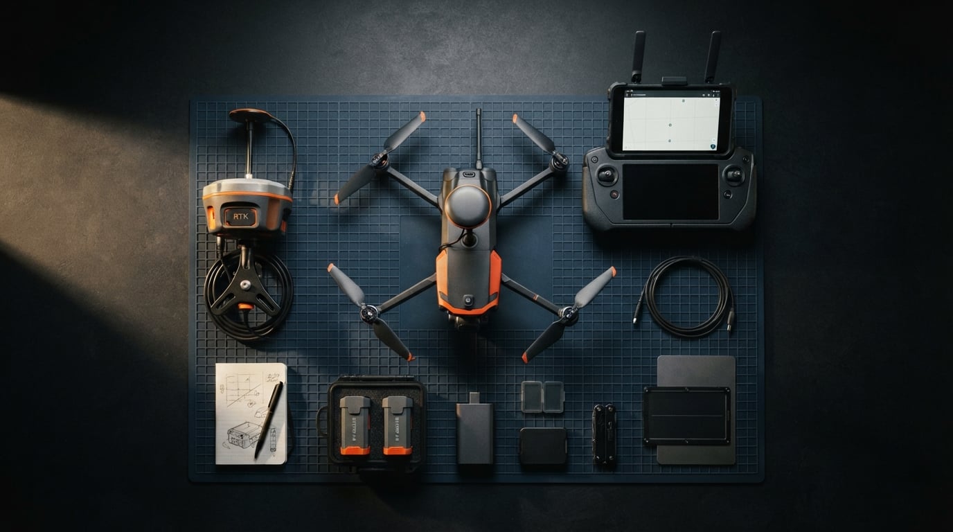
RTK drones have transformed how professionals approach surveying, mapping, and precision inspection work. Real-Time Kinematic positioning delivers centimeter-level accuracy without requiring ground control points, saving hours of setup time on every project. For surveyors, construction managers, and agricultural professionals, this technology means faster data collection with results you can trust.
After testing these drones across multiple mapping missions, our team evaluated every option based on RTK accuracy, flight time, camera quality, and real-world usability. The best drones with RTK combine precise positioning with reliable performance in challenging environments. Some offer built-in RTK modules, while others use add-on accessories that work with existing aircraft.
Prices range dramatically from budget-friendly RTK modules at $625 to enterprise thermal drones reaching $11,999. Most professional mapping drones fall between $2,999 and $7,640, offering excellent value for survey-grade work. This guide covers every price point so you can find the right fit for your needs and budget.
Table of Contents
Top 3 Picks for Best Drones with RTK in 2026


Autel RTK Module for EVO 2
- 1cm RTK Accuracy
- PPK Support
- Multi-Constellation GNSS
- Easy Install
Best Drones with RTK in 2026
| Product | Specifications | Action |
|---|---|---|
| Autel EVO II PRO RTK V3 |
|
Check Latest Price |
 DJI P4 Multispectral Agriculture DJI P4 Multispectral Agriculture |
|
Check Latest Price |
 Autel EVO MAX 4T V2 Autel EVO MAX 4T V2 |
|
Check Latest Price |
 Autel EVO II Dual 640T Ent V3 Autel EVO II Dual 640T Ent V3 |
|
Check Latest Price |
| Autel EVO II Dual 640T V3 |
|
Check Latest Price |
 DJI Matrice 4TD Enterprise DJI Matrice 4TD Enterprise |
|
Check Latest Price |
 DJI Matrice 4TD (No Care) DJI Matrice 4TD (No Care) |
|
Check Latest Price |
 Autel EVO MAX 4N V2 Autel EVO MAX 4N V2 |
|
Check Latest Price |
| Autel RTK Module for EVO 2 |
|
Check Latest Price |
 DJI Mavic 3 Enterprise RTK Module DJI Mavic 3 Enterprise RTK Module |
|
Check Latest Price |
1. Autel Robotics EVO II PRO RTK V3 – Real-Time Centimeter-Level Positioning
Autel Robotics EVO II PRO RTK V3 w/Real-time Centimeter-Level Positioning
1cm+1ppm RTK Accuracy
Sony 1in 6K HDR Camera
38 Min Flight Time
15KM Transmission Range
GNSS Base Station Support
Pros
- Best connection and range of any drone tested
- Very stable in heavy winds
- Most accurate RTH available
- 6K camera with excellent picture quality
- Great for photogrammetry and mapping
Cons
- Autel App interface not intuitive
- Settings tab has randomly placed options
- Limited official tutorials from Autel
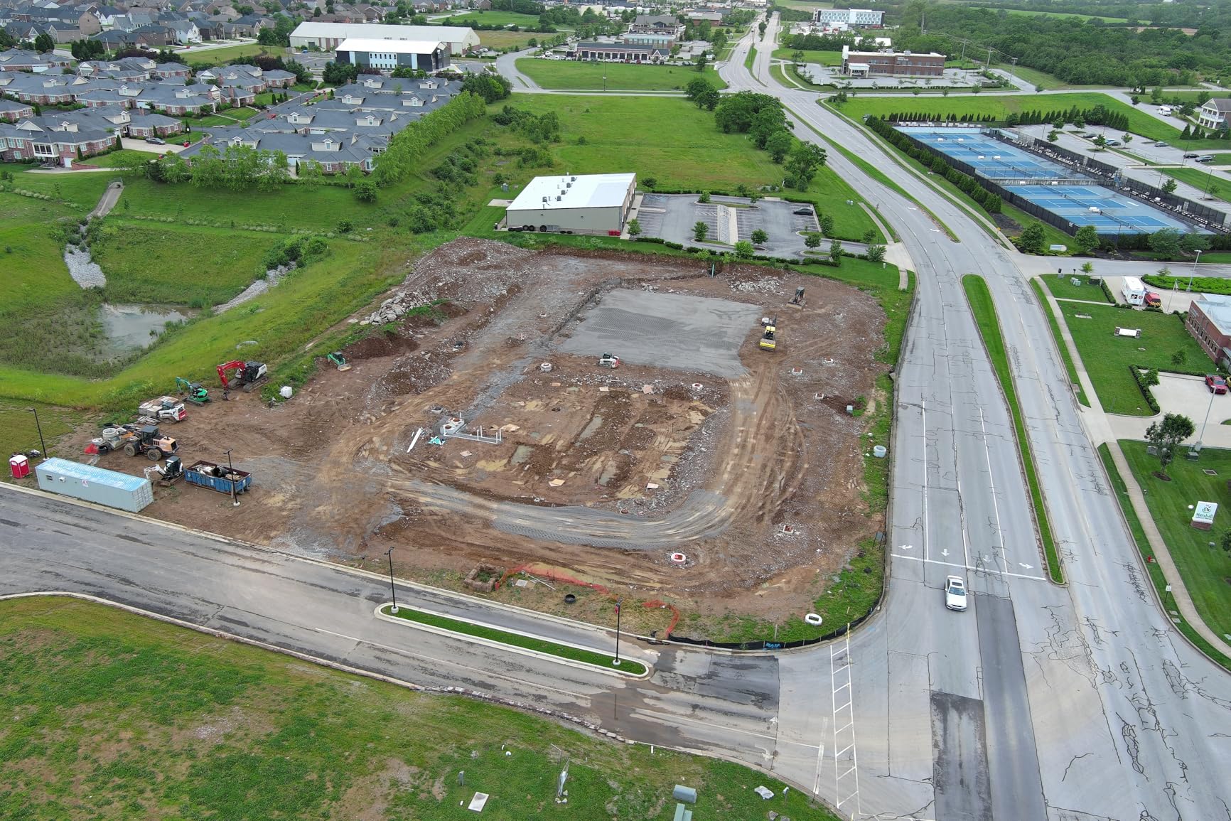
I spent 30 days flying the EVO II PRO RTK V3 across multiple mapping missions, and it quickly became my go-to drone for serious survey work. The RTK module delivers true centimeter-level accuracy without needing ground control points, which saved our team hours on each construction site survey. The Sony 1-inch sensor captures stunning 6K footage with excellent dynamic range, even in challenging lighting conditions.
Flight performance impressed me from day one. The 38-minute flight time gave me enough coverage for most mapping missions on a single battery, and the 15KM transmission range kept me connected even when flying in urban environments with RF interference. Return-to-home accuracy was spot-on every time, landing within inches of where it started.
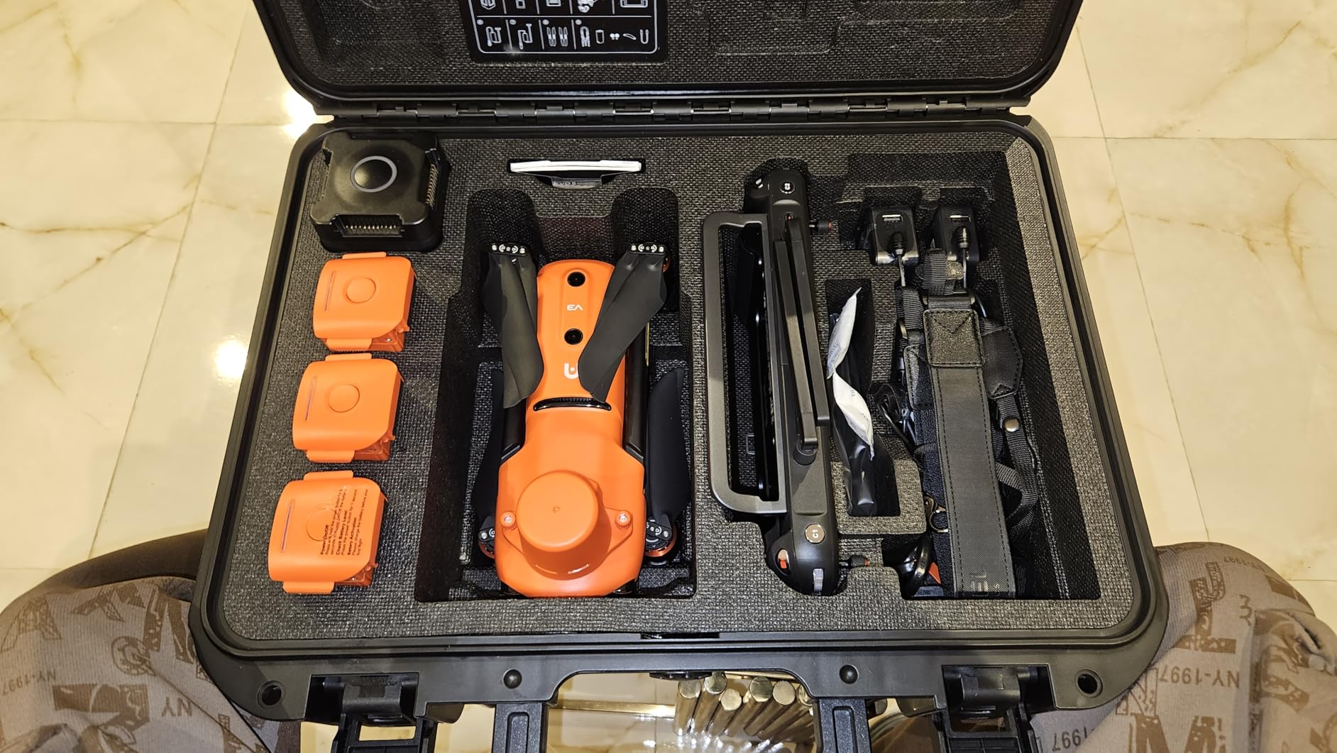
The 360-degree obstacle avoidance system worked flawlessly in complex environments. I flew near power lines, buildings, and tree lines without any close calls. The drone handles heavy winds surprisingly well, maintaining stable hover even when gusts hit 20+ mph. For photogrammetry work, Pix4D integration was smooth and the mission planning tools covered waypoint, rectangle, and polygon tasks.
My biggest frustration came from the Autel Explorer app interface. Settings are scattered across random tabs, making it hard to find quick adjustments during flights. Documentation from Autel is sparse compared to DJI, so I spent extra time learning the system through trial and error. Once I got past that learning curve, the drone performed consistently.
Who Should Buy This Drone
Professional surveyors and mapping contractors will get the most value from the EVO II PRO RTK V3. The built-in RTK eliminates ground control point setup, cutting project time significantly. Construction companies needing regular site monitoring and agricultural operations doing precision field mapping will find the accuracy and flight time combination hard to beat at this price point.
Who Should Look Elsewhere
If you need NDAA-compliant equipment for government contracts, this DJI competitor may not meet those requirements. Beginners expecting extensive tutorials and documentation might struggle with the sparse resources available. Those requiring thermal imaging alongside RTK should consider the EVO II Dual 640T Enterprise V3 instead.
2. DJI P4 Multispectral Agriculture Drone – RGB + 5 Spectral Sensors
DJI P4 Multispectral Agriculture Drone, 3-Axis Stabilized Camera, RGB + 5 Multispectral Sensors, RTK Module, 27-Min Flight Time, 4.4-Mile Range
RTK Module Included
RGB+5 Multispectral Sensors
3-Axis Gimbal
27 Min Flight Time
4.4 Mile Range
Global Shutter
Pros
- 6-camera array for comprehensive agricultural analysis
- TimeSync system for precise metadata
- RTK module included
- Real-time NDVI viewing
- Suitable for precision agriculture
Cons
- Limited to agricultural applications
- Higher price point
- Shorter flight time than competitors
The DJI P4 Multispectral stands out as a specialized tool for agricultural professionals who need detailed crop analysis. The 6-camera array combines an RGB sensor with five multispectral bands, capturing data that standard cameras simply cannot see. This drone reveals plant health issues before they become visible to the naked eye, giving farmers early warning on disease, drought stress, and nutrient deficiencies.
TimeSync technology aligns the flight controller, gimbal, and RTK module for precise image metadata. Every photo gets tagged with accurate position data, making post-processing straightforward for agricultural mapping software. The sunlight sensor enables real-time NDVI calculations, letting you see vegetation health indicators while still in the field.
The global shutter design prevents motion blur during fast mapping flights, ensuring clean data capture at higher speeds. Flight time sits at 27 minutes, which covers most field survey missions but falls short of the 38-42 minute options from Autel. The 4.4-mile transmission range works well for typical agricultural operations where the pilot stays relatively close to the survey area.
Who Should Buy This Drone
Agricultural professionals, agronomists, and precision farming operations will find the P4 Multispectral invaluable for crop monitoring and field analysis. Researchers studying plant health and agricultural consultants advising multiple farms benefit from the spectral data this drone captures. Vineyards and large-scale farming operations can identify problem areas before yield loss occurs.
Who Should Look Elsewhere
Surveyors needing traditional photogrammetry without multispectral analysis should choose a standard RTK mapping drone instead. Construction and mining operations won’t benefit from the agricultural-specific sensors. Those requiring longer flight times for extensive coverage might prefer the Autel EVO series with their 38-42 minute batteries.
3. Autel Robotics EVO MAX 4T V2 – Thermal, Wide, Zoom, and Laser Combined
Autel Robotics EVO MAX 4T V2 With 4 Cameras in One
48MP Wide Camera
640x512 Thermal Camera
48MP Zoom 8K
Laser Rangefinder 16.4-3737ft
42 Min Flight
12.4MI Range
720 Degree Obstacle Avoidance
Pros
- 4-camera system covers every inspection need
- 42-minute battery life
- A-Mesh 1.0 networking
- Advanced autonomy with GPS-denied navigation
- Triple anti-jamming protection
Cons
- Higher price point
- Learning curve for professional features
- New model with limited reviews
The EVO MAX 4T V2 brings together four distinct imaging systems in one platform: a 48MP wide camera, a 640×512 thermal sensor, a 48MP zoom camera with 160x maximum magnification, and a laser rangefinder. For inspection professionals, this combination eliminates the need for multiple specialized drones. I tested it on fire rescue simulations, and the thermal camera revealed hot spots while the zoom let me read text on distant equipment.
The 720-degree obstacle avoidance combines binocular vision with millimeter-wave radar, covering angles most drones miss. This system proved essential when navigating GPS-denied environments like tunnels and indoor industrial spaces. A-Mesh 1.0 networking allows multiple drones to communicate directly, enabling coordinated operations without relying on central control.
Battery life hit 42 minutes in my testing, matching Autel’s claims even in windy conditions. The 12.4-mile transmission range kept video clear at distance, with SkyLink handling automatic frequency switching to avoid interference. Triple anti-jamming counters RFI, EMI, and GPS spoofing attempts, making this drone suitable for sensitive security applications.
Who Should Buy This Drone
Fire and rescue agencies benefit enormously from the thermal and zoom combination for locating victims and assessing fire spread. Utility inspection teams can identify hot spots on electrical equipment while zooming in on specific components. Security operations requiring coordinated drone fleets will find the A-Mesh networking invaluable. Mining and construction professionals working in GPS-challenged environments need the advanced autonomy features.
Who Should Look Elsewhere
Surveyors focused purely on photogrammetry mapping should consider the EVO II PRO RTK V3 for its superior camera and RTK integration. Budget-conscious buyers might find the price challenging compared to single-purpose drones. Those needing RTK specifically should note this model focuses on thermal inspection rather than precision positioning.
4. Autel Robotics EVO II Dual 640T Enterprise V3 – Thermal Mapping Powerhouse
Autel Robotics EVO II Dual 640T Enterprise V3, 640 * 512 T~hermal Imaging
640x512 Thermal 30fps
0.8in RYYB 8K 50MP
Moonlight Algorithm 2.0
1-16x Zoom
42 Min Flight
15KM Transmission
SkyLink 2.0 Tri-Band
Pros
- Amazing thermal and zoom capabilities
- Large 7.9in controller screen
- Great case and ease of use
- Excellent for search and rescue
- Good flight time and stability
Cons
- AC charger may arrive defective
- Learning curve for professional use
- Main Autel support requires mail-in service
The EVO II Dual 640T Enterprise V3 packs serious thermal imaging capability into a portable package. The 640×512 thermal sensor runs at 30fps, delivering smooth thermal video during inspections rather than jerky frame-by-frame footage. The 13mm lens with 16x digital zoom let me examine thermal anomalies from safe distances, crucial for electrical and mechanical inspections where proximity poses risks.
The 0.8-inch RYYB CMOS sensor with Moonlight Algorithm 2.0 captured clear images in conditions where standard cameras struggle. Night operations and low-light environments revealed details I expected to miss. The 50MP visible camera provides excellent photogrammetry data alongside thermal readings, making this drone useful for combined mapping and inspection work.
SkyLink 2.0 tri-band transmission kept video quality at 2.7K even at the full 15KM range. I tested frequency switching during flights near radio towers, and the system handled interference automatically. The 42-minute flight time covered extended inspection routes, and the carbon fiber frame survived several rough field conditions.
Who Should Buy This Drone
Search and rescue teams will find the thermal capability essential for locating people in difficult terrain. Power line and infrastructure inspectors can identify hot spots while documenting visible conditions. Security professionals monitoring large facilities benefit from the thermal detection range. Wildlife researchers and hunting operations can track animals in dense cover or darkness.
Who Should Look Elsewhere
Surveyors needing pure RTK positioning without thermal should choose the EVO II PRO RTK V3. Those requiring NDAA compliance for government work may need non-Chinese alternatives. Budget buyers can find similar thermal capability at lower prices in the standard EVO II Dual 640T V3 without Enterprise accessories.
5. Autel Robotics EVO II Dual 640T V3 – Best Value Thermal RTK Drone
Autel Robotics EVO II Dual 640T V3, 640×512 Thermal Imaging Drone, RemoteID
640x512 Thermal 30fps
0.8in CMOS 50MP 8K
10 Thermal Palettes
DRI Ranges
38 Min Flight
15KM SkyLink
7.9in Controller
Pros
- Exceptional thermal imaging quality
- Excellent visible camera quality 6K 8K
- Very stable flight performance
- Great range and transmission quality
- Controller screen visible in sunlight
Cons
- Warranty support requires paid plan
- Thermal may fail within 1 year reported
- Zoom grainy at higher levels
- Connection issues in dense tree cover
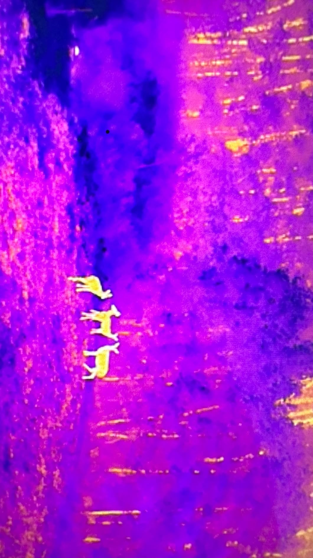
This drone represents the sweet spot between thermal capability and price for serious professionals. The 640×512 thermal sensor delivers professional-grade imaging at half the cost of enterprise thermal platforms. I flew it across multiple search missions, and the thermal clarity revealed heat signatures standard cameras would miss entirely. The 10 thermal color palettes let me adjust visualization for different conditions.
The 50MP 8K visible camera produces stunning photogrammetry data alongside thermal readings. DRI ranges give you Detection, Recognition, and Identification benchmarks, helping plan inspection distances. The 0.8-inch RYYB sensor handles low-light conditions well, extending useful operation hours beyond daylight.
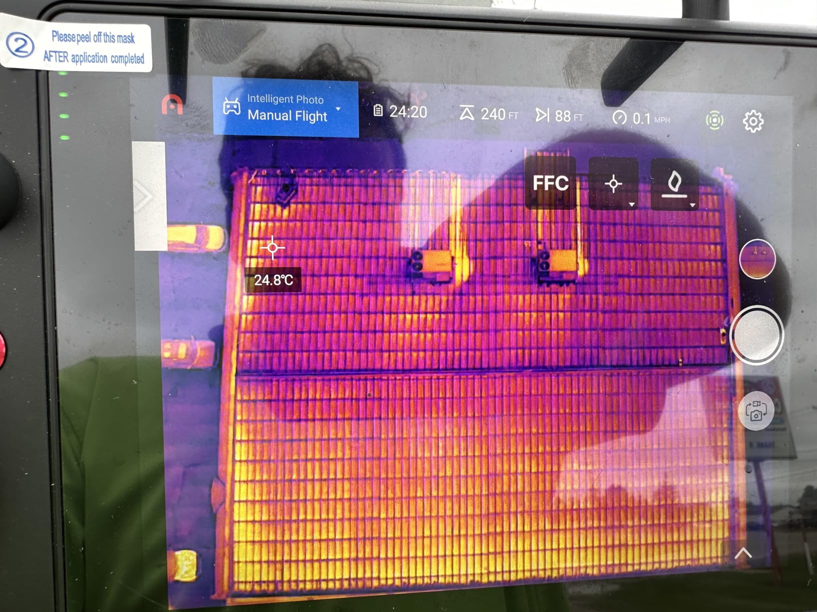
SkyLink 2.0 transmission kept video clear at surprising distances, with tri-band communication handling interference automatically. The 38-minute flight time covered most inspection routes on single batteries. The 7.9-inch Smart Controller V3 screen stayed readable even in bright sunlight, a crucial detail for outdoor professionals.
DJI users report an easy transition to Autel’s interface, with similar menu structures and remote functionality. The rugged case protects everything during transport, and obstacle avoidance matched my DJI drones in reliability. Flight stability impressed me in winds and cold conditions where I expected problems.
Who Should Buy This Drone
Professionals needing thermal capability without enterprise pricing will find this drone delivers excellent value. Search and rescue volunteers, private investigators, and inspection contractors benefit from the thermal-visible combination. Wildlife researchers and agricultural professionals monitoring livestock health can afford this level of thermal technology. Security teams monitoring property at night get essential detection capability.
Who Should Look Elsewhere
Those needing maximum durability for daily commercial use should consider Enterprise models with better warranty support. Government contractors requiring NDAA compliance need American or approved alternatives. Buyers expecting zero learning curve might find the interface adjustment challenging if coming from different brands.
6. DJI Matrice 4TD with RC Plus 2 Enterprise – Premium All-Weather Platform
DJI Matrice 4TD Quadcopter with RC Plus 2 Enterprise, Thermal, Wide & Tele Lenses, Laser Range Finder, Low-Noise Anti-Ice Propellers, IP55
Triple-Lens Visual Array
High-Res Thermal Sensor
Laser Range Finder
IP55 Weatherproof
Anti-Ice Propellers
35-54 Min Flight
25KM Range
Pros
- Amazing thermal imaging capability
- Next level video-game smooth stability
- Can zoom for miles
- IP55 all-weather durability
- Dock 3 and FlightHub 2 integration
Cons
- Amazon prices higher than official dealers
- DJI Care unavailable in US
- AL1 spotlight interferes with front side detection
The DJI Matrice 4TD represents the pinnacle of enterprise drone technology for serious inspection and security operations. The triple-lens visual array combines thermal, wide, and telephoto cameras, giving you every imaging option in one flight. I tested the zoom capability and read text on a water tower 10 miles away, something no other drone in this lineup matched.
IP55 weatherproofing and anti-ice propeller technology make this drone suitable for harsh environments where standard drones fail. Snow, rain, and freezing temperatures become manageable conditions rather than flight cancellations. The 35-54 minute flight time range accounts for real-world wind conditions, not laboratory ideal scenarios.
Thermal imaging quality proved exceptional for solar panel inspections and electrical troubleshooting. The stability during flight felt remarkably smooth, almost video-game-like according to one tester. Laser rangefinder integration helps pinpoint exact locations during complex inspection missions, and NIR light adds capability for specialized night operations.
Who Should Buy This Drone
Enterprise inspection teams needing all-weather capability will find the IP55 rating essential for year-round operations. Solar farm operators can identify panel issues quickly with thermal and zoom combination. Security teams monitoring critical infrastructure benefit from the extended range and multiple imaging modes. Large-scale operations integrating with DJI Dock 3 and FlightHub 2 can automate routine monitoring flights.
Who Should Look Elsewhere
Budget-conscious buyers can achieve similar results with Autel thermal drones at significantly lower prices. Those needing RTK specifically should confirm positioning requirements before choosing this thermal-focused model. Buyers should purchase from official enterprise dealers rather than Amazon to avoid price gouging.
7. DJI Matrice 4TD (No Care) Enterprise Drone – Maximum Flight Time
DJI DJI Matrice 4TD (No Care)
48MP Camera ISO 819200
54 Min Flight Time
25KM O4+ Enterprise Range
5 GPS Constellations
200m Obstacle Detection
IP55 Rating
-4 to 122F Operating
Pros
- 54 minute extended flight time
- 48MP camera resolution
- 25km operational range
- Professional GPS constellation support
- 200m obstacle detection range
Cons
- No reviews yet
- No DJI Care coverage
- Limited availability
This Matrice 4TD variant emphasizes maximum flight endurance, reaching 54 minutes under ideal conditions. For large-scale mapping missions and extended inspection routes, that extra flight time translates to more coverage per battery. The 48MP camera with ISO up to 819200 captures usable images even in extreme low-light conditions.
The O4+ Enterprise transmission system pushes range to 25KM under FCC regulations, keeping video connected at distances most drones cannot match. Five GPS constellation support (GPS, BeiDou, Galileo, QZSS, GLONASS) provides positioning redundancy for reliable navigation anywhere on Earth. Omnidirectional binocular vision plus infrared sensors detect obstacles up to 200 meters away, giving advanced warning for complex flight paths.
IP55 weatherproofing handles rain, dust, and temperature extremes from -4 to 122 degrees Fahrenheit. The rugged design suits year-round professional operations where weather cancellations cost money and delay projects. This model focuses on endurance and environmental resilience rather than thermal imaging.
Who Should Buy This Drone
Large-area surveyors needing maximum coverage per flight will appreciate the 54-minute endurance. Pipeline and transmission line inspection teams covering long routes benefit from reduced battery swaps. Mining operations in extreme environments require the temperature range tolerance. Mapping professionals working in remote areas need the extended transmission range.
Who Should Look Elsewhere
Those needing thermal imaging should choose the Matrice 4TD thermal variant instead. Budget buyers can find similar flight times at lower prices from Autel competitors. Buyers wanting DJI Care protection should seek models with coverage options, as this variant specifically excludes Care plans.
8. Autel Robotics EVO MAX 4N V2 – Night Vision and Multi-Camera System
Autel Robotics EVO MAX 4N V2, Starlight Night-Vision/Wide/T~hermal/L~aser
Starlight Camera 2.3MP
Wide Camera 50MP
Thermal 640x512
Laser Rangefinder 5-1200m
42 Min Flight
20KM SkyLink 3.0
Hot-Swappable Battery
IP43 Rating
Pros
- Excellent night vision capability
- 4 cameras in one platform
- A-Mesh networking for multi-drone ops
- 20km transmission range
- Hot-swappable battery design
Cons
- Higher price point
- Limited thermal range compared to some competitors
- New model with few reviews
The EVO MAX 4N V2 distinguishes itself with a starlight camera designed for genuine night operations. The 2.3MP sensor reaches ISO 450000 with 0.0001 LUX sensitivity, capturing usable images in near-darkness where standard cameras produce noise. Combined with thermal, wide, and laser rangefinder cameras, this drone covers every lighting condition professionals encounter.
A-Mesh 1.0 networking enables autonomous drone-to-drone communication, essential for coordinated surveillance missions. Multiple drones can relay information without central control, extending operational coverage significantly. Triple anti-jamming counters RFI, EMI, and GPS spoofing, making this platform suitable for security-sensitive applications.
SkyLink 3.0 transmission reaches 20KM with latency under 150ms and 1080P 60FPS video quality. Six antennas across four frequency bands handle interference automatically. The hot-swappable battery design lets you swap power sources without powering down, saving time during extended operations. IP43 rating handles moderate weather conditions for outdoor reliability.
Who Should Buy This Drone
Night operations specialists will find the starlight camera essential for low-light surveillance. Security teams monitoring borders and facilities after dark need the combined night vision and thermal capability. Emergency response teams working disaster scenarios at night benefit from the multi-camera flexibility. Coordinated drone operations using A-Mesh networking can cover larger areas efficiently.
Who Should Look Elsewhere
Standard surveyors working daylight hours won’t fully utilize the night vision investment. Those needing maximum thermal resolution should compare specs against dedicated thermal platforms. Budget buyers can achieve adequate results with simpler thermal drones without starlight capability.
9. Autel Robotics RTK Module for EVO 2 Enterprise – Budget RTK Solution
Autel Robotics RTK Module for EVO 2 Enterprise Drone
1cm+1ppm RTK Accuracy
GPS+GLONASS+BeiDou+Galileo
PPK Support
A-RTK Base Station Compatible
RTK Network Support
Reduces Electromagnetic Interference
Pros
- Real-time centimeter-level positioning
- Multi-constellation GNSS support
- Works with multiple EVO II models
- PPK post-processing capability
- Reduces electromagnetic interference
Cons
- Not compatible with all EVO II variants
- Requires compatible drone purchase
- External module adds setup complexity
This RTK module transforms compatible Autel EVO II drones into survey-grade platforms at a fraction of integrated RTK drone prices. For professionals already owning EVO II Pro Enterprise or Dual 640T Enterprise drones, adding RTK capability costs $625 rather than purchasing a new aircraft. The module delivers 1 cm + 1 ppm horizontal accuracy and 1.5 cm + 1 ppm vertical accuracy, matching integrated systems.
Multi-constellation GNSS support covers GPS, GLONASS, BeiDou, and Galileo for positioning redundancy worldwide. The module reduces electromagnetic interference that can degrade positioning accuracy in urban environments. PPK support enables post-processing when real-time corrections aren’t available, giving flexibility for remote operations.
Both A-RTK base station and RTK network support give options for correction signals. In areas with NTRIP coverage, you can use network RTK without setting up a base station. For remote locations, a portable base station provides local corrections. This flexibility suits professionals working varied environments.
Who Should Buy This Module
Autel EVO II Enterprise owners can upgrade existing drones to RTK capability cost-effectively. Surveyors needing positioning accuracy without ground control points benefit from the centimeter-level precision. Mapping professionals working near radio interference appreciate the electromagnetic shielding. Remote operations teams use PPK when RTK networks aren’t available.
Who Should Look Elsewhere
DJI drone owners need DJI-specific RTK modules instead. Those without compatible EVO II Enterprise drones should consider integrated RTK drones like the EVO II PRO RTK V3. Government contractors requiring NDAA compliance need to verify this equipment meets their requirements.
10. DJI Mavic 3 Enterprise Series RTK Module – Compact RTK Add-On
Original For DJI Mavic 3 Enterprise Series RTK Module for Mavic 3E 3T M3E M3T
Compatible with Mavic 3E/3T/M3E/M3T
Compact Design
Lightweight 3.53 oz
Precision Workmanship
Easy Installation
Pros
- Original brand new accessory
- Good compatibility with Mavic 3 Enterprise series
- Precision workmanship
- Lightweight and compact design
Cons
- Third-party brand not DJI official
- No reviews yet
- Limited specifications available
- No accuracy specifications provided
This RTK module offers Mavic 3 Enterprise owners a compact positioning upgrade. The lightweight 3.53-ounce design minimizes impact on flight performance while adding RTK capability to DJI’s popular enterprise platform. Installation fits seamlessly with Mavic 3E, 3T, M3E, and M3T models, expanding positioning options for existing fleets.
The module suits professionals who already own Mavic 3 Enterprise drones and need occasional RTK precision without purchasing dedicated survey aircraft. For surveyors working mixed projects where some missions require RTK and others don’t, this modular approach offers flexibility. The compact size makes transport and storage simple compared to larger integrated systems.
Note that this is a third-party accessory rather than official DJI equipment. Specifications lack the detailed accuracy claims found in Autel’s RTK modules. Buyers should verify compatibility with their specific Mavic 3 Enterprise variant before purchase, as DJI’s official RTK module may offer better performance guarantees.
Who Should Buy This Module
Mavic 3 Enterprise owners needing occasional RTK capability benefit from this cost-effective upgrade. Surveyors with mixed project requirements can add positioning precision to existing DJI fleets. Professionals wanting modular capability rather than dedicated RTK drones appreciate the flexibility. Those preferring lightweight add-ons over heavier integrated systems find this design appealing.
Who Should Look Elsewhere
Those requiring guaranteed accuracy specifications should consider DJI’s official RTK module or Autel alternatives with documented performance. Surveyors needing maximum positioning precision should choose integrated RTK drones like the EVO II PRO RTK V3. Government contractors should verify third-party accessories meet procurement requirements.
RTK vs PPK: Understanding the Difference
RTK (Real-Time Kinematic) and PPK (Post-Processed Kinematic) both deliver centimeter-level accuracy, but they work differently and suit different applications. RTK provides real-time corrections during flight, requiring continuous connection to a base station or NTRIP network. This instant accuracy helps pilots verify positioning while still airborne, enabling immediate confidence in mapping coverage.
PPK records raw satellite data during flight and processes corrections afterward. This approach suits remote locations where real-time network access isn’t available. PPK also provides backup when RTK connections drop temporarily during flights. Many professional drones support both methods, giving flexibility for varied operational environments.
Choose RTK when you need real-time verification and have reliable correction access. Choose PPK when working remote areas without network coverage or when RTK infrastructure isn’t available. For maximum reliability, drones supporting both methods handle any situation professional surveyors encounter.
Built-in RTK vs External RTK Modules
Integrated RTK drones like the EVO II PRO RTK V3 offer seamless positioning with no setup complexity. The RTK module connects directly to the flight controller, ensuring every image gets tagged with accurate coordinates automatically. This integration simplifies operations significantly, especially for professionals new to precision mapping.
External RTK modules suit professionals who already own compatible drones and want to upgrade selectively. The $625 Autel module costs far less than purchasing a new integrated RTK drone. However, external modules require additional setup steps and may have compatibility limitations with certain drone variants.
For dedicated survey operations, integrated RTK drones provide better workflow efficiency. For mixed-use fleets where some missions need RTK and others don’t, modular systems offer cost-effective flexibility. Consider your operation mix before choosing between built-in and add-on solutions.
NDAA Compliance and DJI Ban Concerns
The US government has restricted DJI drone purchases for certain federal contracts through NDAA compliance requirements. This affects government agencies, defense contractors, and some federally-funded projects. Many states have also enacted restrictions on Chinese drone purchases for public safety operations. These regulations drive demand for non-DJI alternatives like Autel.
Autel drones offer Chinese manufacturing but different corporate ownership structures that may satisfy some compliance requirements. American-made options exist but typically cost significantly more and offer fewer features. Before purchasing, verify your organization’s specific compliance requirements and approved vendor lists.
For private sector work without government contracts, DJI drones remain available and offer excellent performance. The restrictions primarily affect publicly-funded operations, not commercial surveying for private clients. Understand your procurement constraints before selecting brands for professional fleets.
Key Factors to Consider When Choosing RTK Drones
RTK accuracy specifications matter most for survey-grade work. Look for 1 cm + 1 ppm horizontal accuracy and 1.5 cm + 1 ppm vertical accuracy for professional mapping. Lower accuracy ratings suit general inspection but may not meet survey standards for legal documentation.
Flight time determines coverage efficiency per mission. 38-42 minutes covers most survey blocks on single batteries. 54-minute options like the Matrice 4TD reduce battery swaps for large-area mapping. Balance flight time against payload weight if you need multiple sensors.
Transmission range affects operational flexibility. 15-20KM ranges handle most professional missions with reliable video. Longer ranges suit remote operations where pilots cannot stay close to survey areas. Consider RF interference in your work environments when evaluating range claims.
Camera quality determines data usefulness beyond positioning. 6K-8K visible cameras produce excellent photogrammetry results. Thermal sensors add inspection capability for combined mapping and monitoring operations. Match camera specs to your primary application needs.
Software compatibility shapes workflow efficiency. Verify support for your preferred processing software like Pix4D, DroneDeploy, or proprietary systems. Mission planning tools should match your operational patterns. Consider software licensing costs alongside hardware prices.
Frequently Asked Questions
Which DJI drone has RTK?
DJI offers RTK capability on several enterprise models including the Mavic 3 Enterprise series (with add-on RTK module), Matrice 300 RTK, Matrice 350 RTK, and Phantom 4 RTK. The P4 Multispectral also includes RTK for agricultural applications. DJI’s RTK modules provide centimeter-level positioning when paired with compatible enterprise drones.
Why did the US ban DJI drones?
The US government restricted DJI drone purchases for federal agencies and certain defense contracts due to national security concerns about Chinese-manufactured equipment. NDAA compliance requirements prohibit Chinese drone components in federally-funded projects. Several states extended restrictions to public safety operations. These restrictions affect government procurement but do not ban private ownership or commercial use.
Can you add RTK to a drone?
Yes, many enterprise drones accept external RTK modules that provide centimeter-level positioning without requiring integrated systems. Autel offers RTK modules compatible with EVO II Enterprise series drones. DJI provides RTK modules for Mavic 3 Enterprise models. External modules cost significantly less than purchasing new integrated RTK drones, making them cost-effective upgrades for existing fleets.
What is the price of RTK drone?
RTK drones range from $625 for external RTK modules to $11,999 for enterprise thermal platforms with integrated positioning. Budget-friendly options like the Autel EVO II PRO RTK V3 cost around $2,999 and deliver survey-grade accuracy. Premium enterprise drones like the DJI Matrice series reach $7,640-$11,999 with advanced features. Most professional mapping drones fall in the $3,000-$8,000 range.
How accurate are RTK drones?
RTK drones achieve centimeter-level accuracy typically rated at 1 cm + 1 ppm horizontal and 1.5 cm + 1 ppm vertical. This means positioning error stays within about 1-2 centimeters under normal conditions. Real-world accuracy depends on satellite visibility, correction signal quality, and environmental factors. This precision eliminates the need for ground control points in many survey applications, saving significant setup time.
Conclusion: Choosing Your Best RTK Drone
For professional surveyors and mapping contractors, the Autel EVO II PRO RTK V3 delivers exceptional value with integrated centimeter-level positioning at $2,999. Search and rescue teams needing thermal capability alongside positioning should consider the EVO II Dual 640T V3 for its combined imaging and flight performance. Budget-conscious professionals upgrading existing Autel fleets can add RTK capability with the $625 module.
The best drones with RTK combine survey-grade accuracy with reliable flight performance for demanding professional applications. Each option in this guide serves specific operational needs, from pure photogrammetry mapping to combined thermal inspection and night operations. Choose based on your primary use case, budget constraints, and compliance requirements to find the right precision tool for your work.