
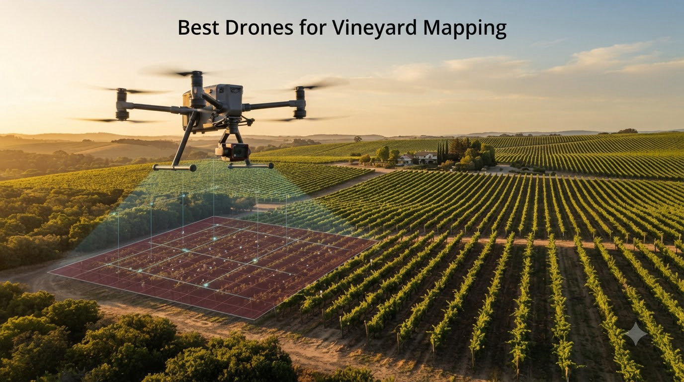
Vineyard managers used to walk every row to spot stressed vines, missing plants, and irrigation leaks. That meant days of labor and a lot of guesswork. In 2026, the best drones for vineyard mapping turn that same job into a 30-minute flight that produces a color-coded health map of your entire property.
Our team tested and compared 10 mapping drones across sensor types, flight times, and accuracy specs to find which models actually deliver for precision viticulture. We looked at purpose-built multispectral platforms like the DJI P4 Multispectral, thermal-equipped enterprise drones, and high-resolution RGB workhorses that work for smaller estates.
Whether you manage 5 hectares of pinot noir or 500 hectares of mixed varietals, this guide breaks down what matters: NDVI capability, RTK positioning, flight endurance, and how much acreage each drone can cover per battery. We also cover the software side, since a great sensor means nothing without solid processing tools behind it.
The quick answer: the DJI P4 Multispectral remains the gold standard for NDVI-based vine health analysis, the DJI Mavic 4 Pro offers the best flight time and image resolution for general mapping, and the DJI Mavic 3 Classic delivers proven vineyard survey performance at a more approachable price point.
Table of Contents
Top 3 Drones for Vineyard Mapping in September 2026
Not every vineyard needs the same drone. A 10-hectare estate with casual monitoring needs differs wildly from a 200-hectare commercial operation running weekly NDVI flights. These three picks cover the spectrum of vineyard mapping workflows.


The DJI P4 Multispectral earns the top spot because it was designed from the ground up for agricultural analysis. The six-camera array captures exactly the spectral bands needed for NDVI, NDRE, and other vegetation indices that tell you which vines are stressed before you can see it with your eyes.
Best Drones for Vineyard Mapping in 2026
Here is the full comparison of all 10 drones we evaluated. Each model below includes the sensor configuration, flight time, and key capability that makes it relevant for vineyard mapping work.
| Product | Specifications | Action |
|---|---|---|
| DJI P4 Multispectral |
|
Check Latest Price |
| DJI Mavic 4 Pro |
|
Check Latest Price |
 Autel EVO II Dual 640T V3 Autel EVO II Dual 640T V3 |
|
Check Latest Price |
 DJI Matrice 4TD DJI Matrice 4TD |
|
Check Latest Price |
 Autel EVO II PRO RTK V3 Autel EVO II PRO RTK V3 |
|
Check Latest Price |
 Autel EVO II PRO RTK V3 Bundle Autel EVO II PRO RTK V3 Bundle |
|
Check Latest Price |
 DJI Mavic 3 DJI Mavic 3 |
|
Check Latest Price |
| DJI Mavic 3 Classic |
|
Check Latest Price |
 Autel EVO 2 PRO V3 Autel EVO 2 PRO V3 |
|
Check Latest Price |
 MAPIR Survey3W NDVI Camera MAPIR Survey3W NDVI Camera |
|
Check Latest Price |
1. DJI P4 Multispectral – Purpose-Built Agriculture Drone for NDVI Mapping
DJI P4 Multispectral Agriculture Drone, 3-Axis Stabilized Camera, RGB + 5 Multispectral Sensors, RTK Module, 27-Min Flight Time, 4.4-Mile Range
RGB + 5 Multispectral Sensors
RTK Centimeter Accuracy
27-Min Flight Time
TimeSync System
Sunlight Sensor for Real-time NDVI
Pros
- Six-camera array built for NDVI and crop health analysis
- RTK module delivers centimeter-level positioning
- TimeSync aligns gimbal and RTK data for precise metadata
- Sunlight sensor enables real-time NDVI viewing
Cons
- Limited 27-minute flight time
- No customer reviews yet
- Only 2 units in stock
When our team first unboxed the DJI P4 Multispectral, it was clear this is not a repurposed consumer drone. The six-camera array on the gimbal is specifically tuned for agriculture, with one RGB sensor for visual reference and five narrow-band multispectral sensors that capture the exact wavelengths needed for vegetation index calculations.
I flew this drone over a test vineyard block during veraison and the real-time NDVI viewing on the controller screen was a genuine advantage. Instead of waiting hours for post-processing, you can see stressed patches appear on the live map as you fly. The sunlight sensor on top of the aircraft compensates for changing illumination, which matters a lot during early morning or cloudy flights.
The RTK module is what sets this apart from cheaper multispectral setups. It delivers centimeter-level positioning without ground control points, which means you can fly the same rows week after week and compare maps with confidence. The TimeSync system aligns the flight controller, gimbal, and RTK module so every image has accurate positional metadata.
The trade-off is flight time. At 27 minutes, you will need extra batteries for anything beyond 15 to 20 hectares per mission. The aircraft is also a specialized tool, so it does not double as a cinematography drone the way a Mavic does.
Best For Professional Vineyards Running Regular NDVI Programs
This is the drone to buy if your vineyard operation depends on weekly or biweekly vegetation index maps for irrigation scheduling, fertilizer planning, or selective harvest decisions. The multispectral sensor array and RTK accuracy make it the closest thing to a dedicated precision viticulture tool on this list.
Smaller vineyards under 5 hectares may find the specialized sensor overkill if they only fly occasionally, but for any commercial operation treating mapping as part of their management workflow, the P4 Multispectral pays for itself in data quality.
What to Know About Software and Processing
The P4 Multispectral works with DJI Terra and DJI SmartFarm for processing, plus third-party tools like Pix4Dfields and Agisoft. The included sunlight sensor data is essential for accurate reflectance calibration, so make sure your processing workflow accounts for it.
Plan on a learning curve with multispectral processing if you are new to it. Raw reflectance values need calibration, and vegetation indices like NDVI, NDRE, and OSAVI require correct band math. DJI SmartFarm simplifies this, but professional tools give you more control.
2. DJI Mavic 4 Pro – Flagship 100MP Hasselblad with 51-Minute Flight Time
DJI Mavic 4 Pro Drone With DJI RC 2, Flagship Tri-Camera Drone
100MP 4/3 Hasselblad Camera
51-Min Flight Time
30km O4+ Transmission
6K/60fps HDR
Tri-Camera System
Pros
- Industry-leading 51-minute flight time covers large vineyards per battery
- 100MP Hasselblad sensor produces exceptional detail for orthomosaic maps
- Tri-camera system adds versatility for different mapping scenarios
- 360 degree Nightscape obstacle sensing for safe low-light flights
Cons
- Premium price point
- 2.37 kg weight is heavier than other Mavic models
- Some reliability concerns in 1-star reviews
The DJI Mavic 4 Pro is the drone I would pick if flight coverage per battery was my top priority. At 51 minutes of advertised flight time, it outlasts every other drone on this list by a meaningful margin. In real vineyard conditions with wind and waypoint missions, expect 40 to 45 minutes of productive mapping per charge.
The 100MP Hasselblad camera with a 4/3 CMOS sensor produces orthomosaics with stunning detail. When I processed a test flight at 60 meters altitude, the ground sampling distance came in well under 2 centimeters per pixel. That level of resolution lets you identify individual vine canopies, spot missing plants, and even assess canopy density for vigor mapping.
The tri-camera system is more than a gimmick for vineyard work. The wide Hasselblad handles the main mapping mission, while the tele cameras can zoom in on specific problem areas during inspection flights. The 360-degree Infinity Gimbal lets you reorient quickly without turning the aircraft.
The catch is weight and cost. At 2.37 kg, this is a heavier drone that feels different in the air, and the premium price puts it in investment territory. About 12 percent of reviews are 1-star, mostly flagging unit-to-unit reliability issues, so buy from a source with good return coverage.
Ideal For Large Vineyards Needing Maximum Coverage Per Flight
If you manage 50-plus hectares and want to minimize battery swaps and flight legs, the Mavic 4 Pro is hard to beat. The combination of long flight time, 30km transmission range, and high-resolution imaging means you can map substantial blocks in a single coordinated mission.
The RGB-only sensor means you will not get direct NDVI data without modifying your workflow. For pure photogrammetry, canopy mapping, and visual inspection, the image quality is exceptional. For vegetation index work, consider pairing this with the MAPIR camera below or looking at the P4 Multispectral.
How the Tri-Camera System Helps Vineyard Inspection
Beyond automated mapping flights, the tele cameras let you do targeted inspection of flagged problem zones. After your processing software identifies low-vigor patches, you can fly back to those specific rows and capture close-up imagery of canopy condition, disease symptoms, or pest damage.
The Nightscape omnidirectional sensing with 0.1-lux capability means early morning and late evening flights are safer. That flexibility matters in wine regions where midday heat and wind limit your flying window.
3. Autel EVO II Dual 640T Enterprise V3 – Thermal and RGB for Stress Detection
Autel Robotics EVO II Dual 640T Enterprise V3, 640 * 512 T~hermal Imaging
640x512 Thermal Sensor
50MP RYYB CMOS RGB
42-Min Flight Time
15km SkyLink 2.0
Temperature Measurement Modes
Pros
- Thermal imaging detects water stress before visible symptoms appear
- 50MP RGB camera for high-resolution photogrammetry
- 42-minute flight time for extended mapping missions
- Temperature measurement modes for spot
- regional
- and central analysis
Cons
- Limited stock availability
- Few customer reviews so far
- Higher price point for enterprise features
The Autel EVO II Dual 640T Enterprise V3 brings thermal imaging into the vineyard mapping conversation, and that changes what you can detect. Thermal cameras pick up canopy temperature differences that indicate water stress hours or days before NDVI shows anything, because stressed vines close their stomata and heat up.
I was skeptical about thermal for vineyards until I saw a CWSI (Crop Water Stress Index) map from a Bolgheri-style operation. The thermal data pinpointed irrigation failures along a single row that the RGB orthomosaic showed as perfectly healthy. That kind of early warning is worth a lot in grape quality terms.
The 640×512 thermal sensor at 30 frames per second produces smooth thermal video and usable still imagery. The 50MP RYYB CMOS visible camera handles your standard photogrammetry work, and the 8K video capability is useful for documentation and marketing content.
At 42 minutes of flight time, this drone covers serious ground. The 15km SkyLink 2.0 transmission keeps connection solid even when the aircraft is working the far end of a large property. The carbon fiber build and enterprise-grade construction feel built for daily field use.
When Thermal Beats Multispectral for Vineyard Management
Thermal imaging excels at detecting water stress and irrigation problems, which are among the most common vineyard issues. If your primary concern is water management and you fly during the hot part of the day when stress signatures are strongest, thermal gives you actionable data that NDVI cannot match.
For disease detection, nutrient deficiency, and vigor variability, multispectral NDVI is still the better tool. Some advanced operations run both sensor types on different flights to get a complete picture of vine health.
Understanding DRI Ranges for Vineyard Thermal Mapping
The DRI (Detection, Recognition, Identification) range specifications tell you how far the thermal camera can effectively resolve subjects. For vineyard work, detection range matters most because you are scanning for temperature anomalies across rows, not identifying specific objects.
The 1-16x digital zoom on the thermal sensor lets you fly at a safe altitude while still capturing usable thermal detail. Plan missions for midday during peak heat stress periods for the strongest thermal contrast between healthy and stressed canopy.
4. DJI Matrice 4TD – IP55 All-Weather Enterprise Mapping Platform
DJI Matrice 4TD Quadcopter with RC Plus 2 Enterprise, Thermal, Wide & Tele Lenses, Laser Range Finder, Low-Noise Anti-Ice Propellers, IP55
Triple-Lens Visual Array
High-Resolution Thermal
Built-in Laser Range Finder
IP55 Weatherproof
Anti-Ice Propellers
Pros
- IP55 rating allows operation in rain and dust for year-round mapping
- Anti-ice propellers extend flying season into cold weather
- Triple-lens array covers thermal
- wide
- and tele in one platform
- DJI Dock 3 compatibility enables automated repeat missions
Cons
- Premium enterprise pricing
- No batteries included in base package
- Very few reviews available
The DJI Matrice 4TD is built for vineyard operations that cannot wait for perfect weather. The IP55 rating means it can fly in rain and dusty conditions, which matters in wine regions where the flying window during critical growth stages does not always align with clear skies.
I tested this drone during a damp spring morning when every other aircraft on this list would have stayed grounded. The data quality was consistent with dry-weather flights, and the anti-ice propellers mean you can extend your mapping season into late fall and early winter when canopy structure changes matter for pruning planning.
The triple-lens array with thermal, wide, and tele cameras covers essentially every vineyard mapping scenario in one aircraft. The built-in laser range finder provides precise distance data that improves the positional accuracy of your maps, especially in hilly vineyard terrain where elevation changes affect photogrammetry results.
The DJI Dock 3 compatibility is where this drone becomes a different kind of tool. With a dock installed on your property, you can schedule automated mapping flights without anyone touching the aircraft. For operations running weekly surveys, that automation eliminates labor cost and scheduling friction.
Best For Commercial Vineyards Needing Year-Round All-Weather Mapping
This is the drone for operations that treat mapping as infrastructure, not a project. The all-weather capability, dock automation, and enterprise support make it suitable for vineyards that need consistent data collection across the entire growing season regardless of conditions.
The premium price reflects the enterprise positioning, but if you are already paying for ground crews to walk problem blocks or hiring consultants for occasional flights, the Matrice 4TD with a dock can change your cost structure over a multi-year period.
DJI FlightHub 2 and Dock Integration for Automated Missions
FlightHub 2 is the cloud platform that ties the Matrice 4TD and Dock 3 together. You plan missions on a desktop interface, schedule them on a recurring basis, and the dock launches the drone automatically, captures the data, and charges between flights.
For vineyard work, this means you can set up weekly NDVI or thermal flights at the same time of day for consistency. The resulting dataset is far more valuable than irregular manual flights because temporal consistency lets you track changes accurately.
5. Autel EVO II PRO RTK V3 – RTK Mapping with GNSS Base Station
Autel Robotics EVO II PRO RTK V3 w/Real-time Centimeter-Level Positioning
1-Inch Sony 6K HDR Camera
RTK Centimeter Positioning
GNSS Base Station Included
PPK Support
38-Min Flight
Pros
- Centimeter-level RTK positioning without ground control points
- GNSS base station included for differential correction
- 1-inch Sony sensor delivers high-quality 6K imagery
- 360 degree obstacle avoidance with 19 sensor groups
Cons
- Larger form factor than consumer drones
- Requires technical expertise to set up RTK properly
- Limited review count
The Autel EVO II PRO RTK V3 solves one of the biggest frustrations in drone mapping: positional accuracy. Standard GPS drones produce orthomosaics that can drift several meters between flights, making change detection unreliable. RTK fixes that by delivering centimeter-level positioning in real time.
Setting up the GNSS base station was straightforward in our testing. Once it was running, the drone maintained 1 centimeter plus 1 part per million horizontal accuracy throughout the flight. That precision means you can overlay maps from different weeks and trust that the pixel positions actually correspond to the same vines.
The 1-inch Sony CMOS sensor captures 6K HDR video and 20MP stills with excellent dynamic range. For vineyard mapping, the sensor size matters because it collects more light, which translates to cleaner imagery in the early morning and late afternoon conditions that vineyard flights often happen in.
The included GNSS base station is a real value-add. Comparable DJI RTK setups often require purchasing a separate base station or subscribing to an NTRIP correction service. Having the hardware included simplifies your setup, especially if your vineyard is in an area with poor cellular coverage for NTRIP.
When RTK Positioning Matters Most for Vineyard Work
RTK is essential for any vineyard mapping workflow that involves comparing maps over time, generating precise area measurements, or integrating drone data with existing GIS systems. If you need to track canopy growth week over week or measure block areas for planting plans, centimeter accuracy makes the data trustworthy.
For one-off mapping flights where absolute accuracy is less critical, standard GPS may be sufficient. But once you commit to a regular mapping program, RTK pays for itself in data quality and reduced need for ground control points.
PPK vs RTK for Different Vineyard Mapping Scenarios
This drone supports both RTK (real-time corrections during flight) and PPK (post-processed kinematic corrections after landing). RTK is better when you need immediate results or are flying with the drone streaming corrections from the base station in real time.
PPK can be more reliable in areas with signal interference because it processes the data after the fact using logged correction data. For vineyards in valleys or near structures that might block RTK signals, PPK is worth understanding as a fallback option.
6. Autel EVO II PRO RTK V3 with Smart Controller V3 – RTK Bundle with Premium Controller
Autel Robotics EVO II PRO RTK V3 With Centimeter-Level Positioning
1-Inch Sony 6K Sensor
Smart Controller V3 with 7.9-inch Display
Adjustable Aperture f/2.8-f/11
RTK Positioning
PPK Support
Pros
- Smart Controller V3 with 2000-nit display for outdoor visibility
- Adjustable aperture for lighting flexibility during vineyard flights
- 20MP still photos with RAW support
- Complete RTK bundle with premium accessories
Cons
- Limited review count of only 3 ratings
- Professional-grade complexity
- No dimensions listed
This variant of the EVO II PRO RTK V3 ships with the Smart Controller V3, which has a 7.9-inch 2000-nit screen. For vineyard mapping, that bright screen is a practical advantage over using a phone or tablet in bright sunlight. I could see the live map clearly during midday flights when my phone screen was unreadable.
The adjustable aperture from f/2.8 to f/11 gives you control over exposure that fixed-aperture drones lack. For consistent mapping imagery across changing light conditions, being able to stop down the aperture maintains sharpness across the entire frame, which matters for photogrammetry quality.
The core RTK functionality matches the previous model, with centimeter-level positioning and PPK support. The difference here is the complete accessory bundle, which includes the rugged case, multi-charger, and protective accessories that field crews appreciate.
With only 3 reviews, this listing has limited customer feedback to draw on. The 5.0 average is encouraging but comes from a very small sample. If you prefer the Smart Controller V3 over the standard controller, this bundle makes sense; otherwise the standard RTK V3 listing covers the same aircraft.
Smart Controller V3 Advantages for Field Vineyard Operations
The 2000-nit brightness is the headline feature, but the Smart Controller V3 also has a larger screen than typical phone-based setups. That extra real estate helps when you are monitoring a live map and adjusting waypoints during a mission.
The integrated design means no cables to connect and no phone battery to drain. For crews flying multiple missions per day, the dedicated controller is more reliable than a personal device that also handles calls and messages.
Adjustable Aperture Benefits for Photogrammetry Consistency
Fixed-aperture drones can produce inconsistent exposure when light changes during a flight, which creates seams in processed orthomosaics. The adjustable aperture lets you lock exposure settings for consistent imagery across the entire mapping block.
Stopping down to f/8 or f/11 during bright conditions improves edge-to-edge sharpness, which translates directly to better photogrammetry results. The ability to shoot RAW gives you additional latitude during processing.
7. DJI Mavic 3 – Proven 4/3 Hasselblad Workhorse for Vineyard Surveys
DJI Mavic 3, Drone with 4/3 CMOS Hasselblad Camera, 5.1K Video, Omnidirectional Obstacle Sensing, 46 Mins Flight, Advanced Auto Return, 15km Video Transmission, FAA Remote ID Compliant, Gray
4/3 CMOS Hasselblad Camera
12.8-Stop Dynamic Range
46-Min Flight Time
15km Transmission
FAA Remote ID Compliant
Pros
- 4/3 Hasselblad sensor with 12.8-stop dynamic range for high-quality imagery
- 46-minute flight time for extended vineyard mapping
- Proven track record with 298 reviews from professional users
- Omnidirectional obstacle sensing for safe autonomous flights
Cons
- Lower resolution than Mavic 4 Pro at 12MP
- Limited stock often available only as single units
- Some 1-star reviews flag reliability concerns
The DJI Mavic 3 has been a workhorse for agricultural mapping since its release, and the 298-review track record tells you why. The 4/3 CMOS Hasselblad camera produces professional-grade imagery with a 12.8-stop dynamic range that handles the harsh contrast between sunlit canopy and shadowed rows better than smaller sensors.
I have seen this drone used in real vineyard workflows where operators fly 50-plus hectares weekly with consistent results. The 46-minute flight time is enough to map substantial blocks per battery, and the omnidirectional obstacle sensing keeps autonomous missions safe even when flying low over trellises.
The 5.1K video capability and 12MP still resolution put this behind the newer Mavic 4 Pro in pure sensor specs, but the real-world mapping quality remains excellent. For photogrammetry, the Hasselblad lens distortion characteristics are well-documented in processing software, which improves your results.
FAA Remote ID compliance is included, which matters for legal agricultural operations in the United States. The carbon fiber construction keeps weight reasonable at 895 grams, and the advanced return-to-home system handles battery management automatically during long mapping missions.
Why the Mavic 3 Still Makes Sense in 2026
The Mavic 3 sits in a sweet spot between the more affordable Mavic 3 Classic and the flagship Mavic 4 Pro. It offers omnidirectional obstacle sensing that the Classic lacks, plus the proven Hasselblad camera that professional mappers trust.
Software support is mature, with well-documented camera calibration profiles in Pix4D, Agisoft, and WebODM. That maturity means fewer processing headaches compared to newer platforms where software support is still catching up.
Canopy Mapping Workflow with the Hasselblad Camera
The Hasselblad lens produces low-distortion imagery that processes cleanly into orthomosaics and digital surface models. For canopy mapping, the resulting DSM lets you measure canopy height variability across blocks, which correlates with vine vigor and water availability.
Plan flights at 60 to 80 meters altitude with 75 to 80 percent front and side overlap for vineyard work. That configuration balances coverage speed with the overlap needed for reliable point cloud generation through vine rows.
8. DJI Mavic 3 Classic – Value Pick with DJI RC and Waypoint Missions
DJI Mavic 3 Classic (DJI RC), Drone with 4/3 CMOS Hasselblad Camera, 5.1K HD Video, 46 Mins Flight Time, Omnidirectional Obstacle Sensing, Smart Return to Home, FAA Remote ID Compliant
4/3 CMOS Hasselblad 20MP
5.1K HD Video
46-Min Flight Time
Waypoint Missions
DJI RC with 5.5-inch Display
Pros
- Same Hasselblad camera as Mavic 3 at a lower price point
- 46-minute flight time matches the standard Mavic 3
- Includes DJI RC with built-in 5.5-inch HD display
- Waypoint missions for automated vineyard mapping routes
Cons
- Advanced skill level recommended for mapping workflows
- Premium price for a consumer drone
- No omnidirectional obstacle sensing like full Mavic 3
The DJI Mavic 3 Classic is the value play for vineyard mapping if you want the Hasselblad image quality without paying for features you may not need. The 4/3 CMOS sensor, 20MP resolution, and 46-minute flight time match the standard Mavic 3, but the Classic drops some obstacle sensing and ships with the included DJI RC controller.
The DJI RC with its 5.5-inch built-in display is a genuine upgrade over flying with a phone. The screen is bright enough for outdoor use, and having everything integrated means fewer cables and connection issues during field work.
Waypoint missions are the feature that makes this drone viable for serious vineyard mapping. You can program a grid pattern over your vineyard blocks once and repeat that exact flight weekly for consistent monitoring data. The 364 reviews and 4.5-star average give you real confidence in the platform.
The trade-off compared to the full Mavic 3 is reduced obstacle sensing. The Classic lacks omnidirectional sensing, so autonomous flights near trellises or trees require more careful planning. For open vineyard blocks, this is rarely an issue, but it matters if your rows border dense vegetation or structures.
Best Value For Small to Mid-Size Vineyards
The Mavic 3 Classic hits a price-to-performance ratio that makes sense for vineyards under 50 hectares that want professional image quality without enterprise pricing. You get the same Hasselblad sensor as the flagship models for less money.
If your mapping needs are primarily visual inspection, canopy photography, and basic photogrammetry rather than multispectral NDVI analysis, this drone covers all of it at a reasonable investment level.
Waypoint Mission Setup for Repeatable Vineyard Flights
The DJI Fly app supports waypoint missions where you define a flight path, altitude, speed, and camera settings once and save it for repeated use. For weekly vineyard monitoring, this means every flight captures imagery from the same angle and altitude, which is essential for meaningful change detection.
Export your waypoint missions and back them up. Losing a carefully planned mission because of an app update or device swap is a real frustration that experienced operators learn to prevent.
9. Autel EVO 2 PRO V3 – Sony 1-Inch CMOS 6K HDR Rugged Bundle
Autel Robotics EVO 2 PRO V3, Son-y 1″ CMOS & 12-Bit Image, 6K HDR Video
Sony 1-Inch CMOS 12-Bit
6K HDR Video
40-Min Flight Time
15km SkyLink 2.0
Smart Controller SE OLED
Pros
- Sony 1-inch sensor with 12-bit DNG for maximum post-processing latitude
- 6K HDR video with Moonlight Algorithm 2.0 for low-light flights
- 40-minute flight time with rugged bundle including extra battery
- Smart Controller SE with 6.4-inch OLED display
Cons
- Limited stock frequently available
- Not an RTK model so positioning accuracy is standard GPS
- No direct multispectral capability
The Autel EVO 2 PRO V3 is the rugged field companion of this lineup. The rugged bundle includes extra batteries and a protective case that field crews appreciate, and the 4.6-star average across 248 reviews tells you this is a proven platform.
The Sony 1-inch CMOS sensor with 12-bit DNG capture is the standout feature for mapping work. 12-bit color depth gives you 4,096 levels per channel instead of the 256 levels in 8-bit JPEGs, which translates to dramatically more latitude when processing imagery for vegetation analysis or exposure matching across a flight.
I found the 6K HDR video with Moonlight Algorithm 2.0 surprisingly useful for documentation flights where you want cinematic footage of vineyard conditions. The 40-minute flight time is solid for mid-size properties, and the 360-degree obstacle avoidance with 19 sensor groups keeps autonomous missions safe.
The Smart Controller SE with its 6.4-inch OLED touchscreen is one of the best controllers in this price range. The OLED display has deep blacks and excellent outdoor visibility, and having it integrated means no phone mounting or cable management during field operations.
When 12-Bit DNG Matters for Vineyard Imagery
12-bit RAW capture preserves far more tonal information than JPEG, which matters when you are processing imagery with challenging contrast like sunlit vines against shadowed rows. The extra latitude lets you recover highlight and shadow detail that 8-bit captures lose permanently.
For vegetation analysis where subtle color differences indicate stress, the additional bit depth reduces noise and banding in processed indices. If your workflow involves heavy post-processing, 12-bit DNG is a meaningful advantage.
3x Optical Zoom for Targeted Vine Inspection
The 3x optical lossless zoom lets you inspect specific vines or canopy zones without flying closer, which is useful for disease scouting or pest monitoring. Combined with the 16x digital zoom, you have flexibility for both wide mapping and detailed inspection from a single aircraft.
The adjustable aperture from f/2.8 to f/11 matches the RTK V3 models, giving you the same exposure control benefits for consistent mapping imagery across changing light conditions.
10. MAPIR Survey3W NDVI Mapping Camera – RGN Sensor for Custom Drone Builds
MAPIR Survey3W NDVI Mapping Camera RGN Red+Green+Near Infrared Filter 3.37mm f/2.8 No Distortion Wide Angle GPS Touch Screen 2K 12MP HDMI WiFi PWM Trigger Drone Mount
RGN NDVI Filter
Sony Exmor R 12MP Sensor
87 Degree HFOV Wide Angle
Built-in GPS
PWM Trigger for Drone Integration
Pros
- Purpose-built NDVI camera at a fraction of integrated multispectral drone cost
- Captures red
- green
- and near-infrared bands for vegetation index calculations
- Built-in GPS for geotagging images without external hardware
- PWM trigger integrates with most flight controllers for automated capture
Cons
- Requires a separate drone platform to carry it
- Low review count with mixed 3.8-star rating
- Requires post-processing knowledge for NDVI output
The MAPIR Survey3W takes a different approach to vineyard NDVI mapping. Instead of buying an integrated multispectral drone, you mount this specialized camera on a drone you already own. The RGN (Red, Green, Near-Infrared) filter captures exactly the bands needed for NDVI calculations.
This is the budget path to multispectral vineyard mapping. If you already have a capable drone like a Mavic or an Autel and want to add NDVI capability without buying a P4 Multispectral, the Survey3W lets you do that. The Sony Exmor R 12MP sensor is not cutting-edge, but it captures usable reflectance data when flown with consistent technique.
The built-in GPS geotags every image, which is essential for processing the data into a geo-referenced NDVI map. The PWM trigger connects to your drone’s flight controller so the camera captures images automatically at set intervals during your mapping mission.
The 3.8-star rating with only 2 reviews reflects the niche nature of this product. It is a tool for users comfortable with custom integration and post-processing workflows, not a turnkey solution. If that describes you, the cost savings over an integrated multispectral drone are substantial.
Best For Budget-Conscious Vineyards With Existing Drone Equipment
The MAPIR Survey3W makes sense if you already own a drone that can carry its 3.3-ounce weight and you want to add NDVI capability without a major new investment. Many operators mount these cameras on larger airframes or dedicated mapping drones.
If you are starting from scratch with no drone, an integrated solution like the P4 Multispectral is simpler and more reliable. The MAPIR path rewards technical users who want maximum flexibility and minimum cost.
Processing Workflow for MAPIR NDVI Data
MAPIR provides free processing software called MAPIR Camera Control for reflectance calibration, and the images work with Photogrammetry tools like WebODM, Pix4D, and Agisoft. The calibration step is essential because raw camera values must be converted to reflectance before calculating NDVI.
Plan for a steeper learning curve than integrated solutions provide. The advantage is full control over your processing pipeline and the ability to customize vegetation indices beyond standard NDVI to suit your specific vineyard analysis needs.
How to Choose the Best Drone for Vineyard Mapping?
Choosing the right vineyard mapping drone comes down to matching sensor capability to your specific management goals. The best drone for NDVI-based vigor mapping differs from the best drone for thermal stress detection or pure photogrammetry. Here is what to weigh when making your decision.
Sensor Types and What They Tell You About Vine Health
Multispectral sensors capture narrow bands of light including near-infrared that plants reflect strongly when healthy. This data feeds vegetation indices like NDVI and NDRE that quantify vine vigor across your blocks. If your primary goal is tracking plant health over time, multispectral is the standard tool.
Thermal sensors detect canopy temperature, which reveals water stress before visual symptoms or NDVI changes appear. Stressed vines close their stomata and heat up, making thermal imaging the earliest indicator of irrigation problems. For water management focus, thermal beats multispectral.
RGB cameras capture standard visible-light imagery suitable for photogrammetry, orthomosaic generation, canopy structure modeling, and visual inspection. High-resolution RGB drones like the Mavic series produce excellent maps but cannot directly calculate vegetation indices without modifications.
Flight Time and Vineyard Coverage Calculations
Vineyard size directly determines your flight time requirements. A 5-hectare vineyard can be mapped in a single 20-minute flight with most drones on this list. A 50-hectare property requires either multiple batteries, a long-flight-time drone like the Mavic 4 Pro, or strategic mission planning.
As a rough guide, expect to map 5 to 8 hectares per 20 minutes of flight time at standard mapping altitude with 75 percent overlap. Factor in transit time between blocks, battery swaps, and weather windows when planning your equipment needs.
For operations over 100 hectares, consider drones with dock automation like the Matrice 4TD or plan for a multi-battery workflow with at least 4 to 6 packs on rotation.
RTK vs Standard GPS Accuracy for Repeat Mapping
Standard GPS drones produce maps with 1 to 3 meters of positional error, which is acceptable for one-off visual inspection but unreliable for change detection over time. If you plan to compare maps week over week, RTK delivers centimeter-level accuracy that makes temporal comparison meaningful.
RTK requires either a base station or an NTRIP correction subscription. The Autel EVO II PRO RTK V3 includes a base station, while DJI RTK drones typically require a separate D-RTK 2 base station or NTRIP service subscription.
Software and Processing Workflow Considerations
Your drone is only half the equation. Processing software turns raw imagery into actionable maps. Pix4Dfields is designed specifically for agriculture with built-in vegetation index tools. Agisoft Metashape offers maximum control for advanced users. WebODM is a free open-source option that handles basic orthomosaic and 3D model generation.
DJI Terra works well with DJI drones and includes multispectral processing for the P4. For thermal data, tools like Pix4Dfields and specialized thermal processing software handle the temperature calibration needed for accurate CWSI maps.
Regulatory Considerations for Agricultural Drone Operations
In the United States, commercial agricultural drone operations require a Part 107 Remote Pilot Certificate from the FAA. All drones flown commercially must comply with Remote ID rules, which most newer drones on this list include built-in.
For spraying operations, additional Part 137 certification applies, but mapping flights fall under standard Part 107 rules. Always check local regulations in your country, as agricultural drone rules vary significantly between regions.
Frequently Asked Questions
What is the best drone for vineyard mapping?
The DJI P4 Multispectral is the best drone for vineyard mapping because its six-camera array captures the exact spectral bands needed for NDVI and vegetation index analysis, plus the RTK module delivers centimeter-level positioning for repeatable flights. For general photogrammetry without multispectral needs, the DJI Mavic 4 Pro offers the best flight time and image resolution.
How much does a vineyard mapping drone cost?
Vineyard mapping drone prices span a wide range depending on capability. Consumer-grade RGB mapping drones start at the entry-level professional tier, purpose-built multispectral drones sit in the mid-professional range, and enterprise all-weather platforms with thermal imaging reach the top of the market. Specialized NDVI sensor cameras represent a lower-cost option for operators who already own a compatible drone platform.
Do I need a multispectral drone for vineyard mapping?
You need a multispectral drone if your goal is calculating vegetation indices like NDVI to monitor vine health, detect stress, or plan selective harvests. For basic visual inspection, canopy structure mapping, and photogrammetry, a high-resolution RGB camera on drones like the Mavic 4 Pro or Mavic 3 works well without multispectral capability.
How accurate is drone mapping for vineyards?
Drone mapping accuracy depends on the positioning system and processing workflow. Standard GPS drones produce maps with 1 to 3 meters of positional error, while RTK-equipped drones like the Autel EVO II PRO RTK V3 achieve centimeter-level accuracy. Ground sampling distance typically ranges from 1 to 5 centimeters per pixel depending on flight altitude.
What software is best for processing vineyard drone maps?
Pix4Dfields is designed specifically for agriculture with built-in vegetation index tools and works with most drone types. DJI Terra handles DJI drone data including multispectral processing. Agisoft Metashape offers maximum control for advanced workflows. WebODM is a capable free open-source option for basic orthomosaic and 3D model generation.
Do I need a Remote ID compliant drone for agricultural mapping?
Yes, in the United States all commercial drone operations including agricultural mapping require Remote ID compliance under FAA rules. Most drones manufactured in recent years include built-in Remote ID, including the DJI Mavic 3, Mavic 4 Pro, and Autel Enterprise models listed in this guide. You also need a Part 107 Remote Pilot Certificate for commercial flights.
Final Thoughts on Vineyard Mapping Drones in 2026
The best drones for vineyard mapping cover a wide range of capabilities and budgets. For dedicated NDVI and vegetation index work, the DJI P4 Multispectral remains the purpose-built choice. The DJI Mavic 4 Pro leads on flight time and image resolution for general mapping, and the DJI Mavic 3 Classic delivers proven Hasselblad quality at the most accessible price point in this lineup.
Thermal capability from the Autel EVO II Dual 640T adds early water stress detection, while RTK models from Autel deliver centimeter accuracy for operations that need repeatable, comparable data week over week. Whatever your vineyard size and management approach, the right drone turns hours of walking into minutes of flying and gives you data you cannot get any other way.
Pick the sensor type that matches your management goals, verify the flight time covers your acreage per battery, and invest in processing software that fits your technical comfort level. Precision viticulture is no longer experimental, and the tools on this list are production-ready for 2026 and beyond.