
When you need to map 500 hectares of land in a single flight, capture survey-grade accuracy, and fly autonomously with minimal hands-on piloting, senseFly drones deliver. These fixed-wing mapping UAVs have become the go-to choice for surveying professionals, agricultural operations, and government agencies who need to cover large areas efficiently.
senseFly drones are professional fixed-wing aircraft built specifically for aerial mapping, surveying, and industrial data collection. Now part of AgEagle Aerial Systems, senseFly has spent over a decade engineering drones that handle massive coverage areas with precision accuracy. Their flagship eBee X can fly for up to 90 minutes and map up to 500 hectares (1,235 acres) in a single mission.
In this guide, I break down every current senseFly drone model available in 2026, compare their specifications, examine the camera and sensor ecosystem, and discuss what you need to know before investing in a professional mapping platform. Whether you are a surveying firm looking to add aerial capabilities or a government agency evaluating tactical UAV options, this article covers the real-world details that matter.
Table of Contents
What Are senseFly Drones?
senseFly is a Swiss-born professional drone manufacturer that specializes exclusively in fixed-wing mapping aircraft. Founded in 2009 and later acquired by Parrot before becoming part of AgEagle Aerial Systems, the company has focused on one core mission: building reliable fixed-wing drones for professional surveying and mapping applications.
Unlike consumer drone brands such as DJI that build multirotor aircraft for photography and videography, senseFly builds fixed-wing aircraft designed for data collection over large areas. Fixed-wing designs offer significantly longer flight times and greater coverage than multirotors because they generate lift aerodynamically rather than relying entirely on motor power.
The current senseFly lineup includes three primary platforms: the eBee X for professional mapping, the eBee TAC for government and tactical operations, and the eBee VISION for surveillance and security. All three share the same hand-launch design, automated flight capabilities, and eMotion mission planning software.
What sets senseFly apart in the professional drone market is their complete workflow approach. They do not just sell an aircraft. They provide the drone, the flight planning software, sensor options, and integration with processing tools like Pix4D. This end-to-end ecosystem is what attracts surveying firms, mining companies, agricultural operations, and government agencies to the platform.
1. senseFly eBee X – The Flagship Mapping Drone
The eBee X is senseFly’s most advanced fixed-wing mapping drone and the cornerstone of their product line. I consider it the gold standard for professional aerial surveying because it combines exceptional flight time with high-accuracy data collection capabilities in a portable, hand-launchable package.
Flight performance is where the eBee X truly separates itself from competing platforms. It can stay airborne for up to 90 minutes per mission, which allows it to cover up to 500 hectares (1,235 acres) in a single flight at 120 meters altitude. That coverage capacity means fewer flights, fewer battery swaps, and less time in the field for surveying teams working on large projects.
The eBee X offers RTK (Real-Time Kinematic) and PPK (Post-Processed Kinematic) positioning for survey-grade accuracy without ground control points. senseFly claims absolute accuracy down to 3 centimeters horizontally and 5 centimeters vertically when using RTK or PPK. This level of precision makes the eBee X suitable for cadastral surveying, construction site monitoring, and any application where measurement accuracy directly impacts project decisions.
One of the standout features of the eBee X is its sensor compatibility. The drone supports interchangeable cameras including the S.O.D.A. 3D for oblique photogrammetry, S.O.D.A. Corridor for linear infrastructure mapping, and the Duet T for thermal imaging. This flexibility means a single airframe can serve multiple project types simply by swapping the payload.
The eBee X also features senseFly’s patent-pending SteadyDrone technology that improves image quality during turbulent conditions. Combined with its wind resistance rating of up to 12.3 meters per second at cruise speed, this drone can operate in weather conditions that would ground lighter aircraft.
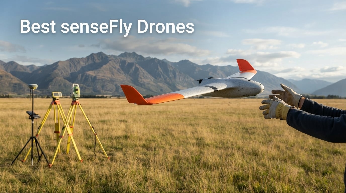
Launch is straightforward thanks to the hand-launch design. You hold the drone overhead, initiate the automated mission from eMotion software, and release. Landing is equally autonomous with the drone performing a controlled circular descent and shallow approach. No runway, no landing gear, no complex setup required.
In terms of ideal users, the eBee X fits surveying companies, construction firms tracking earthwork progress, mining operations calculating stockpile volumes, and agricultural enterprises conducting precision crop analysis. If your work involves covering large land areas and producing accurate maps or 3D models, the eBee X is engineered for your workflow.
What to Consider Before Buying the eBee X
The eBee X requires a learning curve for pilots transitioning from multirotor drones. Fixed-wing aircraft behave differently during launch and landing, and while the flight itself is autonomous, understanding weather conditions and launch angles is critical. senseFly recommends their training programs for new operators, which adds to the initial investment.
You also need to budget for the complete system, not just the airframe. The eBee X is sold through authorized dealers with pricing that varies based on configuration, sensor selection, and included accessories. Based on current market listings, a complete eBee X system typically ranges from $15,000 to $35,000 depending on sensor package and RTK/PPK configuration.
eBee X Real-World Performance
From user discussions in the professional mapping community, the eBee X earns praise for its reliability in the field. Surveying teams report successfully completing missions in challenging environments including mountainous terrain, coastal areas with steady winds, and remote locations where ground control point placement is impractical. The RTK/PPK accuracy consistently meets project specifications when properly configured.
However, users also flag some considerations. Launch technique matters significantly because the drone must launch directly into the wind at the correct angle. Pilots new to fixed-wing drones sometimes need practice to achieve consistent launches. Additionally, repair costs can be substantial, with autopilot replacements reported at approximately $7,000 according to forum discussions in the UAV mapping community.
2. senseFly eBee TAC – Government and Tactical Operations
The eBee TAC is senseFly’s purpose-built variant designed specifically for government, military, and public safety applications. It shares the same airframe foundation as the eBee X but incorporates modifications that make it suitable for sensitive operations where security and compliance are non-negotiable requirements.
The TAC designation reflects this drone’s tactical orientation. It is designed to meet the operational needs of government agencies, defense organizations, and security contractors who need aerial mapping and surveillance capabilities in environments where standard commercial drones may not meet security protocols or regulatory requirements.
Key differentiators of the eBee TAC include enhanced communications security features, compliance with government procurement requirements, and support for operational scenarios that go beyond standard commercial mapping. The drone maintains the same mapping and surveying capabilities as the eBee X while adding layers of security and operational flexibility.
The flight performance specifications mirror those of the eBee X, with up to 90 minutes of flight time and coverage of large areas per mission. This makes the TAC suitable for border surveillance, infrastructure inspection over extended distances, emergency response mapping during natural disasters, and military surveying operations.
Government agencies value the eBee TAC for its proven reliability in field conditions and its integration with professional data processing workflows. The same eMotion software that powers the standard eBee X provides mission planning for the TAC, though with additional features tailored to government operational requirements.
Who Should Evaluate the eBee TAC
The eBee TAC is specifically designed for government and defense buyers. If you are a commercial surveying firm or agricultural operation, the standard eBee X will serve your needs at a more accessible price point. The TAC exists for organizations that require its specific compliance, security, and tactical capabilities.
Procurement for the eBee TAC follows government purchasing channels rather than standard commercial sales. Interested agencies work directly with senseFly or authorized government dealers to evaluate the platform against their operational requirements. This purchasing process ensures proper vetting and compliance verification before deployment.
3. senseFly eBee VISION – Surveillance and Security
The eBee VISION represents senseFly’s entry into real-time surveillance applications. Unlike the eBee X and TAC, which are optimized for photogrammetric mapping and post-flight data processing, the VISION is designed to stream live video and provide real-time situational awareness during flight operations.
This drone fills a specific niche in the senseFly lineup. While mapping drones capture imagery for later processing into maps and 3D models, the VISION provides immediate visual intelligence. This makes it valuable for security applications, event monitoring, emergency response, and any scenario where real-time aerial observation is critical.
Based on current market listings, the eBee VISION system is priced between $42,300 and $58,600 for complete packages. This pricing reflects its specialized surveillance capabilities and positions it as a premium solution for organizations that need persistent aerial observation rather than mapping data.
The eBee VISION shares the fixed-wing design philosophy of the broader eBee family. It launches by hand, flies autonomous missions planned through eMotion software, and lands autonomously. This operational commonality means that organizations already operating eBee X or TAC drones can integrate the VISION into their existing workflow with minimal additional training.
Primary use cases for the VISION include law enforcement aerial surveillance, border monitoring, critical infrastructure security, large event security management, and emergency response coordination. The ability to maintain extended observation of an area for prolonged periods gives security teams capabilities that multirotor drones simply cannot match due to their limited flight times.
Is the eBee VISION Right for Your Organization
The VISION is not a mapping drone and should not be evaluated as one. If your primary need is generating maps, 3D models, or survey-grade measurements, the eBee X is the appropriate choice. The VISION exists for real-time intelligence gathering and surveillance.
Organizations considering the VISION should also evaluate their regulatory environment. Operating a surveillance drone for law enforcement or security purposes involves compliance requirements that vary significantly by jurisdiction. senseFly and their authorized dealers can provide guidance on regulatory considerations during the evaluation process.
Legacy senseFly Models
Before the current eBee X, TAC, and VISION lineup, senseFly produced several models that remain in active use across the professional mapping community. Understanding these legacy platforms is important because many are still operational, and the used market occasionally offers them.
The eBee Plus was the predecessor to the eBee X and introduced RTK/PPK capabilities to the senseFly lineup. Many surveying firms still operate eBee Plus drones, and the platform remains capable for professional mapping work. However, finding replacement parts and service for older models is becoming increasingly difficult as senseFly focuses support resources on current products.
The eBee Geo was a more affordable variant designed for educational institutions and organizations entering the professional mapping space. It offered reduced specifications compared to the Plus and X but provided the same fixed-wing workflow and eMotion integration. The Geo is no longer in production but occasionally appears on the secondary market.
The original eBee Classic launched the entire eBee platform and established senseFly’s reputation in professional mapping. These early drones pioneered the hand-launch, autonomous-mission, automatic-landing workflow that remains the hallmark of every senseFly drone today.
If you encounter a used senseFly drone, verify the current support status before purchasing. senseFly provides information about product lifecycle status on their website, and authorized dealers can advise on parts availability and service options for older models.
Camera and Sensor Options for senseFly Drones
The sensor ecosystem is where senseFly drones gain much of their versatility. Rather than being locked into a single camera, senseFly platforms support interchangeable payloads that can be swapped based on project requirements. This modularity means one airframe can handle photogrammetry, thermal imaging, multispectral analysis, and corridor mapping.
The S.O.D.A. 3D camera is senseFly’s flagship photogrammetric sensor. It captures imagery at multiple angles during flight, which enables the generation of detailed 3D models and high-quality orthomosaics. The gimbal adjusts automatically during flight to capture oblique imagery in addition to NADIR shots, producing richer datasets for 3D reconstruction.
The S.O.D.A. Corridor variant is optimized for linear infrastructure mapping. Roads, railways, power lines, and pipelines present a specific mapping challenge because they extend over long distances with relatively narrow width. The Corridor sensor configuration ensures efficient data capture along these linear features without wasting flight time on unnecessary coverage of adjacent areas.
The Duet T combines a thermal camera with a RGB sensor for applications requiring heat signature detection. This dual-sensor setup is valuable for solar panel inspection, building energy audits, search and rescue operations, and agricultural stress detection. Having both thermal and visible light data captured simultaneously simplifies data interpretation and reporting.
MicaSense sensors bring multispectral imaging capabilities to the senseFly platform. These sensors capture data across multiple spectral bands beyond visible light, enabling vegetation health analysis, crop counting, and precision agriculture applications. MicaSense integration makes senseFly drones capable agricultural research tools alongside their surveying capabilities.
Selecting the right sensor depends entirely on your primary use case. Surveying and general mapping work calls for the S.O.D.A. 3D. Infrastructure inspection along corridors benefits from the S.O.D.A. Corridor. Thermal applications require the Duet T. Agricultural analysis is best served by MicaSense multispectral sensors. Many professional operators invest in multiple sensors to expand the range of services they can offer.
Sensor Pricing and Compatibility
Individual sensors for senseFly drones represent significant investments. Based on current market data, sensors like the S.O.D.A. Corridor with eBee X integration kit are listed at approximately $1,800. Complete sensor packages can add substantially to the base airframe cost, so budgeting for the full sensor complement you need is essential when evaluating a senseFly purchase.
Not all sensors are compatible with all senseFly airframes. The eBee X supports the broadest range of current sensors, while legacy models like the Plus and Geo have more limited compatibility. Always verify sensor compatibility with your specific drone model before purchasing, and consult with an authorized dealer if you are unsure about integration requirements.
Flight Performance and Coverage Comparison
Understanding flight performance specifications is essential when evaluating any professional mapping drone. The numbers determine how efficiently you can complete projects and what types of terrain and conditions you can operate in. Here is how senseFly drones compare across the key performance metrics.
Flight time is the single most impactful specification for mapping efficiency. The eBee X leads the senseFly lineup with up to 90 minutes of flight time per mission. This extended endurance translates directly to coverage capacity because the drone spends more time collecting data and less time on the ground for battery swaps.
Coverage area depends on multiple factors including flight altitude, ground sampling distance (GSD) requirements, and sensor field of view. At standard mapping altitude of 120 meters with the S.O.D.A. 3D sensor, the eBee X can cover up to 500 hectares (1,235 acres) in a single flight. Higher resolution requirements at lower altitudes reduce coverage, while higher flights with lower resolution settings increase it.
All current senseFly drones use the same hand-launch method. This eliminates the need for runways, catapults, or other launch infrastructure. The pilot holds the drone overhead facing into the wind, initiates the mission through eMotion software, and releases the airframe. The onboard autopilot takes over immediately and climbs to mission altitude.
Landing is similarly autonomous. The drone descends in a circular pattern and performs a shallow gliding approach to the designated landing zone. senseFly drones typically land on their belly using a reinforced fuselage designed to absorb impact. No landing gear means lighter weight and more space for payload.
Wind resistance is a critical specification for professional operations. The eBee X can handle wind speeds up to 12.3 meters per second at cruise speed, which is approximately 27 miles per hour. This rating means the drone can operate safely in moderate wind conditions that would ground lighter consumer drones.
Cruise speed for the eBee X ranges from approximately 11 to 19 meters per second depending on mission parameters and conditions. This speed range allows efficient coverage of large areas while maintaining image quality at the sensor level. The autopilot adjusts speed automatically based on mission requirements and environmental conditions.
Fixed-Wing Versus Multirotor for Mapping
The fixed-wing design philosophy that defines senseFly drones offers distinct advantages over multirotor platforms for large-area mapping. Fixed-wing aircraft fly more efficiently because wings generate lift aerodynamically, while multirotors must constantly expend energy to stay airborne. This fundamental difference is why senseFly drones achieve 90-minute flight times while most mapping multirotors max out around 30 to 40 minutes.
However, fixed-wing drones cannot hover or fly in confined spaces. If your work involves inspecting structures, flying under bridges, or operating in urban canyons, a multirotor platform may be more appropriate. Many professional mapping operations maintain both types of drones to handle the full range of project requirements they encounter.
eMotion Flight Planning Software
eMotion is the mission planning and flight management software that powers every senseFly drone. It is not an optional add-on. It is the central interface through which operators plan missions, monitor flights, and manage data. Understanding eMotion is essential to understanding the senseFly workflow.
The software allows operators to define mission areas, set flight parameters including altitude and overlap, select sensor configurations, and generate automated flight plans. The software calculates flight lines, estimates coverage and resolution, and identifies potential obstacles or terrain challenges before the drone ever leaves the ground.
During flight, eMotion provides real-time telemetry data including aircraft position, battery status, signal strength, and mission progress. The operator can monitor the mission and intervene if necessary, though the autopilot handles all flight control. This combination of automation and monitoring capability makes single-pilot operation practical for complex mapping missions.
eMotion integrates with Pix4D for post-flight data processing. Once the drone lands and data is offloaded, imagery flows into Pix4D for photogrammetric processing to produce orthomosaics, digital surface models, 3D point clouds, and other deliverables. This integrated workflow from mission planning through final output is a significant advantage of the senseFly ecosystem.
Some users in the professional mapping community have noted challenges with eMotion software access. Reports indicate that the software requires invitation keys in some configurations, which can create delays for new users or organizations setting up additional workstations. If you are evaluating a senseFly purchase, confirm software licensing and access procedures with your authorized dealer.
Buying Considerations for senseFly Drones
Purchasing a professional mapping drone is fundamentally different from buying a consumer drone. The investment is significant, the purchasing process involves consultation with dealers, and ongoing costs including maintenance, training, and software must factor into your decision. Here is what you need to consider.
senseFly drones are not sold through standard retail channels or Amazon. They are available exclusively through senseFly’s network of authorized dealers and distributors. This dealer model ensures that buyers receive proper consultation, training, and ongoing support, but it also means you cannot simply add a drone to an online cart and check out.
Price ranges vary significantly based on model and configuration. Based on current market data, the eBee VISION surveillance platform commands the highest pricing at $42,300 to $58,600 for complete systems. The eBee X flagship mapping drone typically ranges from $15,000 to $35,000 depending on sensor package and RTK/PPK configuration. Individual sensors and accessories like the S.O.D.A. Corridor integration kit start around $1,800.
Maintenance and repair costs are a significant consideration that many first-time buyers underestimate. Professional mapping forums contain numerous reports of repair bills that can strain budgets. Autopilot replacements have been reported at approximately $7,000, and other component repairs can accumulate quickly. Budgeting for maintenance and potential repairs should be part of your total cost of ownership calculation from the start.
Training is another essential investment. Fixed-wing drone operation requires skills that differ from multirotor piloting, and proper training ensures safe operations and reliable data collection. senseFly offers training programs, and many authorized dealers include training as part of the purchase package. Factor this into your budget and timeline.
Total cost of ownership for a senseFly drone extends well beyond the initial purchase. Over a typical operational lifespan of three to five years, expect to invest in additional batteries, replacement sensors or sensor repairs, software licensing, periodic maintenance, and potentially one or more component repairs. A reasonable rule of thumb is to budget an additional 20 to 30 percent of the purchase price annually for operational and maintenance costs.
Warranty coverage varies by model and region. senseFly provides manufacturer warranties on their drones, but coverage terms, duration, and what constitutes covered versus wear-and-tear issues should be clarified before purchase. Extended warranty or service contract options may be available through authorized dealers and can provide budget predictability for organizations that need fixed annual maintenance costs.
Where to Buy senseFly Drones
The authorized dealer network is your primary purchasing channel. senseFly maintains relationships with dealers worldwide who specialize in professional drone sales and support. These dealers can provide demonstrations, arrange training, configure systems to your specifications, and provide ongoing service and support.
When selecting a dealer, consider their experience with senseFly products specifically, their proximity to your operational area for support purposes, and their ability to provide training and ongoing service. A dealer who understands surveying workflows and can provide informed consultation is worth seeking out, even if they are not the closest option geographically.
Frequently Asked Questions
What is the senseFly drone?
senseFly is a professional drone manufacturer specializing in fixed-wing mapping aircraft for surveying, agriculture, and industrial applications. Now part of AgEagle Aerial Systems, senseFly produces the eBee series including the eBee X, eBee TAC, and eBee VISION, which can fly for up to 90 minutes and cover up to 500 hectares per mission.
What are the top 3 drone brands?
For professional mapping and surveying, senseFly, Wingtra, and DJI Enterprise are widely considered top brands. senseFly specializes in fixed-wing mapping drones, Wingtra produces VTOL surveying aircraft, and DJI Enterprise offers multirotor platforms. Each excels in different applications within the professional drone market.
What is the best drone with sensors?
The senseFly eBee X is one of the best sensor-equipped mapping drones, supporting interchangeable cameras including the S.O.D.A. 3D for photogrammetry, S.O.D.A. Corridor for linear mapping, Duet T for thermal imaging, and MicaSense sensors for multispectral agricultural analysis. This sensor flexibility makes it versatile across multiple professional applications.
How much does a senseFly drone cost?
senseFly drone prices range from approximately $15,000 for a basic eBee X configuration to over $58,000 for a complete eBee VISION surveillance system. Individual sensors start around $1,800. Pricing varies based on model, sensor package, RTK/PPK configuration, and included accessories through authorized dealers.
What is the flight time of the eBee X?
The senseFly eBee X has a maximum flight time of up to 90 minutes per mission, allowing it to cover up to 500 hectares (1,235 acres) in a single flight at 120 meters altitude. This extended endurance is one of the key advantages of the fixed-wing design over multirotor mapping drones.
Final Thoughts on senseFly Drones
senseFly drones occupy a specific and important position in the professional drone market. They are not consumer toys or entry-level aircraft. They are purpose-built mapping tools designed for professionals who need to cover large areas with survey-grade accuracy and reliable performance.
The eBee X stands as the flagship choice for surveying, construction, mining, and agricultural applications. The eBee TAC serves government and tactical operations with security-focused features. The eBee VISION brings real-time surveillance capabilities for security and law enforcement applications.
If your work involves professional aerial mapping, large-area surveying, or industrial data collection where accuracy and coverage matter, senseFly drones deserve serious evaluation. Contact an authorized dealer to arrange a demonstration and discuss how a senseFly platform can integrate into your workflow in 2026.