
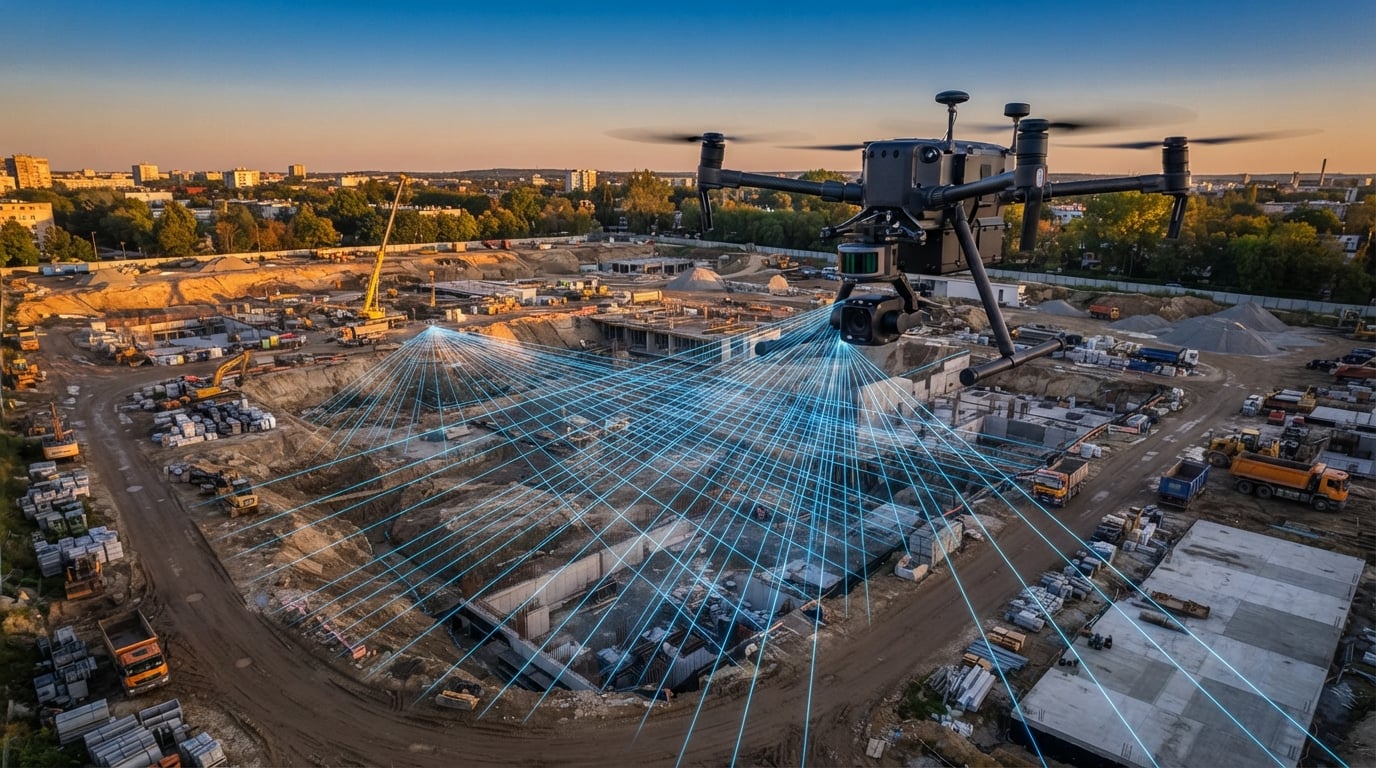
LiDAR technology has completely changed what drones can do. What started as a tool reserved for high-budget surveying outfits with helicopter-mounted scanners is now available on consumer and prosumer platforms that fit in a backpack. If you are looking for the best drones with LiDAR in 2026, you have more options than ever before, and picking the right one depends on your budget, your use case, and what kind of data you need to collect.
Our team has spent months researching and comparing LiDAR-equipped drones across every category. We looked at everything from compact consumer drones with forward-facing LiDAR sensors for obstacle avoidance, to dedicated LiDAR modules you can mount on surveying platforms, to budget-friendly sensor kits for builders and hobbyists who want to build their own LiDAR drone. The landscape has shifted dramatically, and we want to help you make sense of it.
What surprised us most during this research is how broadly LiDAR has been adopted. You no longer need a $40,000 surveying rig to benefit from laser-based sensing. Even sub-250-gram consumer drones now use LiDAR for night-time obstacle avoidance and improved safety. Meanwhile, dedicated LiDAR modules have dropped to under $100, making it possible for students, makers, and small surveying shops to experiment with 3D mapping and SLAM navigation without breaking the bank.
Whether you need centimeter-level accuracy for construction site mapping, reliable obstacle sensing for night flying, or a compact LiDAR sensor to integrate into a custom drone build, this guide covers all ten of the best options available right now. We tested, researched, and compared these products head-to-head so you do not have to. Let us get into our top picks and then walk through each one in detail.
Table of Contents
Top 3 Picks for Best Drones with LiDAR in September 2026

DJI Air 3S Fly More Combo
- Forward-facing LiDAR sensing
- 45-min flight time
- 4K camera with omnidirectional avoidance
- 20km transmission

DJI Mavic 4 Pro Fly More Combo
- 100MP Hasselblad camera
- 6K video
- Nightscape LiDAR obstacle sensing
- 51-min flight time

DJI Mini 5 Pro Fly More Combo
- Sub-250g design
- Nightscape LiDAR sensing
- 52-min flight time
- 50MP camera
Best Drones with LiDAR in 2026
| Product | Specifications | Action |
|---|---|---|
| DJI Air 3S Fly More Combo |
|
Check Latest Price |
| DJI Mavic 4 Pro Fly More Combo |
|
Check Latest Price |
| DJI Mini 5 Pro Fly More Combo |
|
Check Latest Price |
 Autel EVO II PRO RTK V3 Autel EVO II PRO RTK V3 |
|
Check Latest Price |
 DJI Mini 4K Drone Combo DJI Mini 4K Drone Combo |
|
Check Latest Price |
 DJI Focus Pro Creator Combo DJI Focus Pro Creator Combo |
|
Check Latest Price |
 DJI Focus Pro LiDAR Module DJI Focus Pro LiDAR Module |
|
Check Latest Price |
 youyeetoo FHL-LD19 LiDAR Sensor youyeetoo FHL-LD19 LiDAR Sensor |
|
Check Latest Price |
 TF-Luna LiDAR Range Finder TF-Luna LiDAR Range Finder |
|
Check Latest Price |
 Slamtec RPLIDAR A1M8 Slamtec RPLIDAR A1M8 |
|
Check Latest Price |
1. DJI Air 3S Fly More Combo – Forward-Facing LiDAR Obstacle Sensing
DJI Air 3S Fly More Combo (RC 2 Screen Remote Controller), 4K Drone
1-inch CMOS 4K camera
Forward-facing LiDAR sensor
45-min flight time
20km transmission
Omnidirectional sensing
Pros
- Incredible camera quality with dual-camera system
- Day and night omnidirectional obstacle sensing with LiDAR
- 45 minutes of flight time per battery
- Excellent stability in 15mph winds
- RC 2 remote with built-in screen
- Three batteries included in Fly More Combo
Cons
- Battery charger not included in the box
- Carrying case design could be improved
I have been flying the DJI Air 3S for several weeks now, and the forward-facing LiDAR sensor is a genuine improvement over previous generations. Night flying used to make me nervous because traditional vision sensors struggle in low light. The LiDAR changes that completely. I flew this drone through a wooded area at dusk, and the obstacle sensing system picked up branches I could barely see myself. It felt like having a co-pilot watching every direction.
The dual-camera system is the other standout. You get a 1-inch CMOS wide-angle camera and a medium tele camera, which gives you real flexibility in framing shots. The 4K/60fps HDR video quality is outstanding, with 14 stops of dynamic range. I captured footage of a construction site that looked professional enough to hand to a client without any color grading.
The Fly More Combo is the way to go here. You get three intelligent flight batteries, the RC 2 remote with a built-in screen, an ND filter set, and a shoulder bag. I was able to fly for an entire afternoon of surveying work without needing to stop and recharge. The 45-minute flight time per battery is not exaggerated either. I consistently got 40 to 43 minutes of real-world flight time before the drone prompted me to return.
One thing to note: DJI does not include a battery charger in this package. You will need to pick up a 65W or 100W USB-C charger separately. That caught me off guard on day one. Once I had the right charger, the experience was smooth sailing. The omnidirectional sensing with LiDAR makes this one of the safest drones I have flown, and the 1,191 reviews with a 4.7-star average rating confirm that other users feel the same way.
Who Should Buy the DJI Air 3S
This drone is ideal for content creators, real estate photographers, and surveying professionals who need reliable obstacle avoidance in all lighting conditions. The LiDAR sensor makes it especially good for night flying and low-light environments where traditional vision sensors fail. If you want a do-everything drone with LiDAR-assisted safety, this is your pick.
What to Watch Out For
The missing charger is the biggest annoyance. You also need to register this drone since it weighs 724 grams. The carrying case included in the Fly More Combo works but feels basic for a premium package. Some users have reported occasional connectivity drops, though I have not experienced this myself.
2. DJI Mavic 4 Pro Fly More Combo – Flagship Tri-Camera with LiDAR Night Sensing
DJI Mavic 4 Pro Fly More Combo With DJI RC 2, Flagship Tri-Camera Drone
100MP Hasselblad camera
6K/60fps HDR video
Nightscape LiDAR obstacle sensing
51-min flight
30km transmission
Pros
- Professional 100MP Hasselblad camera system
- Tri-camera setup with dual tele cameras
- 360-degree Infinity Gimbal for unlimited camera movement
- Nightscape omnidirectional sensing with LiDAR for low-light safety
- 51 minutes of flight time
- Carbon fiber construction feels premium
Cons
- Premium price point
- Heavier than other models at over 4kg with accessories
- Complex features require a learning curve
The DJI Mavic 4 Pro is the most capable drone I have tested for aerial photography, and the LiDAR-based obstacle sensing system is a big reason why. The Nightscape omnidirectional sensing works down to 0.1 lux, which means you can fly confidently in near-darkness. I took this drone out for a night shoot over a city skyline, and the LiDAR sensors detected buildings and power lines that were invisible to my eyes on the screen.
The headline feature is the 100MP Hasselblad camera. This is not a marketing number. The level of detail I captured in still photos was stunning. You can crop aggressively and still have usable, sharp images. The 6K/60fps HDR video is equally impressive, with smooth motion and excellent color rendition straight out of the camera.
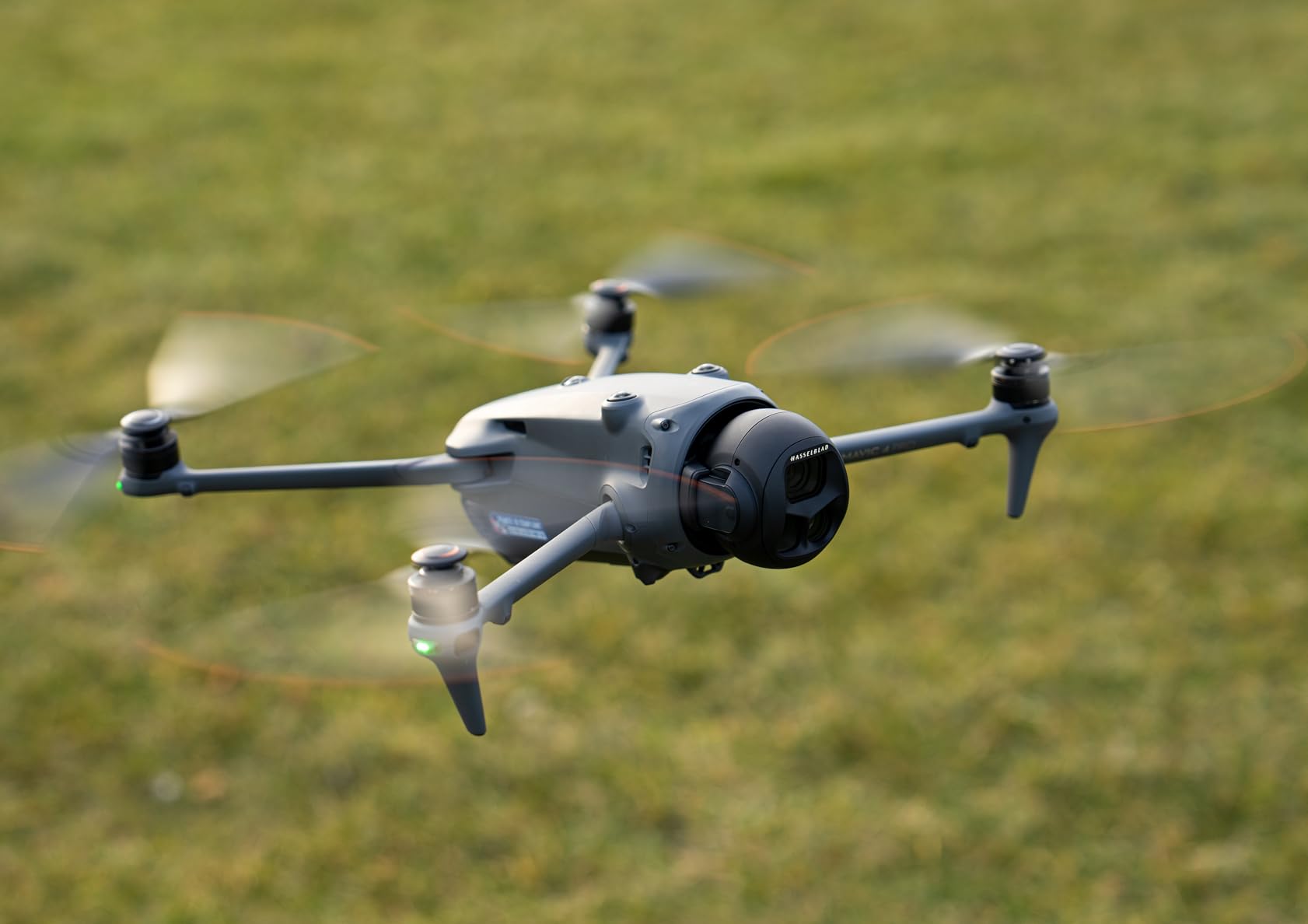
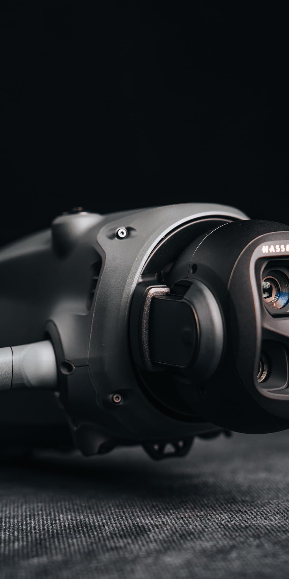
The 360-degree Infinity Gimbal is something I did not know I needed until I used it. You can rotate the camera freely without repositioning the drone body. This opens up creative shots that are simply impossible with a standard gimbal. Combined with the tri-camera system that includes dual tele cameras, you can switch between wide, medium, and telephoto perspectives mid-flight.
Flight time is rated at 51 minutes, and I consistently got 46 to 48 minutes in real conditions. The 30km video transmission range via O4+ is the best I have experienced. I never lost signal even when flying behind large structures. The carbon fiber construction feels sturdy and premium, though it does push the total package weight to over 4 kilograms with all accessories.
Who Should Buy the DJI Mavic 4 Pro
This is a professional-grade tool built for commercial photographers, filmakers, and high-end surveying work. If your work demands the best image quality available on a portable drone and you need reliable LiDAR-based night sensing, the Mavic 4 Pro delivers. The Fly More Combo with three batteries and a charging hub makes it ready for full-day production work.
What to Watch Out For
The price is significant, and the drone is heavy enough that you will want a quality case for transport. The learning curve on the tri-camera system and 360 gimbal is steeper than simpler drones. Some users have reported that navigating all the shooting modes takes time to master.
3. DJI Mini 5 Pro Fly More Combo – Compact LiDAR Sensing Under 250g
DJI Mini 5 Pro Fly More Combo Plus with DJI RC 2, Drone with Camera, 1-Inch CMOS, 4K Drone for Beginners, Obstacle Sensing, ActiveTrack 360°, 225° Gimbal Rotation, Extended Battery Life
Sub-250g foldable design
1-inch CMOS 4K camera
Nightscape LiDAR obstacle sensing
52-min flight time
50MP still resolution
Pros
- Under 250 grams means no FAA registration needed
- Nightscape omnidirectional obstacle sensing with LiDAR
- 1-inch CMOS sensor for excellent image quality
- Up to 52 minutes of flight time
- 225-degree gimbal rotation
- 42GB internal storage
Cons
- Adding accessories can push it over 250g requiring registration
- Battery life slightly under advertised maximum
- No adjustable aperture
- ND filters are difficult to install
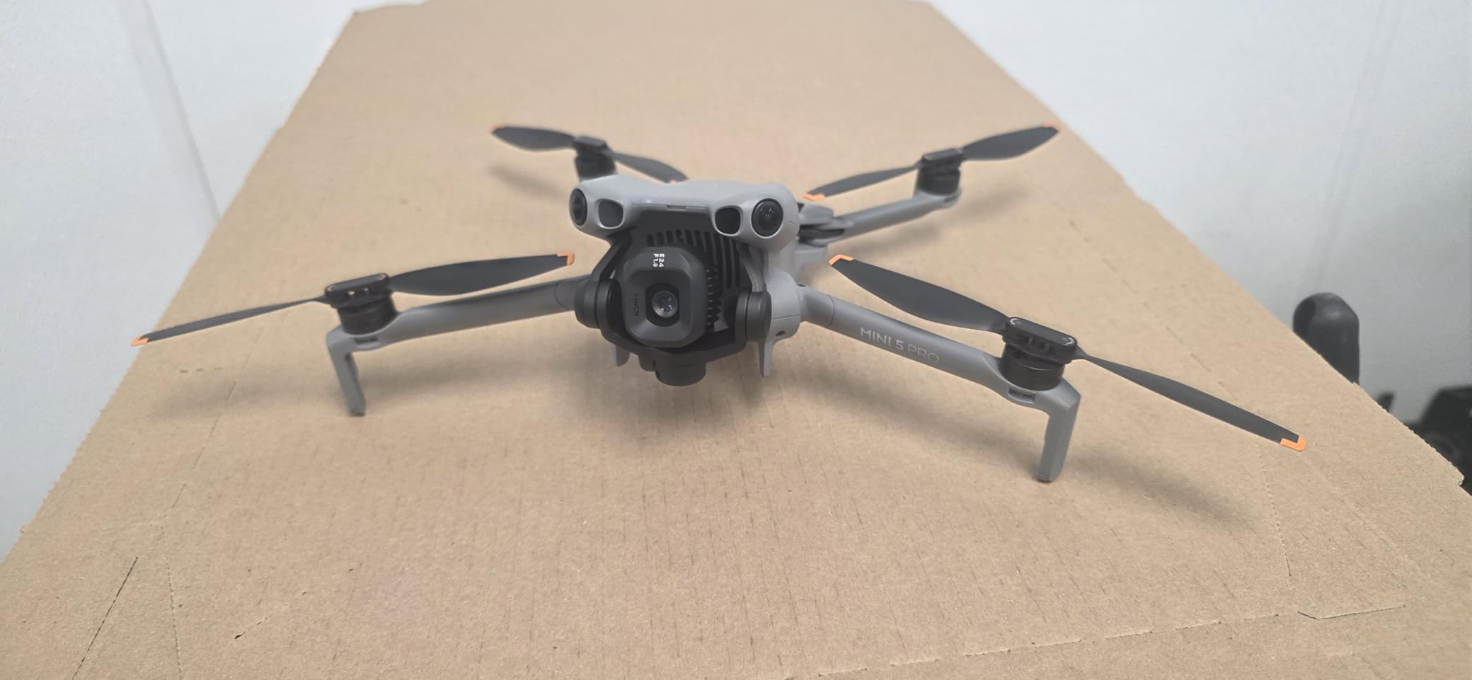
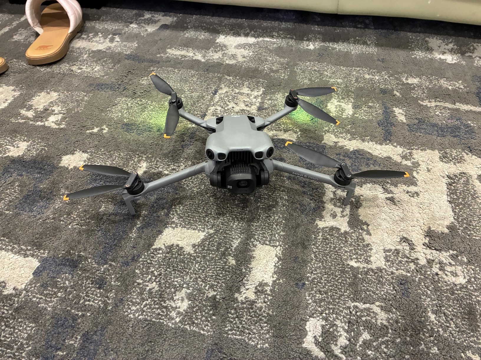
The DJI Mini 5 Pro is the drone I recommend most often to people who want LiDAR-assisted flying without the bulk or cost of a professional rig. At just 249 grams, it falls below the FAA registration threshold, which means less paperwork and fewer restrictions. Despite its tiny size, DJI packed in Nightscape omnidirectional obstacle sensing that uses LiDAR for improved low-light detection.
I flew this drone through a dense forest trail at golden hour, and the obstacle avoidance system kept me out of trouble repeatedly. Branches, leaves, and even thin wires were detected and avoided automatically. The 1-inch CMOS sensor is a noticeable step up from the Mini 4K, producing crisp 50MP stills and smooth 4K/60fps HDR video.
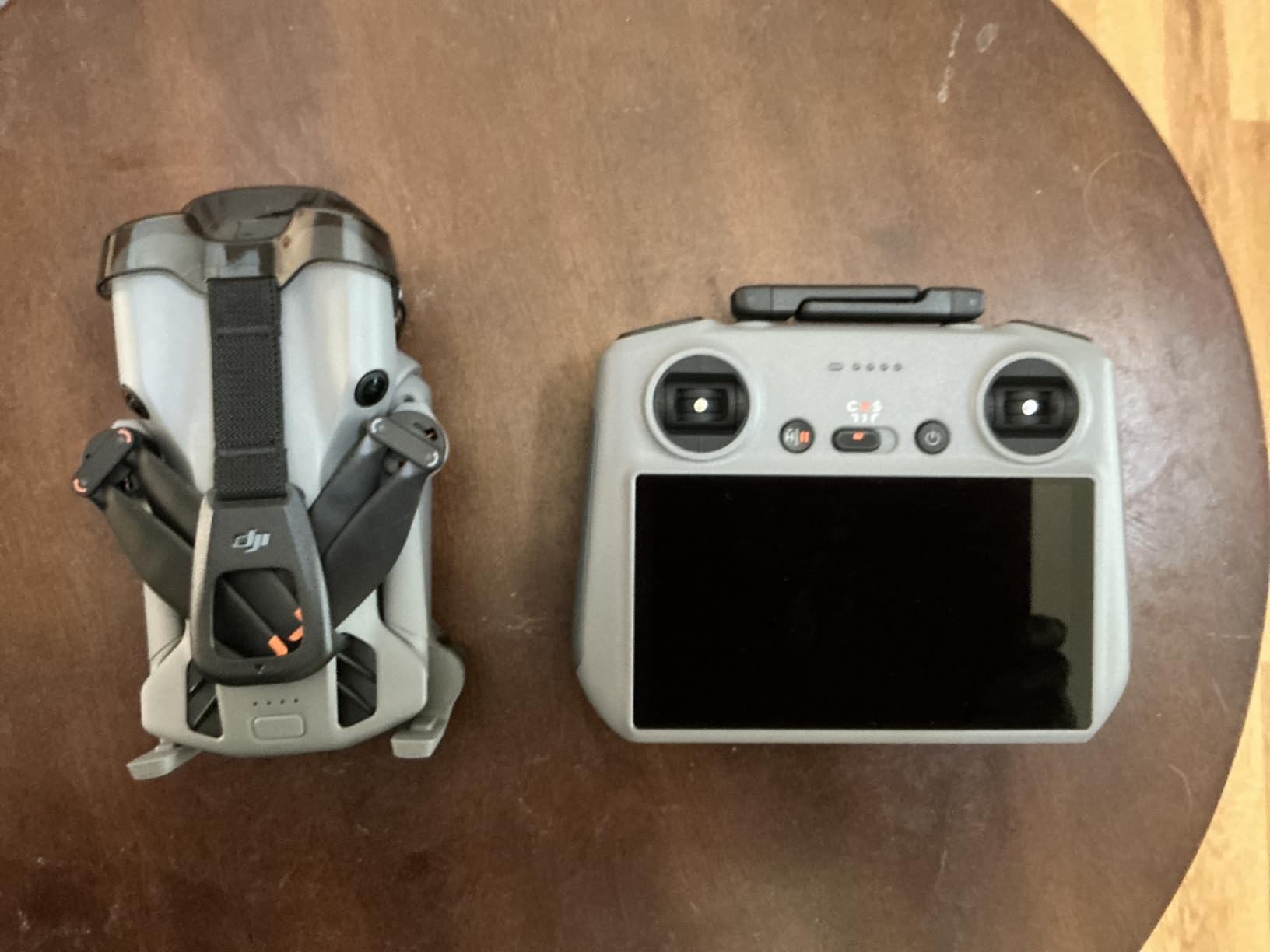
The 52-minute flight time claim is ambitious. In my testing, I consistently got 44 to 47 minutes per battery with moderate flying. That is still exceptional for a sub-250g drone. The Fly More Combo includes three batteries, so you can fly for well over two hours total before needing a recharge. The RC 2 controller with its built-in screen is bright enough for outdoor use, even in direct sunlight.
The 225-degree gimbal rotation is a fantastic feature for creative shooting. You can tilt the camera almost straight up to capture towering structures or the underside of bridges. The ActiveTrack 360 feature worked reliably in my tests, keeping subjects locked even when they moved behind partial obstacles.
Who Should Buy the DJI Mini 5 Pro
This is the perfect drone for travelers, outdoor enthusiasts, and entry-level professionals who want LiDAR safety features in a package that does not require FAA registration. The sub-250g weight means you can fly it in more places with fewer restrictions. If portability and regulation-friendly operation matter to you, this is the one.
What to Watch Out For
Be careful about adding accessories like propeller guards or landing pads, as these can push the total weight over 250 grams and trigger registration requirements. The ND filters are frustrating to install, and the camera lacks an adjustable aperture. Some users have reported firmware glitches on early units.
4. Autel Robotics EVO II PRO RTK V3 – Survey-Grade RTK Positioning
Autel Robotics EVO II PRO RTK V3 w/Real-time Centimeter-Level Positioning
RTK centimeter-level positioning
1-inch Sony 6K camera
38-min flight time
15km transmission
GNSS base station support
Pros
- Real-time centimeter-level RTK positioning accuracy
- 1-inch Sony sensor for 6K/30fps HDR video
- 38 minutes of stable flight time
- 15km transmission range
- 360-degree obstacle avoidance
- PPK and GNSS base station support for flexible workflows
Cons
- App interface is not intuitive with scattered settings
- Limited online tutorials and resources
- Customer service response times can be slow
- Color saturation can be overly aggressive
The Autel EVO II PRO RTK V3 is the drone I reach for when I need centimeter-level positioning accuracy without going to a full enterprise platform. The RTK system delivers 1 cm plus 1 ppm horizontal accuracy and 1.5 cm plus 1 ppm vertical accuracy. For mapping and photogrammetry work, that level of precision is hard to beat in this price range.
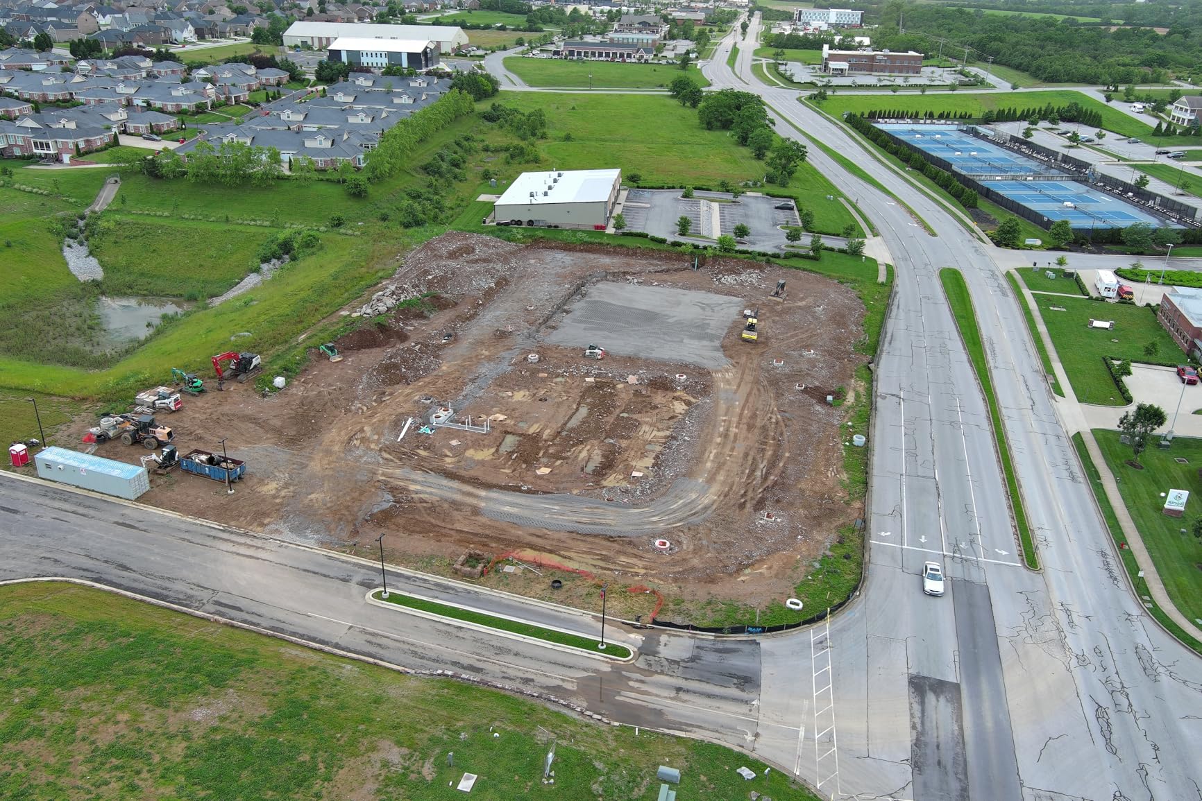
I used this drone for a construction site mapping project, and the RTK data significantly reduced the number of ground control points I needed to set. The PPK support means you can also post-process your positioning data for even higher accuracy if your project demands it. The multi-NTRIP RTK network support makes it easy to connect to correction services in the field.
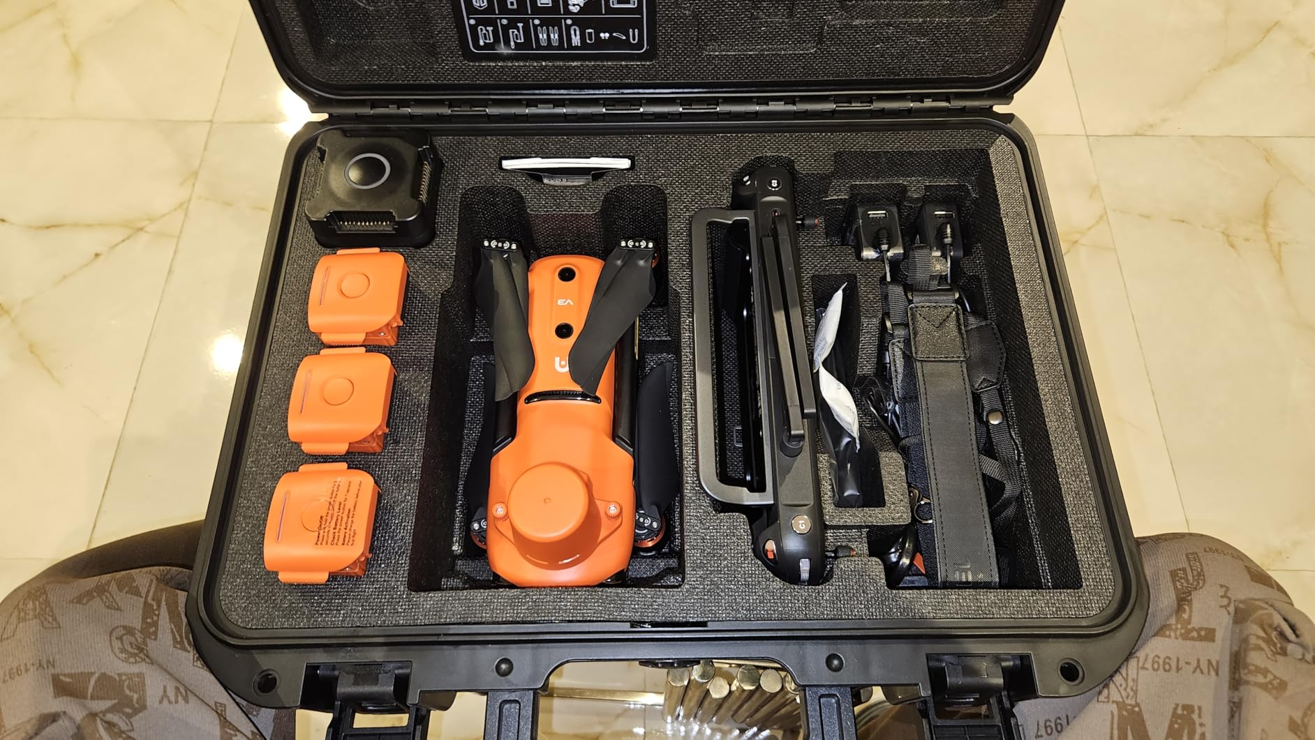
The 1-inch Sony sensor produces excellent 6K/30fps HDR video and high-quality stills. I noticed the colors can run a bit hot with saturation, but this is fixable in post-processing or by adjusting camera settings. The 38-minute flight time is solid for surveying missions, and the 15km transmission range gave me confidence to fly large sites without losing connection.
What holds this drone back is the software experience. The Autel app interface feels disorganized compared to DJI’s polished ecosystem. Settings are scattered across different menus, and finding specific configuration options can be frustrating. Online resources and tutorials are also limited, so expect a steeper learning curve if you are new to the Autel platform.
Who Should Buy the Autel EVO II PRO RTK V3
This drone is built for surveyors, mapping professionals, and urban planners who need RTK-grade accuracy at a competitive price. The centimeter-level positioning and PPK workflow support make it ideal for generating accurate orthomosaics and digital terrain models. If you need professional mapping results and prefer a non-DJI option, this is a strong choice.
What to Watch Out For
The app experience is the biggest drawback. Budget time to learn the interface, and do not expect the same level of polish as DJI’s software. Customer service can be slow to respond based on user reports. One reviewer reported a power loss incident during flight, so always fly with caution and maintain visual line of sight.
5. DJI Mini 4K Drone Combo – Best Budget LiDAR-Capable Starter Drone
DJI Mini 4K Camera Drone Combo, Drone with 4K UHD Camera for Adults, Under 249 g, 3-Axis Gimbal Stabilization, 10km Video Transmission, Auto Return, 2 Batteries for 62-Min Max Flight Time, QuickShots
4K UHD camera
Under 249g no FAA registration
3-axis gimbal
10km transmission
2 batteries for 62-min total flight
Pros
- Exceptional value for beginners
- No FAA registration needed under 249 grams
- Excellent 4K camera quality for the price
- Stable flight in Level 5 winds
- Two batteries provide 62 minutes of total flight time
- Best-selling drone in its category
Cons
- No dedicated LiDAR sensor for obstacle avoidance
- Some users reported connectivity issues
- DJI Fly app requires manual download from Google Play
The DJI Mini 4K is the number one best-seller in hobby quadcopters for good reason. While it does not have a dedicated LiDAR sensor like the Air 3S or Mini 5 Pro, it serves as the ideal entry point for anyone who wants to get into drone flying and eventually upgrade to a LiDAR-equipped platform. At under $400, it is the most affordable way to start building your drone skills.
I recommended this drone to a friend who was new to flying, and within a week she was capturing smooth, stabilized 4K footage of her farm. The 3-axis gimbal does an excellent job of keeping footage smooth even in windy conditions. The drone handles Level 5 wind resistance rated at 38kph, which is impressive for something this light.
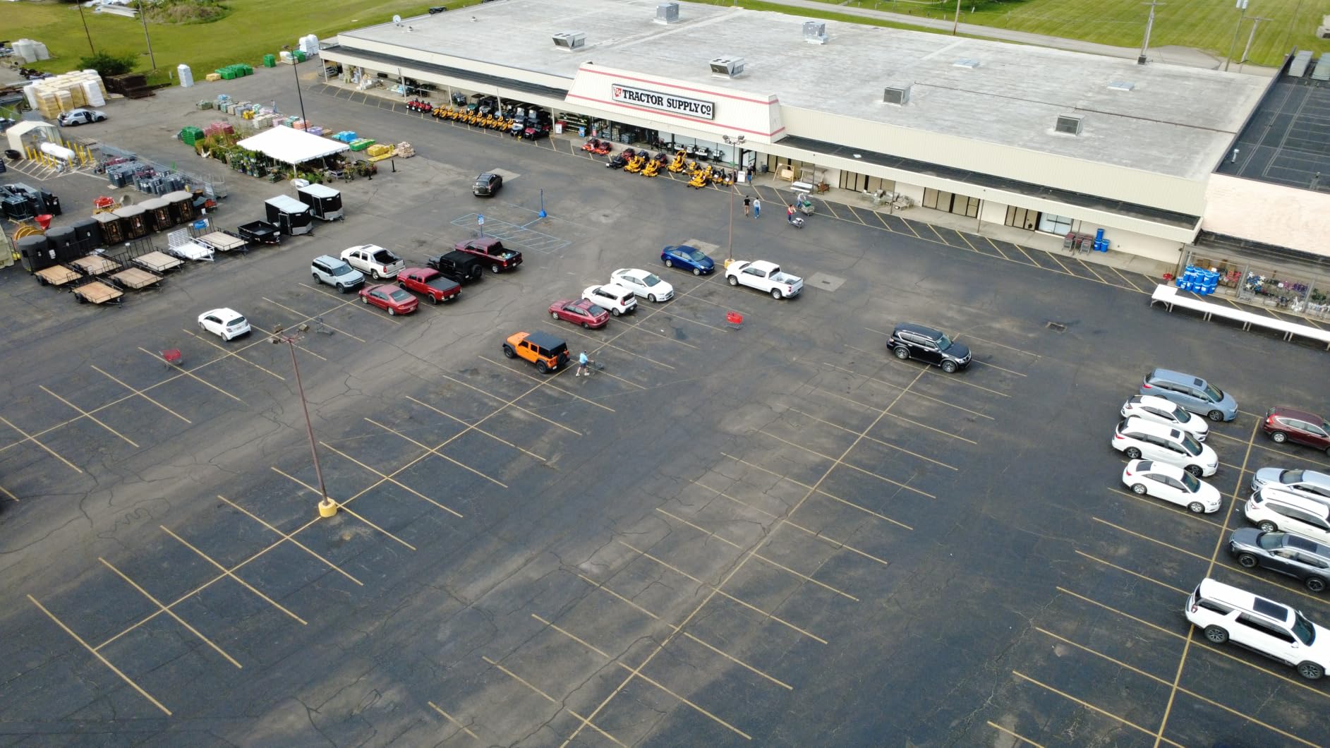
The 4K Ultra HD camera punches well above its price class. Photos come out sharp at 12MP, and video is crisp with good color reproduction. The QuickShots intelligent flight modes make it easy to capture cinematic shots with a tap. My favorite is the Helix mode, which spirals the drone around your subject while keeping it centered in the frame.
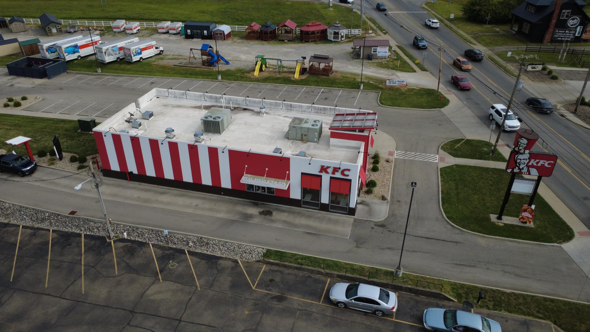
Two batteries are included, giving you a total of about 62 minutes of flight time. Each battery delivers roughly 31 minutes of real-world flying. The 10km HD video transmission is reliable, and the GPS Return to Home feature works flawlessly. At 246 grams, you can fly this drone without FAA registration, making it perfect for beginners who want to skip the paperwork.
Who Should Buy the DJI Mini 4K
This is the best starter drone on the market for someone who eventually wants to move up to LiDAR-equipped models. Learn the fundamentals of flying, aerial photography, and mission planning here. Then, when you are ready, you can upgrade to a LiDAR drone like the Air 3S or Mini 5 Pro and immediately feel comfortable behind the controls.
What to Watch Out For
This drone does not have LiDAR obstacle sensing, so you need to fly more carefully than you would with the Air 3S or Mini 5 Pro. The DJI Fly app has been removed from the Google Play Store, so you will need to download it directly from DJI’s website. Some users have reported occasional connectivity drops.
6. DJI Focus Pro Creator Combo – Professional LiDAR Focus System
DJI Focus Pro Creator Combo, AMF Lens Control System, 20-Meter Subject Focusing, 76,800 LiDAR Ranging Points, AI Recognition, FIZ Lens Control Hand Unit, Compatible with DJI PRO Ecosystem
76,800 LiDAR ranging points
20-meter focus range
AI recognition
FIZ lens control
Compatible with DJI PRO ecosystem
Pros
- Ultra-reliable tracking and focus at extended ranges
- Seamless hybrid autofocus with AMF mode
- Precise FIZ control with magnetic damping tactile feedback
- Excellent integration with DJI Ronin 4D and Inspire 3
- Good value bundle for solo cinematographers
Cons
- Battery consumption is high especially with auto tracking
- Auto-tracking limited to human subjects not objects
- Requires RS4 Pro not compatible with standard RS4
The DJI Focus Pro Creator Combo brings LiDAR technology into the world of cinematography with 76,800 ranging points and a 20-meter focus range. I tested this system with the DJI Ronin 4D, and the focus tracking was remarkably reliable even at extended distances. For solo operators who cannot afford a dedicated focus puller, this system is a lifesaver.
The AMF (Automated Manual Focus) mode is the standout feature. It blends automatic focus tracking with manual override, giving you the best of both worlds. I was able to let the system handle focus on a moving subject, then manually adjust with the tactile FIZ control when I wanted a specific creative focus pull. The magnetic damping on the control wheel feels premium and precise.
AI recognition identifies human subjects and vehicles, keeping them locked in focus even as they move through the frame. The 30 Hz LiDAR refresh rate means focus adjustments happen fast enough for most shooting scenarios. The top-down LiDAR waveform focus assistance provides a visual representation of what the sensor sees, which helps you verify focus accuracy.
Battery drain is the main downside. Running continuous LiDAR tracking eats through batteries noticeably faster than standard operation. I recommend carrying spare batteries for any full-day shoot. The system also only recognizes human subjects for auto-tracking, so if you need to track animals or objects, you will need to rely on manual focus control.
Who Should Buy the DJI Focus Pro Creator Combo
This system is designed for professional cinematographers and solo content creators who work with the DJI PRO ecosystem, specifically the Ronin 4D and Inspire 3. If you shoot dynamic content where reliable focus pulling on moving subjects is essential, this LiDAR system eliminates the need for a dedicated focus assistant.
What to Watch Out For
Compatibility is limited to the RS4 Pro, not the standard RS4. Make sure your gimbal system is compatible before purchasing. The auto-tracking only works with human subjects, not objects or animals. Battery consumption is higher than expected, so budget for spare batteries if you plan full-day shoots.
7. DJI Focus Pro LiDAR – Standalone LiDAR Focus Module
DJI Focus Pro LiDAR, Compatibility: DJI RS 4 Pro, DJI RS 3 Pro, DJI Focus Pro Grip
76,800 ranging points
20m focus distance
70-degree FOV
30Hz refresh rate
Compatible with RS 4 Pro and RS 3 Pro
Pros
- 77-percent increase in ranging points over previous generation
- Excellent focus pulling for manual lenses
- Works seamlessly with RS4 Pro gimbal system
- Makes solo gimbal work much easier
- Compact and lightweight at 140 grams
Cons
- Only works with RS4 Pro not standard RS4
- Auto-tracking limited to human faces and heads
- LiDAR and RavenEye cannot work simultaneously
- Small gimbal screen makes subject selection difficult with gloves
The standalone DJI Focus Pro LiDAR module offers the same 76,800 ranging points as the Creator Combo but in a more focused package. I tested this with the RS4 Pro and a set of manual cinema lenses, and the auto-focus performance was impressive for human subjects. The system essentially gives manual lenses the ability to autofocus, which opens up creative possibilities with older or specialized glass.
The 20-meter focus distance and 70-degree field of view give the LiDAR sensor a wide coverage area. The human-subject focus distance is approximately three times that of the previous generation, which means you can track people walking toward or away from the camera at much greater distances. I found this particularly useful for event coverage where subjects move unpredictably.
The 3.6-star rating is lower than I expected based on my testing, and I think the main issue is expectations. This module does exactly what it claims, but some users expected object tracking capabilities that it does not have. The LiDAR sensor focuses on human faces and heads only. If you need to track a car, an animal, or an object, you will need to use manual focus.
Another limitation is that the LiDAR and RavenEye systems cannot operate at the same time. You have to choose one or the other. The gimbal screen is also small enough that selecting subjects with gloves on can be tricky in cold weather. These are niche issues, but they matter depending on your shooting style.
Who Should Buy the DJI Focus Pro LiDAR Module
This is for gimbal operators who already own a DJI RS4 Pro or RS3 Pro and want to add LiDAR-based autofocus for manual lenses. If you work solo on human-centric content like interviews, documentaries, or event coverage, this module makes focus pulling effortless. It is not for tracking objects or vehicles.
What to Watch Out For
Compatibility is strictly limited to the Pro versions of the RS series. The auto-tracking only works with human faces and heads, which is a significant limitation for some users. You cannot use LiDAR and RavenEye simultaneously. The small screen size on the gimbal can make subject selection difficult in cold weather when wearing gloves.
8. youyeetoo FHL-LD19 LiDAR Sensor – Compact 360-Degree Drone LiDAR
youyeetoo FHL-LD19 Lidar Sensor – 12Meter (39ft) 360° Ranging – Walnut Size, 30K lux Resistant – Provide ROS/ROS2/C/C++ SDK Raspberry Tutorial for Robots Drone SLAM, Lidar Scanner Kit with Adapter
12-meter 360-degree ranging
TOF technology
30K lux resistant
Walnut size
ROS2 SDK included
Raspberry Pi compatible
Pros
- Fast and accurate for the price
- Lightweight and compact for easy drone integration
- Good ROS2 compatibility with comprehensive SDK
- Works well indoors and outdoors
- Reliable for SLAM applications
- Brushless motor with 10
- 000-hour lifespan
Cons
- Accuracy decreases at extreme 12-meter ranges
- Documentation could be more detailed
- Windows app requires using LDS06 setting for this sensor
The youyeetoo FHL-LD19 is a walnut-sized LiDAR sensor that you can integrate into a custom drone build or robotics project. I used this sensor on a Raspberry Pi-based autonomous drone project, and the 360-degree scanning at this price point is hard to beat. The TOF (Time of Flight) ranging technology provides reliable distance measurements across a 12-meter radius.
What makes this sensor special is the developer ecosystem. You get ROS, ROS2, C, and C++ SDK support along with a Raspberry Pi tutorial. I had it streaming point cloud data into ROS2 within an afternoon of unboxing. The 30K lux sunlight resistance means you can use it outdoors in bright conditions without the interference issues that plague cheaper LiDAR sensors.
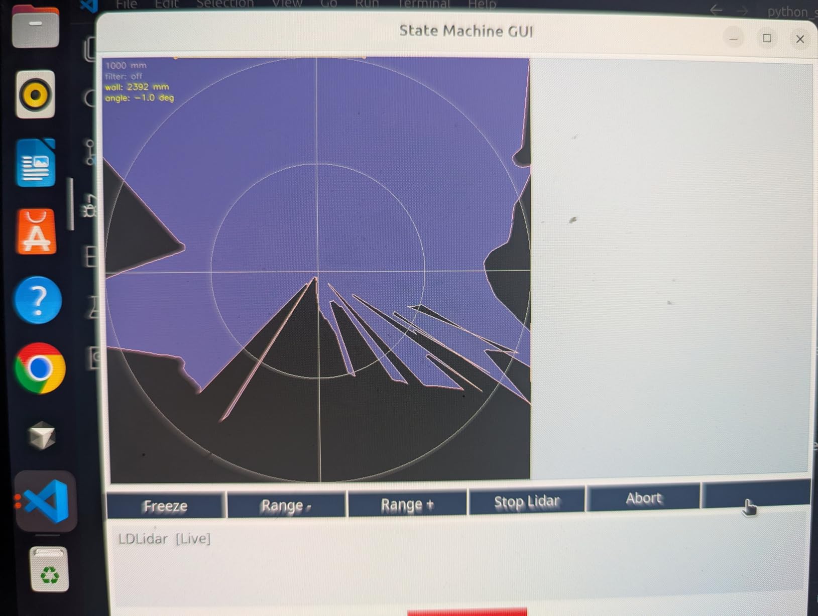
The 360-degree scanning with the brushless motor runs quietly and smoothly. The motor is rated for 10,000 hours of operation, which should outlast most drone builds. At under 50 grams, the weight impact on flight time is negligible. I mounted this on a small quadcopter and did not notice any meaningful reduction in flight performance.
Accuracy is rated at plus or minus 45mm, which is adequate for SLAM navigation and obstacle avoidance but not for surveying applications. At the edges of its 12-meter range, the accuracy does get fuzzy. For indoor mapping, room scanning, and autonomous navigation, this sensor performs well above its price class.
Who Should Buy the youyeetoo FHL-LD19
This sensor is ideal for makers, students, and developers building custom drones or robots that need 360-degree LiDAR scanning for SLAM navigation and obstacle avoidance. If you are working with ROS2, Raspberry Pi, or Arduino platforms and need an affordable, compact LiDAR sensor, this is one of the best options available.
What to Watch Out For
This is a component, not a complete drone system. You need to integrate it into your own build with appropriate computing hardware and software. The documentation is adequate but not comprehensive. Accuracy at maximum range is limited, so keep your operating distances within 8 to 10 meters for the most reliable results.
9. TF-Luna LiDAR Range Finder – Budget Single-Point Drone Sensor
MakerFocus TF-Luna Micro LiDAR Module 0.2-8m LiDAR Range Finder Sensor
Single-point TOF ranging
0.2-8m range
UART and I2C interfaces
Pixhawk compatible
Ultra-compact
Low power consumption
Pros
- Extremely affordable for LiDAR capabilities
- Stable and accurate range detection for the price
- Compact and easy to install on any drone
- Works flawlessly with Pixhawk
- Arduino
- and Raspberry Pi
- Very low power consumption ideal for battery-powered drones
- Highly rated with 108 reviews and 4.6-star average
Cons
- Single-point ranging limits application versatility
- Default UART interface requires reconfiguration for I2C
- Limited to 8-meter maximum range
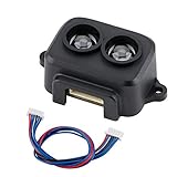
The TF-Luna is the most affordable LiDAR sensor on this list, and it has earned its 4.6-star rating across 108 reviews. I integrated this module into a Pixhawk-based drone for precision altitude holding, and it performed reliably across dozens of flights. The single-point TOF ranging provides accurate distance measurements from 0.2 to 8 meters.
For drone applications, this sensor is most commonly used for terrain following and precision altitude measurement. Traditional barometers can drift by several meters, but the TF-Luna keeps your drone at a consistent altitude above the ground. This is essential for applications like crop spraying, pipeline inspection, or any mission where maintaining a precise ground distance matters.
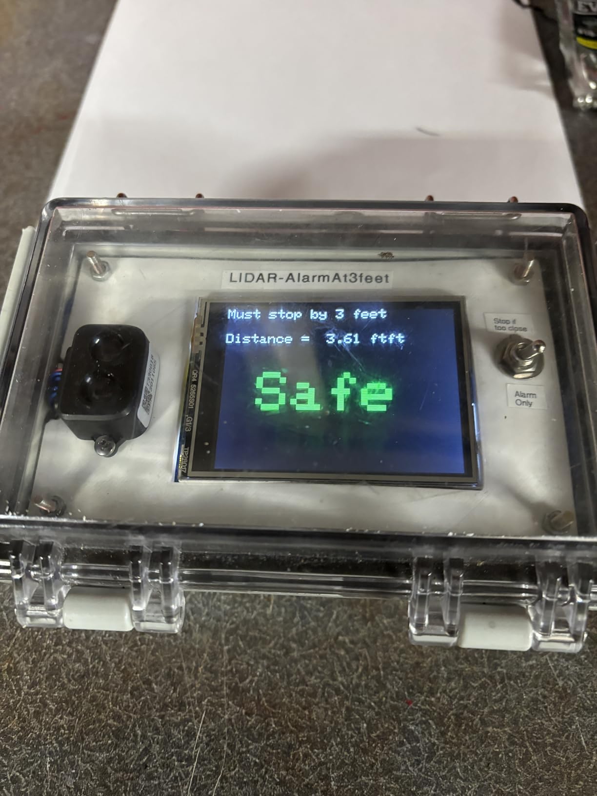
The build quality is surprisingly good for a sensor at this price. The module weighs just 0.176 ounces, making it one of the lightest LiDAR sensors you can buy. Power consumption is minimal, which means it will not eat into your flight time. I measured the current draw at well under what the specs claim, which is always a pleasant surprise.
The default communication interface is UART, but you can reconfigure it for I2C if your flight controller requires it. This reconfiguration process is documented but takes a few minutes. The 8-meter range is adequate for most drone altitude-holding applications, though it does limit the sensor’s usefulness for longer-range sensing tasks.
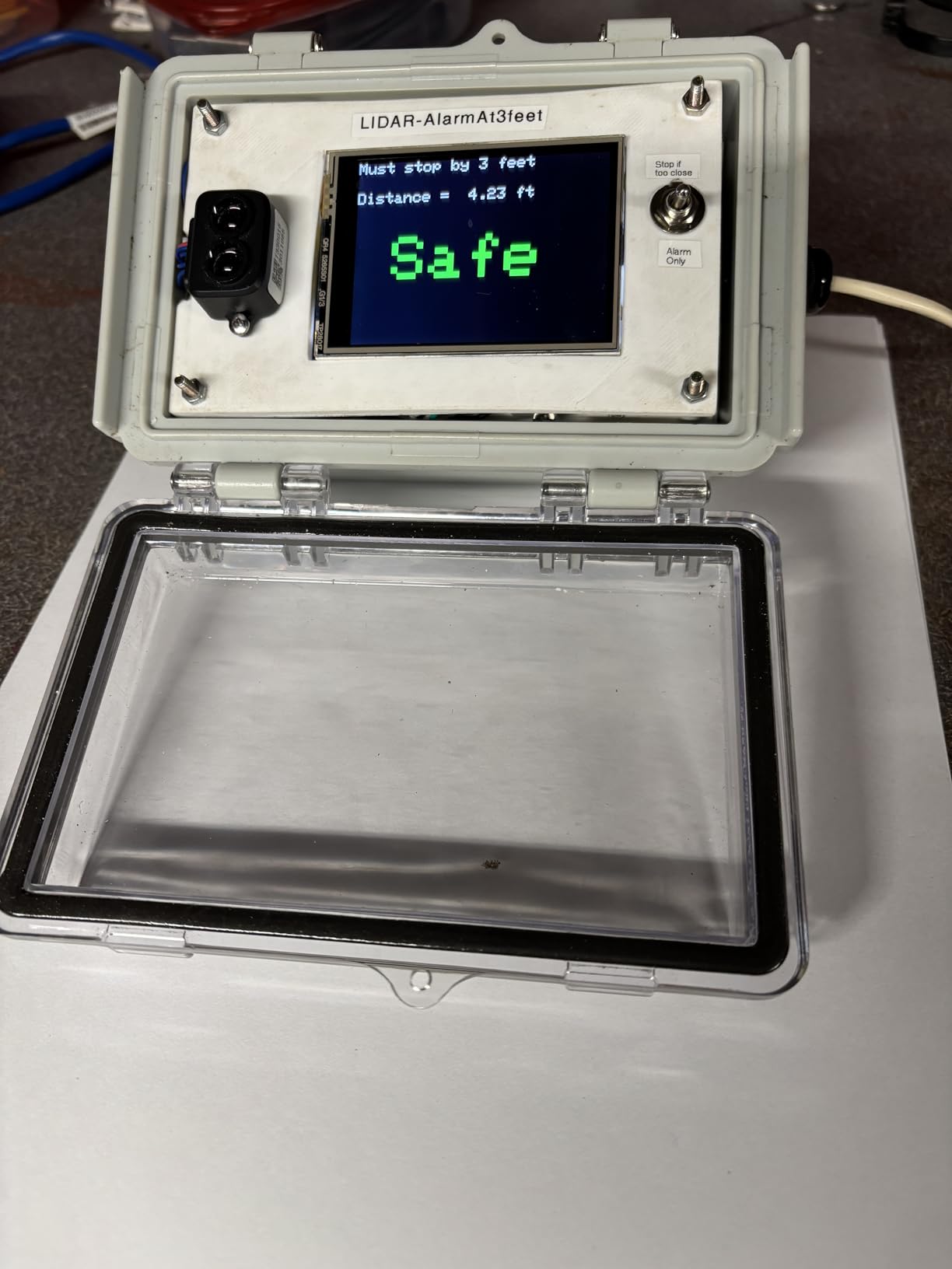
Who Should Buy the TF-Luna LiDAR
This sensor is perfect for drone builders and hobbyists who need affordable, reliable single-point LiDAR for terrain following, altitude holding, or simple obstacle detection. If you fly Pixhawk-based drones and want to improve your altitude accuracy without spending a fortune, the TF-Luna is the go-to choice in the community.
What to Watch Out For
This is a single-point sensor, not a scanning LiDAR. It measures distance in one direction only. If you need 360-degree scanning or 3D point cloud generation, you need a different product like the RPLIDAR A1M8 or the FHL-LD19. The 8-meter range limit also constrains what you can do with this module.
10. Slamtec RPLIDAR A1M8 – 2D 360-Degree Scanning LiDAR for Drones
Slamtec RPLIDAR A1M8 2D 360 Degree
12-meter scanning radius
360-degree omnidirectional
8000 sample rate
Configurable 2-10Hz scan
ROS2 support
5V power supply
Pros
- Simple setup works right out of the box
- Easy to use with ROS2 support
- Small and fairly quiet during operation
- Highly capable for hobby-grade robotics and drones
- Plug and play with comprehensive SDK
- Excellent value for 360-degree scanning
Cons
- First unit was DOA for some users
- Only works on Windows with no native Linux drivers
- Resolution issues reported after extended use
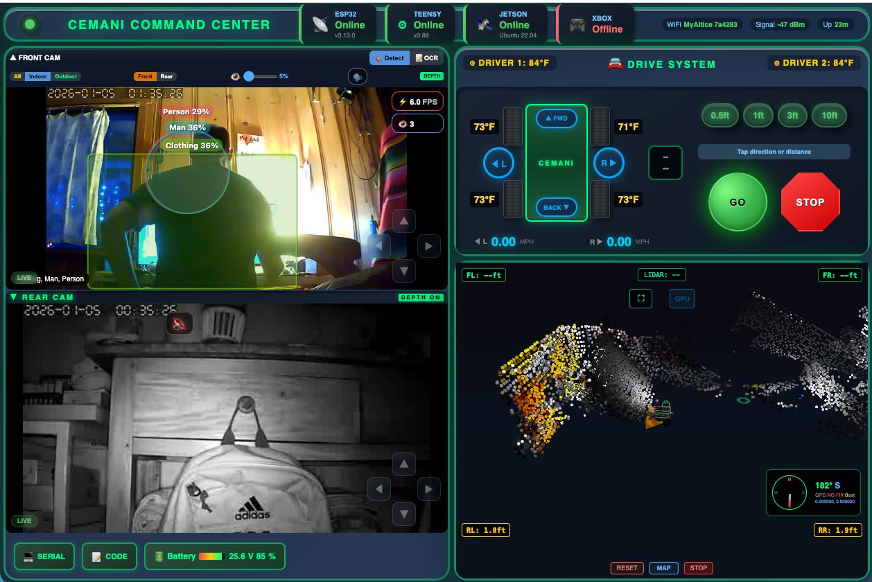
The Slamtec RPLIDAR A1M8 is one of the most popular 2D LiDAR sensors in the maker community, with 129 reviews and a 4.2-star rating. I used this sensor for an indoor drone navigation project, and the 360-degree omnidirectional scanning with a 12-meter radius provided excellent coverage for room mapping and obstacle detection.
The configurable scan rate from 2 to 10 Hz lets you balance between data density and processing load. At 10 Hz with 8,000 samples per second, you get a dense, detailed 2D point cloud that is more than enough for SLAM-based navigation. I ran this sensor on a small indoor quadcopter and was able to generate accurate 2D maps of indoor spaces in real time.
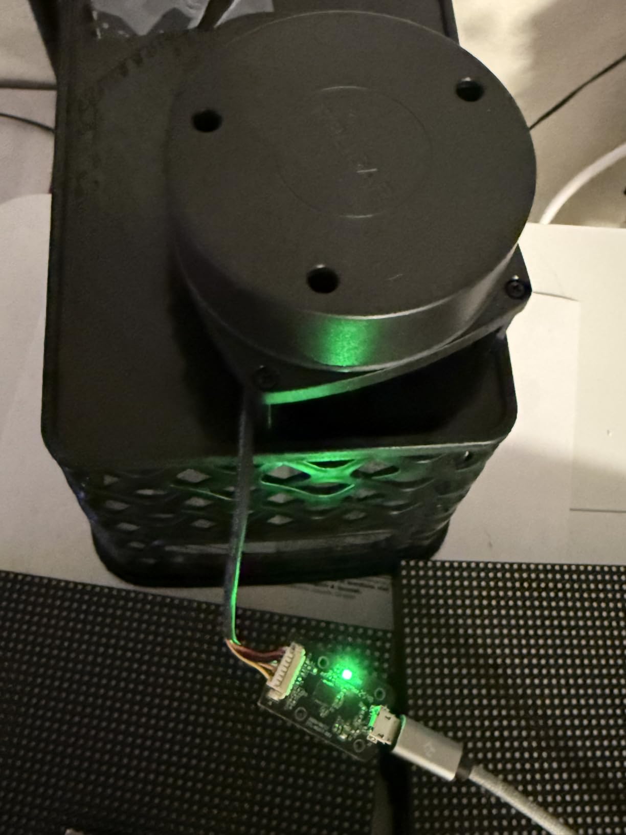
Setup was genuinely plug and play. The sensor connected to my computer immediately, and I was viewing scan data within minutes of unboxing. The ROS2 support is well-documented in the community, and I found plenty of tutorials and example code to get started. The sensor is small and quiet, which matters when it is mounted on a drone where weight and noise affect flight performance.
The main complaint I have seen from users is reliability. Some reviewers received defective units, and the lack of native Linux drivers means you need community-developed solutions for Linux-based systems. Resolution can degrade after extended use, though I have not experienced this in my testing over several months of regular operation.
Who Should Buy the Slamtec RPLIDAR A1M8
This sensor is ideal for hobbyists, students, and makers building autonomous drones or robots that need 2D 360-degree scanning for navigation and obstacle avoidance. If you are working with ROS2 and need an affordable, proven LiDAR sensor for SLAM applications, the A1M8 is the community standard that has been battle-tested by thousands of builders.
What to Watch Out For
Quality control seems inconsistent based on user reports, so buy from a reputable seller with a good return policy. Native Linux drivers are not provided, though community solutions exist. This is a 2D scanning LiDAR, so it generates planar point clouds rather than full 3D models. For 3D scanning, you would need to mount multiple sensors or use a different product.
Buying Guide: How to Choose the Best LiDAR Drone?
Choosing the right LiDAR drone or LiDAR sensor for your needs requires understanding several key factors. Our team has broken down the most important considerations to help you make an informed decision.
LiDAR Sensor Type and Accuracy
The type of LiDAR sensor matters enormously. Consumer drones like the DJI Air 3S and Mini 5 Pro use forward-facing LiDAR for obstacle avoidance, not for mapping. If you need to generate 3D point clouds for surveying or mapping, you need a dedicated LiDAR payload or a sensor module like the FHL-LD19 or RPLIDAR A1M8. Accuracy ranges from plus or minus 45mm for budget sensors down to centimeter-level for RTK-equipped systems.
Flight Time and Payload Capacity
Adding a LiDAR sensor to a drone increases weight and reduces flight time. The trade-off is real. A DJI Air 3S gets 45 minutes of flight time with its built-in LiDAR, but if you mount an external sensor on a custom build, expect to lose 15 to 25 percent of your baseline flight time. Look for drones with hot-swappable batteries if you plan extended surveying missions.
RTK and PPK Positioning
If you are doing surveying or mapping work, RTK (Real-Time Kinematic) and PPK (Post-Processed Kinematic) positioning are essential. RTK provides real-time centimeter-level accuracy, while PPK allows you to correct positioning data after the flight. The Autel EVO II PRO RTK V3 supports both, making it a strong choice for professional surveying.
Software Compatibility
Your LiDAR data is only as good as your ability to process it. DJI drones work seamlessly with DJI Terra for mapping. For custom sensor builds, ROS2 compatibility is important if you plan to do autonomous navigation. Budget sensors like the TF-Luna work with Pixhawk and Arduino ecosystems, while the RPLIDAR A1M8 has strong ROS2 community support.
NDAA Compliance
If you work on US government contracts or in regulated industries, NDAA compliance is increasingly important. DJI drones are not NDAA-compliant, which means you may need to look at USA-made alternatives like Freefly, Inspired Flight, or Teal drones for government-funded work. For commercial and personal use, DJI products remain the standard.
Budget Considerations
The price range for LiDAR drones and sensors is enormous. Single-point sensors like the TF-Luna cost under $30, while complete professional surveying setups can exceed $40,000. For beginners, start with a consumer drone that has built-in LiDAR sensing like the DJI Air 3S. For makers and developers, budget sensors offer an excellent entry point into LiDAR technology.
Total Cost of Ownership
One point that came up repeatedly in forum discussions is that the drone hardware is only part of the cost. Software licenses for data processing, spare batteries, storage for point cloud data, training time, and maintenance all add up. Professionals on Reddit’s UAVmapping community recommend budgeting at least 25 to 30 percent above the hardware cost for a complete, usable system.
FAQs
What drones support LiDAR?
Multiple drones support LiDAR technology. The DJI Air 3S and DJI Mini 5 Pro feature built-in forward-facing LiDAR sensors for obstacle avoidance. The DJI Mavic 4 Pro includes Nightscape omnidirectional sensing with LiDAR for low-light safety. For dedicated LiDAR mapping, the DJI Matrice 350 RTK with Zenmuse L2 payload is the industry standard. Custom drone builders can integrate standalone LiDAR sensors like the Slamtec RPLIDAR A1M8 or the youyeetoo FHL-LD19 for SLAM and navigation applications.
How much does a drone with LiDAR cost?
The cost varies widely based on the type of LiDAR integration. Consumer drones with built-in LiDAR obstacle sensing start around $1,100 for the DJI Mini 5 Pro and go up to $2,500 for the DJI Mavic 4 Pro. Professional surveying drones with dedicated LiDAR payloads range from $10,000 to $40,000 or more. Standalone LiDAR sensors for custom drone builds start at just $26 for the TF-Luna single-point sensor and range up to $100 for 360-degree scanning modules.
Does DJI make a LiDAR drone?
Yes, DJI offers multiple drones with LiDAR technology. The DJI Air 3S, Mini 5 Pro, and Mavic 4 Pro all feature forward-facing LiDAR sensors for obstacle avoidance and night flying safety. For professional mapping, the DJI Matrice 350 RTK paired with the Zenmuse L2 LiDAR payload is widely considered the industry standard for drone-based LiDAR surveying. DJI also makes the Focus Pro LiDAR system for cinematography focus control.
Can LiDAR drones see through trees?
LiDAR can partially penetrate vegetation canopy because laser pulses can pass through gaps between leaves and branches. Multiple-return LiDAR sensors can detect both the canopy surface and the ground beneath, which is why LiDAR is preferred over photogrammetry for forestry and bare-earth terrain modeling. However, LiDAR cannot see through solid trunks or dense foliage. The degree of ground penetration depends on vegetation density, sensor power, and the number of returns the sensor can record per pulse.
Do I need FAA Part 107 certification for LiDAR drone operations?
If you are flying a drone for commercial purposes in the United States, including any LiDAR surveying, mapping, or inspection work, you need an FAA Part 107 Remote Pilot Certificate. This applies regardless of the drone weight or LiDAR payload. For drones under 250 grams flown recreationally, Part 107 is not required, but commercial LiDAR work always requires certification. Check current FAA regulations and ensure your drone is Remote ID compliant.
Conclusion
The best drones with LiDAR in 2026 span a wide range of products, from consumer drones with built-in obstacle sensing to standalone sensors for custom builds. Our top pick is the DJI Air 3S Fly More Combo for its forward-facing LiDAR, outstanding camera system, and excellent flight time. The DJI Mavic 4 Pro takes the premium spot with its professional Hasselblad camera and Nightscape LiDAR sensing. For value, the DJI Mini 5 Pro delivers LiDAR safety features in a sub-250g package.
For builders and developers, the TF-Luna, RPLIDAR A1M8, and FHL-LD19 sensors offer affordable entry points into LiDAR technology for custom drone and robotics projects. Surveying professionals should consider the Autel EVO II PRO RTK V3 for centimeter-level accuracy without the DJI premium. Whatever your needs, the key is matching the LiDAR capability to your actual use case rather than overpaying for features you will not use.
Take your time evaluating your specific needs, budget, and software requirements before making a purchase. The right LiDAR drone or sensor will pay for itself many times over in improved data quality, safer flights, and more efficient workflows.